Untaken Trails
  • Home
  • About
  • Multi-Day Trails
    • Bucket List
    • 2025
      • Arizona Trail 2025
      • Spruce Woods Provincial Park
      • Riding Mountain National Park
    • 2024
      • Arizona Trail
    • 2023
      • Gros Morne National Park
    • 2022
      • Pioneer Footpath
    • 2021
      • GDT Section C
      • The Boreal Trail
    • 2020
      • GDT Section B
  • Dayhikes
  • Gear
    • Gear We Use
    • Gear Reviews
  • Blog
  • Contact
  • Hiking Riding Mountain National Park: Central Trail to Whitewater Lake | Day 1

    About the Central Trail at Riding Mountain National Park

    We were on the hunt for one last hike of 2025 and landed on Riding Mountain National Park. With four days available for hiking, we explored our options and found a combination of campgrounds that would allow us to hike all four days.

    Riding Mountain National Park was established back in 1933 and was Manitoba’s first national park. It’s a pretty special place with a mix of forests, open meadows, and lakes that make it feel really varied and peaceful. You can see all kinds of wildlife here, including moose, elk, black bears, deer, and even foxes if you’re lucky. Birdwatchers have a lot to look for too, with over 200 species spotted in the park. Hiking through it is really enjoyable. There is something about the combination of quiet forests, open spaces, and sparkling lakes that makes it feel like a proper escape into nature.

    The park offers a mix of day hikes as well as multi-day routes that can be planned end-to-end, as loops, or out-and-back. The loops were too short for what we wanted, and being limited to a single vehicle ruled out the end-to-end hikes. We chose an out-and-back route with a loop at the end that allowed us to stay at three different campgrounds while only repeating the middle section of the trail.

    There are other trails in Riding Mountain National Park that interest us for future weekend hikes, such as the East Escarpment and Grey Owl’s Cabin. We’ll save those for next year. For this hike, our route was:

    • Day 1: Central Trailhead to Whitewater Lake Campground
    • Day 2: Whitewater Lake to Gunn Lake Campground
    • Day 3: Gunn Lake Campground back toward Whitewater Lake and down to Long Lake
    • Day 4: Long Lake through the Grasshopper Lake Trail, up to Central Trail, and back to the Central Trail Trailhead

    Since this was our first year hiking in the area, we weren’t sure how busy the trails could be. Backcountry sites in Riding Mountain National Park do require reservations, but we had plenty of options available in the reservation system. Conditions may differ during peak season, so plan ahead and make your reservations early to secure the sites you want.

    Day 1: Central Trailhead to Whitewater Lake

    Wasagaming Townsite

    We drove up to Wasagaming Campground on Thursday evening, planning to start the trail on Friday morning. The frontcountry campsite had all the amenities we could want, including flush toilets and showers. The downside was the time of year we visited. Some sites had already closed for the season, and even the closest outhouse to our campground loop was no longer available, which meant a longer walk to the restroom at night.

    Another downside is that when you enjoy the quiet of backcountry camping, it can be tough to start your trip surrounded by the noise of vehicles arriving late, car alarms, and music from distant campsites. Fortunately, we knew we would be in the backcountry soon enough, and most people had quieted down before midnight. Staying at the campground saved money, since hotels aren’t cheap, and it put us in a good position to drive 40 minutes to the trailhead in the morning. From Winnipeg, the drive to the Central Trail Trailhead takes about three hours.

    On Friday morning, we went into the townsite in search of breakfast. We wanted some good fuel before hitting the trail. Being later in the season, some locations had already closed for the year, and those that were open tended to open later in the morning. One exception was The Boardwalk on Clear Lake. We were pleasantly surprised by this little store, restaurant, and ice cream shop. While waiting for our orders of breakfast mash, Cheryl bought a new hat to wear on the trail. Our meals were ready quickly and were delicious. If you are looking for a place for breakfast before hiking, we would recommend The Boardwalk. You might also be tempted by a few baked goodies while you’re there.

    Bison Enclosure

    Bison were hanging out in their enclosure close to the road near the Central Trail.

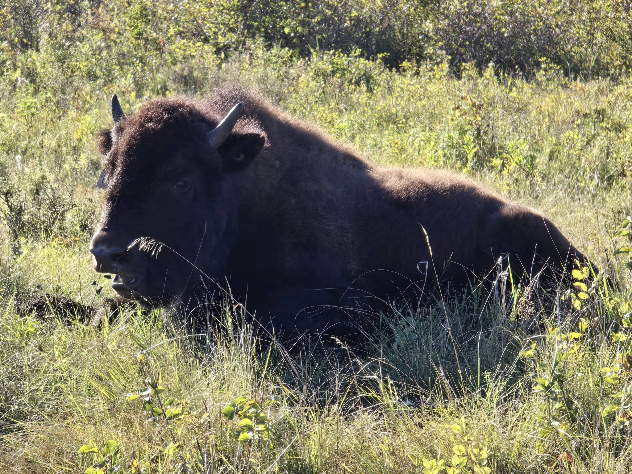
    The nice thing about starting our hike on the Central Trail at the Central Trail Trailhead is its proximity to the bison enclosure. You could skip the enclosure and drive a little further from Audy Lake to reach the turnoff to the trail, but why not drive through the bison enclosure and see the bison first? Turn off at the enclosure and drive through. Along the way, you will reach a T-intersection. Turning right will take you back toward Wasagaming, while turning left leads to the bison viewing platform. The Central Trail Trailhead is just a little past the platform up another dirt road.

    When we entered the enclosure, we weren’t sure if we would see any bison at all. We drove through open fields and winding trees before finally spotting them over a distant hill. Turning left at the T-intersection brought us right to them, with bison on both sides of the dirt road. We parked for a while, taking pictures and video before heading to the viewpoint. There is an outhouse here as well if you want to use the facilities. Take a moment to get out of your car, stretch your legs, and check out the bison from the platform.

    A tip: don’t do what we did and go back the way you came from the platform, which takes you back to the T-intersection. Instead, follow the road around the platform to reach the trailhead.

    Bison viewing tip: We recommend visiting the bison in the morning when you start the trail. In the afternoon, they are more likely to be resting in the shade of the trees, out of sight, especially if you try to view them after you exit the trail.

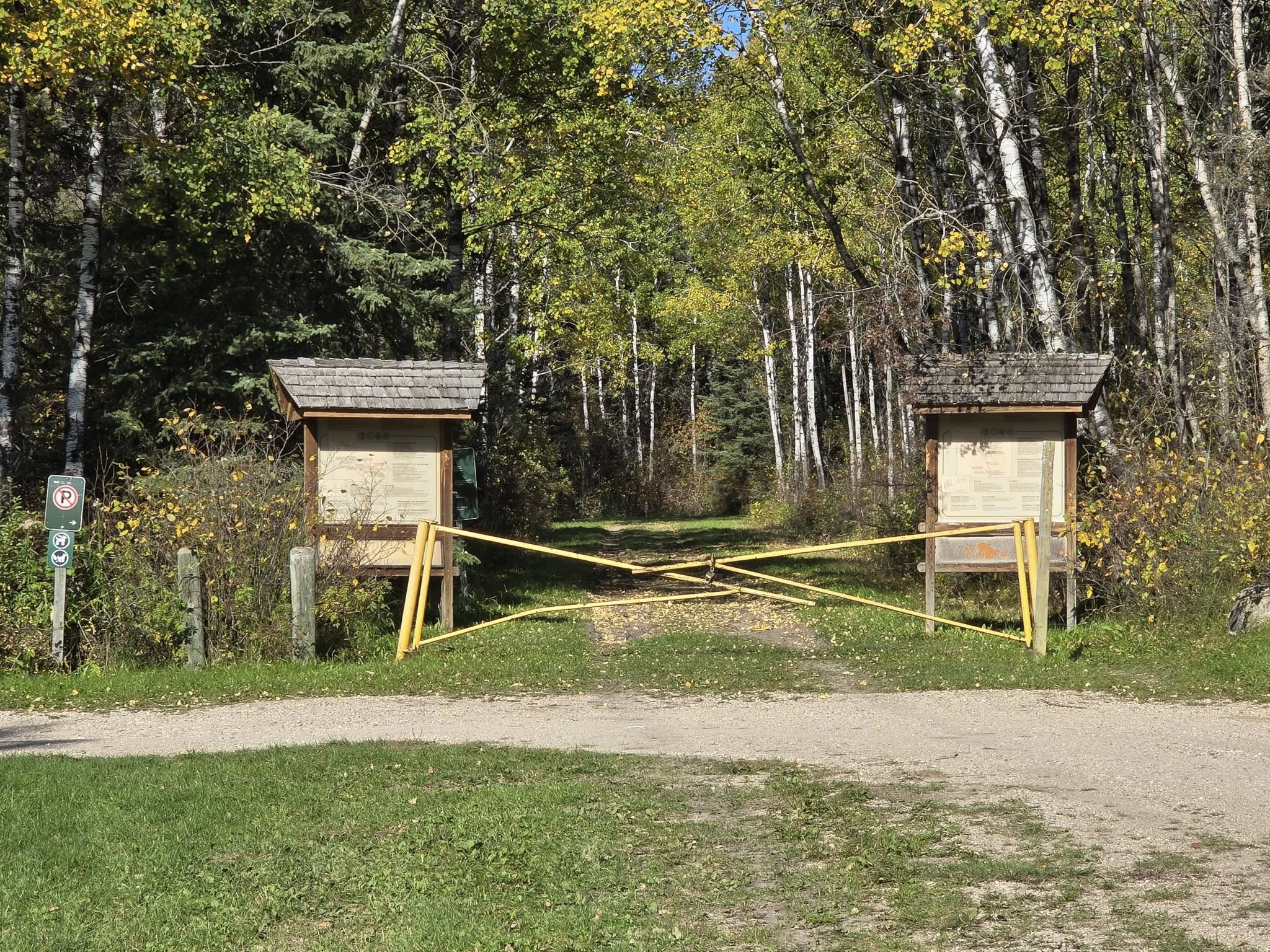
    Central Trail Parking Lot and Trailhead

    Central Trail Trailhead and the start of Central Trail and Strathclair Trail.

    While it was still early morning when we drove to the Central Trail, the dirt road leading up to the trailhead was lined with sunbathing snakes. Unfortunately, some of these snakes had not survived encounters with vehicles that had passed through. We did our best to dodge them on the single-lane road. Hopefully, most of them made it through the morning sun safely.

    The Central Trail Trailhead has two small dirt parking lots that can each fit about three to four cars. We had no trouble finding parking, but during peak season, it could be a challenge if you are competing with day hikers. Time your arrival accordingly.

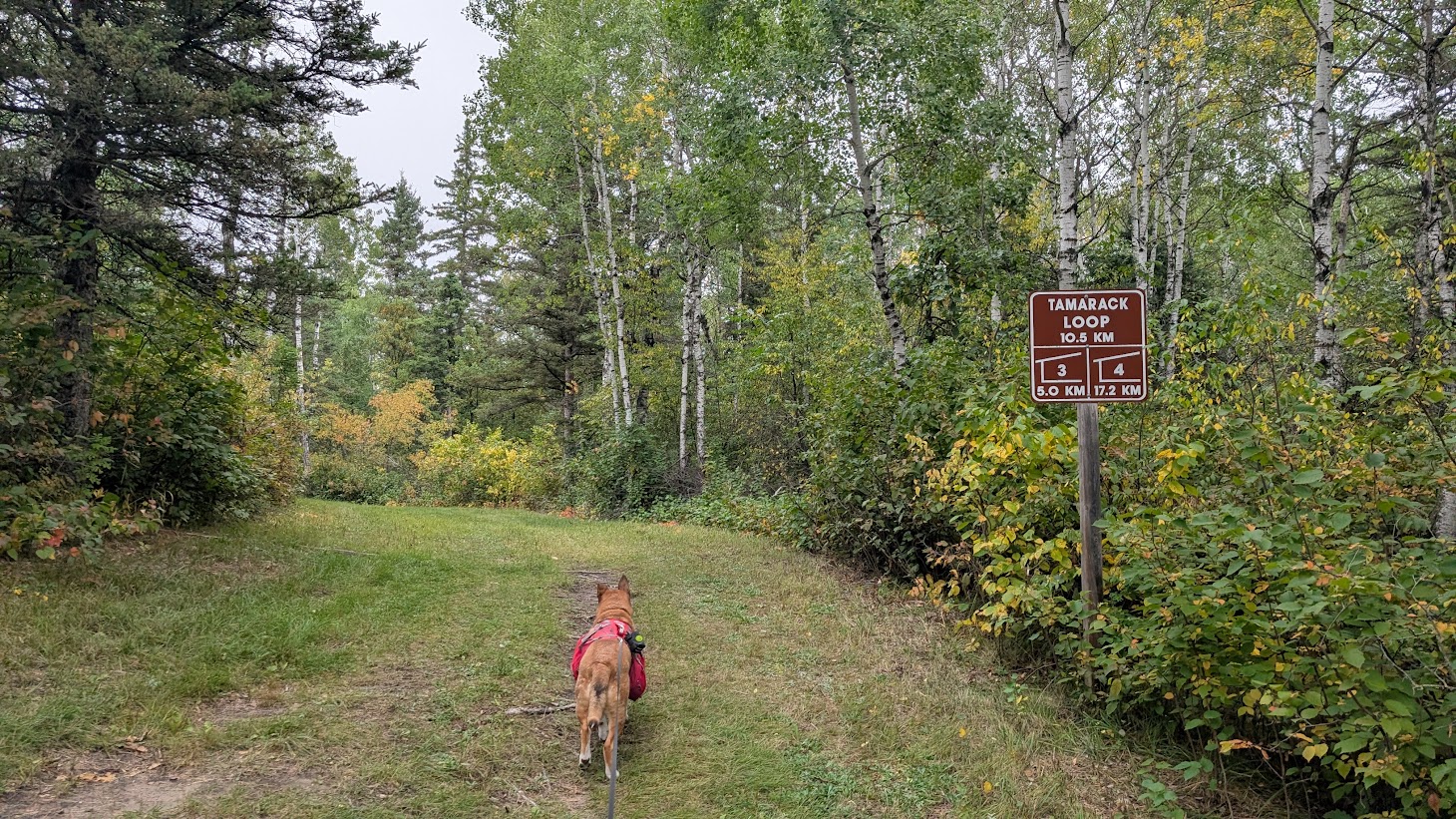
    This trailhead also serves as the parking lot for the Strathclair Trail. When we arrived, we saw cyclists heading out for a ride. The Strathclair Trail also has campgrounds, but it is best done with two vehicles for an end-to-end hike. Like the Central Trail, you can do an out-and-back hike, choosing how far you want to go before turning around. Unlike our route on the Central Trail, it does not offer loop options like the Grasshopper Valley section we planned.

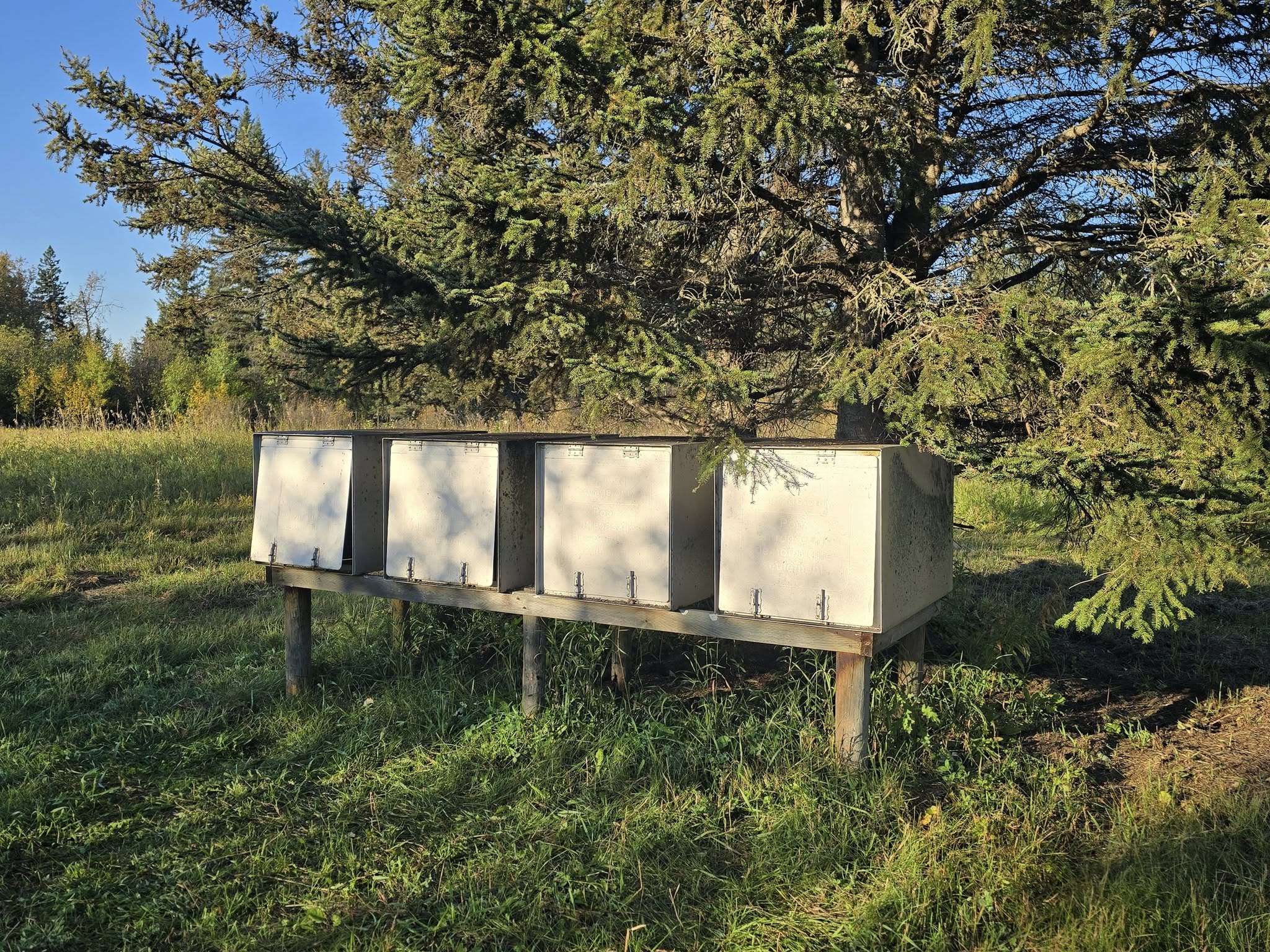
    At the parking lot, you will find a garbage can for any last-minute trash you don’t want to leave in your car. There is also a green throne toilet down a short path at the turnaround loop. Keep in mind that there are no doors, so use the hiker signal of trekking poles in the path, make some noise, or have a friend stand guard during busy season. When we arrived, there was toilet paper in a mailbox attached to a post by the toilet, but the supply was limited by the time we were leaving. Always bring your own on the trail just in case.

    Toward Whitewater Lake

    The Central Trail is wide, well-maintained and easy to follow with clear signage.

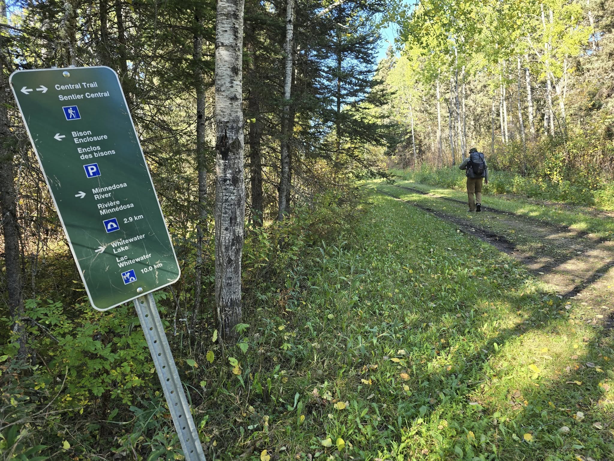
    Following the Central Trail to Whitewater Lake is about 10.4 kilometers. There is roughly a hundred meters to the Strathclair Trail fork from the trailhead and another hundred meters from the Central Trail down the approach to Whitewater Lake. A sign along the way will indicate the distance to the next turnoff, but it doesn’t always show the final distance to your destination.

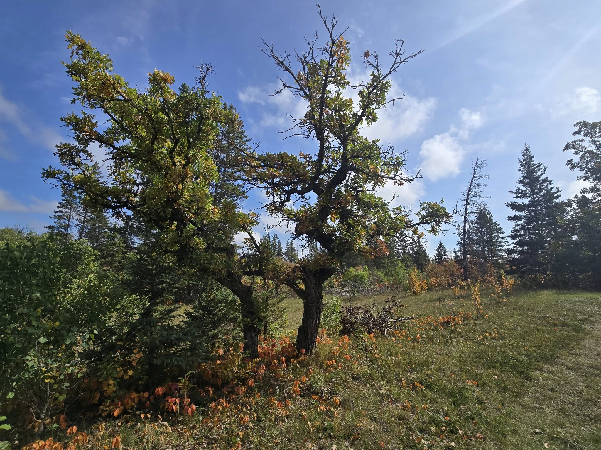
    We found the trail very easy. Riding Mountain National Park’s map also labels it as easy, and we agree. The trail is mostly flat, with just a couple of small hills near the end. There was one downed tree that hadn’t been cleared yet. Oliver chose to go around it, while Cheryl climbed through. Both options worked fine.

    The ground had no tripping hazards, unless you count your own feet or the wagon and tire tracks. There were a few gravel sections, but most of the trail was grass-covered with some patches of mud. Horse droppings were more common than bear scat along the way.

    We noticed signs of prescribed burns and other trail maintenance, which made it clear that the park takes its time to keep the area healthy and safe for visitors. We were happy to see their efforts.

    While the trail doesn’t reach any high points, there are glimpses of meadows where wildlife can sometimes be spotted. We like to make noise on the trail to avoid surprising bears, so we didn’t see much wildlife—except for grouse, which don’t seem to mind you sneaking up on them, even when you give them plenty of warning.

    We made quick work of the trail and arrived at Whitewater Lake in time for lunch. The signage made it easy to spot where we would be hiking on the return trip and where we would be heading the following day.

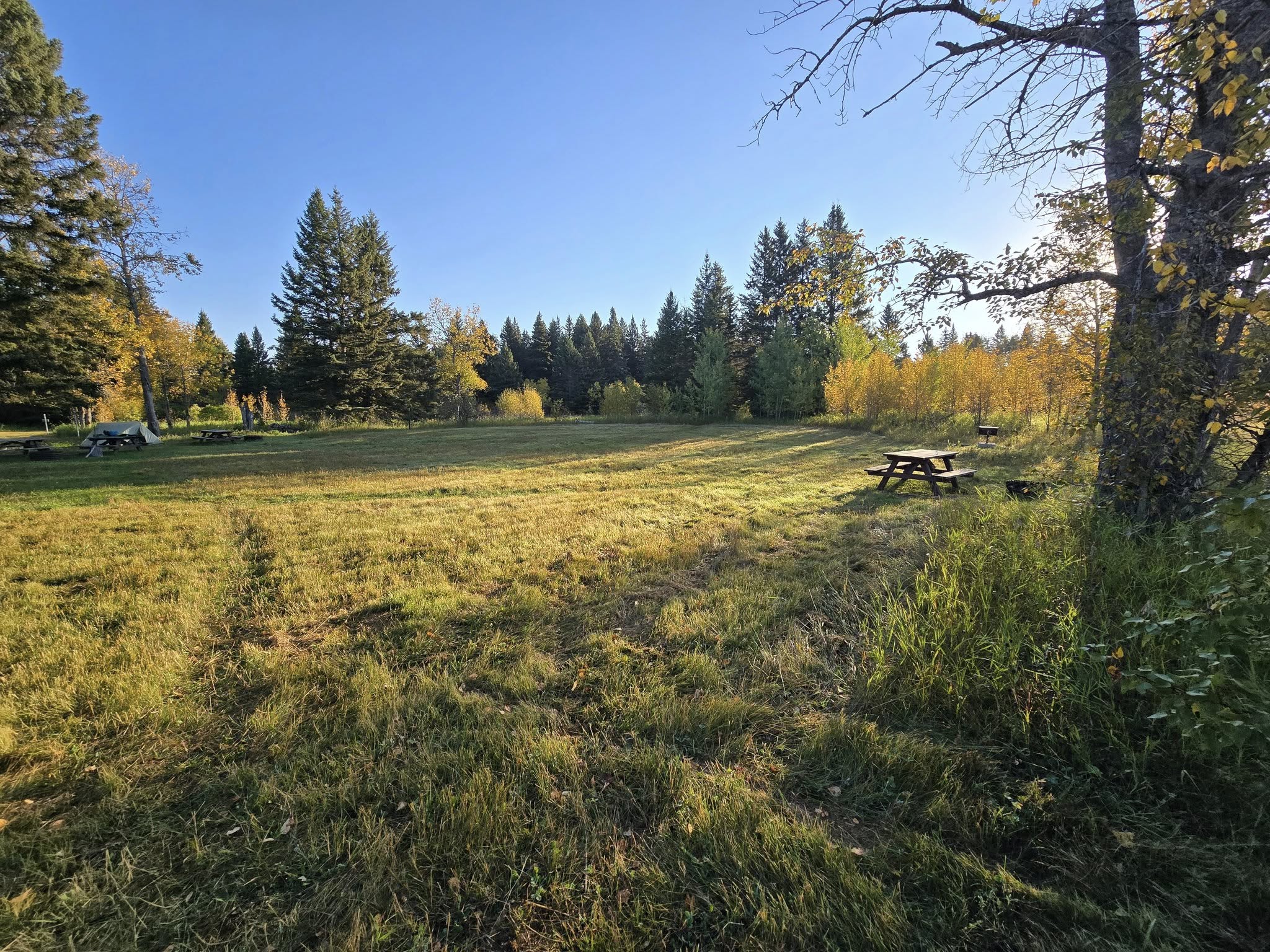
    Whitewater Lake Campsite

    Plenty of space for tents at Whitewater Lake Campground.

    Approximately 100 meters off the Central Trail is Whitewater Lake Campground. As you enter, you’ll see a hitching post corral for horses and a register box with a log book. When we reserved our campsite, there were no other guests booked, so we knew we would have the place to ourselves. From reading the log book, it looked like there were usually one or two groups at the site, so it’s not overused.

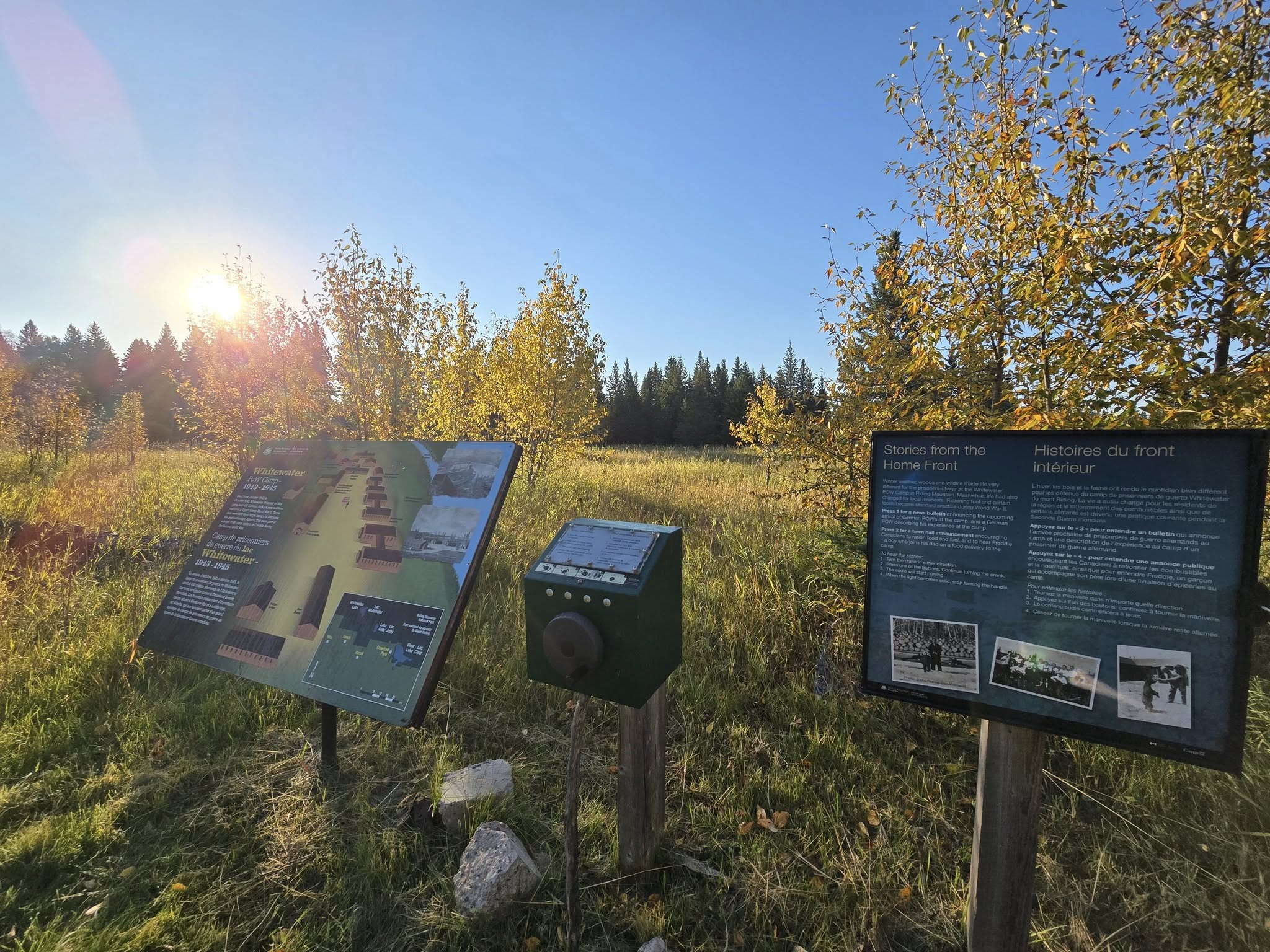
    Whitewater Lake Campground is built on the site of an old World War II POW camp. There are a couple of signs at the campground which explain the history as well as a hand crank to power up some educational audio recordings. We appreciated having the opportunity to explore some of the history of the area while we were there.

    The campground is fairly open. When reserving, we recommend selecting site 1, as you can pitch a tent under the tree for shade. Site 2 has potential if they were to clean up behind the site marker, allowing a tent to be pitched closer to the trees, but as it was when we visited, tents could only be set up in the open field with no shade. Site 3 might look sunny at first, but the trees behind it do a decent job of blocking the sun. Our recommendation is to choose site 1 first, then site 3.

    The bear lockers were in excellent condition with no signs of mice. We were happy to have a secure place to store our food. On this trip, we brought food bags instead of bear canisters since lockers were available. Our only concern was small gaps where a mouse might squeeze in, but the locks kept the lids sealed and we had no issues.

    While Cheryl pitched the tent, Oliver went for a 5-kilometer run back along Central Trail. Since he was now familiar with the stretch from Whitewater Lake to the Long Lake connector, he ran from the water pump to the turnoff about 2.1 kilometers away and then turned around. The hills on the return to camp were a bit more challenging the second time through.

    With the hike over for the day and Oliver’s run completed, it was time to relax around camp and search for the lake.

    Evening in Camp

    We put in a good effort to find the creek canoe access that was used when the site was a POW camp. We went behind the water pump and bushwhacked through the trees until we came out along the winding creek. There were many tussocks along the edge, which made walking challenging. We had planned to follow the creek until we reached the lake, but we quickly realized just how far away it was and how uneven the terrain would be. We had no interest in twisting an ankle.

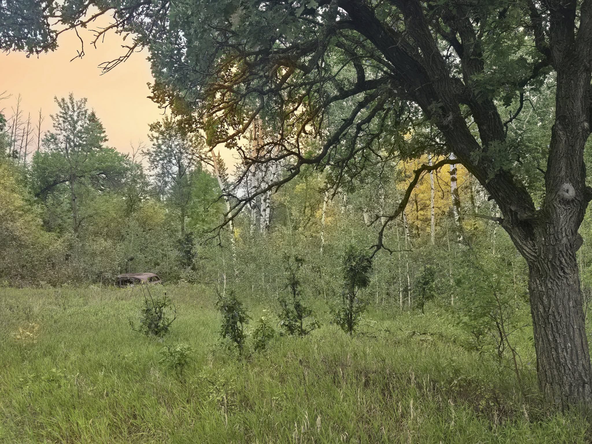
    Instead, we made our way back through the trees and studied the map to see if there was another way to the lake. Log reports mentioned a lot of swamp, which we had hoped to avoid, and it soon became clear how difficult the trek would be. We called off our attempt and instead strolled around the site, searching for remnants of the past. You can find scraps from an old power building and the foundation of another structure near the water pump. A few old pipes stick out of the ground here and there if you take a wander through the grass.

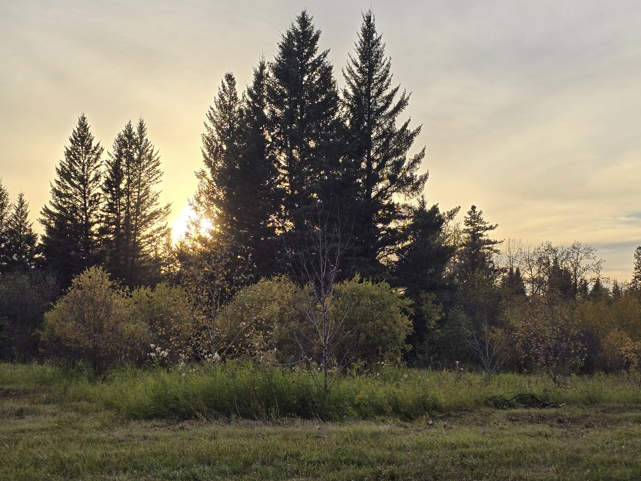
    As we sat by a fire, we watched geese fly overhead and listened to the bugling of elk. Eventually, coyotes started yapping, and later, even wolves could be heard howling. While we couldn’t see much wildlife, we could hear it all around us. We watched the sunset and, after dousing the last of the flames, climbed into the tent.

    The sounds carried on through the night. At one point, Cheryl heard something cracking in the trees, which she figured was probably a deer. There was also the sound of rocks clanging together, likely from the creekbed that ran along one side of the field. A deer probably dislodged a few stones while climbing up. Otherwise, it was a quiet, uneventful evening—the kind of night we like best.

    Central Trail Conditions and Scenery

    We found the first day on Central Trail to be very easy. There was one downed tree on the trail that hadn’t been cleared yet, but otherwise the grass was mowed and the path was clear. There were some tire rivets along the trail, though we couldn’t tell if they came from maintenance vehicles or the wagons used for horse-and-wagon rides that go through the area.

    This trail connects to other day hikes and campgrounds along the way, such as Grasshopper Valley to the end of Lake Audy or the Minnedosa River Campground. If you are looking for a short hike to a backcountry campground with your family, Minnedosa is a simple option, with only the final approach being slightly uneven in places. We discovered this campground on our final day as we hiked back to the trailhead.

    There are a few short hills about seven kilometers into the trail, but none of them were strenuous. Unless you take one of the connector trails, you shouldn’t have any trouble following the route. Central Trail is wide and mostly mowed grass, and you only need to turn off when reaching a connector trail or the turnoff to your destination. Each turn is clearly marked with signs showing the distance.

    At times, the trail feels like a tunnel through the trees. Since we hiked in the fall, the changing colors of the leaves made it especially enjoyable. Fireweed and other plants added variety along the path. Keep an eye on the sides of the trail for open meadows and other breaks in the trees—they offer moments of charm. Also, watch for grouse, which have a knack for giving you a surprise.

    Whitewater Lake Campground Amenities and Tips

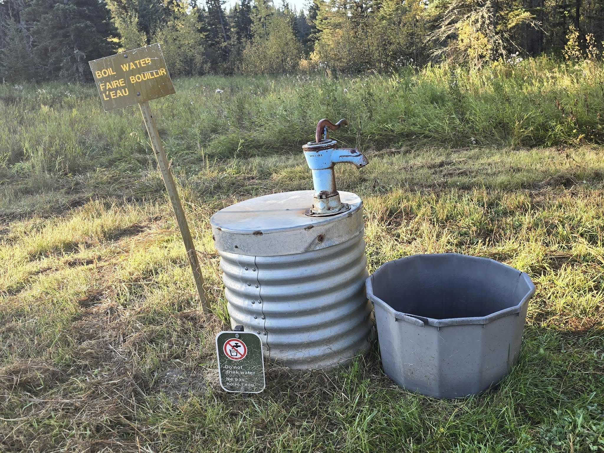
    Water Pump: Some logbook comments mention that the water pump can be difficult to locate when the grass isn’t maintained. To be helpful, we documented its location in our video. Basically, stand behind the firewood shelter and face the small aspen to the right of the World War II signs. Stay between a few short aspens and head toward the cluster of trees down a slight decline. The pump will be near the trees, close to a small remnant of an old building foundation.

    Outhouse: The outhouse at Whitewater Lake was in decent condition. Tucked away in the trees near the campground, it had adequate toilet paper. It made some creaking noises in the wind, but it wasn’t going anywhere.

    Firewood: For the end of September, the firewood pile was well stocked. We were able to enjoy a nice fire that evening without putting a dent in the pile.

    Bear Lockers: Whitewater Lake had good bear lockers located a reasonable distance from the campsite. We’re used to lockers being even further away, but this distance was fine. They were solid, with no signs of mouse entry.

    Final Thoughts on Central Trail Trailhead to Whitewater Lake – Day 1

    Our first day on the Central Trail was a gentle introduction to Riding Mountain National Park. The trail itself was very easy, with mostly flat, mowed grass and just a few short hills near the end. With clear signage and wide paths, it was simple to follow, and the fall colours added a beautiful touch along the way. Even though we didn’t see any wildlife on the trail itself, the occasional grouse and glimpses of meadows reminded us that the park is alive with activity.

    Whitewater Lake Campground was a perfect spot to end the day. The campground is open, peaceful, and well-maintained, with good bear lockers and a couple of shaded tenting options. We enjoyed exploring the remnants of the old POW camp, wandering along the creek, and taking in the sights and sounds of nature. The bugling of elk, the calls of coyotes, and even distant wolf howls made for a memorable evening, proving that you don’t need to see wildlife to experience it fully.

    Overall, the first day was a great mix of easy hiking, historical exploration, and peaceful backcountry camping. It set the tone for the rest of our trip and reminded us why Riding Mountain National Park is such a special place for both first-time visitors and experienced hikers. With well-marked trails, good terrain, and opportunities to enjoy the sights and sounds of nature, it’s a hike that feels accessible while still offering a true sense of adventure.

    Day 1 Summary

    • Date: September 26, 2025
    • Distance: Central Trail Trailhead to Whitewater Lake – 10.4 km / 6.4 mi
    • Elevation: 213 ft
    • Amenities:
      • Central Trailhead: Green throne toilet, garbage can, trail maps, parking.
      • Whitewater Lake: Pit toilet, firewood, water pump, firepit, picnic tables, horse hitching posts, bear lockers.
    • Water Sources: No water source at trailhead, water pump at Whitewater Lake Campground. No lake access.
    • Wildlife: Bison enclosure near trailhead, deer tracks, beaver dams, elk bugling, wolves and coyotes howling at night and some bear scat.
    • Navigation: Wide, mowed trail with clear signage showing distances to the parking lot and next cabin
    • Best Time to Hike: Spring (before ticks) or fall (after ticks). We heard the ticks at Riding Mountain National Park are very bad when the grass hasn’t been mowed.

    WATCH THE VIDEO FROM RIDING MOUNTAIN NATIONAL PARK: CENTRAL TRAIL TO WHITEWATER LAKE – DAY 1

    More From This Hike:

    • Hiking Riding Mountain National Park: Central Trail to Whitewater Lake | Day 1 (You’re here!)
    • More coming soon!

    Cheryl

    October 26, 2025
    2025, Manitoba, Multi-Day Trails, Riding Mountain National Park
    Central Trail, manitoba, Riding Mountain National Park, Whitewater Lake
  • Hiking the Epinette Creek Trail, Spruce Woods | Day 3

    A Quiet Night with a Reminder

    Night two on the Epinette Creek Trail in Spruce Woods Provincial Park was calm. Unlike the first night, we weren’t bothered by mice on the guylines, and the forest sounds were limited to the usual chatter and the occasional snapping of twigs in the distance. We convinced ourselves that the noises were just deer passing through, while coyotes howled far off, hunting in the dark.

    Watson was completely unconcerned. He snuggled up against Cheryl in their tent and even rolled onto his back with his paws in the air.

    We felt happy—and lucky—to have such a restful, quiet evening. A couple of weeks later, on our hike at Riding Mountain National Park, we ran into another hiker who told us about his experience at this exact campsite in April or May. He had hiked along and camped where we had pitched our tents. That evening, he spotted a juvenile black bear leaning on a tree near his tent. When he tried to scare it off, a second bear, likely the mother, appeared. He ended up in a tense standoff for several minutes before retreating into the cabin without his gear. Later, with a small tea light candle from the cabin for light, he tried to retrieve his sleeping bag from his now collapsed tent, but momma bear came crashing out of the woods again. Luckily, he managed to alert his wife despite limited signal, and a park ranger picked him up at 2:30 a.m.

    Seeing the bear scat on our September hike and hearing this story made it clear: bear spray is essential Epinette Creek Trail in Spruce Woods Provincial Park, even if it doesn’t seem necessary at first.

    Takeaway tip: Always carry bear spray in Spruce Woods Provincial Park and know how to use it—wildlife encounters can happen even at seemingly quiet campsites.

    Day 3: Cabin 4 Jackfish Lake to Epinette Creek Trailhead, Spruce Woods Provincial Park

    Leaving Cabin 4 on the Newfoundland Loop South

    As we prepared to leave Cabin 4, we noticed a shortcut behind the cabin that at least one other hiking parties had taken. From what we could tell, it was a steeper climb and not well maintained. While it might save time for some, we encourage hikers to stick to the clearly marked trail.

    We chose the stone-covered hill, following the official route—not because the shortcut is dangerous, but because the marked trail is easier to navigate, better maintained, and staying on the trail also ensures you don’t unintentionally damage surrounding vegetation. Plus, by taking the marked path, we were able to capture the full experience for our YouTube viewers, showing exactly what the trail has to offer and highlighting the route everyone should follow for a safe and enjoyable hike. Choosing the well-marked trail isn’t just about safety—it’s about respecting the land, the trail, and future hiking experiences.

    South on the Newfoundland Loop

    We were surprised by the number of oak trees in Spruce Woods Provincial Park.

    From the top of the hill, the trail splits and gives you the choice of following either the north or south loop. Like the northern half, the southern portion is rolling with plenty of ups and downs. It is not overly strenuous, but it is definitely less flat than the earlier loops of the Epinette Creek Trail.

    The terrain here felt different as well. The south loop included several sandy stretches, with a couple of large sandy hills that would be tough for any maintenance vehicles, especially on a wet day. These were not sand dunes, but the inclines were steep enough that tires would have little to grip without the stones the park has placed for traction. As hikers, we actually enjoyed the sandy sections. It was a nice change from the usual soil, and we were grateful the trail was not muddy during our visit.

    Another unique feature of this loop was the number of oak trees. While we had spotted a few earlier in the hike, the south loop had noticeably more. Cheryl even wondered if some of them had been intentionally planted. Just before Cabin 3, we entered an open area that looked as though it might once have been a homestead. An old abandoned car sat off to the side, oak trees lined the trail, and we crossed an infrequently used dirt road. Seeing so many oak trees in this part of the park felt unusual and memorable, and it added character to this stretch of trail.

    An old abandoned car near an oak tree on Epinette Creek Trail.

    A Short Break at Cabin 3

    When we reached Cabin 3, we took a break. It was time to load up on more water and have some snacks. We had access to the outhouse and of course the garbage cans and took advantage of the amenities. There was no one there. Anyone we had stayed with previously had moved on and we could stretch out on picnic tables and on the water pump platform, dryihg out our dew-soaked socks and soothing aching muscles.

    We knew we only had about 8 km left to hike before reaching the trailhead and that if the next half of the loop was the same as our approach from the trailhead on day one, it would be an easy go. We made sure Watson was well rested and got plenty of water and then we set off on the home stretch.

    Onward to the Trailhead

    We took a break on a hill to catch a light breeze.

    While the scenery on this half of the trail was about the same, with open grass and prairie mixed with tree tunnels, we were likely feeling a bit more fatigued after already completing 13 km of hiking. The stretch to Cabin 2 felt hillier than day one, and there was one good hill climb that reminded us Manitoba isn’t completely flat.

    The temperatures were rising, and we were in an open stretch, so it was time for another break. We always try to find the most scenic places on a trail to stop. When hiking, the views are a great reward and something you work hard for. On this trail, however, “views” had a different meaning. We were looking for a nice creek weaving through the trees or a field that stretched out for a while. Views are those locations where your eyes move from one point of interest to another. We found a spot that looked out over the grassy prairie outlined by trees. It might not have been a significant viewpoint for some, but we appreciated watching the grasses sway and the many colours of the leaves.

    After our break, we finished the walk to Cabin 2. Because there were benches, we took another short rest. Why not? There was no rush. We knew we were only a short distance from the parking lot, and sometimes we’re just not ready for a hike to be over.

    Arriving at the Trailhead

    When we spotted the car, we were pleased to see the end of the trail. We always feel happy when we see our car. The last thing you want after finishing a hike is to discover your vehicle is missing. We told Watson it was time for a car ride, and even he seemed pleased by the announcement.

    At the trailhead, we saw the teenagers from the school group taking photographs together. Oliver offered to help take their group photo so the chaperones could also be in the shot. It was nice to reconnect with them one last time before we all went home. We also learned that a lost cell phone had been recovered. They had dropped it somewhere between Cabin 2 and the parking lot, then backtracked and found it on the ground. It served as a reminder that you can lose something at any time on the trail, even when you’re close to the end.

    As Oliver changed into fresh clothes, Cheryl sat with Watson in the open trunk of the car. Watson proudly looked out at the parking lot, happy to be on his blanket and excited for another car ride adventure. He’s always up for anything.

    Driving Home

    The drive home took about two hours, plus a stop in Portage la Prairie where we each grabbed a hamburger. Watson scored some fries. Because Spruce Woods Provincial Park isn’t too far away, we were able to get home at a decent time to clean up our gear and enjoy a relaxing evening. Sometimes, trails can be a long drive away, and after a full day of hiking and then driving, you end up exhausted before you even reach home. If you plan to do the full 20+ km hike on the Epinette Creek Trail and you’re not a slow hiker, you can expect to be back in Winnipeg by the afternoon, which is a good time to arrive and start planning your next hike in Spruce Woods Provincial Park.

    Newfoundland Loop Conditions and Scenery

    This section of the trail is approximately 13.5 km. Although signage may read 11.7 km, the distance is longer from Cabin 3 because of the connector trail to the loop split. You will see a sign indicating about 2 km left when your Garmin shows 11.7 km. Be prepared for slightly longer mileage.

    As mentioned, there are no water sources after leaving Cabin 3 until Cabin 4. Carry enough water on hot days, as there are no streams or creeks along this section.

    This section has more rolling hills than other loops. Besides the stone-covered hill after Cabin 3, the hills are gentle but consistent. Uneven areas come from clumpy grass, cleared downfall, or tracks left by maintenance vehicles. The trail is mostly hazard-free.

    While Epinette Creek Trail in Spruce Woods Provincial Park does not offer sweeping vistas, the prairies and colorful fall leaves create a beautiful scene. The trail passes through different landscapes, from tree tunnels to open fields, with mushrooms and flowers scattered along the way.

    Final Thoughts on Epinette Creek Trail, Spruce Woods Provincial Park – Day 3

    Day 3 on the Epinette Creek Trail had more hills than Days 1 or 2. Doing the full length from Cabin 4 to the trailhead meant we were combining the portions of the loops that we had not yet completed when hiking in.

    For beginner hikers, we would recommend breaking up the 20 km day into two shorter days by stopping at Cabin 3 before hiking out the rest of the way. Another option is to start early and take your time. If you begin in the morning, you have all day to reach your car. It is not a strenuous hike; it is simply long. If you are not used to doing 20 km days, remember that you have that option. Once you reach Cabin 2, just keep going. You are almost there.

    While we had no issues with animals on the trail, knowing what we know now, we would advise bringing bear spray just in case. The trail maintainers keep the trail in fantastic shape with wide paths. Do watch for scraps of wood, as you could trip on a stick or loose piece that might roll your ankle. Other than that, the trail is excellent and easy to navigate. As long as you know which cabin number you are targeting, you will have no problem reaching your destination.

    We truly appreciated having the amenities of toilets, water pumps, and firepits. The garbage and recycling bins were a luxury. Who would have thought people would be so excited to see garbage cans? When you are used to packing out your trash all the time, having a place to dump smelly scraps on a hot day and not have them bake inside a plastic bag in your bear canister feels like a treat. You will appreciate a garbage can in the backcountry too.

    The only downside is that there are no bear boxes. We made use of the cabins to store our food at night. Since we used bear vaults, we could have left our canisters outside a safe distance from camp, but not having to worry about bears knocking them around at night or searching for them in the morning if they were moved made the cabins a much nicer option. If you plan to store your food in the cabins, remember that they are home to mice. You may want to use a mouse-proof container to make sure your food does not get munched on overnight. I hope that in the future they install bear boxes at these sites. That is the only thing missing.

    Day 3 Summary

    • Date: September 14, 2025
    • Distance: Cabin 4 (Jackfish Lake) to Trailhead – ~20 km / 12.6 mi
    • Elevation: 1650 ft
    • Water Sources: Only available at cabin water pumps and beaver dam creek after Cabin 2.
    • Wildlife: Deer tracks and plentiful bear scat.
    • Navigation: Wide, mowed trail with clear signage.
    • Best Time to Hike: Spring (before ticks) or fall (after ticks)

    WATCH THE VIDEO FROM EPINETTE CREEK TRAIL – DAY 3

    More From This Hike:

    • Hiking the Epinette Creek Trail, Spruce Woods | Day 1
    • Hiking the Epinette Creek Trail, Spruce Woods | Day 2
    • Hiking the Epinette Creek Trail, Spruce Woods | Day 3 (You’re here!)

    Cheryl

    October 25, 2025
    2025, Manitoba, Multi-Day Trails, Spruce Woods Provincial Park
    epinette creek trail, manitoba, spruce woods provincial park
  • Hiking the Epinette Creek Trail, Spruce Woods | Day 1

    About the Epinette Creek Trail

    The Epinette Creek Trail is located in Spruce Woods Provincial Park, about 180 km from Winnipeg, Manitoba. The trail system consists of four connected loops that together create a total return distance of 41.7 km. These moderate trails—Spruce, Juniper, Tamarack, and Newfoundland—take hikers through prairie grasses, mixed forests, and rolling sandy hills.

    The Epinette Creek Trail is a multi-use trail with year-round traffic, permitting hiking, biking, and winter activities. The backcountry campsites include cabins equipped with wood stoves. These are most often used in winter, as mice tend to be active during the summer months. Cabins are generally intended for emergency shelter, except for Jackfish Lake cabin, which can be reserved. One of the perks of the Epinette Creek Trail is that you don’t need reservations. When we hiked in 2025, park entry fees were waived until March 31, 2026, making it an especially budget-friendly adventure.

    After moving from Labrador to Manitoba this summer, we were eager to find a short weekend hike to scratch the itch of getting outdoors. Google suggested a few options, but the Epinette Creek Trail stood out because it allowed us the flexibility to shorten our trip if needed.

    While Oliver had hiked the Arizona Trail earlier in the year, Cheryl was just coming out the other side of medical roadblocks and hadn’t been on a hike since her diagnosis. This would be her first strenuous exercise, and we weren’t sure if her body would be as willing as her mind. We needed a trail that would let us opt out of sections if necessary, but still continue if things went well. It also had to not be too challenging, since we didn’t know how much would be too much. The Epinette Creek Trail turned out to be the right choice for our circumstances. On September 12, 2025, we set out from Winnipeg with our dog, Watson, to explore Spruce Woods Provincial Park.

    Day 1: Epinette Creek Trail Trailhead to Cabin 3

    Driving to Spruce Woods Provincial Park

    We began our drive from Winnipeg after Cheryl’s specialist appointment that morning. The drive was uneventful as we made our way west past Portage la Prairie and into Austin, where we stopped at Subway for a quick bite to eat. We then turned south toward Carberry before finally reaching Spruce Woods Provincial Park.

    Our first stop was the Friends of Spruce Woods Provincial Park Gift Shop, where we looked for additional information about the route before hitting the trail. The gift shop hours do change, so check their calendar for the dates and times they are open. The Visitor Centre was already closed for the season, so it was a very short visit. We then went back up the road to the turnoff for Epinette Creek Trail. The signs off the main road are well marked with large wooden signs to direct you where to go.

    Trailhead and Parking

    The road in passes through an open grassy field before you arrive at a dirt parking lot. Here you’ll find the access points for Epinette Creek Trail and a portion of the Trans Canada Trail, which eventually leads to the Yellow Quill Trails. There were a few cars already in the parking lot, but we weren’t concerned about space since there was plenty for everyone. If you aren’t in a rush to start hiking, you can wander around and read the interpretive signs in the area.

    Cabin 1 is located right at the parking lot. If you arrive extremely late and don’t want to hike in the dark, I could see why you might camp here. It would be most appropriate in the winter months, when it’s ideal for staging cross-country ski trips, warming up while switching into winter gear, or waiting for friends to arrive.

    Hiking to Cabin 2 (1.5 km)

    The first trail sign for the Epinette Creek Trail is beside Cabin 1. You’ll have no difficulty spotting the trail—it’s a wide, two-track path that has been worn from use and frequently mowed. The ground was quite level as well, which meant we could walk without worrying about twisting an ankle or tripping on roots. We had wondered if the trail would eventually narrow, but it stayed this wide for all four loops.

    Approximately 1.5 km from the parking lot is Cabin 2. The hike in is an easy stroll through open grassy plains before leading into the trees, where the cabin is tucked down a hill. There is adequate signage to find your way, and the trail leads straight to the entrance. At Cabin 2 you’ll find a hand pump, a firepit surrounded by benches, picnic tables, garbage and recycling bins, and an outhouse. Inside, there’s a logbook to sign.

    We had heard from other hikers who camped there that mice were active in the evening, so they preferred to pitch their tents outside instead of sleeping in the cabin.

    The wide and mowed Tamarack Loop trail.

    Toward Cabin 3 (~7.5 km): Tree Tunnels, Fall Colors, and Wildlife

    We didn’t stay long at Cabin 2 and continued down the trail. There were sandy patches here and there, but eventually we were led into tree tunnel after tree tunnel. This wasn’t an issue, since we appreciated the shade when temperatures rose. Bear scat soon became frequent, evidence that they had been eating berries in the area.

    Since we went in the fall, the trail was surrounded by vibrant color. We enjoyed greens, yellows, oranges, and reds, with leaves gently falling to the ground in front of us. We spotted mushrooms and wildflowers along the way.

    Before a large sandy hill we had to climb, we came across a creek running through a culvert. A beaver had built a dam both at the culvert and a little further upstream. This was the only water source between Cabin 2 and Cabin 3, but we recommend stocking up at Cabin 2 rather than drinking from the beaver pond. As we climbed the sandy hill, we saw beaver prints in the dirt and a freshly chewed stump from the resident.

    We continued on, passing more bear scat and deer tracks along the way. What impressed us most was how easy the trail remained. The condition was consistent—well mowed and clear—and the difficulty never increased. Rolling hills broke up the terrain, but aside from the sandy climb by the creek, there were no steep sections. We stopped for a snack at a viewpoint bench and then carried on to finish the last few kilometers.

    Watson resting at the viewpoint.

    Arriving at Cabin 3

    The trail pointed straight to the water pump, so we knew we had reached our destination when it came into view. Several tents were already set up nearby. As we explored, we found the outhouse, the cabin, and two picnic tables with firepits. Unfortunately, there are no bear storage lockers on these trails, and we even noticed bear scat near the outhouse. We used the garbage bins to get rid of food wrappers and stored our bear-proof food canisters inside the cabin.

    Since we were hiking with our dog Watson—and Cheryl wanted practice setting up her own gear for future solo hikes—we opted to bring two tents. Cheryl camped in the Durston X-Mid 2p with Watson, while Oliver camped in the Durston X-Mid 1p that he had used on the Arizona Trail.

    Our tenting spot at Cabin 3.

    Evening in Camp

    After dinner, the students from the other tents returned from day-hiking the Newfoundland Loop, which we planned to hike the next day. They were on a school trip working toward their Duke of Edinburgh Award and had been practicing fire-starting with flint and steel. We shared fire starting tips before we finally turned in for the night.

    Watson curled up happily on his sleeping mat, and we quickly fell asleep—thankfully with no bear visitors that we were aware of.

    Epinette Creek Trail Conditions and Scenery

    Trail conditions on the Epinette Creek Trail were excellent. The path was wide, with no concerns about packs snagging on branches or needing to climb over fallen trees. We even noted the lack of spiderwebs across the trail, likely because the path is so broad.

    Since we hiked in the fall, the leaves were just beginning to change colour. A few were starting to fall, creating a beautiful seasonal backdrop. The trail was very well maintained, with few branches or roots underfoot that could trip you up. There were several scenic viewpoints to pause and enjoy a snack—though only one spot had a bench.

    The scenery shifts often along this section, alternating between open spaces and denser vegetation. Even though the trail itself is easy, it never feels monotonous because there’s always something new to see in the plant life around you.

    Cabin Amenities and Tips

    Water: The pump at Cabin 3 was functional but noisy. If you’re an early riser, consider collecting water the night before to avoid disturbing others in the morning.

    Outhouses: At Cabin 3, the outhouse had no hand sanitizer left, which isn’t unusual since it appeared to be the most used cabin of the four. If you want sanitizer, be sure to pack your own. Toilet paper wasn’t an issue, though we always bring extra just in case.

    Firewood: We noticed very little firewood at Cabin 2, but we didn’t stay long enough to search thoroughly. Cabin 3, however, had plenty.

    Final Thoughts on Epinette Creek Trail – Day 1

    Day 1 on the Epinette Creek Trail made for a smooth and enjoyable start. The trail was wide, well-marked, and very well maintained. Campsites were clean and thoughtfully equipped with basic amenities. There was plenty of toilet paper, the water pumps worked, and we found enough firewood for a campfire. Having garbage and recycling bins available was an unexpected bonus, something you don’t often see in backcountry hiking. It was nice not to have to pack out every bit of trash.

    We aren’t accustomed to such wide trails, as most of our hiking has been on narrow singletrack with some overgrowth. While we had expected this style of trail on the Mantario, wildfires had closed it this year. Even if it had been open, easing back into hiking after medical issues would have made us hesitate.

    One surprise was the sheer amount of bear scat. We had originally left the bear spray at home, thinking it unnecessary this far south in Manitoba. After seeing fresh scat along the trail and later hearing from another hiker who had a stand-off with two bears by Cabin 4 earlier this year, we decided that bringing bear spray would be a good idea next time.

    Day 1 Summary

    • Date: September 12, 2025
    • Distance: Trailhead to Cabin 3 – 9 km / 5.5 mi
    • Elevation Gain: 521 ft
    • Amenities:
      • Cabin 1: Pit toilet, warming cabin with wood stove, water pump, bear-proof garbage and recycling bins
      • Cabin 2: Pit toilet, warming cabin with wood stove, water pump, firepit, picnic tables, benches, bear-proof garbage and recycling bins
      • Cabin 3: Pit toilet, warming cabin with wood stove and sleeping loft, water pump, firepit, picnic tables, bear-proof garbage and recycling bins
    • Water Sources: One beaver-occupied creek; otherwise, only available at cabin water pumps
    • Wildlife: Deer tracks, beaver prints, and plentiful bear scat (especially between Cabins 2 and 3, and near Cabin 3’s outhouse)
    • Navigation: Wide, mowed trail with clear signage showing distances to the parking lot and next cabin
    • Best Time to Hike: Spring (before ticks) or fall (after ticks)

    WATCH THE VIDEO FROM EPINETTE CREEK TRAIL – DAY 1

    More From This Hike:

    • Hiking the Epinette Creek Trail, Spruce Woods | Day 1 (You’re here!)
    • Hiking the Epinette Creek Trail, Spruce Woods | Day 2
    • Hiking the Epinette Creek Trail, Spruce Woods | Day 3

    Cheryl

    October 12, 2025
    2025, Manitoba, Multi-Day Trails, Spruce Woods Provincial Park
    2025, epinette creek trail, hiking, manitoba, Multi-Day Trails, spruce woods provincial park

©2023 All rights reserved.

  • Facebook
  • YouTube