Untaken Trails
  • Home
  • About
  • Multi-Day Trails
    • Bucket List
    • 2024
      • Arizona Trail
    • 2023
      • Gros Morne National Park
    • 2022
      • Pioneer Footpath
    • 2021
      • GDT Section C
      • The Boreal Trail
    • 2020
      • GDT Section B
  • Dayhikes
  • Gear
    • Gear We Use
    • Gear Reviews
  • Blog
  • Contact
  • Battle Harbour – Labrador

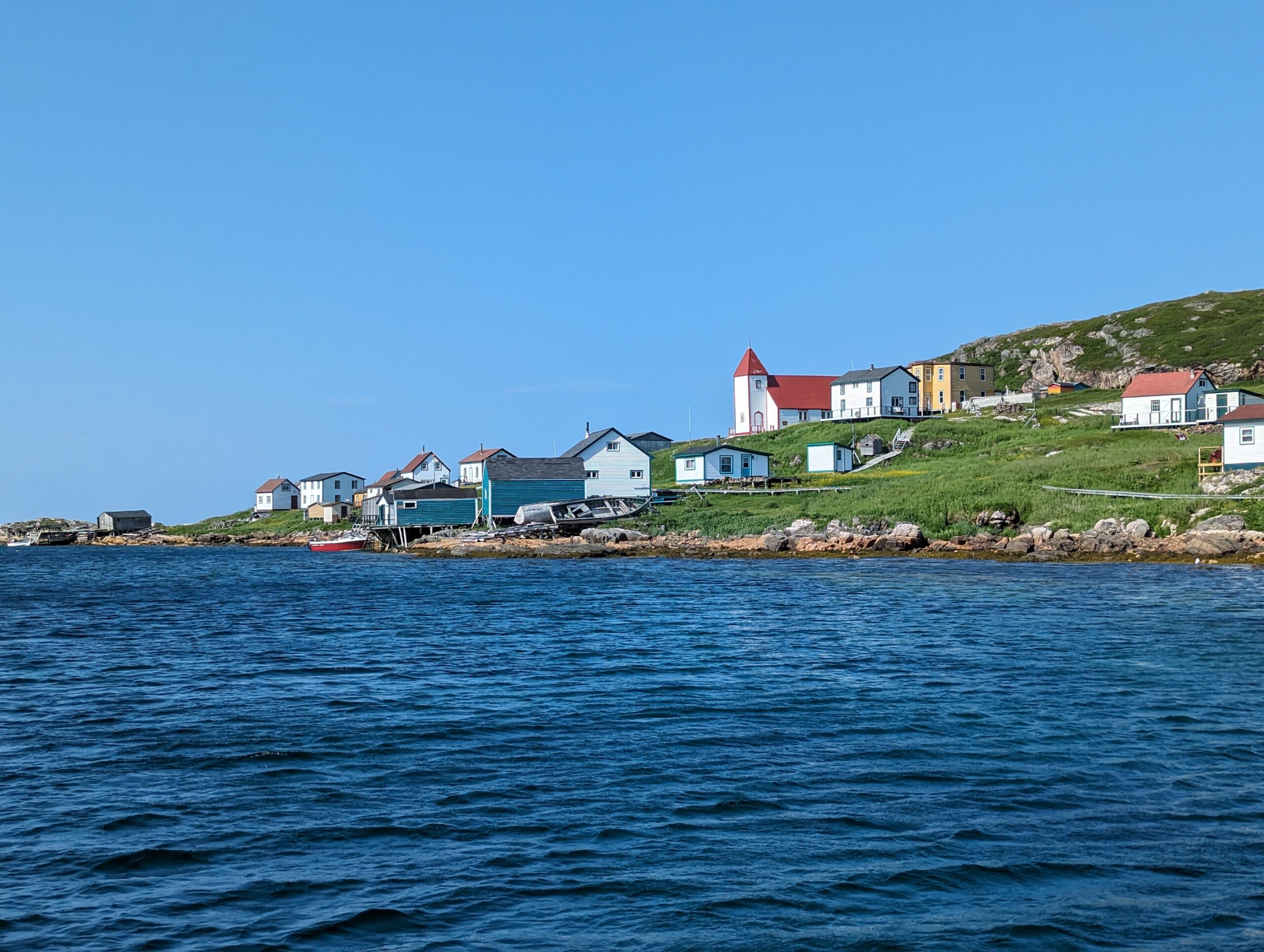
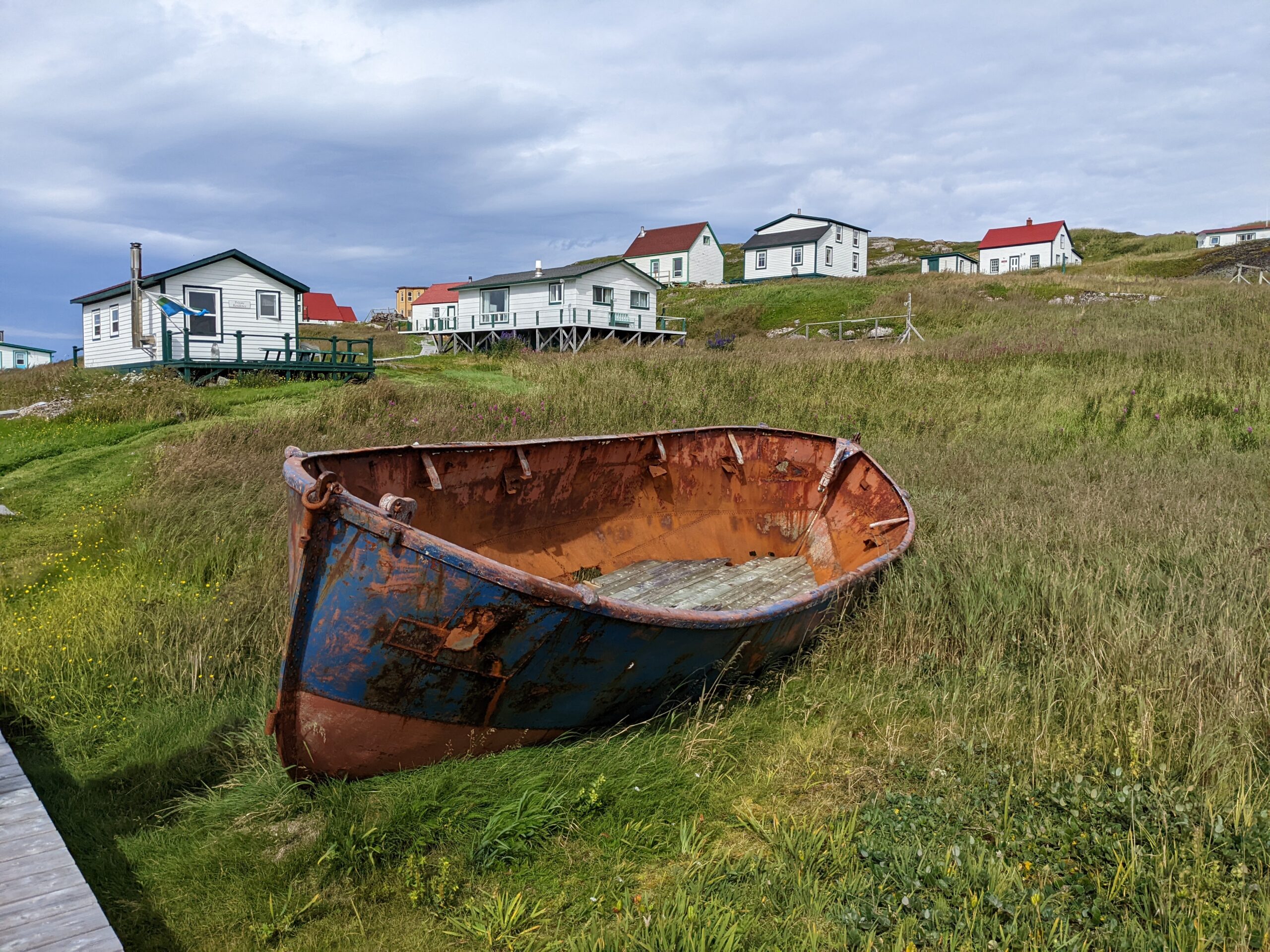
    Battle Harbour is a neat historic island in Newfoundland and Labrador. It offers a unique glimpse into the hardships of the sealing and fishing industry. Battle Harbour was founded in the 1970s with most people resettling in 1966 when the fishing industry declined. It is now a historical site with some summer homes and tourist accommodations.

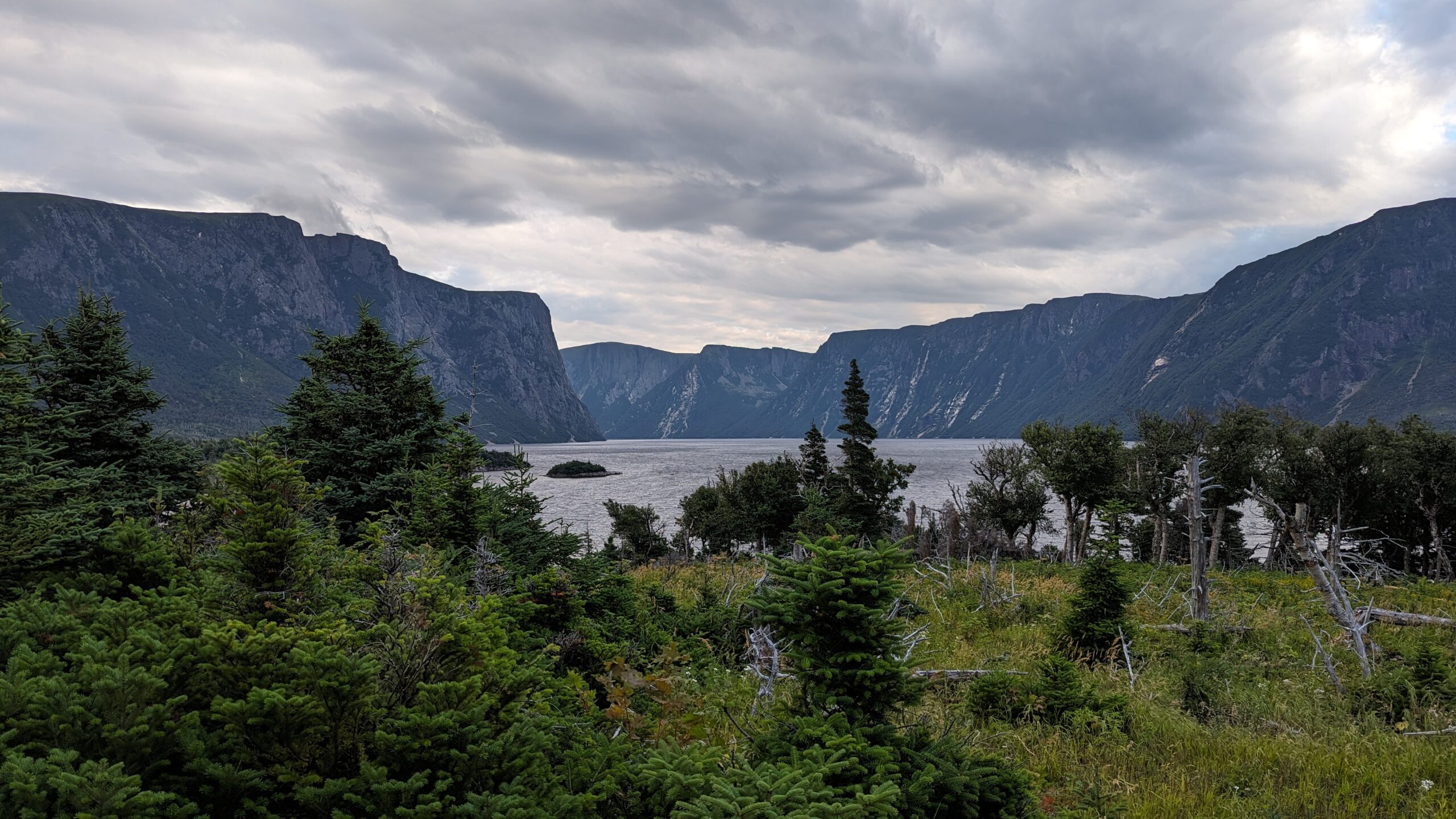
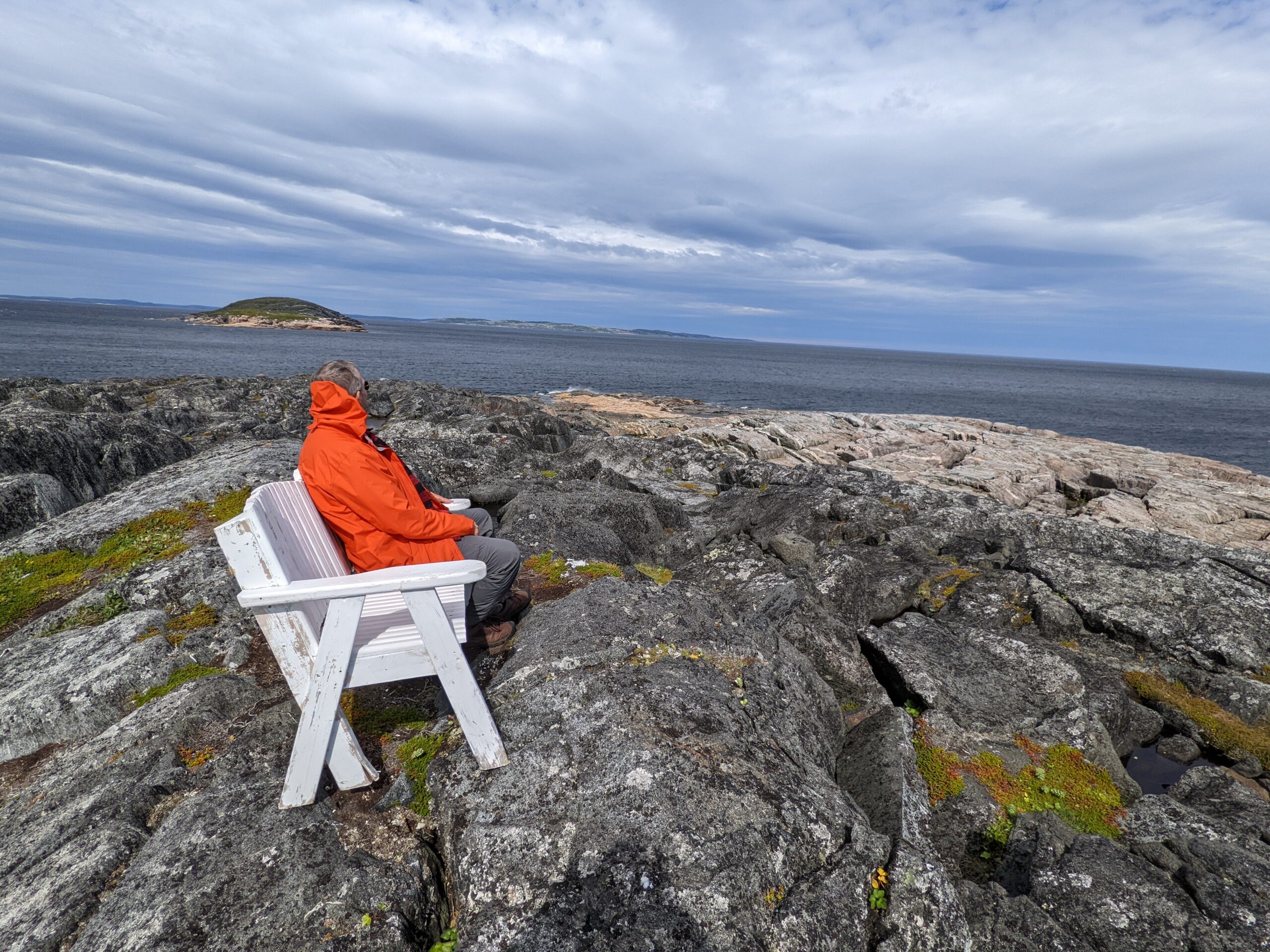
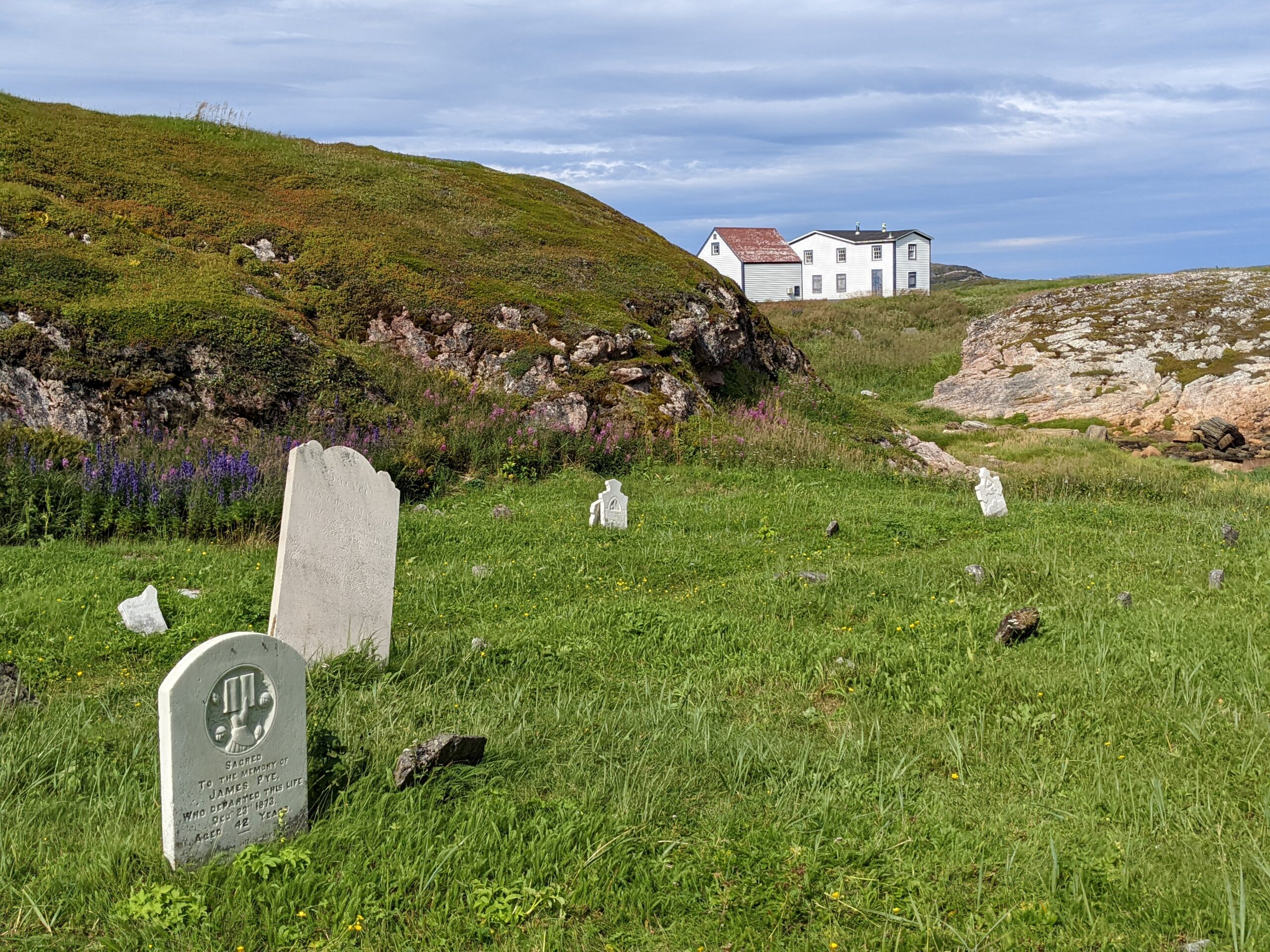
    We have visited Battle Harbour twice on day trips. This site doesn’t offer a “hike” in the sense of walking a long distance. It does have a loop that goes around the entire island. On this footpath, you walk through a graveyard and up a hillside onto the top of the hill. There you have spectacular views of the ocean. On one trip, we spotted icebergs in the distance.

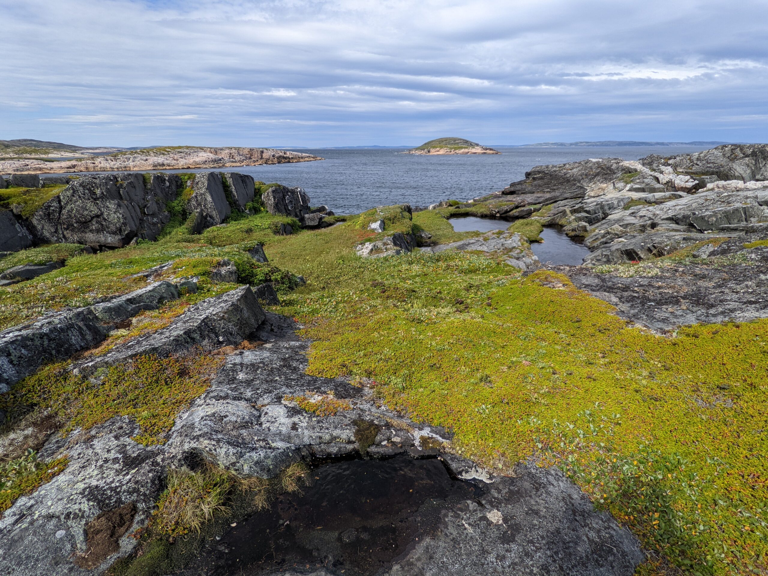
    The moss and lichen growing on the rocks is fascinating. During a visit, there was a tourist who was sunning herself on the moss. The hot sun had dried it, making the moss a dry bed to rest on. If we had more time, we might have tried it ourselves. With the sound of the waves and a light breeze, it was a tempting to do the same.

    For our trips to Battle Harbour, we went on day trips. We took a boat from Mary’s Harbour and arrived at Battle Harbour just before lunch. We had enough time for a quick walk around the island before lunch. The serve the meals family style at the dining hall. They have large tables for groups of about six people each. The freshly baked buns are always a treat for the guests. We had chicken pot pie for lunch, which was delicious. They do ask about diet restrictions before you arrive at the island and will give you an option.

    After lunch, they offer a guided tour of the buildings on the island. You will learn about the salting of fish and processing of seal. Many of the tour guides either grew up on the island or had family members who did. They are full of knowledge and are ready to answer your questions. Whenever we have been there, they were always working on the maintenance of the buildings and the docks. The volunteers take a lot of care to maintain the site.

    Battle Harbour is one of those places that if you can spend a longer time there, you should. There is limited internet at Battle Harbour, which helps you disconnect from the world for a while. You can find internet in the loft building if you really need access. The quietness of the Battle Harbour offers gives you a chance to slow down and breathe. And when you breathe, you take in the fresh air around you.

    If you take advantage of their accommodations, you can really slow down your walk around the island to stop and reflect on the different views along the way. Often we have found people sitting on the rocks staring out at the ocean. They also are checking out the foundation from the old wireless radio station and the site of an old airplane crash. Parts from the crash are still there to observe.

    We hope to return for a third time and stay for a weekend. Our visits have always felt rushed and we always say we need more time. Again, Battle Harbour is not a trail but offers an experience that we highly recommend should you be in Newfoundland and Labrador. It isn’t every day you can visit an island such as this and look out at the endless ocean in all directions.

    Cheryl

    February 18, 2024
    Dayhikes, Outdoors
    battle harbour, dayhike, labrador, newfoundland
  • VIDEO: Gros Morne Northern & Long Range Traverses

    We didn’t get a lot of footage during our hike at Gros Morne National Park but we did take a lot of pictures. This video is more of a slide show, but it should give you a nice idea of what the traverses have to offer at Gros Morne.

    Cheryl

    February 13, 2024
    2023, Gros Morne National Park, Uncategorized, Videos
    gros morne, hiking, newfoundland
  • VIDEO: Pioneer Footpath

    During our hike of the Pioneer Footpath, we captured footage of our hike from Pinware to L’Anse au Loup in 2022. This is a lesser known trail that had connected fishing villages along the coast of Labrador, Canada. The trail can be experienced as multiple short day hikes or a shorter thru-hike. Check out our video and subscribe to see future videos.

    Cheryl

    February 12, 2024
    2022, Pioneer Footpath, Videos
    hiking, labrador, newfoundland
  • Trip Report Part 8: Gros Morne Long Range and Northern Traverses Day 7 Aug 27 2023

    The final day. We would get a lovely restaurant meal when we got out. But there was the small matter of getting out. And contrary to popular wisdom, downhill isn’t always easier.

    The morning started with a ford across a complicated creek with many pools and holes. I managed to find a very good track crossing first ahead of the two other groups we shared camp with. The ones that followed me did well. The others… did not.

    Picking their way across the ford

    Then a bracing climb up to Upper Green Island Pond camp. Breezy and exposed, with a long trek to water. We made the right choice the night before. The terrain rolling away from this point was up and down, over exposed rock with few mudholes. We made good time.

    We stopped for a break at the Bakeapple Viewpoint, which looks down on Ten Mile Gulch, another fjord that had been silted in until it was a lake. Quite breathtaking if not quite as breathtaking as Western Brook Pond.

    As Gros Morne rounded into view, we began to see the drop into Ferry Gulch campground was going to be steep. Very steep. Despite the strength of the trail (it saw a good amount of traffic because dayhikers would come up from Ferry Gulch to Bakeapple Pond viewpoint), the steep inclines and lack of good handholds going down made it quite challenging, especially after 6 long, taxing days. We took our time picking our way down to Ferry Gulch, reaching there around 2pm. The well established and maintained trail up Gros Morne on the other side of the gulch seemed covered with ants, as we watched the dayhikers taking on the mountain. A couple of times we recognized our former campmates giving it a try. But clouds were forming, and we were tired so we elected not to go for the peak.

    At the top of the drop. Gros Morne is on the right.

    And it was a good thing we didn’t. The trail down to the parking lot from Ferry Gulch felt much longer than it looked on a map. It went on forever. The first 5km was brutal – it was a trail, but not gravelled – more like broken out of the stone into fragments. We traversed several scree fields, and footing was treacherous often with shifting rocks under our feet. At least it was dry…

    Finally arriving at Ferry Gulch. The camp was on the far end of the lake – I’d call it a front-backcountry campground.

    Finally the rocky footing subsided into gravelled trail. But that still stretched on for some time. The map says we did 14km today, but it felt like 18. The trail on the map was not the same that we walked, and I believe the reroute added 4km. The last 5km water was sprinkling out of the sky on us – so this experience began with some cloud and rain, and ended with cloud and rain – but because the 5 days in between were glorious and sunny, we cannot complain about that at all!

    Too tired to celebrate…

    A well deserved feast in Rocky Harbour was a fitting denouement to this trip. All told, with the many extra kms we logged getting off track then back on track, I am convinced we made this trek into one closer to 100km instead of 80. As I have said to many people, it was a once in a lifetime trip, and we loved it… but we NEVER want to do it again!

    Total Distance: 18km

    Total Ascent/Descent: 200m ascent, 700m descent

    admin

    January 4, 2024
    2023, Gros Morne National Park, Multi-Day Trails, Outdoors, Trails, Uncategorized
    gros morne, hiking, newfoundland
  • Trip Report Part 7: Gros Morne Long Range and Northern Traverses Day 6 Aug 26 2023

    Rising early is my normal. I tended to get nice sunrise photos of our campsites.

    On this day we would be making for Green Island Pond. There is an upper and a lower campsite we would have to choose from. But that was later.

    First, to leave Mark’s Pond we had to cross a swift, rocky creek. Cold feet first thing in the morning wasn’t as bad as we had feared – and we scouted a crossing for our friends to follow. But they hiked much faster than us so they quickly left us behind.

    We went up and down several lovely passes. The views to the interior were beautiful. If I didn’t know they were covered in swamps I would have called them idyllic. But I didn’t have to walk there so I enjoyed the views.

    The walking was once again much easier. I began a streak on this day where I did not get my socks wet again for the rest of the traverse. Now, my wife thought I was nuts because I would skirt widely around wet boggy spots that she would slog through. I probably added at least 1km to my distance on the day from all my extra steps. But I had dry feet and I think that was worth it.

    The group of young fellows from the States caught up and passed us. Several times. They took long breaks but pushed hard when they were moving. They ploughed through the sloppiest bogs – they had totally given up keeping their feet dry. black mud all up their legs, they were just going hard. With higher amounts of traffic, it was easier to guess where the traverse went, but at the same time, we found a couple of instances where the “good” track went off in the wrong direction from many people making the same mistake in trusting the tracks in front of them.

    We enjoyed this day’s walk until the very end, just before Green Island Pond. There was a steep draw down to the lower campsite by a wide creek crossing. We had been warned about this place by the guide who briefed us before we started – she told us “stick to the wooded draw. Don’t take the cliff!”

    We took the cliff.

    We found out after the trail that we would have had to backtrack at least 1 km to find the wooded draw once we were at the cliff. But the cliff is so tempting, because from there you can see the campsite just below you. Tantalizingly close. But it’s stupid hard to get down.

    You either have to jump about 9 feet down the cliff onto a muddy spot about 1 foot deep, and if you lose your balance, you’re tumbling down a steep muddy bank for another 20 feet and probably getting scratched and stabbed by the bushes growing there. OR you traverse across the cliff, to a point where a spring leaks down the cliff, cross over that slimy surface without falling, to reach a muddy step down that avoids the cliff. Your only assistance is a 10 foot piece of paracord someone tied to a slender tree.

    We made it across, but it was a dispiriting end to the day. Down in the campsite, all the pads were taken by the vanlifers and the young men, but we found a mostly dry, mostly level bit of ground and pitched up.

    We could have had a tent pad, we would find out the next day, but we would have had to cross the creek in the evening, when we were tired, then climb a steep hill. And when we got there the only water access was to go down another steep hill to Green Island Pond itself. We made the right choice. This would be our last night on the trail.

    Total Distance: 14km

    Total Ascent/Descent: 2-300m ascent/descent

    Day 7 – Lower Green Island Pond to Gros Morne Trailhead

    admin

    January 4, 2024
    2023, Gros Morne National Park, Multi-Day Trails, Outdoors, Trails
    gros morne, hiking, newfoundland
  • Trip Report Part 6: Gros Morne Long Range and Northern Traverses Day 5 Aug 25 2023

    After the difficulty of yesterday, I briefly considered whether we should hike down to the boat launch and call it a trip. But my wife does not go half way. She’s all in. She said she was finishing this, and besides, the rest of the way would be on the Long Range Traverse, which by all accounts is easier than the Northern.

    One last view of Gilley’s Pond as we climbed into the trees
    If you know what kind of bird this is let me know
    The pile of bones

    And she was right. The morning started out tough with a stiff climb out of Gilley Pond through thick bush but the trail was clear at least. Then it was up and down a couple more draws, a creek crossing, but thankfully no more real tuckamore. Lots of interesting sights though. A strange bird family hanging out by the trail, and down in a copse of trees by the trail was a little lair with a pile of moose bones. I wonder if a wolfpack had used it as a den.

    And then we arrived at “the viewpoint”. The place where everyone wants a picture.

    And it was stunning.

    Proof I didn’t just steal the above image from a stock photos site…

    There have only been two occasions in my life where I have looked out over a natural wonder, and thought to myself, “This doesn’t look real. This can’t be real. It is too beautiful to be real.” One was here at the east end of Western Brook Pond. The other was at the Grand Canyon. That’s the scale of epicness.

    We lunched at that viewpoint, and rested in the knowledge that at long last, the Northern Traverse was done. Now, on to the easy part.

    And it was easier. The path was clearer, the swamps were less common. The tuckamore became infrequent to the point where when it did appear, it was a refreshing interlude. The campsites were more frequent. We cruised through the first one (Little Island Pond) with a 30 minute break to snack and sit on a dry tent platform, and pushed on to the second one: Mark’s Pond. Somewhere in this stretch we had a short muddy descent. My wife jammed her trekking pole in too deep and bent it in half. I gave up one of mine to her and used the bent one the rest of the way as I didn’t need steadying as often.

    Littel Island Pond. Walking along that rock face that drops straight into the lake was interesting.

    Coming into Mark’s was interesting because there was a wide flat swamp to navigate and tracks of those before us went everywhere. It was unclear what the “official” route was. Because most of the day had not needed it, I had gotten out of the habit of referring to my GPS constantly. So we fumbled around a bit, until we finally found tracks into camping spots.

    Switched to blue to show our travel on the LRT because the underlying line was red.

    Mark’s has no wooden tent pads. But dry tent sites are plentiful. We found one by the lakeshore with a convenient log to sit on and hang socks off to dry. It was a bit of a walk to find the bear locker and the toilet, but we managed. Another couple, a retired couple who were vanlifing, camped next to us. We really enjoyed their company. They told us a group of young men were behind them, so we would probably see them sooner or later. We settled in for the night, resting much easier.

    Total Distance: 16km. That’s how much easier the LRT is compared to the NT.

    Total Ascent/Descent: probably around 300m.

    • Day 6 – Mark’s Pond to Lower Lower Green Island Pond
    • Day 7 – Lower Green Island Pond to Gros Morne Trailhead

    admin

    January 3, 2024
    2023, Gros Morne National Park, Multi-Day Trails, Outdoors, Trails
    gros morne, hiking, newfoundland
  • Trip Report Part 5: Gros Morne Long Range and Northern Traverses Day 4 Aug 24 2023

    The following days was likewise perfect weather – partly cloudy and warm but not hot. We hoped against hope the Tuckamore was behind us. It was not to be. There were stretches where the going was easy and we were able to pick our way over stony stretches. But there was a lot more up and down today. And worse: the tuckamore we encountered lined the walls of the valleys we traversed! Now we had to fight the tuckamore up or downhill! And when you can’t even see where to put your feet… it was less hiking and more pulling and pushing.

    The highlands, where the tuckamore opened into rock-strewn clearings, were covered in berries. low-bush cranberries (locally called partridgeberries), bakeapples (cloudberries to some) and blueberries – millions of blueberries. There is a reason the bears are no trouble up here – they are full of berries! More accessible and less trouble than any hiker’s lunch!

    Steep look down on a tuckamore slope

    I neglected to mention just how thick and violent the tuckamore was. On the second day as we climbed the headland, at one point I passed a pair of women’s underwear hanging on a branch. We saw a couple coming down on day 1, before we reached Snug Harbour. My guess it was theirs. It must have been drying on the outside of her pack and the branches stripped it clean off without her realizing. We ourselves had brought a small tripod to use with our phones – we arrived in camp this evening with only the phone clamp still attached to my wife’s pack. The rest had been ripped off somewhere in the tangle. We hadn’t even noticed. Brutal stuff. If you come this way, do not keep anything tied to the outside of your pack. You will lose it.

    Resting on a steep climb up

    I wish I could show you a picture that did justice to the terrain we crossed on this day. It would just look like thick bush. You wouldn’t be able to see the ground standing like a wall behind it and having to pull myself up it by inches. Or the ground dropping away at other times, and I would find myself walking on branches suspended far from the ground, wondering where the GPS line was, because anything had to be easier than this. I’d find some easy walking, then realize I was 50, 100m off the track. Then I’d have to backtrack.

    Finally, as the sun began to make its descent, the ground fell away on a steep grassy slope, and a lake was at the bottom – our lake! The next campsite was visible on its shores on a wide open dry grassy area. Signage was clear – there was a toilet there too! The bear locker looked in good repair! I began to rejoice.

    Gilley Pond is the one at the back. The steep slippery slope is before my feet in this shot. You can see a bit of a track… at the bottom. But not on the slope before me.

    But then we looked at the slippery, narrow, muddy, slick, grass-covered track that others had used to get down this hill. And with tired, aching muscles, we tried to make it down. It was painfully slow. Especially since this slippery track traversed the top of a 50 foot cliff. We picked our way down that hill over the course of an hour, at our slowest pace yet. The sun was fully setting as we shambled into the shockingly flat, dry campsite. No wood platforms needed – it was big enough and flat enough to accommodate a dozen tents. And the ground was loamy and great for tent pegs. The tent went up in a flash and we settled in with a lovely view down another lake which fell away directly into the Western Brook fjord.

    The camping spot on Gilley Pond at sunset
    This image has an empty alt attribute; its file name is Day-4-GM-NT-LRT.png

    Total Distance: 7.5km by map, 14km by Garmin

    Total Ascent/Descent: 3-400m both ways

    • Day 5 – Gilley Pond to Mark’s Pond
    • Day 6 – Mark’s Pond to Lower Lower Green Island Pond
    • Day 7 – Lower Green Island Pond to Gros Morne Trailhead

    admin

    January 3, 2024
    2023, Gros Morne National Park, Multi-Day Trails, Outdoors, Trails
    gros morne, hiking, newfoundland
  • Trip Report Part 4: Gros Morne Long Range and Northern Traverses Day 3 Aug 23 2023

    On the third day…

    This is what is known on the Northern Traverse as the “Tuckamore Day”. Newfoundland is famous for low scrubby black spruce bunches, twisted and bent by deep snowpack and howling winds. This type of forest is rarely taller than 8 feet, and often around 5 feet or less. But the height means nothing. It is DENSE. It is tangled and vicious and it snags on everything, pulls on everything, it cuts bare legs and scratches legs in pants. And up top on the Traverses of Gros Morne, there are many many patches of Tuckamore to navigate through.

    We actually hit the first bunches of them on Day 2 but they were relatively minor. On this day we would be fighting them all day long. The GPS track we were assigned was our only guide most of the time, as the “trail” would fade in and out of sight. And when the track let to Tuckamore, it was a misery trying to spot where the bush would give way to a slightly more passable tangle than the untouched parts. It would not be a trail or an opening we would be looking for – just a slightly less dense passage. And because GPS is typically only accurate to 2-4m, we could be standing right next to the right path and not even see it.

    Our camp to start the day. The fog was lifting. Note the Tuckamore on three sides of our tent.

    But to our experience. Up reasonably early, the headland was socked in with swirling fog. We had been warned that fog could sock in so hard we might have to wait hours for it to clear. But thankfully, the fog began to clear before 9am. It was thin enough that we could get going. And it burned off before an hour or two passed, giving way to a beautiful sunny day.

    That was good, because as I said, the navigation was hard. My wife managed to find a soft spot in the swamp and sank one leg up to her thigh. I hit a spot before long too. We desperately hoped we would see Triangle Lake, the first established campground in the direction we were going. It was only 7km away, but it was a fight. Still, when we would climb a rise, the views of the surrounding hills, especially the distant views of the fjord, were breathtaking.

    Triangle Lake in the distance. The rocky opening you can see on the left. Looks tempting doesn’t it?

    Finally we glimpsed the lake. It glistened bright blue in the distance. I saw a rocky draw that pointed the way to the lake and celebrated – rocks would be simple to navigate compared to the tuckamore. But it turned out that wasn’t true for my wife. Her balance was not as good as mine, and so we climbed over each and every boulder one at a time, until finally reaching the campsite around 3pm.

    Tired feet in cold water.

    The campsite had seen better days. There were three wooden tent pads in various states of disrepair. There was a bear storage locker, but it looked like someone landed a helicopter on it. All our literature said there was a toilet here, but we never did find it. The most sheltered, dry, flat tent pad there had a nice piece of sod dug out and replaced – someone used it as the toilet. Still sunning ourselves on the unused wooden pads in a fork in the little creek that bisected the camp was glorious. There were no bugs there which was amazing. We soaked tired feet in the cold creek water and contemplated taking a swim in the lake. The lake and stream were very cold and the sun was nice but not quite hot enough to overcome our fear of the chilly water.

    The sun allowed us to dry out wet shoes and socks, and wet tent from the night before. It definitely increased morale! We began to look forward to the next day where we hoped to get all the way to famous viewpoint.

    Ups and downs and battles and swamps – oh my!

    Distance: ~7km officially, 15km according to my Garmin

    Ascent/Descent: 200-300m both ways

    • Day 4 – Triangle Lake to Gilley Pond
    • Day 5 – Gilley Pond to Mark’s Pond
    • Day 6 – Mark’s Pond to Lower Lower Green Island Pond
    • Day 7 – Lower Green Island Pond to Gros Morne Trailhead

    admin

    January 3, 2024
    2023, Gros Morne National Park, Multi-Day Trails, Outdoors, Trails
    gros morne, hiking, newfoundland
  • Trip Report Part 3: Gros Morne Long Range and Northern Traverses Day 2 Aug 22 2023

    Waking up at Snug Harbour we had cause for trepidation, but were ready to face the challenge. We set off fairly early, and the trail would take us along the beach for 1km or so before cutting uphill.

    Our destination for the day was not an established campsite – most people who do the Northern Traverse do it by itself, so they take the boat up Western Brook Pond and then turn left at the top of the waterfall. The campsites are laid out with that in mind, and usually when people come from the east (westbound) they are prepared for a few more kms because they have been going downhill, and are looking forward to getting off trail. We were doing it backwards, and expected after climbing to the top of the headland, we would be out of gas, so we were planning to random camp near where the trail forks to a viewpoint over the pond, or heads towards the “Tuckamore”. I’ll explain more about that word in Part 4.

    A small cairn marker close to the top of the climb

    Climbing the hill was not great. Trail markers were more and more scant – few people take this route at all, and the markers were put up over 20 years ago when the park had a vision to actually make this a trail. Now, they are content to let the wilderness claim it and just warn people what they are in for. Once we got out of the draw we were climbing, the terrain opened up and we could make out faint trail… sometimes. They were very untrustworthy as these paths saw more moose prints and bear paws than human boots.

    Open terrain above the draw

    The terrain climbing up I thought would be fairly rocky. It was not. Somehow, it is possible that swamps can exist on slopes. We were sloshing through moss and wet, desperately trying to hop from log to log, stable spot to stable spot (and hoping what we thought were stable spots weren’t just taller piles of moss that would give way when we put our weight on it). It was not long before both of us had feet soaked through.

    A word about footwear. If you are looking for a nice dry stroll in trail runners, this is not the trail for you. The terrain is so treacherous, I see why many prefer real hiking boots for this trip, but I chose to wear Keen Gore-Tex lined low rise hiking shoes. My reasoning was this: if I stepped in wet but shallow, the gore-tex would keep my feet dry and if I stepped in the deep stuff, they would dry faster. Higher ankles might have given me more support, but I am not prone to ankle twists, so I wasn’t worried. I was happy with my shoe choice. Normally I’d think a waterproof hiker would be too hot, but Newfoundland is rarely hot and the amount of wet we faced, there was no chance I’d have to worry about heat blisters. Trenchfoot? Maybe. Heat blisters? No.

    We reached the top and the weather was getting blustery again. Nothing to block it up here, so we hunted around for as much shelter as we could find. At the top, the trees don’t get more than 7 feet high, and they are stunted and twisted into a mass that is well nigh impassable. But we found a little clearing with thick sphagnum moss to tuck our tent into an set it up before the weather hit.

    Today’s progress

    And the weather did hit. It began drizzling, and the wind became very gusty. It would blow lightly for a few minutes, then hit like a freight train. At about 6pm one such gust did manage to knock loose one of the tent pegs, so I had to go wander the field next door looking for rocks to stack on our pegs. The moss was so thick we couldn’t sink the pegs into soil at all. Once I had 3 or 4 on each corner, the tent held up all night.

    Distance: About 5km by map, 9km by Garmin

    Ascent/Descent: 600m-ish, or about 2000 feet

    • Day 3 – crest to Triangle Lake
    • Day 4 – Triangle Lake to Gilley Pond
    • Day 5 – Gilley Pond to Mark’s Pond
    • Day 6 – Mark’s Pond to Lower Lower Green Island Pond
    • Day 7 – Lower Green Island Pond to Gros Morne Trailhead

    admin

    January 3, 2024
    2023, Gros Morne National Park, Multi-Day Trails, Outdoors, Trails
    gros morne, hiking, newfoundland
  • Trip Report Part 2: Gros Morne Long Range and Northern Traverses Day 1 Aug 21 2023

    Our plan was to start with the Northern Traverse. This means instead of the popular boat ride, we would be hiking to the boat launch on lovely groomed trails, then heading north along the edge of Western Brook Pond, destination a Parks Canada maintained backcountry campsite called “Snug Harbour”.

    Map of Day 1 to Snug Harbour

    As you can see, we had a choice of going all the way to the boat launch or take a trail through the woods. The first leg from the parking lot to the fork (where the green line diverges) was on wide, gravelled trail. It is well maintained because anyone taking the boat tour has to walk in. At the fork, it just looked like a narrow bush trail heading off to the north, skirting a swampy area. It turns east again when we hit the Western Brook outflow, a creek/river about 20m wide. We needed to wade it but the water was never past my knees. Refreshing.

    After crossing the creek the trail reduced down to barely a discernible path – except for where it gets swampy. Still, we ran into the odd boardwalk in poor condition, which sometimes made the going easier. The clouds were building as we went, but we knew we only had a short distance to cover our first day and little elevation to deal with. A good portion of the walk was along a gravelly beach which was better than picking our way along the swampy bits. Little did we realize it would get much worse.

    View from the trail looking east over the Brook. Trees up here are mostly scrubby due to the winds.

    But not today. We pulled up at Snug Harbour in just a few hours, and set up camp. Snug Harbour was very nicely appointed – a good bear locker, a “green throne” toilet, and easy to find camping spots for tents. It wasn’t called Snug Harbour for no reason – we faced a sheltered cove and listened to the wind and rain all night howl around, but little of it hit us. By morning, it was cloudy but the storm had passed.

    Our snug tent at Snug Harbour

    Total distance: about 6km by map, 11km by my Garmin

    Ascent/Descent: negligible

    • Day 2 – Snug Harbour to the crest
    • Day 3 – crest to Triangle Lake
    • Day 4 – Triangle Lake to Gilley Pond
    • Day 5 – Gilley Pond to Mark’s Pond
    • Day 6 – Mark’s Pond to Lower Lower Green Island Pond
    • Day 7 – Lower Green Island Pond to Gros Morne Trailhead

    admin

    January 3, 2024
    2023, Gros Morne National Park, Multi-Day Trails, Outdoors, Trails
    gros morne, hiking, newfoundland
1 2
Next Page

©2023 All rights reserved.

  • Facebook
  • YouTube