This aricle first appeared on The Trek on April 7, 2025.
Continuing North from Patagonia
Catching some views on a shady break
Day 5: El Pilar Tank and Scenic Camp
Patagonia was brilliant, but it felt good to get back on trail the next day. We caught a lift up to the trailhead on 82 and stepped off north.
The trail was much nicer a starting out than the southern segments, with good grade and following contours for nice easy climbs. The contouring got vigorous for the first half of the day as we zigzagged along a series of hills. At the top of that we went in search of water at CCC Lakes, but it wasn’t easy. We had to hike up an unmarked hillside, then wander around until we spotted an old road down to the right which finally brought two small reservoirs into view, tucked away. They looked well used by cattle but smelled clean and filtered almost clear.
El Pilar was peak for a water source/camp.The pool at the base of El Pilar was the best quality.
Our camp destination was El Pilar Tank which turned out really well: the two rock pillars standing watch over excellent water springing from the cliff were dramatic. Above the spring was a flat area of soft soil, easy pitching and tons of room to share with other hikers. Because all this was down in a bowl, we were sheltered from wind and shaded.
Watch Day 5 of Oliver’s Arizona Trail series:
Day 6: Trail Names, Cowboys, and Kentucky Camp
At this point we began to be very careful about water sources, and planning our where we could get it. I also got my trail name! So I have been dubbed “Chuckles”. Something about *mumble mumble positivity something…*
The Dude on horseback was actually a passage steward for the AZT!
We reached Apache Springs Trailhead and lo and behold the same guy who gave us trail magic near Parker Lake was here too! His son is solo hiking the AZT and he is supporting him. We chatted for a bit more and then watched as a quintessential Arizonan Cowboy rode by in chaps, on his horse, with two dogs moving about 20 head up to a range. What a moment.
If you’re coming through, stop at Kentucky Camp. Worth it. Free oranges for thruhikers!
We stopped for lunch at Kentucky Camp, and enjoyed the many historic signs leading up to it explaining the hydrological processes used to mine gold in the area at the turn of the 20th Century. The camp itself was very welcoming to hikers, offering pit toilets, sheltered furniture on a covered veranda, garbage, and tap water. Even a bucket of free oranges! They also have antique houses as BnBs if one was poshly inclined.
The fateful night…
We pushed up to Box Canyon trailhead, where we topped up on water and looked for a campsite. The stuff closest to the cache weren’t very hospitable, so we kept going another 0.7 miles to a Ridgeline. Pitched up and tried to sleep but at 1am the wind picked up hard and rattled my tent until morning.
Watch Day 6 of Oliver’s Arizona Trail series:
Day 7: Long Desert Push to Sahuarita Trailhead
On half a night’s rest we set out for our longest push yet: 20 miles plus to Sahuarita Trailhead. Water was even more scarce, we tried to rely on caches because the cattle ponds were low and actively used by cattle.
The brutal winds continued all day, slamming us around on the trail. On the bright side they were cool winds for most of the day, so that was welcome. But they never quit, gusts smacking us and steady blowing the rest of the time.
The trail was downhill most of the day, and after lunch as we got down onto flatter terrain and we began to see houses dotting hillsides, indicating we were entering suburbia, the trail began to get… Illogical. It wound back and forth in silly S curves, doubling back on itself for no obvious reason. At one point I nearly walked into someone with their cathole who thought they had gone off trail for privacy but really were only a few feet off the next loop.
Quintessential AZT
In this same section we made the transition to full desert. Few trees left, and multiple varieties of cacti. The Ocotillos were in bloom which were very pretty. But we kept pounding the miles, knowing we would not see more water until Sahuarita Trailhead and the cache. We thought this would set us up for an easy 5 miles on day 8 and an Uber ride from Gabe Zimmerman trailhead.
But once we finally reached the trailhead at Sahuarita at 5pm, the winds were unabated and we realized with the flattening of terrain there would be no shelter from them or from the noise of traffic from the roads around. We were spent, and decided to call an Uber from here, into a Zero in Tucson early. What this will do to our plan is make our day on Thursday about 12 miles from Sahuarita to Colossal Caves, where there is a nice camp at the base of the hill. Then we will punch up to Grass Shack in Saguaro National Park on Friday. Should be a good plan. We will see if the plan holds up to reality!
This article first appeared on The Trek on April 2, 2025.
Day 0: Travel, Gear, and Arrival in Tucson
Taking off from my Denver connection…
I bet you’re all dying to know what happened! Well let the ride begin.
Four, count ’em four flights to get from Labrador to Phoenix. Hope and prayers went up that they didn’t lose my one checked bag: my entire gear list minus fanny pack. Miracle of miracles, it arrived at the same time as me!
I had made a conscious decision not to make these posts political, but I will point out that I am worried what happens when I try to fly home. The border services people at the Toronto airport were great but sadly they didn’t know anything about Trump’s plan to require Canadians more than 30 days in the USA to register and be fingerprinted. So my 30 days will pass before I return to the airport. I really hope more clarity is made public whole I’m down here so I don’t run afoul of anyone trying to return home.
Got a shuttle from the Airport via Groome Transport to Tucson. The driver was very helpful in pointing out I booked the wrong dropoff point for the hotel I was planning to stay at but he dropped me at a better one. I Ubered over to the hotel and managed to crank out a Day 0 video before passing out at 11pm.
Watch the video from Day 0 of Oliver’s Arizona Trail series:
Day 1: Miller Peak Challenges and Solo Camping
Up at 5am for a 6am pickup by Finding True North, I luckily discovered a 24 hour IHOP right next door so I slammed down some pancakes before my ride showed up.
At the border! Here’s hoping nobody checks my passport…
Dropoff was faster than expected: myself and 5 other hikers stepped off before 830! Tagged the border and started the long climb up Miller Peak.
Sunset day 1. You can’t buy colours like that
Oh. My. Gosh. Miller Peak punished me. Apparently my preparations were insufficient for the altitude gain from my home at sea level. In hindsight, I should have taken a day in Tucson to acclimate. I did feel dizzy at times but mostly I simply couldn’t catch my breath, especially at altitude. Up near 9000 feet I would pause to catch my breath and minutes would pass while I continued to pant. I hiked off and on with some of the people on my shuttle. Somehow we all managed to be at Bathtub Spring at the same time (excellent water BTW). We all kind of planned to camp at mile 13ish (there was reports of a large campsite on FwrOut) but one couple powered down at mile 9 and I tapped at mile 11. Haven’t seen the other two since but they were both significantly younger so they may have actually stayed at the camp.
So I camped solo my first night on trail. I was super exhausted and it took me a long time to set up camp because of my condition. I barely managed to choke down some supper before dark but I didn’t feel like eating. I was also dehydrated and had a ton of cramps and spasms as I went to bed so I chugged some electrolytes and passed out at 7:30 feeling chilled. Woke up having to pee at 1045 which to me was a good sign that I had successfully rehydrated. And I felt comfortable and warm.
Watch Day 1 of Oliver’s Arizona Trail series:
A continuation of day 1, after Oliver found his lost footage:
Day 2: Long Downhill, Trail Magic, and Stock Tank
Got up with the sun, which I was hoping to do. Puttered around camp at a leisurely pace and just finished packing when one of my shuttle mates came up: a lovely person who was section hiking. She hiked with me for a few miles then stopped for a break so I kept going.
Water source. Not as bad as it looks!
This day has a very long downhill but despite the pounding, the day got easier and easier as I descended into thicker, more oxygenated air. I reached Stock Tank at mile 18.9 at 11am so I elected to have a bit of a siesta and lunch. The older couple that I was supposed to camp with night 1 rolled up, and we caught up and proceeded together.
At Parker Canyon Trailhead we stopped for a breather and experienced our first trail magic. A guy came down from the parking lot offering water jugs and PB&J’s as he was waiting for his sone who tagged the border the day before.
We wound up camping at Small Ridge Top mile 24.4, there were a couple of good pads but hard ground for tent stakes. It was a dry camp but good overall and we knew the next water wasn’t far.
Watch Day 2 of Oliver’s Arizona Trail series:
Day 3: Hot Valleys, Cows, and Red Bank Well
Broke camp before 7 which was awesome. Gave us lots of time to push to where we hoped to get: somewhere far enough to make a short hike into Patagonia on day 4,
We stopped for water at Middle Canyon Tank which was wonderfully shaded, but it was bovine soup. The water we scooped was orange and smelled of cow urine and droppings. My hiking companions, Cheers and Take Charge had marvelous charcoal filters by Katadyn that cleaned up the water perfectly. I was quite jealous but I still had two liters so I just filled my CNOC with cow water and carried on, knowing I could always filter it if I needed.
Thankfully when we reached the end of Passage 1 (Canelo Pass Trailhead) the hiker box had just been resupplied with 30 some gallons of water. So we dumped our cow water and refilled from that. What an amazing thing it is to have so many people willing to support the trail with waterl one this! Ina drought year it is truly a gift.
We descended into a ranch area and met our first cows. It turned out that the AZT through here has become quite tragic (for cows) as we found three different sets of cow bones on the ground as we went. It got real hot through here because the trees were left behind. Some cool history we passed though with ruins of what I thought was an old ranch house.
We pushed on through the windy valley until we reached Red Bank Well (mile 41.2), after passing Down Under Tank which didn’t exist as depicted but there was a dugout with sketchy water nearby. Red Bank Well on the other hand was very good water. It was fresh in the cow trough so it may have been drooled in by cows but wasn’t filthy. We elected to camp there, scouting out a couple of spots where the cow pies weren’t too thick on the ground.
This bully would not let me pass. I had to use stern language before I could get through the gate to Patagonia.
Well earned rest at TerraSol!
Watch Day 3 of Oliver’s Arizona Trail series:
Day 4: Arrival in Patagonia and Hiker Resupply
After a restful night at TerraSol, we were in striking distance of Patagonia. I elected to take the direct route via the Harshaw Road trail, while Take Charge and Cheers elected to take the purist’s route and hike up to highway 82. My route got me to the trailhead before 9:30am which gave me a nice long Near0 to recover. We resupplied and had an amazing dinner at the Wagon Wheel, and spent the night at Überhost, Mary and TerraSol campground which bends over backwards for hikers! Did some laundry, and socialized with a number of other hikers in various states of repair. What a great start to this thru hike!
This article was first published on The Trek on March 16, 2025.
Oliver’s Journey to the Arizona Trail
In case you’re just tuning in, my name is Oliver and I am a Canadian Armed Forces chaplain. I am going to leave to hike the Arizona Trail in 9 days. A lot of conventional wisdom out there seems to suggest that prepping isn’t that important – that you don’t get your “trail legs” until a week or two in anyway, and the only way to truly prepare your body for thru-hiking is by thru hiking. That’s great if you’re in your 20s to 30s and you’re a handful of pounds from a healthy weight. It’s another if you have spent the last 30 years since high school raising children and riding a desk.
There’s Dome Mountain off in the distance…
Overcoming Health and Fitness Challenges
Of course, my story includes a few more challenges than that – last year I had a cardiac event which left me in a hospital for 3 weeks straight, and health-related anxiety that had me questioning whether my heart was going to stop every time I started breathing hard. Since then I have been working hard to trust my body again, slowly building my capacity up to be ready to hike on March 26.
My plan, as I outlined earlier, was to work on averaging 10 thousand steps per day in January, 15 thousand in February, and 20 thousand in March. I hit my goal in January, and in February. Here we are halfway through March, and I thought I would give one more update. I plan to go into rest and recover mode by next Saturday, and give myself 3-4 days before hitting the trail to let blisters and chafing heal up, before tackling Miller Peak day 1.
The event was the end of June. I am really proud of the trendline ever since and the total steps I have put in the last few months – some of the biggest non-hiking months of my life.
Dome Mountain Training and Loaded-Pack Hikes
The first week of March I got into a routine of pushing hard for 25 thousand steps, then the next day slowing down to 15 thousand. This worked well for the first week, then week 2 I tried to include more 25 thousand step days, culminating in Saturday, where I have made it a habit to climb Dome Mountain (the only height of land around here with elevation gain and a trail that works in most weather).
In January I was only doing the mountain itself, 9km (6 miles). In February I started walking up with a light daypack, some water and snacks, and beginning my journey at the start of a 2 mile stretch of road to the base, making the total distance 13.5km (8 miles) up and back to the car. In March I strapped on my loaded Durstongear Kakwa 55 and carried that up the 13.5, then yesterday I took it even farther: I hiked from my house up the mountain and back for a total of 22km (13.6 miles)!
I was in rough shape last night, pretty tapped out but I think I was worse off than I could have been because I planned to have a Mountain House meal at the summit for lunch… but realized that since my pack was loaded with trip gear the stove didn’t have a gas canister in it (because I have to fly with it, I didn’t have one packed).
So a handful of cookies was all the calories I was fuelling with up and back, and I think that was a mistake. But doing that kind of distance with load was a huge confidence builder because that’s the distance I expect to do on day 1 up close to 9500 feet on Miller Peak (albeit with a lot more elevation gain… but on trail I’ll have all day to get it done, whereas yesterday I did the whole distance in 5 hours!)
Don’t worry, I didn’t exceed the speed limit of the snowmobile trail on foot!
Final Preparations Before Hitting the Trail
All in all, I am feeling very good about the prep I have managed to get in. I feel confident in my body for this trip, barring unforeseen accidents. All that remains now it to finish out this week, plan out my first week’s meals and snacks, pack them up, and wait for my flight!
This last week of training will be still aiming for 20 thousand steps per day, but I won’t be pushing for more. And I may wind up doing it in the gym on the treadmill as we have two warmup days forecast, which may turn the roads and trails into ice sheets. That isn’t the worst problem to have though… I have some Icebug shoes that can deal with traction. But with two rapid warmups it is also likely to be very windy, and windchill is miserable.
In any case, my next post will probably be on the 26th about my journey to the trail! See you in Arizona!
Watch the final preparation video in Oliver’s Arizona Trail series:
This article was first published on The Trek on March 1, 2025.
February Training Goals and Achievements
Well, I managed to live through February! You may have read in my earlier post at the end of January, my plan was to average 15 thousand steps per day this month, plus conquer Dome Mountain every Saturday. I also planned to visit the gym for strength training weekdays. I don’t recall if this was originally part of the plan, but I decided to roll into using a weight vest on the treadmill at the gym by midmonth, and outdoors begin to use a mostly loaded pack on walks.
One of the frostier climbs up Dome Mountain. I’ve since shaved off the stache.
I am proud to say that I hit the 15k step goal average. My actual average for the 28 days of February was 15,811 steps each day! I will concede I did not hit 15k every day. About halfway through the month I was feeling low energy and low mood (which I know happens when I overexert and do not have enough recovery time), so I took a “zero” and only did around 2000 steps. It really helped.
Challenges on Dome Mountain and Snowy Walks
I didn’t manage to conquer the Dome every Saturday. One Saturday, after a 10-15 cm (4-6 inches) snowfall, I set out to do it, but fell short by a couple of km (1 there, 1 back) because the depth of snow and difficult footing was just exhausting. My Garmin watch was telling me I was in zone 5 most of the time, which is pretty much the hardest push I have done since last summer and the heart event. I’m not interested in hurting myself before I go, so I backed off. But I handily met my step goal that day, since the steps I was taking in the deep snow were smaller. So while I didn’t make it to the top, it was a successful workout in every other way.
That’s Dome Mountain in the distance. You can even see the radar dome on top, hence the name.
Late in the month (the 25th) I celebrated the 4 week countdown until my departure by strapping on my pack for the first time and taking it out for a shakedown. I circumnavigated the base in just over 17 km (a little over 10 miles) on mostly packed snow and in the 20-25 lb ballpark for load. And surprisingly, I didn’t feel completely wrecked afterward!
Interesting observation: training in the snow means I was doing everything just about nonstop, which is not how I plan to hike. I want to be taking regular breaks and enjoy the journey when I am on trail, and hiking the same area over and over again in sometimes breathtaking cold is not conducive to this style of hiking. So for example, on my 17 km day, I took exactly one break: at 12 km when I stopped into a convenience store for some jerky and Doritos. I sat with the dog on the front step of the store for about 5 minutes, but I didn’t want to sit too long on cold concrete without a sitpad.
Gym, Recovery, and Mental Health Insights
But back to my goals. Attending the gym weekdays did not turn out well. I found that my mental health greatly impacted my consistency in that area. There were days I just barely managed to motivate myself to walk the dog and hit my 10k steps, let alone go to the gym. I also had 2 days per week scheduled for ankle and support muscle strengthening for prevention of injury (groin pulls, sprains etc.), but I was very unmotivated to do those because so much of my outdoor training has been on uneven snow and ice, which I believe is already meeting that need.
This is a Ptarmigan. Ptarmigan, meet world! I was about 6 feet away when I snapped his profile pic.
Preparing for March and the Arizona Trail
I did some research on how to acclimatize to altitude when you live at sea level, and I learned something interesting. Apparently sauna is a very good tool for this: regular sits in the sauna has been shown to increase your red blood cell count and allow you to cope with altitude quicker. Lucky for me, my gym has a sauna! So I am counting on that to help motivate me to work out at the gym more.
Looking ahead now to March, the plan is:
20 thousand steps average, from March 1 to 22;
Continue to work on consistency with the gym;
Continue to “Own the Dome” every Saturday, adding in the 2km approach, for a total of 13 km;
Cease training on the 23rd to give myself some rest and an opportunity to “heal up” before hitting the trail.
I am SOOO PUMPED to get on trail! It is almost unbearable seeing hikers already posting pictures already this year! March 26 is coming!
Watch the next video in Oliver’s Arizona Trail Series:
This article was first published on The Trek on February 14, 2025.
Why a 50-Year-Old Chaplain Chose the Arizona Trail
So what makes a 50 year old military chaplain want to burn a year’s worth of leave on one trail experience? Why leave behind wife and family, work and responsibilities to take on a long trail? I am sure there are people in my life questioning my sanity at just wanting to walk for 800 miles in a go, but there are probably some who will be asking the deeper questions. It is natural to wonder, and also very common to judge that thru hikers are shirking responsibilities, ignoring those who need them, being selfish, having a mid-life crisis (or quarter-life crisis, depending on age), there’s a million assumptions that could be made. So I will attempt an explanation.
Where to start. I am going to begin with 2022. It probably wasn’t the beginning. There are neither beginnings nor endings on the wheel of time… but it was a beginning. After three years of COVID and the challenges that go along with that, Canada was finally beginning to return to normal. And just like that, real estate prices took off. In 2022 we were slated to be posted to a new base, and we realized that most of the places I could be sent would be to inflated housing markets, which if a market correction happened, would destroy a lot of equity for us. The only alternative was to take a posting to an isolated base, where we could live in base provided housing. Goose Bay, NL was available, so I put my name forward for it and was accepted.
From Isolation and Burnout to Rediscovery
July 2022: rolling up on a more than 5000km road move with the family
The downside to such an isolated station was that I would be a one of one, and far from immediate support if things go sideways. As I mentioned, COVID had affected many, and I was feeling like I needed more human connection and support, but thought I could “tough out” three years there, especially if the community was as close-knit as I was led to believe. And certainly, that wasn’t a lie, but I probably underestimated the relational barrier that my trade presents. People make assumptions, sometimes subconsciously, and it leads to distance.
By the dead of winter, 2024, I was beginning to notice that the isolation was affecting me. I was starting to see signs in me that I had been trained to watch for in others. I was thinking possibly burnout, but my wife and I thought that an early spring hiking trip together might give me some sun, some vitamin D, and R&R to get my mind back in the game. We decided on a section hike of the AZT.
Down in a wash north of the Gabe Zimmerman Trailhead
It was a very good time from my perspective. I did come back feeling better… for a couple of weeks. But then the symptoms were back. By May I decided to throw a flag on the play as it were, and alert my supervisor that I needed some support. I was put on sick leave, but I found it very difficult to separate myself from the job when you’re the only one there doing your job, and feelings of guilt and responsibility for people continued to weigh me down.
Health Scare and the Need to Rebuild
I threw myself into running training, which I usually do in the early spring because it’s really easy to slack off in the silly season of October to December. I pushed myself perhaps too hard one day in early June, doing some very intense sprints. Did I mention I was 49? My Garmin Instinct 2 watch told me my heart rate was 200. 200? That can’t be right. I watched it as I finished up my training program and it stayed in that range for 15 minutes before normalizing. I thought, a minute or two it could just be a glitch, but that long a period, I should probably check in with my doctor.
I popped by the base medical, and saw my doctor, who referred me to the hospital for a blood test. The hospital took my blood, and then in a few minutes returned wanting to put me on monitors, and admitted me for more tests.
I had never experienced anything like this before. The sudden concern, the tests, the medications… they all had me doubting my health for the first time in my life. That evening one of the medications dropped my heart rate abnormally low, which I now believe set off my first panic attack in my life. The doctor took me off that med, but by the next day they told me that I was showing signs of having experienced a cardiac event, and they wanted me to stay on bedrest until they could move me to the provincial capital, a 2 hour plane flight away. So began a wait of over 3 weeks in the hospital, wondering if I was dying every day.
By early July they finally found me a spot on a medivac flight (I had to wait because I was stable, compared to many other cardiac patients they saw during that time). In St. John’s they gave me a dye test and a heart ultrasound, until finally concluding that no, I did not have a heart attack. But I did have a little plaque, and they kept me on Statins to resolve that.
So I returned home having been told no, I am not dying, but basically in a state where the burnout I had been feeling had now been piled on by a large dose of health anxiety. I needed to begin to rebuild myself, my confidence, my resilience, and find a new way of living that would allow me to return to the work that I loved, helping people and making a difference.
The Physical, Mental, and Spiritual Benefits of Thru-Hiking
These guys didn’t thru-hike. That, and they threatened Wyatt Earp and his brothers. Neither was a healthy decision.
Over the years as my passion for hiking had grown, I had run across studies of veterans with PTSD and other disorders, experiencing wilderness adventures and even through hiking and finding themselves making real progress. For me, I believe that this thru hike can do a lot for me in terms of rebuilding myself. What will it do?
I won’t have to be responsible for anyone but myself. Eat, hike, sleep. The daily rhythm will provide stability and rest from the variable environment I have been in.
I don’t have to chaplain anyone. I don’t have to parent anyone (I have teenage and young adult sons at home). I can lay those burdens and stressors down for a time. To be fair, and I have been told by several peers, I need to be able to let go of my job, and be okay with it being someone else’s responsibility. I can make excuses about why that’s hard, but I can’t disagree.
Physical Health. Using my body all day every day, I fully expect to lose some weight.
Trust again in my Body. I also expect that overcoming the challenges of the trail will help restore my confidence in my own health, that I am not dying, that I am not fragile. It is easy to tell oneself these things, it is another to believe it deep inside after a scare like I had.
Reconnection to the Spirit. As a chaplain, my faith is not just a part of me. My sense of hope, my sense of purpose, my recognition of the parts of the person that are often overlooked or neglected by others are key to doing my job well. These things are meant to be shared, especially for people who are doing a job that deals with life and death. I have found I have been so busy serving others that I have let my own connection shallow out. I need to spend time with God – undistracted time. I have always found that easier in nature; in creation.
Trail Connections. My hope is that I do not spend the whole time alone. My hope is that I will meet fellow travellers along the trail and form new relationships – relationships that do not expect anything from me, that do not see me as “other”. And from these relationships perhaps I will carry some into the future to help sustain me after I return to work and life.
So that’s my why. A little long-winded perhaps, but I actually skipped a lot! Save some for camp chat in the evenings, I hope!
Watch the first video in Oliver’s Arizona Trail Series on YouTube:
This article was first published on The Trek on February 6, 2025 under the title Solo AZT Loadout – Kinda UL.
My Arizona Trail Gear List for 2025
Everyone loves gear lists, don’t they? I am not sure why, because it seems to me what’s in your pack is very much in the same vein as “Hike Your Own Hike” – your reasons for hiking, for speed, for zeroes, and for carrying next to nothing or the kitchen sink are your own, and probably unique to you.
But maybe that is what makes gearlists so fascinating. Because they are like a fingerprint. They identify you, where you’ve been, how you think, and probably more.
So, with that preamble, I present to you another gearlist (clicky linky for Lighterpack) running 15.9lbs Baseweight. This gearlist is by no means generic. Let me give you a run down of the big flavours.
What Makes My Arizona Trail Gear List Unique
It’s a Canadian’s Arizona Trail gear list. Despite us being America’s next door neighbour, our dollar is weaker, and whatever kind of “free trade” deal is currently in place does not touch duties and costs of cross-border shopping.
It’s a 50 year old‘s gearlist. I got me some pills to take, and a set of reading glasses, and probably some other bits and bobs that a strapping 20 year old wouldn’t even think to take.
It’s a gearlist that still has some throwback items I have had from before I ever heard of Ultralight. There’s probably a story for each of them… catch me in camp some evening and I’ll tell you a couple.
It’s a gearlist to hike the AZT. There’s a lot of stuff I am leaving at home, because it just isn’t needed. Two of them are bug spray and bear spray, just as examples. And there’s some stuff that I would only bring to the desert – the foam mattress, the stargazer kit and the groundsheet to name a few.
Arizona Trail gear for 2025.
The Big Four and Core Setup
Here’s a closer look at the core setup of my Arizona Trail gear list, including my shelter, sleep system, and pack. My shelter is the Durston Drop XMid 1P. That’s right, the OG. I picked it up back when I first began to hear of ultralight, and I cast my eyes around for a trekking pole tent that would not break the bank. Sadly, next to none of them were available in Canada. But at least this one was designed by a Canadian, so I ate the import duties and received my prize. Honestly, I haven’t had it out much – I picked up a 2P a year later when my wife wanted to do a section of the Great Divide Trail with me. Had to snag it second hand, they were rare as hen’s teeth at that time.
I have the stargazer kit and the new groundsheet, mainly because desert nights could be both prickly and stunning. Worth the weight penalty.
My sleep system is going to include my oldest foam mattress, an old Thermarest Z-Lite from I think about 2003. That will go in the tent on the bottom, not necessarily for extra warmth, but to protect my air mattress. On top of that will be my Nemo Tensor insulated, which is plenty of R-Value for me. I’ve had it out in sub-freezing temps and been fine on it. I have a Thermarest mattress sheet as well – a small weight penalty, but I can wash it with my laundry and it will take my sweat and body oils. I just upgraded my pillow from a Sea-to-Summit Aeros to the Aeros UL Deluxe. I found the smaller pillow to be awkward to manage, hoping the larger one works better. Lastly, I have a hand-stitched 20 degree quilt from Little Shop of Hammocks, a cottage company in Saskatchewan. I’ve actually met the owner (and craftsperson) who made it while on trail and it’s excellent work.
My pack, you can probably guess is a DurstonGear Kakwa 55. I have a Drop 40 and a Kakwa 40 as well, but I find that when I use the Kakwa 40 for extended trips, I max it out. I mean, it’s stuffed. So I decided to grab a 55 so I don’t have to spend as much time carefully organizing and compressing everything, and so that I can fit a bearcan if I have to. Not that I’m bringing one this time.
Hanging out with a statue at Colossal Caves in 2024.
Food, Water, and Clothing for the Desert
When planning my Arizona Trail gear list, I paid close attention to food, water, and clothing to survive desert conditions. I am still extremely weirded out at how nonchalant hikers are on the AZT. People eat in their tents, sleep with their food bags, and never worry about rodents or bears. It’s crazy. But, I am not going to overpack so I am just bringing a drysack with an Opsak inside for food (I think I’m going to eat outside my tent anyway, and hopefully there will be no food scents inside), and then a Sawyer Squeeze for water. I’ve used and been happy with the Katadyn BeFree on many trips, but I’ve been convinced that the rugged Squeeze will serve me better with the sketchy water sources on this trip. I also picked up a CNOC 2L bladder to complement my Smartwater bottles, which will give me a carrying capacity of 4L on the trail. I hope that’s sufficient.
For a stove, I prefer the Jetboil Stash. I have used a BRS stove, and must concede it is lighter, but the Jetboil just outperforms it in so many ways, I won’t be going back unless I am desperate. The Stash boils faster, uses less fuel, won’t overheat and collapse (Which I have literally seen a BRS do in the wild), and all for maybe a 15 gram weight penalty.
My Lighterpack only includes the clothes that will be in my pack, not the stuff I will be wearing. So, add a set of Outdoor Research Ferrosi shorts, an OR sun hoodie, a nylon belt, my Saucony trail runners (got them for a steal on clearance last year, and they are decent performers though I would prefer Hoka Speedgoats, and will probably buy them if I need a new pair on trail), a set of Injinji sock liners, a pair of Darn Tough Micro Crews, my Dirty Girl gaiters, and my Garmin Instinct 2 Solar watch. Oh, and a ball cap.
In my pack I’ll have a light half zip fleece which is my go-to midlayer 90% of the time which gets worn first for light rain, chilly mornings, chilly evenings, and any other time I need more than thin technical fabric. I’ll also have a Decathlon Forclaz hooded puffy for REALLY cold mornings and evenings (anything within spitting distance of freezing), a pair of OR Ferrosi pants, some short shorts for when I am too hot to think or want to go for a swim in Hutch’s Pool, a merino t-shirt for a backup top and extra underwear and socks. I’ll have a pair of very light merino gloves if I am desperate, but my hands usually run pretty hot.
I’m bringing raingear – OR Helium top and bottom just in case. They are very lightweight and not very durable, but if something sustained hits – especially wind and rain at the same time, I think I’ll be glad to have them. Better safe than sorry.
Breaking trail… an easy job on this segment! I believe this was heading into Saguaro National Park.
Electronics and Other Essentials
Finally, my Arizona Trail gear list includes electronics and a few other essentials to make desert hiking safer and more comfortable. I’ll be packing a GroPro 12, and hope to put together some trail videos. I will have a couple of attachments along with, including a headmount and a polemount. Packing a 20mAh Battery pack, and it should last as long as I need it to as I think the longest pull away from a potential recharge is 6 days. I have an extra battery for the GoPro too, so if I can avoid the need to top that up and just use the battery pack for my phone, that will be awesome.
Just a few other notables – I use a stick sunscreen – I find it less messy and chance of spilling. Got a Jereko Gear Stake/Spade driver from GearTrade in Calgary – it was handy on my last trip for driving stakes in the hard ground without resorting to smashing the stakes with rocks. Only caution – it is plastic, so if it is not used carefully it will break. I managed to get my hands on a teardrop thermometer – I like knowing how cold it really is in the microclimate. I have this handy cooling towel I got a couple of years ago at a fitness event on base – it is so light and quick drying I love bringing it. It can serve as a drying towel for a swim, a drying towel for condensation on the inside of the tent, and of course something to cool the neck on a hot day. Also packing a cork ball – I wanted something to massage feet and limbs with in case I inflame some tendons or something. You never know right?
This content was first published on The Trek on January 31, 2025.
Meet Oliver: A Canadian Hiker Taking on the Arizona Trail
Hello, TheTrek-Verse! I thought I would introduce myself to you tonight, and give you a little hint of what is to come from my keyboard(s) as I step off on this adventure of Thru-Hiking. My name’s Oliver (still waiting for a trail name), and I’m a 50 year old father, whose day job is in the Canadian Armed Forces. If that doesn’t put you off, read on!
It might be a little disingenuous to call it my first thru-hike, but the ones I have completed up to this point have been shorter – completable in a week or two. My longest hike to date was Section C of the Great Divide Trail, coming in around 200 kilometres or about 120 miles. So, taking on all of the Arizona Trail (800 miles) is a very exciting challenge.
Two grizzlies hanging out about 2km from the northern terminus of Section B on the GDT, summer of 2020.
From Bear Country to the Desert
Coming from Canada, hiking the desert is a refreshing change of pace. Hiking in Canada is primarily a summer activity, and most of the best hiking is in Bear Country, and when I say bears I mean BEARS. So coming south of the border to a place where bears and mountain lions are such a rarity that nobody even packs bear spray is definitely refreshing.
Not that there aren’t dangers in Arizona. Diamondbacks are no joke, and I kind of wish it were possible to pack antivenom because I hear search and rescue is very expensive in America. (CORRECTION: a reader advised me that Arizona has volunteer search and rescue teams that do not charge for service, so that’s a good thing! For the record I would not hesitate to call for aid regardless, I value my life and so does my family!)
And the desert landscape itself is a hazard. Planning your day around water sources, making sure you are protected from the big yellow ball of hate in the sky, these are definitely new challenges. But in the long tradition of Canadian Snowbirds, I am going to come south and enjoy the desert heat while my home eagerly awaits spring, which should arrive around the time I get off trail in May.
Why I’m Hiking the Arizona Trail
Why thru hike? Why now? My why has a lot to it, so watch for another post on my “Why” in a few weeks, but for now the busyness and disconnectedness of modern western civilization is soul crushing in my opinion. My job involves caring for people, and that costs mental and emotional energy. All of these things have added up to the point where I need to get away from everything, reconnect with nature, reconnect with my soul, and reconnect with God. Where better to do that than the desert wilderness? Mystics have a very ancient tradition of retreating to the wilderness for just such aims, from the 2nd century Desert Fathers to the monasteries of the Middle Ages.
Up until this point I have preferred hiking with others, both for safety reasons and because I just like people. But this time, this hike is not just about the miles I walk and the things I see, but also an internal journey to wellness. I need to be with me and find my strength not in other people, but deep inside. Hence, this journey.
My wife, Cheryl, South of Colossal Cave, March 2024 AZT Section Hike
A Taste of the Arizona Trail
I got a taste of the trail, both the good and the bad last spring with my wife. We hiked a section of trail from Vail (outside of Tucson) to about 11 miles north of Oracle. Unfortunately, at that point we ran into a nasty cloudburst that ripped the peg lines off two corners of our tent at 4am. After we retreated to the city to do repairs, we decided to just enjoy the state for the remainder of our two weeks. However, it did not leave my mind… and when the opportunity presented itself again for this year, It was my #1 choice. Unfinished business.
Looking Ahead to the Full Thru-Hike
I am looking forward to meeting people out on the trail, catching up again with some wonderful trail angels we met last spring, and seeing the parts of the state north of Phoenix. I am also looking forward to seeing what my body can really do, whether I can really crank the miles after I get my trail legs, and experience true “hiker hunger” where American size plates of food still aren’t enough! I am excited to get a “trail name” but most of all, I am looking forward to how the trail shapes me, and that I will be refreshed and ready for the next season. I hope you’ll follow along with my blog posts and my vlogs on Youtube! (Untaken Trails)
Stay tuned for a few more posts before my start date (March 26). I plan to write more on “my why” and my health journey in 2024, as well as some posts on how I am preparing for a thru-hike while living in the frozen hinterlands of Labrador. Who knows what else I’ll start talking about! See you soon!
This article was first published on The Trek on February 2, 2025.
Getting Back Into Shape Before the Arizona Trail
It is super true what they say about how people my age feel like they are 20 inside… until they do something physical with a 20 year old… then they KNOW they are no longer 20! That’s definitely the thru-hiker world! Lots of 20 somethings on the trail, mountain goating, hiking into the night, up at the crack of dawn, and drinking their faces off in every trail town. I won’t be one of them.
Dawn half marathon training run by the shores of Cold Lake, April 2021
Staying in shape has been a challenge to me at the best of times – if I am honest, I prioritized my kids over my own health for much of the last 20 years. Thankfully, back in 2010 I began to focus on my cardio, and started doing running training for 5, then 10k, then half marathons. But every year it was the same – start whipping myself into shape from January, get to the summer, take advantage of a reasonable amount of fitness until September then give it all up and become a slug until January again. And when I say a reasonable amount of fitness, I mean lose about 10 pounds but still be a good 20 lbs overweight.
However, I am the kind of person that works well with a goal. A thru-hike will be the most physically demanding thing I have ever done over 45-50 days in my life… outside of basic training (which I did at the tender age of 40 by the way…)! With my eyes on a flight date, March 25 2025, I am determined to prepare more carefully for this than for pretty much anything else I have ever done – including the half marathons I have run!
Building a Training Plan for the Arizona Trail
Now, I do have one advantage over many prospective thru-hikers. Because I am in the military, we have fitness instructors to consult, and they have helped me customize something to prepare me for the rigors of the trail. They have me doing a bunch of strengthening exercises for those small muscles in my lower body that get taxed on irregular ground like trails, for stability and to keep my footing. The last thing I want is a twisted ankle or knee to take me off trail!
For my big muscles, I have decided to focus on just increasing my walking, and as I get closer to the start I will be adding in a weight vest to simulate the backpack. I don’t want to use my actual backpack because where I live the temperature varies from 32F down to -30F. I don’t want to risk a plastic buckle cracking in the cold or the fabric of the pack getting compromised because of the cold, or any of the gear I throw inside for ballast.
Who’s a handsome boy? Watson, that’s who!
In January I planned to walk a minimum of 10 thousand steps per day. That will be a little over an hour a day of walking. I have a trusty sidekick to motivate me named Watson, and he doesn’t care how cold it is either – he has a double coat and is happy as a clam in any weather. Come February I plan to ramp up to a floor of 15 thousand steps per day, which should be about an hour and a half of walking per day. Then in March, I’ll move up the floor to 20 thousand steps per day which will definitely require more than 2 hours per day walking. I hope by then the sunrise will be earlier and I’ll be able to get most of those steps in before the kids go to school so it doesn’t take over my day.
Training for the Arizona Trail in the Canadian Winter
Depending on the amount of snow we get I may shift over to snowshoeing. If I do, my total steps expectation will drop but my time goal will remain the same – snowshoeing is definitely higher intensity than walking! Preparing for a thru hike outdoors in the dead of winter is definitely giving me an excuse to put to use everything I know about layering and frostbite protection. Not to mention teaching me about perseverance!
And the last element will be getting some vertical in. Most of my local walking trails are fairly flat, but one: Dome Mountain! The site of an old radar station, if I hike up the access road to the top it’s about 6 miles return, with a gain of about 850 feet. I hope to start doing that once a week, moving to a double go in March (up, down, then up and down again) once a week. My hope is with all of this prep, the trail won’t be quite as shocking as if I went in cold… I’ll already be going in “cold”, but cold and unprepared? I plan to be ready for 15-20 mile days once I reach Patagonia, and to be pushing 25s when I reach the vicinity of Pine. If I can do that or better I will finish on time!
January Training Results
So, how did I do in January? Seeing as how it ended just a few days ago…
The beginning of January I took a week or so to work on healthy relationships, taking a flight out to see my family and old friends out west. Unfortunately, that trip proved disruptive to my goals – I only met that step goal twice in those 9 days.
It’s chilly at the top of Dome Mountain.
On the bright side though, on my return, my trusty sidekick Watson and I built some solid pattern in January the rest of the time! My average steps per day over the month was in excess of 10 thousand, in spite of the lull. And we did Dome Mountain three times. The last time we added in an extra mile and a half before and after, doing about 8 or 9 miles along with the elevation profile. The snow on the road was fairly even due to snowmobile traffic, and the fact we haven’t had any major dumps of fresh snow.
I have also been able to add in some work at the gym, working on strength and stability of feet, ankles and knees, as well as some “Jacob’s Ladder” and the stairclimbing machine. The treadmills have been helpful, as they have variable inclines, so I can get some more glute work in.
No sidewalks in the winter, only roadwalking…
The best part of all of this additional training is it has fit into less than 2 hours per day. I typically do an hour in the morning, just after the kids go to school, and an hour after they return. With the late sunrise (around 8am) and early sunset (around 4pm) this is safest, so I don’t have to worry about reflective vests. We don’t have plowed trails, so all our walking is on roads!
It hasn’t all been wine and roses. I have been watching carefully for signs of wear – blisters, chafing, etc. I have had some achiness on the back of my right heel, but it seems to have largely resolved itself. I have also had what feels like a puffy spot on the ball of my left foot, that gets a little achey and sensitive, but when I walk on it, there is no pain. I thought it might just be some inflammation, so after my big push up Dome early last Saturday morning, I resolved to take “36 hours” off. I put off my 10k steps on Sunday until the evening, giving me all day Saturday, all night, then all day Sunday as rest. It seems to have worked and I kept up my streak!
Lessons Learned and Motivation for Fellow Hikers
As the days get longer I plan to move my morning hour to before the kids go to school and more into the supper hours, to leave more time with family. I hope that this is an encouragement to anyone who is trying to figure out how to make time to train for a thru-hike whilst still doing “normal” life. You can do it!
More From This Series
Preparing for an Arizona Trail (AZT) Thru-Hike at 50 – January Results (You’re here)
About the Central Trail at Riding Mountain National Park
We were on the hunt for one last hike of 2025 and landed on Riding Mountain National Park. With four days available for hiking, we explored our options and found a combination of campgrounds that would allow us to hike all four days.
Riding Mountain National Park was established back in 1933 and was Manitoba’s first national park. It’s a pretty special place with a mix of forests, open meadows, and lakes that make it feel really varied and peaceful. You can see all kinds of wildlife here, including moose, elk, black bears, deer, and even foxes if you’re lucky. Birdwatchers have a lot to look for too, with over 200 species spotted in the park. Hiking through it is really enjoyable. There is something about the combination of quiet forests, open spaces, and sparkling lakes that makes it feel like a proper escape into nature.
The park offers a mix of day hikes as well as multi-day routes that can be planned end-to-end, as loops, or out-and-back. The loops were too short for what we wanted, and being limited to a single vehicle ruled out the end-to-end hikes. We chose an out-and-back route with a loop at the end that allowed us to stay at three different campgrounds while only repeating the middle section of the trail.
There are other trails in Riding Mountain National Park that interest us for future weekend hikes, such as the East Escarpment and Grey Owl’s Cabin. We’ll save those for next year. For this hike, our route was:
Day 1: Central Trailhead to Whitewater Lake Campground
Day 2: Whitewater Lake to Gunn Lake Campground
Day 3: Gunn Lake Campground back toward Whitewater Lake and down to Long Lake
Day 4: Long Lake through the Grasshopper Lake Trail, up to Central Trail, and back to the Central Trail Trailhead
Since this was our first year hiking in the area, we weren’t sure how busy the trails could be. Backcountry sites in Riding Mountain National Park do require reservations, but we had plenty of options available in the reservation system. Conditions may differ during peak season, so plan ahead and make your reservations early to secure the sites you want.
Day 1: Central Trailhead to Whitewater Lake
Wasagaming Townsite
We drove up to Wasagaming Campground on Thursday evening, planning to start the trail on Friday morning. The frontcountry campsite had all the amenities we could want, including flush toilets and showers. The downside was the time of year we visited. Some sites had already closed for the season, and even the closest outhouse to our campground loop was no longer available, which meant a longer walk to the restroom at night.
Another downside is that when you enjoy the quiet of backcountry camping, it can be tough to start your trip surrounded by the noise of vehicles arriving late, car alarms, and music from distant campsites. Fortunately, we knew we would be in the backcountry soon enough, and most people had quieted down before midnight. Staying at the campground saved money, since hotels aren’t cheap, and it put us in a good position to drive 40 minutes to the trailhead in the morning. From Winnipeg, the drive to the Central Trail Trailhead takes about three hours.
On Friday morning, we went into the townsite in search of breakfast. We wanted some good fuel before hitting the trail. Being later in the season, some locations had already closed for the year, and those that were open tended to open later in the morning. One exception was The Boardwalk on Clear Lake. We were pleasantly surprised by this little store, restaurant, and ice cream shop. While waiting for our orders of breakfast mash, Cheryl bought a new hat to wear on the trail. Our meals were ready quickly and were delicious. If you are looking for a place for breakfast before hiking, we would recommend The Boardwalk. You might also be tempted by a few baked goodies while you’re there.
Bison Enclosure
Bison were hanging out in their enclosure close to the road near the Central Trail.
The nice thing about starting our hike on the Central Trail at the Central Trail Trailhead is its proximity to the bison enclosure. You could skip the enclosure and drive a little further from Audy Lake to reach the turnoff to the trail, but why not drive through the bison enclosure and see the bison first? Turn off at the enclosure and drive through. Along the way, you will reach a T-intersection. Turning right will take you back toward Wasagaming, while turning left leads to the bison viewing platform. The Central Trail Trailhead is just a little past the platform up another dirt road.
When we entered the enclosure, we weren’t sure if we would see any bison at all. We drove through open fields and winding trees before finally spotting them over a distant hill. Turning left at the T-intersection brought us right to them, with bison on both sides of the dirt road. We parked for a while, taking pictures and video before heading to the viewpoint. There is an outhouse here as well if you want to use the facilities. Take a moment to get out of your car, stretch your legs, and check out the bison from the platform.
A tip: don’t do what we did and go back the way you came from the platform, which takes you back to the T-intersection. Instead, follow the road around the platform to reach the trailhead.
Bison viewing tip: We recommend visiting the bison in the morning when you start the trail. In the afternoon, they are more likely to be resting in the shade of the trees, out of sight, especially if you try to view them after you exit the trail.
Central Trail Parking Lot and Trailhead
Central Trail Trailhead and the start of Central Trail and Strathclair Trail.
While it was still early morning when we drove to the Central Trail, the dirt road leading up to the trailhead was lined with sunbathing snakes. Unfortunately, some of these snakes had not survived encounters with vehicles that had passed through. We did our best to dodge them on the single-lane road. Hopefully, most of them made it through the morning sun safely.
The Central Trail Trailhead has two small dirt parking lots that can each fit about three to four cars. We had no trouble finding parking, but during peak season, it could be a challenge if you are competing with day hikers. Time your arrival accordingly.
This trailhead also serves as the parking lot for the Strathclair Trail. When we arrived, we saw cyclists heading out for a ride. The Strathclair Trail also has campgrounds, but it is best done with two vehicles for an end-to-end hike. Like the Central Trail, you can do an out-and-back hike, choosing how far you want to go before turning around. Unlike our route on the Central Trail, it does not offer loop options like the Grasshopper Valley section we planned.
At the parking lot, you will find a garbage can for any last-minute trash you don’t want to leave in your car. There is also a green throne toilet down a short path at the turnaround loop. Keep in mind that there are no doors, so use the hiker signal of trekking poles in the path, make some noise, or have a friend stand guard during busy season. When we arrived, there was toilet paper in a mailbox attached to a post by the toilet, but the supply was limited by the time we were leaving. Always bring your own on the trail just in case.
Toward Whitewater Lake
The Central Trail is wide, well-maintained and easy to follow with clear signage.
Following the Central Trail to Whitewater Lake is about 10.4 kilometers. There is roughly a hundred meters to the Strathclair Trail fork from the trailhead and another hundred meters from the Central Trail down the approach to Whitewater Lake. A sign along the way will indicate the distance to the next turnoff, but it doesn’t always show the final distance to your destination.
We found the trail very easy. Riding Mountain National Park’s map also labels it as easy, and we agree. The trail is mostly flat, with just a couple of small hills near the end. There was one downed tree that hadn’t been cleared yet. Oliver chose to go around it, while Cheryl climbed through. Both options worked fine.
The ground had no tripping hazards, unless you count your own feet or the wagon and tire tracks. There were a few gravel sections, but most of the trail was grass-covered with some patches of mud. Horse droppings were more common than bear scat along the way.
We noticed signs of prescribed burns and other trail maintenance, which made it clear that the park takes its time to keep the area healthy and safe for visitors. We were happy to see their efforts.
While the trail doesn’t reach any high points, there are glimpses of meadows where wildlife can sometimes be spotted. We like to make noise on the trail to avoid surprising bears, so we didn’t see much wildlife—except for grouse, which don’t seem to mind you sneaking up on them, even when you give them plenty of warning.
We made quick work of the trail and arrived at Whitewater Lake in time for lunch. The signage made it easy to spot where we would be hiking on the return trip and where we would be heading the following day.
Whitewater Lake Campsite
Plenty of space for tents at Whitewater Lake Campground.
Approximately 100 meters off the Central Trail is Whitewater Lake Campground. As you enter, you’ll see a hitching post corral for horses and a register box with a log book. When we reserved our campsite, there were no other guests booked, so we knew we would have the place to ourselves. From reading the log book, it looked like there were usually one or two groups at the site, so it’s not overused.
Whitewater Lake Campground is built on the site of an old World War II POW camp. There are a couple of signs at the campground which explain the history as well as a hand crank to power up some educational audio recordings. We appreciated having the opportunity to explore some of the history of the area while we were there.
The campground is fairly open. When reserving, we recommend selecting site 1, as you can pitch a tent under the tree for shade. Site 2 has potential if they were to clean up behind the site marker, allowing a tent to be pitched closer to the trees, but as it was when we visited, tents could only be set up in the open field with no shade. Site 3 might look sunny at first, but the trees behind it do a decent job of blocking the sun. Our recommendation is to choose site 1 first, then site 3.
The bear lockers were in excellent condition with no signs of mice. We were happy to have a secure place to store our food. On this trip, we brought food bags instead of bear canisters since lockers were available. Our only concern was small gaps where a mouse might squeeze in, but the locks kept the lids sealed and we had no issues.
While Cheryl pitched the tent, Oliver went for a 5-kilometer run back along Central Trail. Since he was now familiar with the stretch from Whitewater Lake to the Long Lake connector, he ran from the water pump to the turnoff about 2.1 kilometers away and then turned around. The hills on the return to camp were a bit more challenging the second time through.
With the hike over for the day and Oliver’s run completed, it was time to relax around camp and search for the lake.
Evening in Camp
We put in a good effort to find the creek canoe access that was used when the site was a POW camp. We went behind the water pump and bushwhacked through the trees until we came out along the winding creek. There were many tussocks along the edge, which made walking challenging. We had planned to follow the creek until we reached the lake, but we quickly realized just how far away it was and how uneven the terrain would be. We had no interest in twisting an ankle.
Instead, we made our way back through the trees and studied the map to see if there was another way to the lake. Log reports mentioned a lot of swamp, which we had hoped to avoid, and it soon became clear how difficult the trek would be. We called off our attempt and instead strolled around the site, searching for remnants of the past. You can find scraps from an old power building and the foundation of another structure near the water pump. A few old pipes stick out of the ground here and there if you take a wander through the grass.
As we sat by a fire, we watched geese fly overhead and listened to the bugling of elk. Eventually, coyotes started yapping, and later, even wolves could be heard howling. While we couldn’t see much wildlife, we could hear it all around us. We watched the sunset and, after dousing the last of the flames, climbed into the tent.
The sounds carried on through the night. At one point, Cheryl heard something cracking in the trees, which she figured was probably a deer. There was also the sound of rocks clanging together, likely from the creekbed that ran along one side of the field. A deer probably dislodged a few stones while climbing up. Otherwise, it was a quiet, uneventful evening—the kind of night we like best.
Central Trail Conditions and Scenery
We found the first day on Central Trail to be very easy. There was one downed tree on the trail that hadn’t been cleared yet, but otherwise the grass was mowed and the path was clear. There were some tire rivets along the trail, though we couldn’t tell if they came from maintenance vehicles or the wagons used for horse-and-wagon rides that go through the area.
This trail connects to other day hikes and campgrounds along the way, such as Grasshopper Valley to the end of Lake Audy or the Minnedosa River Campground. If you are looking for a short hike to a backcountry campground with your family, Minnedosa is a simple option, with only the final approach being slightly uneven in places. We discovered this campground on our final day as we hiked back to the trailhead.
There are a few short hills about seven kilometers into the trail, but none of them were strenuous. Unless you take one of the connector trails, you shouldn’t have any trouble following the route. Central Trail is wide and mostly mowed grass, and you only need to turn off when reaching a connector trail or the turnoff to your destination. Each turn is clearly marked with signs showing the distance.
At times, the trail feels like a tunnel through the trees. Since we hiked in the fall, the changing colors of the leaves made it especially enjoyable. Fireweed and other plants added variety along the path. Keep an eye on the sides of the trail for open meadows and other breaks in the trees—they offer moments of charm. Also, watch for grouse, which have a knack for giving you a surprise.
Whitewater Lake Campground Amenities and Tips
Water Pump: Some logbook comments mention that the water pump can be difficult to locate when the grass isn’t maintained. To be helpful, we documented its location in our video. Basically, stand behind the firewood shelter and face the small aspen to the right of the World War II signs. Stay between a few short aspens and head toward the cluster of trees down a slight decline. The pump will be near the trees, close to a small remnant of an old building foundation.
Outhouse: The outhouse at Whitewater Lake was in decent condition. Tucked away in the trees near the campground, it had adequate toilet paper. It made some creaking noises in the wind, but it wasn’t going anywhere.
Firewood: For the end of September, the firewood pile was well stocked. We were able to enjoy a nice fire that evening without putting a dent in the pile.
Bear Lockers: Whitewater Lake had good bear lockers located a reasonable distance from the campsite. We’re used to lockers being even further away, but this distance was fine. They were solid, with no signs of mouse entry.
Final Thoughts on Central Trail Trailhead to Whitewater Lake – Day 1
Our first day on the Central Trail was a gentle introduction to Riding Mountain National Park. The trail itself was very easy, with mostly flat, mowed grass and just a few short hills near the end. With clear signage and wide paths, it was simple to follow, and the fall colours added a beautiful touch along the way. Even though we didn’t see any wildlife on the trail itself, the occasional grouse and glimpses of meadows reminded us that the park is alive with activity.
Whitewater Lake Campground was a perfect spot to end the day. The campground is open, peaceful, and well-maintained, with good bear lockers and a couple of shaded tenting options. We enjoyed exploring the remnants of the old POW camp, wandering along the creek, and taking in the sights and sounds of nature. The bugling of elk, the calls of coyotes, and even distant wolf howls made for a memorable evening, proving that you don’t need to see wildlife to experience it fully.
Overall, the first day was a great mix of easy hiking, historical exploration, and peaceful backcountry camping. It set the tone for the rest of our trip and reminded us why Riding Mountain National Park is such a special place for both first-time visitors and experienced hikers. With well-marked trails, good terrain, and opportunities to enjoy the sights and sounds of nature, it’s a hike that feels accessible while still offering a true sense of adventure.
Day 1 Summary
Date: September 26, 2025
Distance: Central Trail Trailhead to Whitewater Lake – 10.4 km / 6.4 mi
Elevation: 213 ft
Amenities:
Central Trailhead: Green throne toilet, garbage can, trail maps, parking.
Water Sources: No water source at trailhead, water pump at Whitewater Lake Campground. No lake access.
Wildlife: Bison enclosure near trailhead, deer tracks, beaver dams, elk bugling, wolves and coyotes howling at night and some bear scat.
Navigation: Wide, mowed trail with clear signage showing distances to the parking lot and next cabin
Best Time to Hike: Spring (before ticks) or fall (after ticks). We heard the ticks at Riding Mountain National Park are very bad when the grass hasn’t been mowed.
WATCH THE VIDEO FROM RIDING MOUNTAIN NATIONAL PARK: CENTRAL TRAIL TO WHITEWATER LAKE – DAY 1
More From This Hike:
• Hiking Riding Mountain National Park: Central Trail to Whitewater Lake | Day 1 (You’re here!) • More coming soon!
Night two on the Epinette Creek Trail in Spruce Woods Provincial Park was calm. Unlike the first night, we weren’t bothered by mice on the guylines, and the forest sounds were limited to the usual chatter and the occasional snapping of twigs in the distance. We convinced ourselves that the noises were just deer passing through, while coyotes howled far off, hunting in the dark.
Watson was completely unconcerned. He snuggled up against Cheryl in their tent and even rolled onto his back with his paws in the air.
We felt happy—and lucky—to have such a restful, quiet evening. A couple of weeks later, on our hike at Riding Mountain National Park, we ran into another hiker who told us about his experience at this exact campsite in April or May. He had hiked along and camped where we had pitched our tents. That evening, he spotted a juvenile black bear leaning on a tree near his tent. When he tried to scare it off, a second bear, likely the mother, appeared. He ended up in a tense standoff for several minutes before retreating into the cabin without his gear. Later, with a small tea light candle from the cabin for light, he tried to retrieve his sleeping bag from his now collapsed tent, but momma bear came crashing out of the woods again. Luckily, he managed to alert his wife despite limited signal, and a park ranger picked him up at 2:30 a.m.
Seeing the bear scat on our September hike and hearing this story made it clear: bear spray is essential Epinette Creek Trail in Spruce Woods Provincial Park, even if it doesn’t seem necessary at first.
Takeaway tip: Always carry bear spray in Spruce Woods Provincial Park and know how to use it—wildlife encounters can happen even at seemingly quiet campsites.
Day 3: Cabin 4 Jackfish Lake to Epinette Creek Trailhead, Spruce Woods Provincial Park
Leaving Cabin 4 on the Newfoundland Loop South
As we prepared to leave Cabin 4, we noticed a shortcut behind the cabin that at least one other hiking parties had taken. From what we could tell, it was a steeper climb and not well maintained. While it might save time for some, we encourage hikers to stick to the clearly marked trail.
We chose the stone-covered hill, following the official route—not because the shortcut is dangerous, but because the marked trail is easier to navigate, better maintained, and staying on the trail also ensures you don’t unintentionally damage surrounding vegetation. Plus, by taking the marked path, we were able to capture the full experience for our YouTube viewers, showing exactly what the trail has to offer and highlighting the route everyone should follow for a safe and enjoyable hike. Choosing the well-marked trail isn’t just about safety—it’s about respecting the land, the trail, and future hiking experiences.
South on the Newfoundland Loop
We were surprised by the number of oak trees in Spruce Woods Provincial Park.
From the top of the hill, the trail splits and gives you the choice of following either the north or south loop. Like the northern half, the southern portion is rolling with plenty of ups and downs. It is not overly strenuous, but it is definitely less flat than the earlier loops of the Epinette Creek Trail.
The terrain here felt different as well. The south loop included several sandy stretches, with a couple of large sandy hills that would be tough for any maintenance vehicles, especially on a wet day. These were not sand dunes, but the inclines were steep enough that tires would have little to grip without the stones the park has placed for traction. As hikers, we actually enjoyed the sandy sections. It was a nice change from the usual soil, and we were grateful the trail was not muddy during our visit.
Another unique feature of this loop was the number of oak trees. While we had spotted a few earlier in the hike, the south loop had noticeably more. Cheryl even wondered if some of them had been intentionally planted. Just before Cabin 3, we entered an open area that looked as though it might once have been a homestead. An old abandoned car sat off to the side, oak trees lined the trail, and we crossed an infrequently used dirt road. Seeing so many oak trees in this part of the park felt unusual and memorable, and it added character to this stretch of trail.
An old abandoned car near an oak tree on Epinette Creek Trail.
A Short Break at Cabin 3
When we reached Cabin 3, we took a break. It was time to load up on more water and have some snacks. We had access to the outhouse and of course the garbage cans and took advantage of the amenities. There was no one there. Anyone we had stayed with previously had moved on and we could stretch out on picnic tables and on the water pump platform, dryihg out our dew-soaked socks and soothing aching muscles.
We knew we only had about 8 km left to hike before reaching the trailhead and that if the next half of the loop was the same as our approach from the trailhead on day one, it would be an easy go. We made sure Watson was well rested and got plenty of water and then we set off on the home stretch.
Onward to the Trailhead
We took a break on a hill to catch a light breeze.
While the scenery on this half of the trail was about the same, with open grass and prairie mixed with tree tunnels, we were likely feeling a bit more fatigued after already completing 13 km of hiking. The stretch to Cabin 2 felt hillier than day one, and there was one good hill climb that reminded us Manitoba isn’t completely flat.
The temperatures were rising, and we were in an open stretch, so it was time for another break. We always try to find the most scenic places on a trail to stop. When hiking, the views are a great reward and something you work hard for. On this trail, however, “views” had a different meaning. We were looking for a nice creek weaving through the trees or a field that stretched out for a while. Views are those locations where your eyes move from one point of interest to another. We found a spot that looked out over the grassy prairie outlined by trees. It might not have been a significant viewpoint for some, but we appreciated watching the grasses sway and the many colours of the leaves.
After our break, we finished the walk to Cabin 2. Because there were benches, we took another short rest. Why not? There was no rush. We knew we were only a short distance from the parking lot, and sometimes we’re just not ready for a hike to be over.
Arriving at the Trailhead
When we spotted the car, we were pleased to see the end of the trail. We always feel happy when we see our car. The last thing you want after finishing a hike is to discover your vehicle is missing. We told Watson it was time for a car ride, and even he seemed pleased by the announcement.
At the trailhead, we saw the teenagers from the school group taking photographs together. Oliver offered to help take their group photo so the chaperones could also be in the shot. It was nice to reconnect with them one last time before we all went home. We also learned that a lost cell phone had been recovered. They had dropped it somewhere between Cabin 2 and the parking lot, then backtracked and found it on the ground. It served as a reminder that you can lose something at any time on the trail, even when you’re close to the end.
As Oliver changed into fresh clothes, Cheryl sat with Watson in the open trunk of the car. Watson proudly looked out at the parking lot, happy to be on his blanket and excited for another car ride adventure. He’s always up for anything.
Driving Home
The drive home took about two hours, plus a stop in Portage la Prairie where we each grabbed a hamburger. Watson scored some fries. Because Spruce Woods Provincial Park isn’t too far away, we were able to get home at a decent time to clean up our gear and enjoy a relaxing evening. Sometimes, trails can be a long drive away, and after a full day of hiking and then driving, you end up exhausted before you even reach home. If you plan to do the full 20+ km hike on the Epinette Creek Trail and you’re not a slow hiker, you can expect to be back in Winnipeg by the afternoon, which is a good time to arrive and start planning your next hike in Spruce Woods Provincial Park.
Newfoundland Loop Conditions and Scenery
This section of the trail is approximately 13.5 km. Although signage may read 11.7 km, the distance is longer from Cabin 3 because of the connector trail to the loop split. You will see a sign indicating about 2 km left when your Garmin shows 11.7 km. Be prepared for slightly longer mileage.
As mentioned, there are no water sources after leaving Cabin 3 until Cabin 4. Carry enough water on hot days, as there are no streams or creeks along this section.
This section has more rolling hills than other loops. Besides the stone-covered hill after Cabin 3, the hills are gentle but consistent. Uneven areas come from clumpy grass, cleared downfall, or tracks left by maintenance vehicles. The trail is mostly hazard-free.
While Epinette Creek Trail in Spruce Woods Provincial Park does not offer sweeping vistas, the prairies and colorful fall leaves create a beautiful scene. The trail passes through different landscapes, from tree tunnels to open fields, with mushrooms and flowers scattered along the way.
Final Thoughts on Epinette Creek Trail, Spruce Woods Provincial Park – Day 3
Day 3 on the Epinette Creek Trail had more hills than Days 1 or 2. Doing the full length from Cabin 4 to the trailhead meant we were combining the portions of the loops that we had not yet completed when hiking in.
For beginner hikers, we would recommend breaking up the 20 km day into two shorter days by stopping at Cabin 3 before hiking out the rest of the way. Another option is to start early and take your time. If you begin in the morning, you have all day to reach your car. It is not a strenuous hike; it is simply long. If you are not used to doing 20 km days, remember that you have that option. Once you reach Cabin 2, just keep going. You are almost there.
While we had no issues with animals on the trail, knowing what we know now, we would advise bringing bear spray just in case. The trail maintainers keep the trail in fantastic shape with wide paths. Do watch for scraps of wood, as you could trip on a stick or loose piece that might roll your ankle. Other than that, the trail is excellent and easy to navigate. As long as you know which cabin number you are targeting, you will have no problem reaching your destination.
We truly appreciated having the amenities of toilets, water pumps, and firepits. The garbage and recycling bins were a luxury. Who would have thought people would be so excited to see garbage cans? When you are used to packing out your trash all the time, having a place to dump smelly scraps on a hot day and not have them bake inside a plastic bag in your bear canister feels like a treat. You will appreciate a garbage can in the backcountry too.
The only downside is that there are no bear boxes. We made use of the cabins to store our food at night. Since we used bear vaults, we could have left our canisters outside a safe distance from camp, but not having to worry about bears knocking them around at night or searching for them in the morning if they were moved made the cabins a much nicer option. If you plan to store your food in the cabins, remember that they are home to mice. You may want to use a mouse-proof container to make sure your food does not get munched on overnight. I hope that in the future they install bear boxes at these sites. That is the only thing missing.
Day 3 Summary
Date: September 14, 2025
Distance: Cabin 4 (Jackfish Lake) to Trailhead – ~20 km / 12.6 mi
Elevation: 1650 ft
Water Sources: Only available at cabin water pumps and beaver dam creek after Cabin 2.
Wildlife: Deer tracks and plentiful bear scat.
Navigation: Wide, mowed trail with clear signage.
Best Time to Hike: Spring (before ticks) or fall (after ticks)

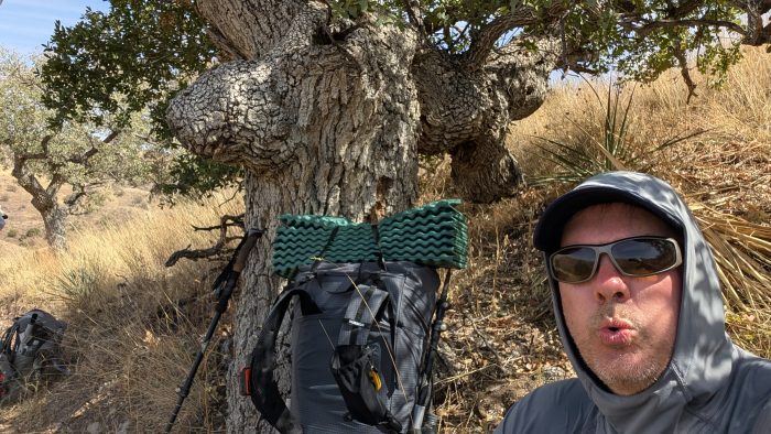
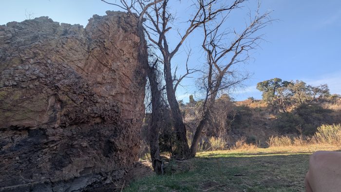
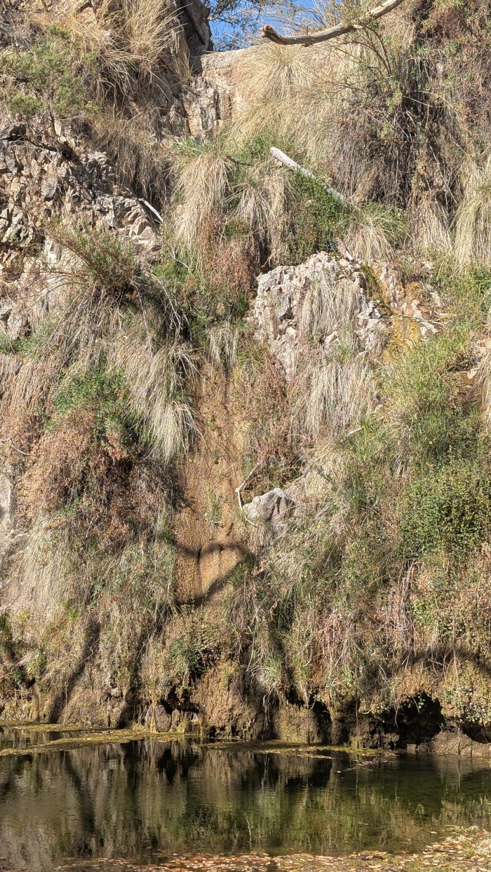
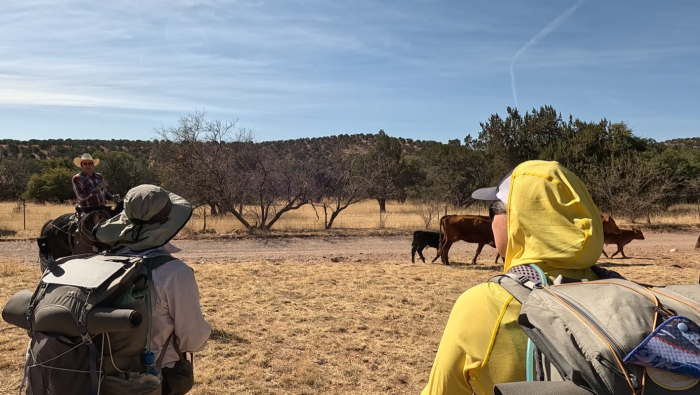
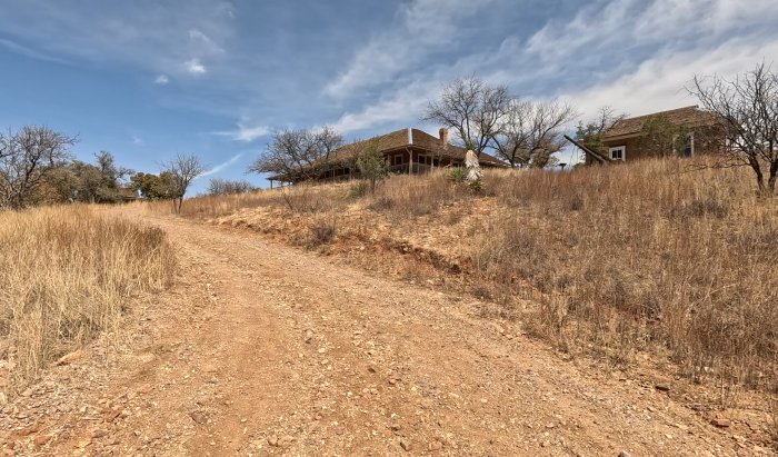
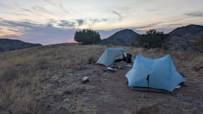
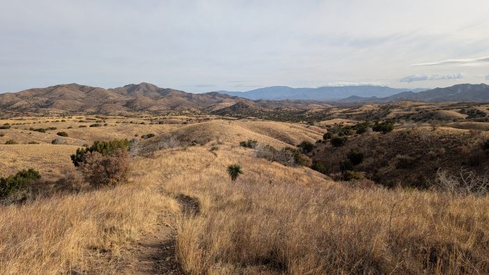
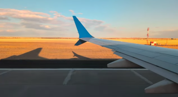
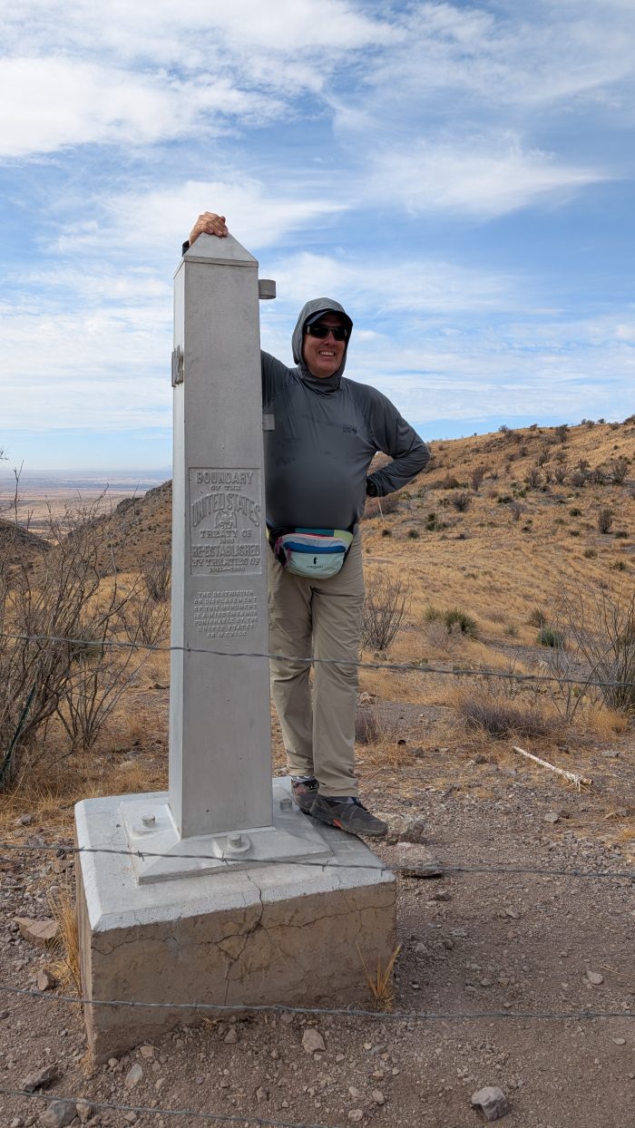
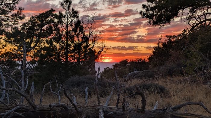
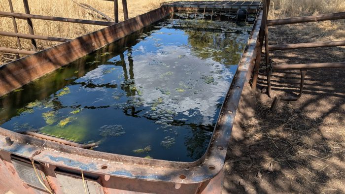
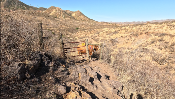
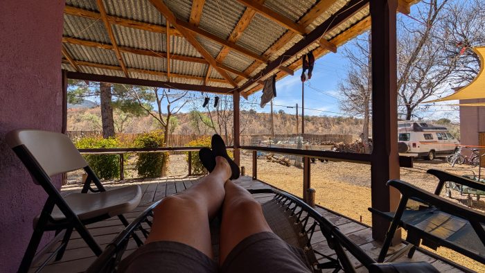
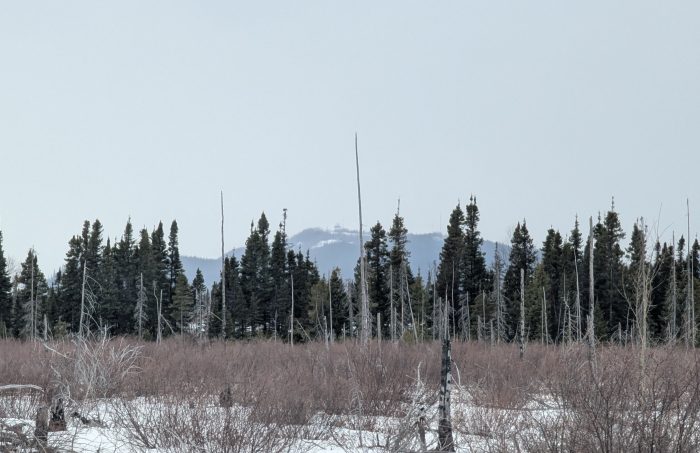
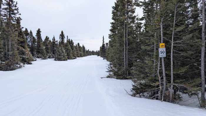
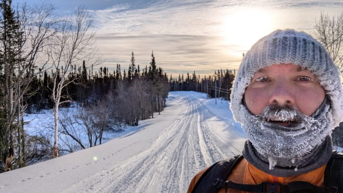

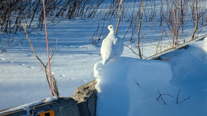
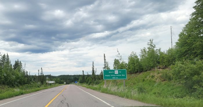
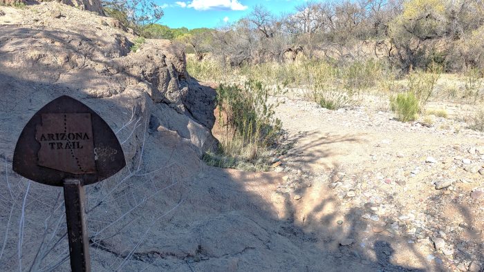
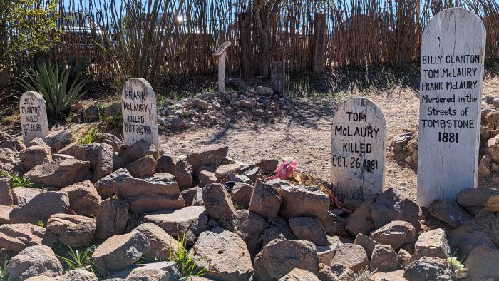
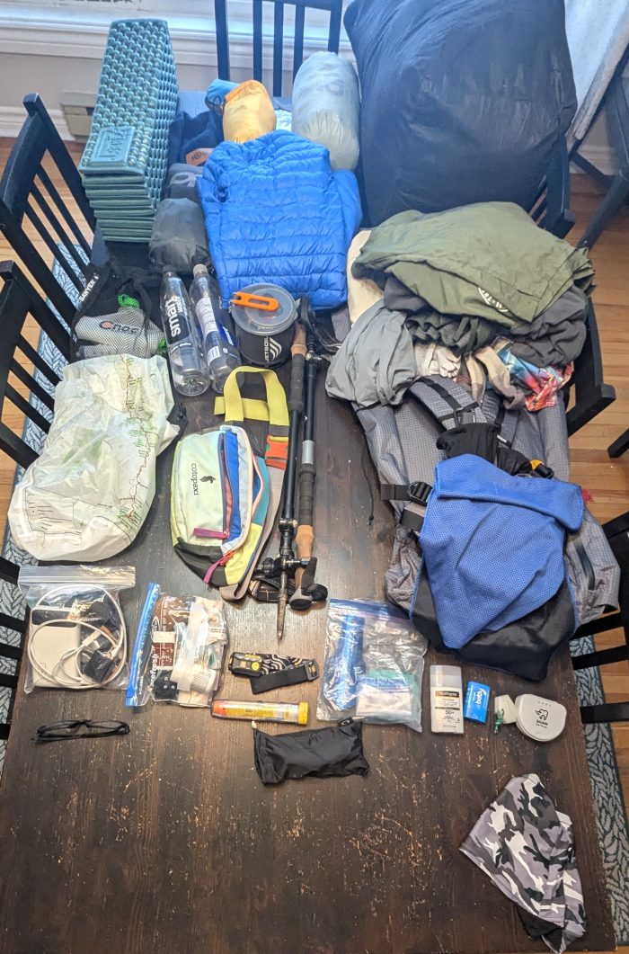
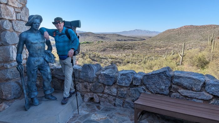
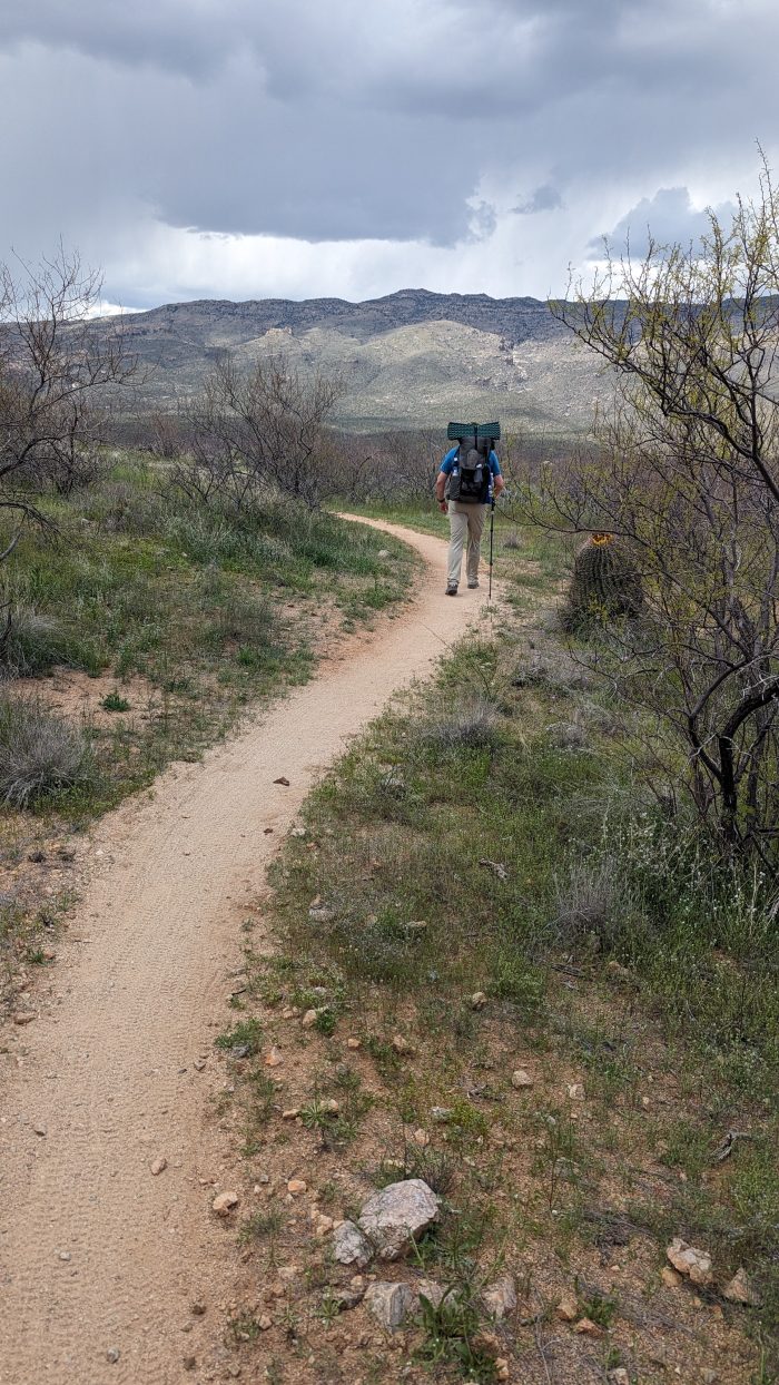
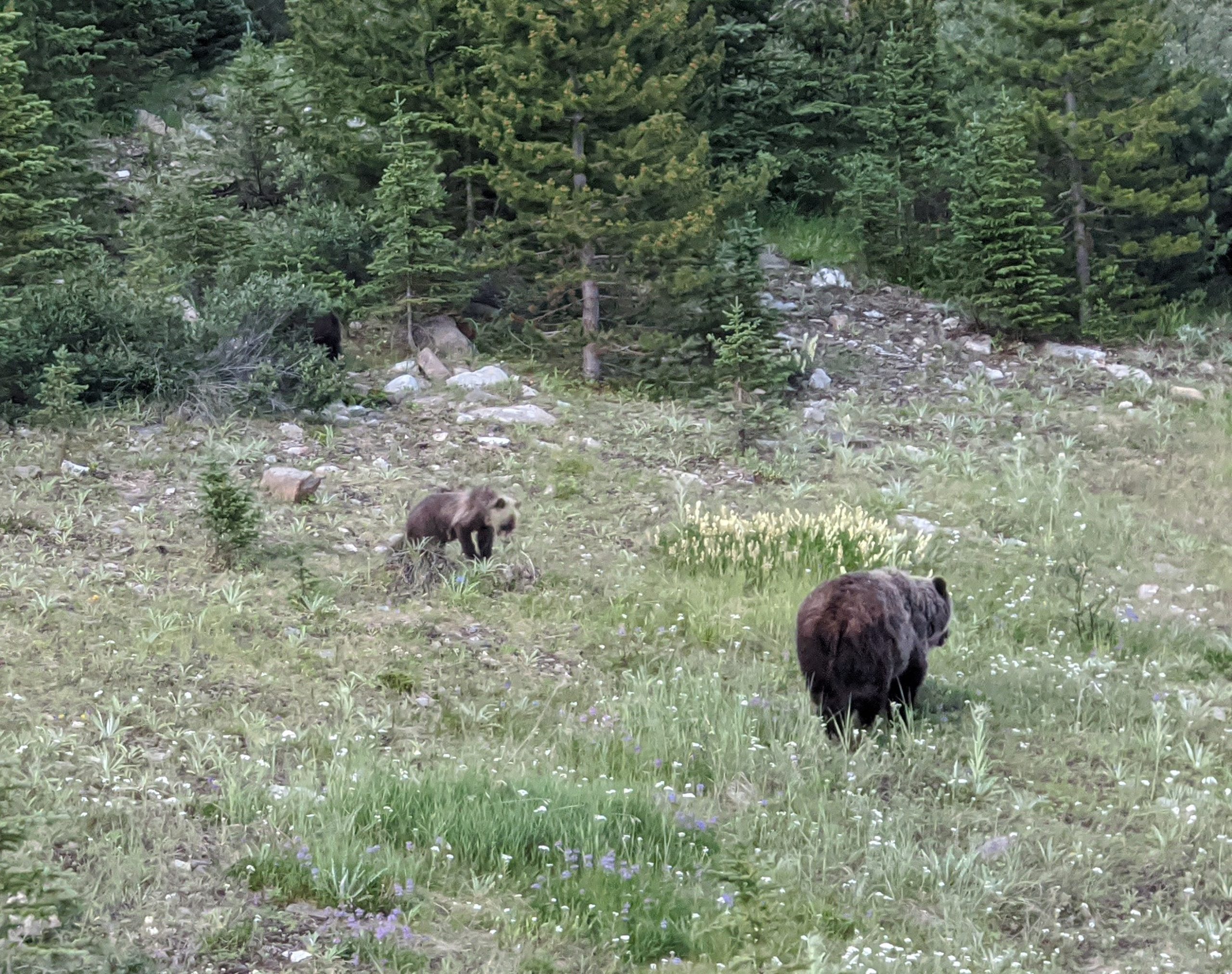
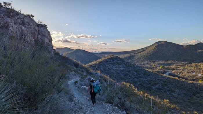
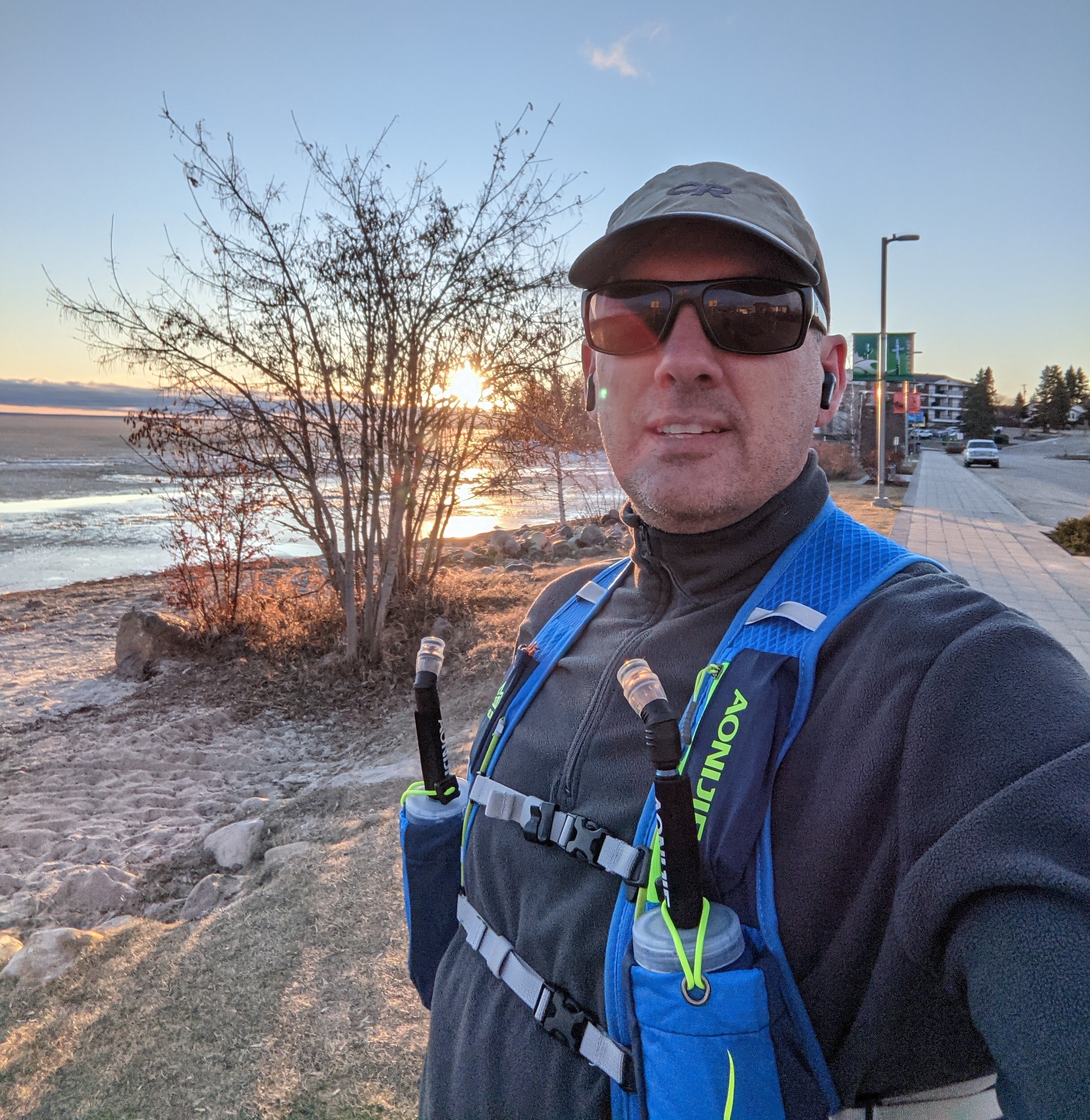

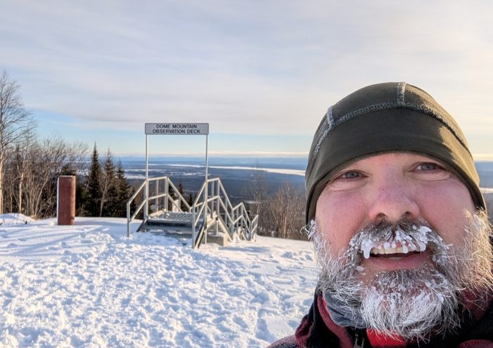
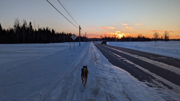
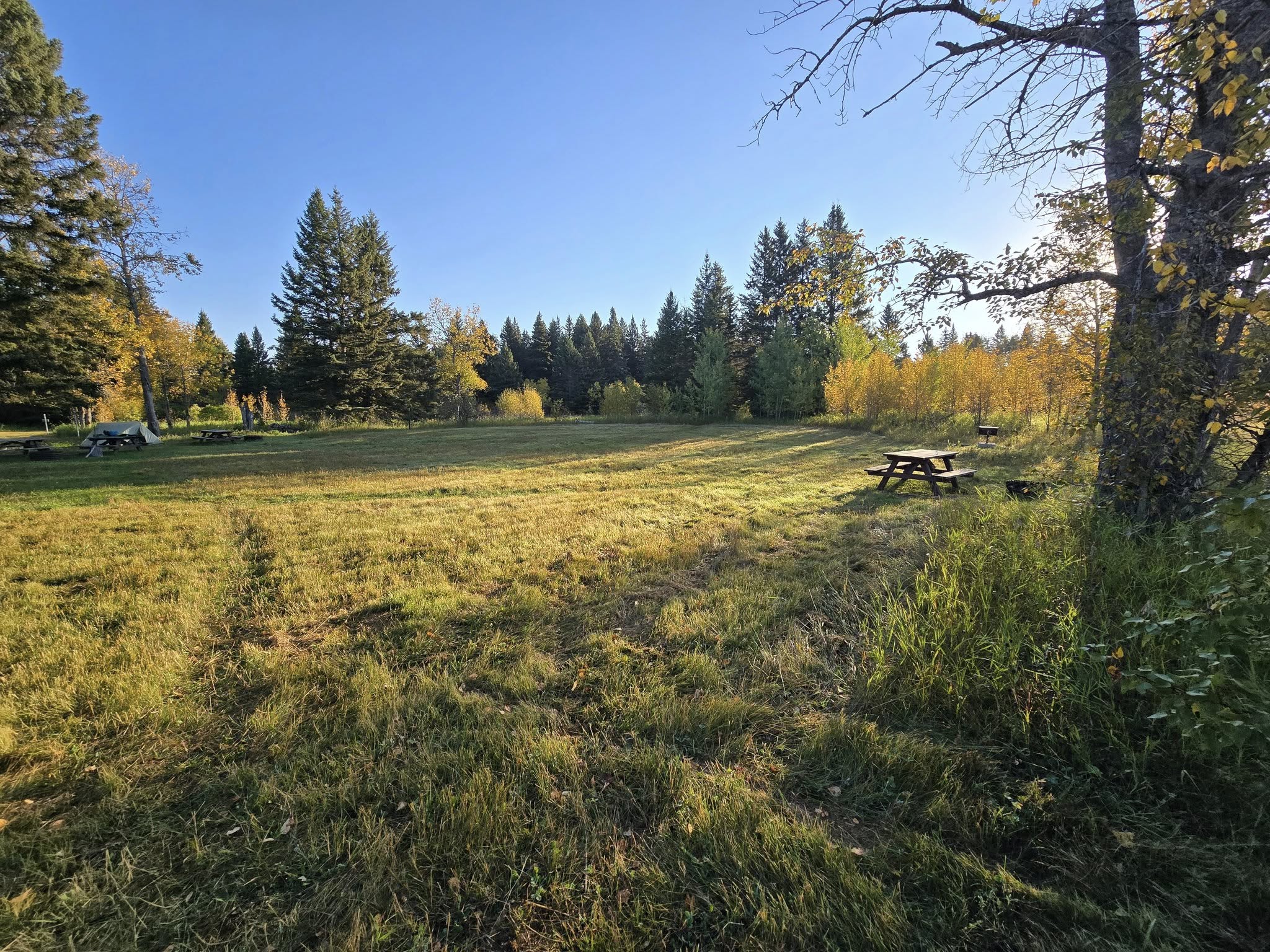
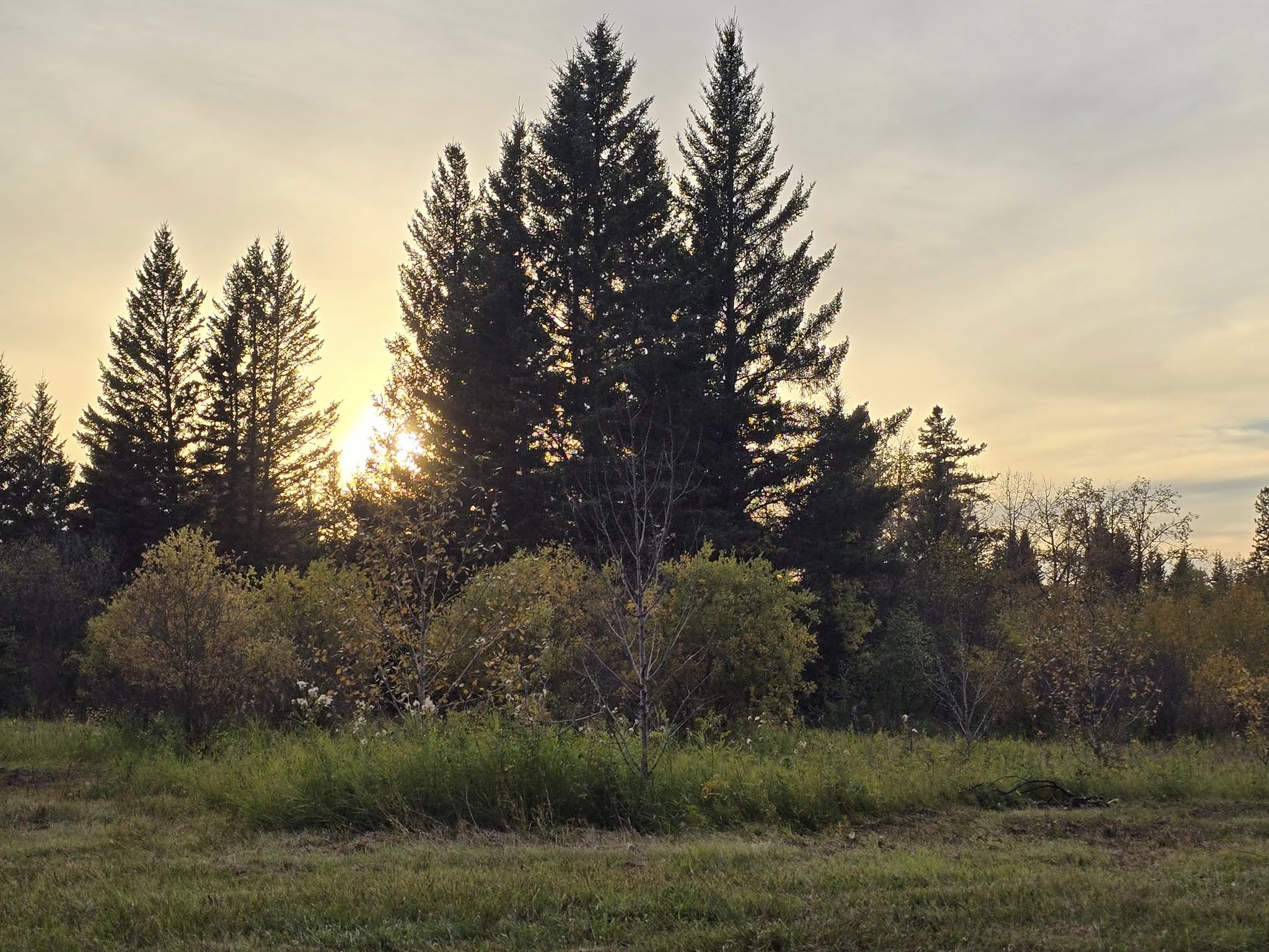
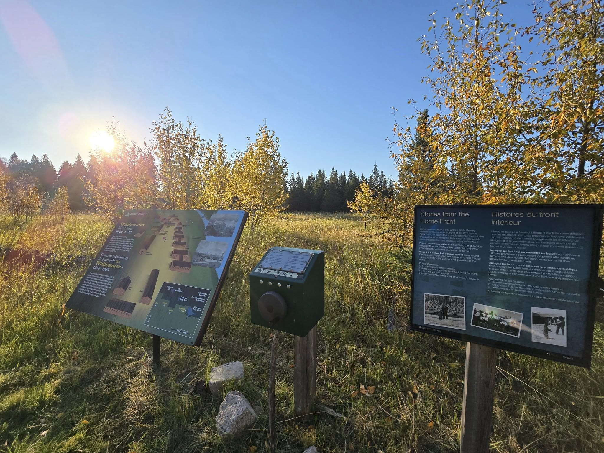
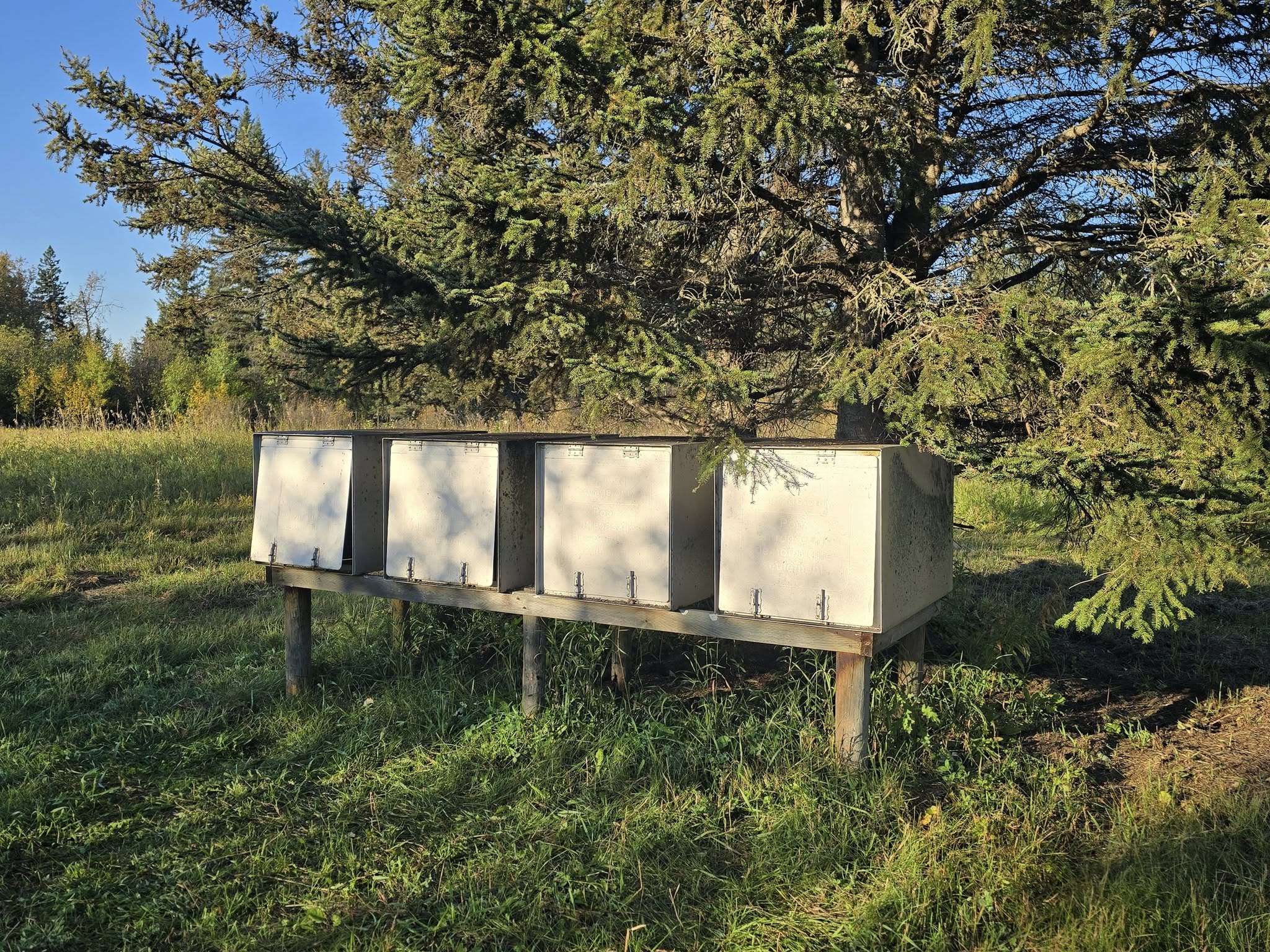
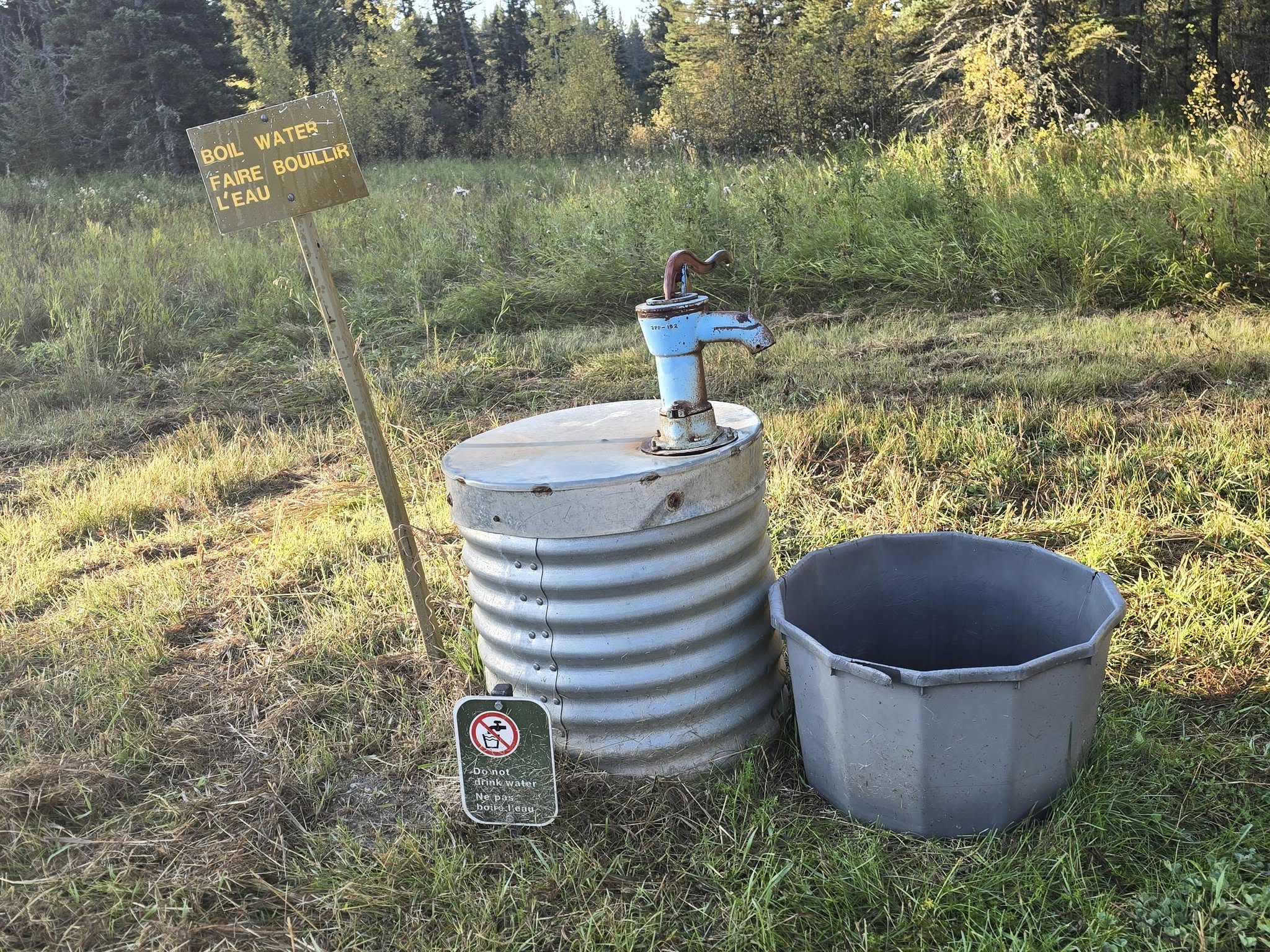
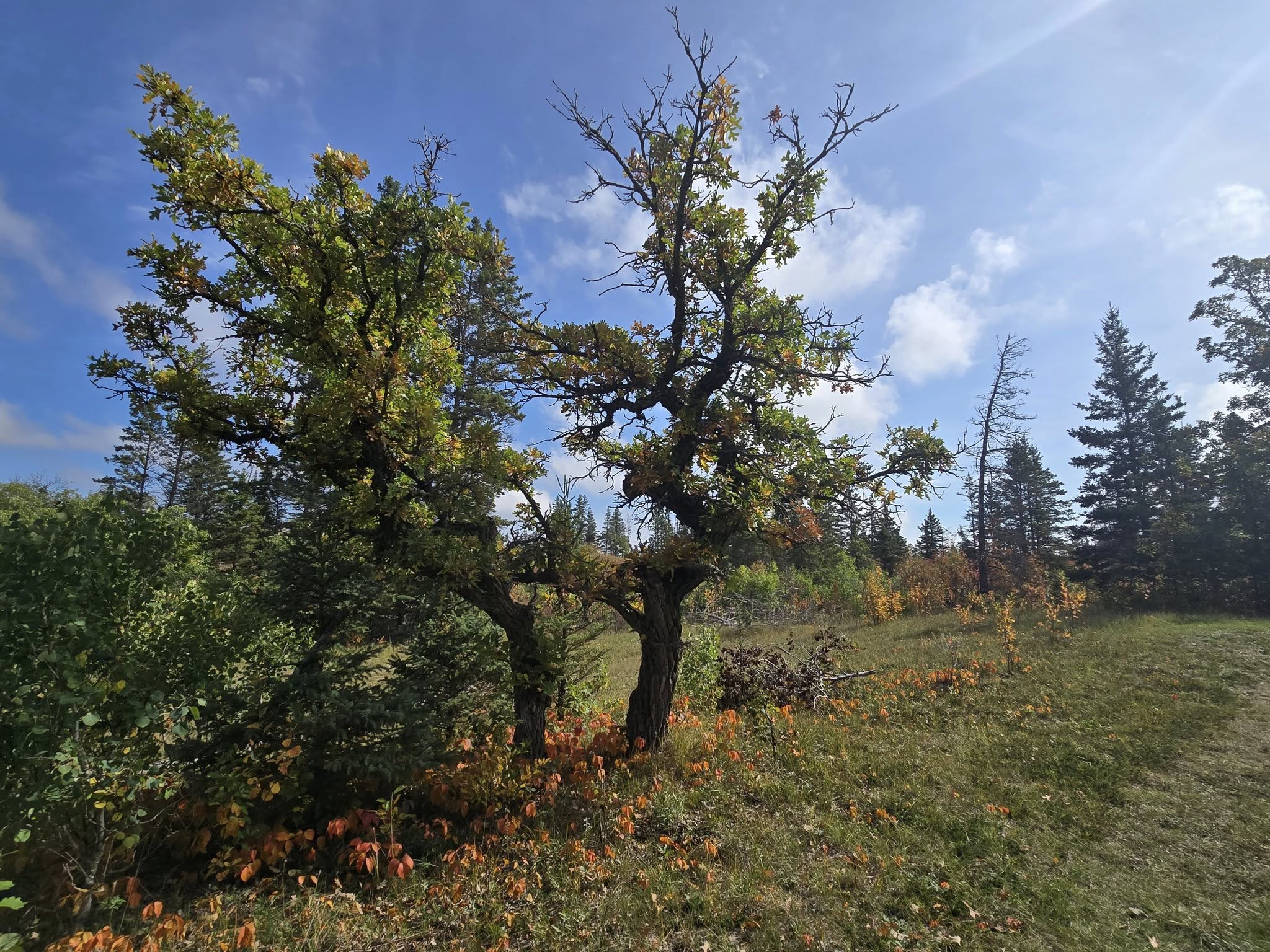
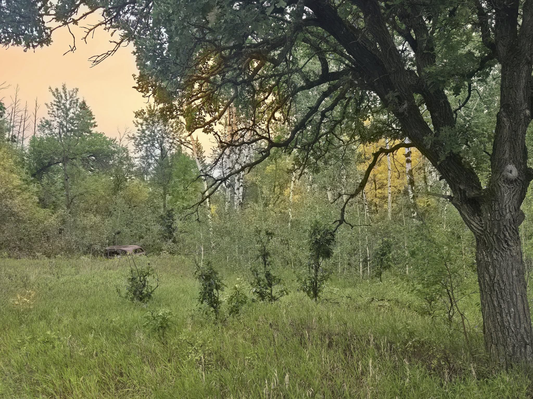