
Ok, here’s the first two days of our trip, broken down. Our original plan:
- Day 1: Upper Kananaskis Lakes (Peter Lougheed Provincial Park, AB) over South Kananaskis Pass to Beatty Lake (Height of the Rockies Provincial Park, BC) – 16km, 780m ascent
- Day 2: Beatty Lake to Palliser Pass Camp (Height of the Rockies Provincial Park, BC) – 10km, 780m descent, 480m ascent
What REALLY Happened:
Our trail angel, Tanya kindly picked us up at our car at the Ottertail Trailhead at 8am, just a few minutes west of Field, BC. It was foggy and coolish, but the perfect temp to be hiking in. I don’t like sweat. Hoping the fog would burn off, we piled into her ancient Ford Explorer and drove… and drove… and drove… 2 hours to get to Kananaskis Lakes. Cheryl (my wife) was getting more and more nervous: “It is THIS far?”
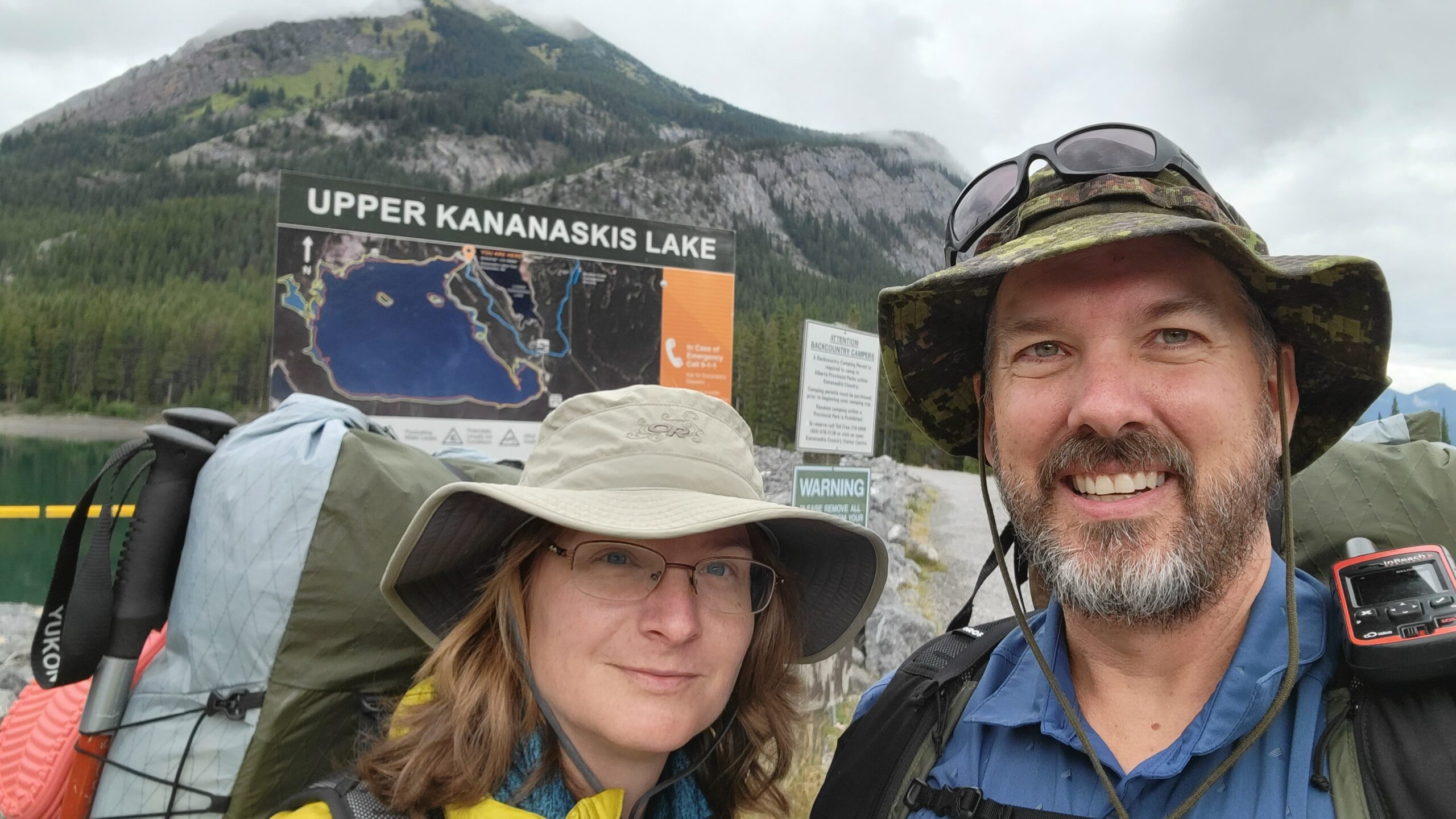
At Kananaskis Lakes by a little after 10am, we used the facilities and shouldered our packs, and said goodbye to Tanya until day 6 when she was to meet us at the Sunshine Village parking lot. We hoped. It seemed daunting to imagine we had to hike 100km or more before seeing her, or civilization again.
The cruise along the lakeshore gave a false sense of confidence as it turned out, and before we knew it, we are at Forks. Yes, there is a “fork” stuck in the top of the sign. From Forks camp, we could glimpse through the drizzle the climb we would have to make up to Three Isle Lake, where most sane people turn around. But we are not most people. We took off our packs under a tree and munched on some lunch, and then continued.
Off we went, scooting over the valley bottom to where the climb begins in earnest. Then Cheryl faced her first test. All our training hikes had been on hilly terrain, but none more than 20m high at a time. This was going to be a sustained climb. The frequent breaks to catch breath began. Just as we thought it might be getting better, we found STAIRS cut into rock! And I should explain that backcountry stairs aren’t that much of a gift. Sure, a little more stable than a sideslope, but each step was about double or triple the height of a normal stair step. We took it easy and while panting, enjoyed the sight of a cow moose and her calf adroitly finding alternatives to the idiotic human course.
On reaching the top, we had a snack reclining on the shores of the lake. A few intrepid fishermen were working the shoreline, and a chipmunk/marmot(?) came begging for a bit of trailmix. I politely shared, and after basking in the almost sunny respite in the weather, we knew we needed to continue. There was still the pass and the descent to Beatty ahead before nightfall.
The alpine meadow at the pass and beyond were gorgeous, even with the broken sky above us. A little glimpse of sunlight appeared to be shining on our destination, still a few km away. We pulled into camp around 6pm, and found the campground empty. Beatty Lake is probably the best appointed campsite in Height of the Rockies Provincial Park: it had well-ordered tent pads, an almost new bear locker, a pit toilet in good repair, and even a little wooden dock jutting out just far enough to allow easy water scoop and filtration!

We slept like rocks that night, not really knowing what was coming on day 2, other than a descent, a creek crossing and an ascent over a short 10km.
This was the descent: (right)
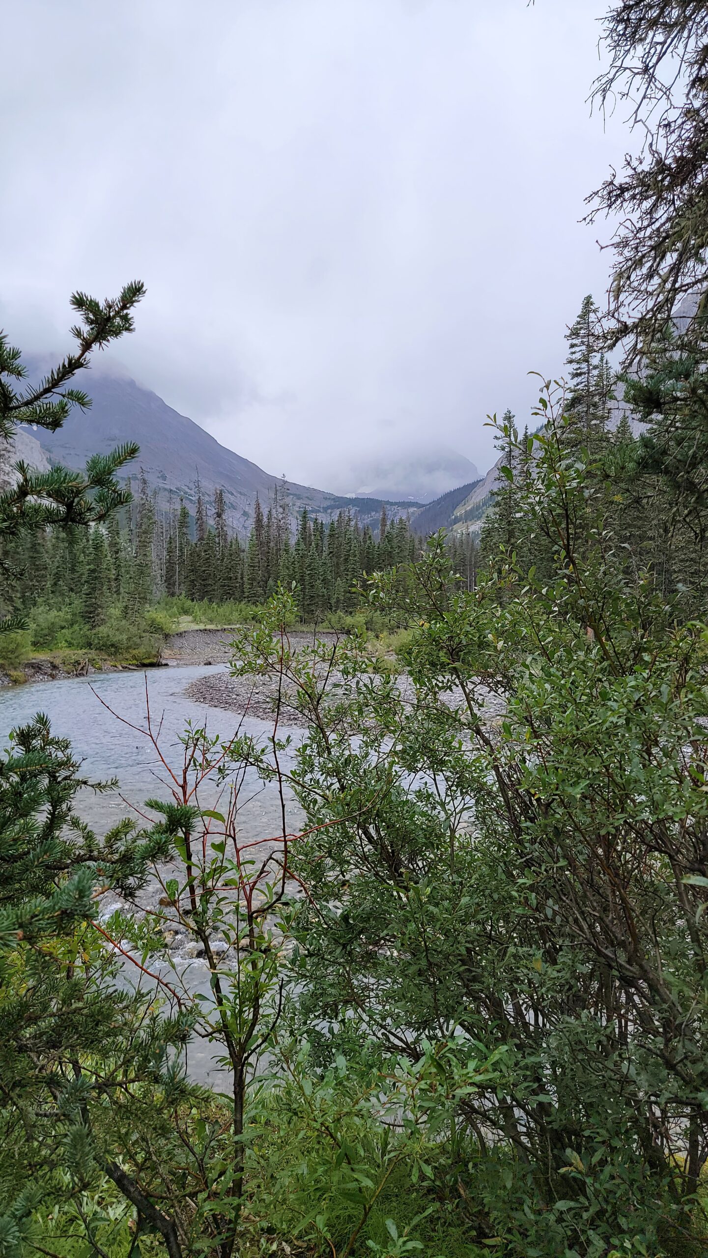
About 45 minutes of picking our way over rocks and a very narrow path that constantly threatened to slide us downslope. Cheryl lost her footing at least twice, but recovered. Then the descent continued through trees for a bit, until finally opening on bushy patches that soaked our feet with residual rain and morning dew. We were overjoyed when we reached LeRoy Creek. We could see the descent to LeRoy from North Kananaskis Pass would have been steep as well, but it will have to wait for us to return to determine which we prefer.
In late August the wade across the creek was easy. No more than shin deep, but cold. On the other side, about 30 minutes of hiking brought us to Palliser River camp, which let me tell you, is not worth your time. Mostly swampy, camp pads were indistinguishable. A spot for a fire and a log of wood to sit on were the only amenities we could see. We ate and moved on, up the watershed towards Palliser Pass.
The climb to Palliser Pass was fairly brushy and wet still from intermittent precip. By this point, both pairs of our hiking socks were wet, and it was cool and cloudy so the unworn pair wouldn’t dry on the exterior of our packs. 3/4 of the way up the pass, we were passed by a handful of French Canadians, who were still in good moods as they had started the day before as we had, but had come down North Kananaskis Pass. They stayed ahead of us until the crest of the pass where we caught up as they ate an early dinner.
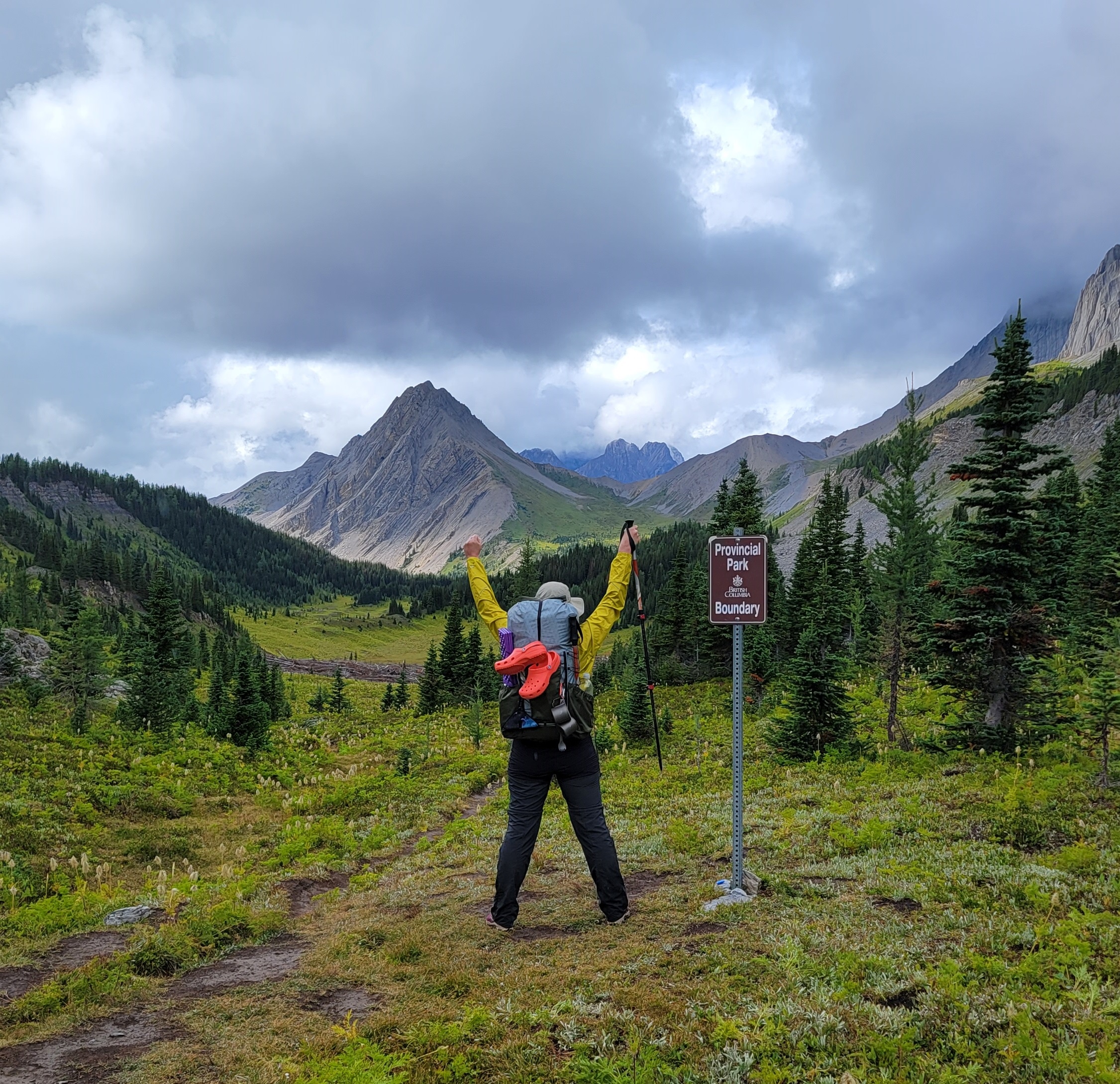
The Palliser Pass campground was before the pass itself. Our original itinerary was to stop us at Palliser Pass camp, for a short day and a little recovery in case Cheryl needed it. However, the camp itself left almost as much to be desired as the River camp. It was drier and flatter, but again no amenities to speak of, and the field near the creek featured a 2 foot pit dug by a hungry grizzly, looking for marmot. Though we were tired, we decided to press on. The incentive was if we skipped a camp here, we would be a day ahead of schedule, and this would enable us to camp at Magog Lake, which I snagged on a whim just in case. A powerful incentive, it kept our feet going over the pass and down into Banff National Park.
The descent from the pass was lovely though it was later in the day and we were tired. The upper Spray River valley was a beautiful grassy space between towering spires, with a snake of water meandering down the middle. With such an easy descent, we managed to coast into Burstall Camp. Without a reservation (I had tried to secure one just in case a day before we left, but it said fully booked), we worried we might not have a camping spot: but it was groundless. The camp was literally empty. The French Canadians arrived 30 minutes after us and were equally without a reservation so we had some company before bed.
So, at the top you can see our planned itinerary. Here is what we ACTUALLY did:
- Day 1: Upper Kananaskis Lakes (Peter Lougheed Provincial Park, AB) over South Kananaskis Pass to Beatty Lake (Height of the Rockies Provincial Park, BC) – 16km, 780m ascent
- Day 2: Beatty Lake over Palliser Pass to Burstall Camp (Banff NP) – 18km, 880m descent, 560m ascent
A VERY strong second day for my champion of a wife! However, we slept hard and hoped somehow our socks would be dry the next day. Stay tuned for days 3 and 4!
Read more:
| Oliver’s Account | Cheryl’s Account |
|---|---|
| Day 1 and 2 | Day 1 |
| Day 2 | |
| Day 3 and 4 | Day 3 |
| Day 4 | |
| Day 5 and 6 | Day 5 |
| Day 6 | |
| Day 7, 8 and 9 | Day 7 |
| Day 8 | |
| Day 9 | |
| Day 10 and 11 – Finish! | Day 10 |
| Day 11 |