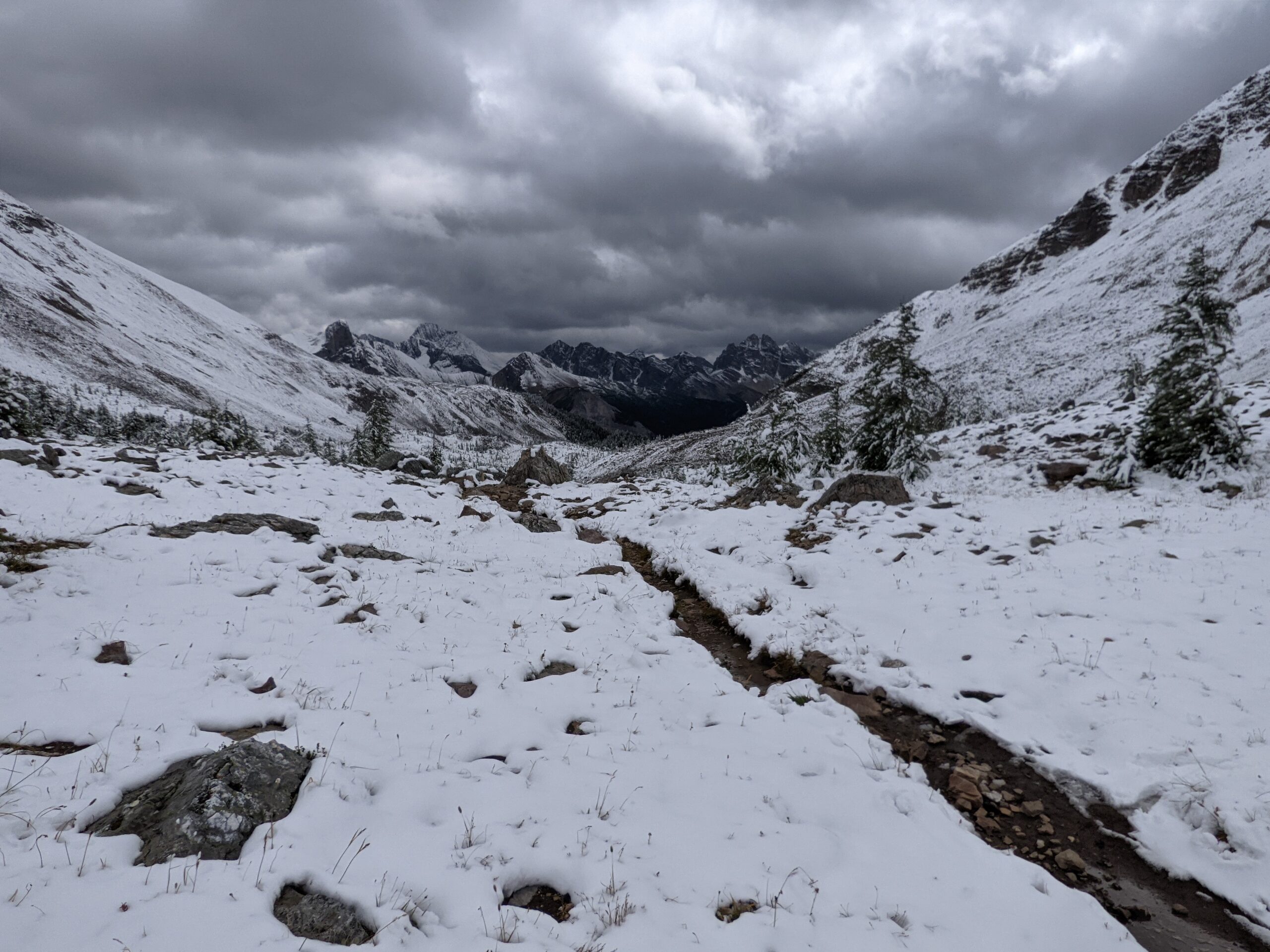
When choosing what to pack for your backpacking trip, think about how many days you are hiking, the weight you’re carrying, and the season. You will need to make adjustments to any list depending on your own personal needs. Follow this link to view our current gear list.
Bring the Right Shelter
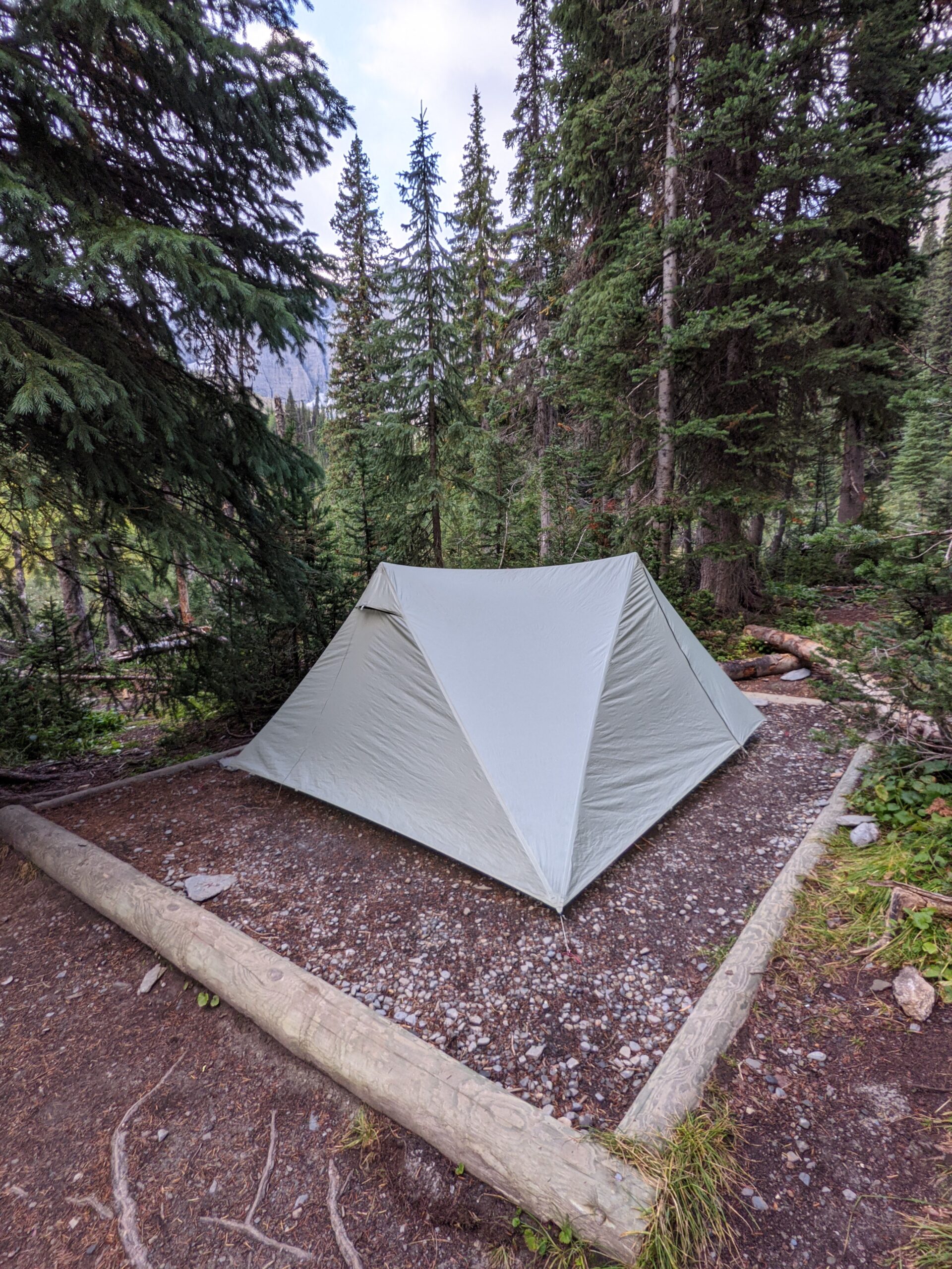
On the trail, you are going to want to pack the best sleeping system for you. Consider how you sleep when choosing a sleeping bag or a quilt. Temperatures for the season will dictate the temperature rating of both your bag/quilt and pad. When packing a tent, think about the weight and how much room you need for you, your partner, and your gear.
Tent
Sleeping pad
Sleeping bag / quilt (rated for the temperatures you’re hiking in)
Pillow or stuff sac
Optional: Ground sheet
Optional: Extra tent pegs
Consider Food & Water
Depending on where you are hiking, bear safety for food storage is an important consideration. You will need to identify the best solution to pack your food when in bear country. Even when not in bear country, you need to pack out your garbage and keep mice out of your food. Also think about how you want to filter your water as more water sources will require purification. Make sure you pack enough calories and don’t forget about managing your electrolytes.
Food storage (e.g. Ursack or BearVault)
Water filter / purification
Water bottles (e.g. Smart water bottles)
Stove (e.g. Jetboil Stash)
Spork
Titanium mug
Freeze dried meals
Snacks (e.g. nuts, jerky)
Electrolytes
Ziploc bag for trash
Pack the Right Clothing
Packing clothing is probably the toughest part of packing for a trail. You have to consider the weather, which is not always predictable. Don’t underestimate the importance of dry socks. Reserving one pair to only wear around camp is a recommended luxury item. Please don’t carry your entire wardrobe. Re-wear clothing and stop in a town to do laundry and take a shower.
Hat / Toque / Beanie
Shorts / Pants
Short sleeve / long sleeve shirt
Fleece and/or Puffy
Thermal layer
Socks for hiking
Socks for camp
Hiking boots or shoes
Shoes for camp / Water crossing (e.g. Crocs)
Underwear
Gloves
Helpful Gear to Include in Your Packing List
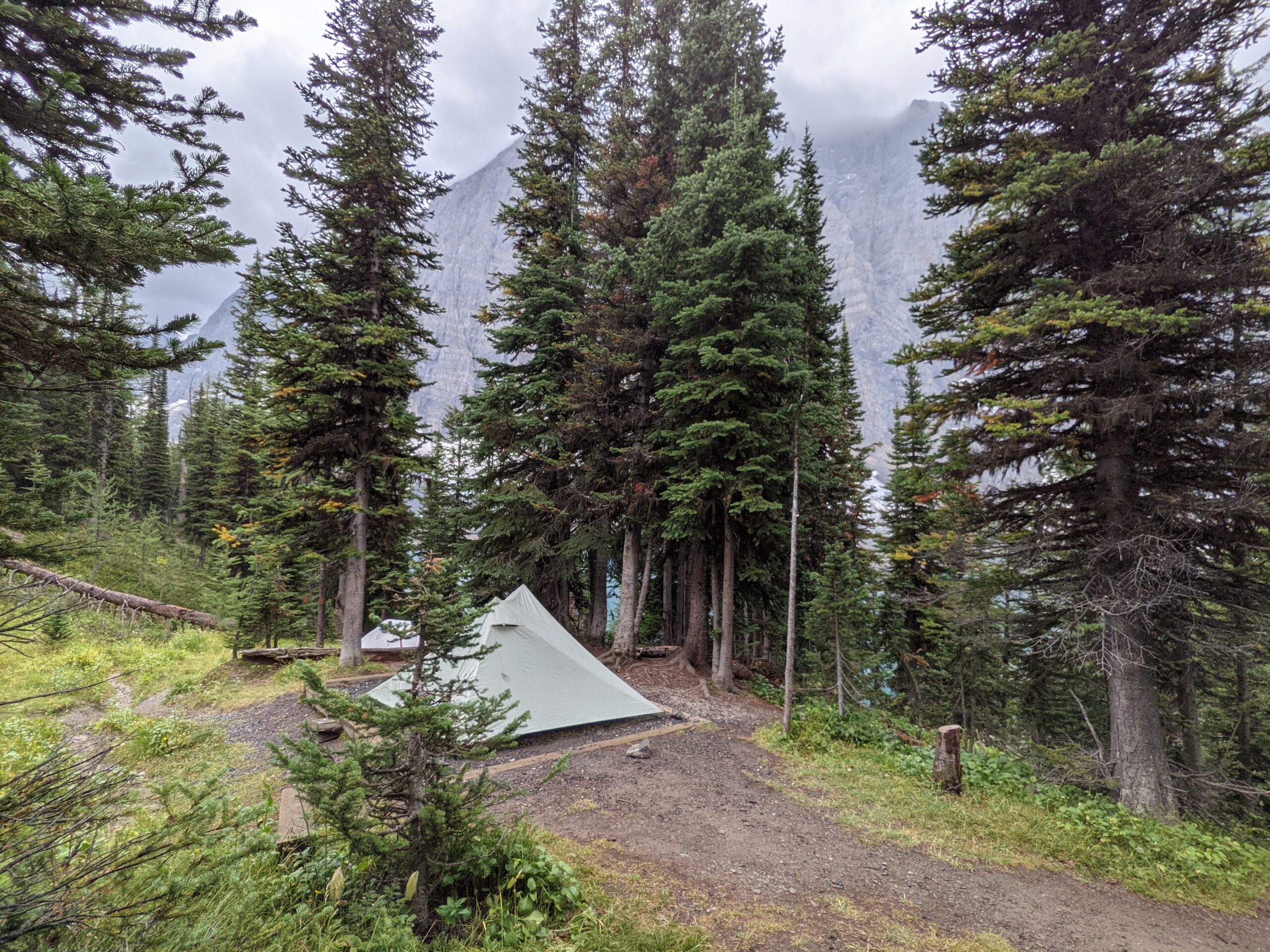
We use trekking poles not only for stability but also for our tent. Some items on this list can be optional based on your preference. We often pack most of these items on our trips.
Pack the amount of toilet paper you think you will need and bring extra. A rash cream of some sort will be helpful with chaffing from your pack or in other sensitive places. Don’t forget to put any smelling products, such as toothpaste, in your bear safe storage at night.
Ziploc bags (Protect your clean toilet paper and another for used paper)
Make sure you pack with safety in mind. In bear country (particularly grizzly bears), you are going to want to pack bear spray. Sunscreen is something you might easily forget and will remember once you start to burn. Always travel with an SOS device and tell someone your travel plans.
Bear spray
First aid kit
Sunscreen
Bug spray
Map and compass or GPS
SOS device (e.g. Garmin inReach)
Entertainment Bundle
Don’t forget the importance of giving yourself something to do when you are stuck in your tent during a rainstorm. When the temperatures drop and you hide out in your tent, having a little something tucked in your pack to help pass the time is helpful. Choose something small and light to enhance your trip.
Journal with pencil
Deck of cards
Kindle
Camera
Final Reminder
It is easy to make a list and stuff everything into your backpack. It is another thing to carry the weight for several days over several miles. Be wise about what you truly need. Don’t be afraid to cut something from your gear if you need to. Make sure you have the right gear for the right weather on the right trail.
In 2021, my husband had expressed an interest in hiking a section of the Great Divide Trail (GDT). He had made arrangements with a friend to hike Section C, but his friend needed to back out. To keep himself from hiking alone, he used Facebook groups to find another hiker to join him on the trail. While he was trying to find a hiking partner, I had been quietly pondering the idea of joining him. Once I told him I was interested, we developed a plan to prepare me for the trip.
Starting Slow
Close to our home was a popular hiking trail. It was perfect for getting my legs ready. We started off with no weight and simply walked the loop of the trail. We counted steps with our smart watches and noted the time it took to complete it each time.
Rain didn’t deter us from hiking as we wouldn’t have that option when we were on the GDT. If it was pouring rain, we would stay home, but a little drizzle was not something to hold us back. Our dog thought our dedication to walking was marvelous and wanted to point out every squirrel he could find.
Adding a Little Weight
As my legs became used to hiking the loop, I started wearing a backpack with a small amount of weight. My body immediately noticed the difference. My pace was slower, but I was determined to get my pace back up to what it was pre-backpack. We increased the number of days per week that we hiked and over time we gradually added more weight. Soon I was carrying ~30lbs over 8-10kms.
Trying an Overnight Hike
After walking the loop multiple times per week in both directions, it was time to hike a different trail. We settled on the the Boreal Trail in Meadow Lake, Saskatchewan. While it was a relatively flat trail, it offered distance and pre-determined camping spots. We positioned vehicles at our entry and exit points and set out on our overnight trip.
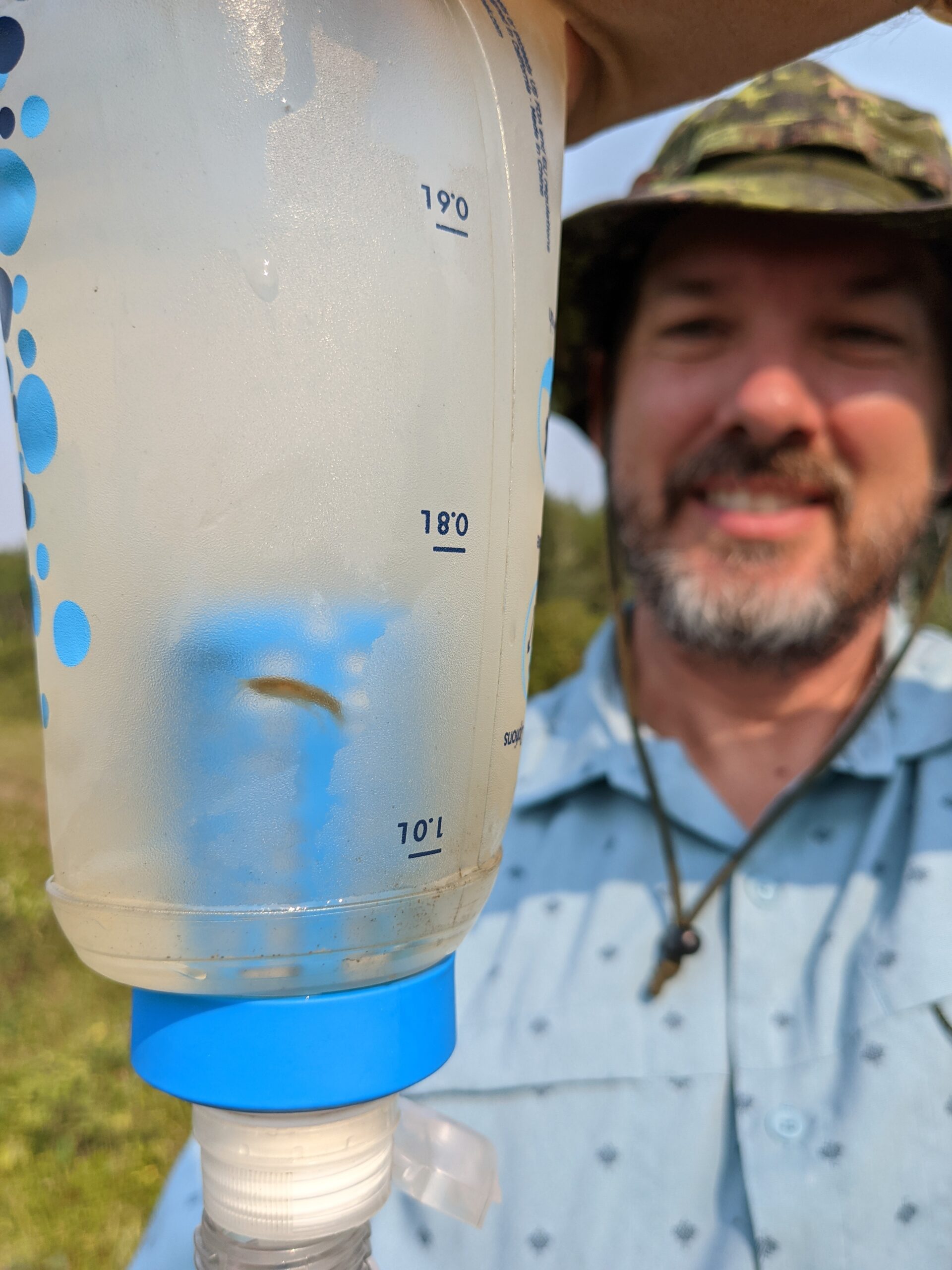
As we hiked, I learned that I didn’t have any problems with climbing over fallen trees. What I did have issues with was the pack not sitting right on my shoulders over long periods. We would need to adjust my pack. I also learned what gear I didn’t want to bring with me when we hiked the GDT. This was also my first time drinking filtered water that had some unwanted guests in our filter. We found water sources containing fresh water shrimp and leeches. Yummy!
What are the Benefits of a Preparation Hike?
Physical Readiness – By doing an early hike, I was able to get my body somewhat ready for what was coming. I say “somewhat” because I couldn’t replicate the mountain terrain. Doing a hike with weight over distance provided an introduction.
Confidence – After we finished our hike in the Boreal Trail, I felt I was capable of hiking the GDT. I knew I wouldn’t be the fastest hiker, but I could carry my own gear. It gave me an understanding of my pace.
Gear Check – A preparation hike helped me determine what gear I wanted to remove from my pack. I also noted what was missing. There was gear I hadn’t used before and learned to trust it, such as gaiters and bear spray.
Adjust to Nature – Sleeping outdoors is different. It can be difficult to sleep when you hear birds, frogs, or other animal noises. It is also challenging at dusk or at night wondering if a bear is watching you nearby as you go to an outhouse or other private corner. A preparation hike provided the opportunity to settle my nerves and not feel I was going to get eaten if I stepped away from my campsite for a few minutes.
Communication – A preparation hike when on trail with someone else is helpful to learn each other’s hiking styles and needs. My husband is an independent hiker. He likes having others hike with him for safety in numbers, but he doesn’t feel the need to stick close. I have a certain distance that I like to keep between us (although I have found that distance has been increasing). Having an initial hike before going on Section C gave us a chance to set expectations before venturing out.
Time to Hike
Completing a preparation hike will give you the confidence you need before going out on the trail. It gives you the chance to identify areas that need a little correcting or what is going to work best for you. While not everyone is going to need a preparation hike, who is going to complain about finding another excuse to hike?
Notice I didn’t say, “thru-hike”? That is because I haven’t spent months on a trail and so I can’t speak to being away from home for a duration longer than two weeks. What I do have is experience with trying to keep up with a faster partner, mom-guilt, and pushing through day after day of hiking tough terrain. Here are a few of my recommendations for a successful multi-day hike.
Set Goals
Trails aren’t easy. Unless you picked a trail with flat terrain and nice gravel paths, you are in for elevation ascents and descents, uneven ground, and a variety of other changing conditions from mud to bugs. There are times when you will feel miserable with the rain pouring down on you while the clouds block the views that you were hoping to see after a long climb. You might also find that despite your best efforts to prepare for the hike, your legs aren’t cooperating and discover climbing switchbacks to be especially difficult. Setting goals will be a huge help in winning the mental game of a hike.
Creating goals allows you to break your hike into bite-sized pieces rather than feel intimidating by what is yet to come. Goals can look different depending on what motivates you, such as:
Target a visible point on the trail, such as a tree twenty feet above on the switchback or the top of a particularly muddy climb.
Take a Zero Day. There is no rule that you can’t leave trail and head into town for a shower, an overnight in a hotel or a nice hot meal. Setting the goal of a Zero Day might be the motivation you need when facing a particularly challenging day.
Reward yourself for reaching a milestone. Rewards can be as simple as a long rest or a drink of water to a snack you have been saving or a drink you tucked away in your pack. Celebrate 50km, 100km, or reaching the top of your first pass. Whatever it is, celebrate your wins.
Set a long-term goal of a particular campsite you want to reach. For me, I was determined to get to Floe Lake on the GDT. I had seen pictures before the start of our hike and was going to push through to make sure I got there.
Know Your Why
There will be stretches of the trail where you love every moment of being out there and times where you wonder what you got yourself into. When the bugs are trying to bite, your legs are scratched up and your feet hurt, you can find yourself spiraling into continuous thoughts of misery. This negativity can take distract you from the beauty that surrounds you and taints the experience.
Recalling why you decided to hike the trail will help refocus your thoughts away from the immediate misery to the payoff that lies ahead. For some, the why will be the accomplish of completing a trail end to end. Others might want to hike a trail to reach a particular view. Fitness might be a why. There are also hikers who are there for the personal journey. Whatever your reason is for hiking, there will be days when you will reflect back on your why. It doesn’t need to be an earth-shattering reason, but the reason will be important to you. The reason is what you will judge your days against. Are you getting out of this hike what you’re putting into it? Is it worth the suffering, sacrifice or cost?
During the last leg of our GDT hike, I found myself mentally drained. We were pulling long days on the trail and I felt I had spent most of those days staring at the ground rather than at the views. The trail had become rather technical with overgrown bushes snagging my already fatigued ankles. Whenever I caught up with my husband, he would take off and I wouldn’t get a chance to stop and take in the view as I felt I was going to be left behind. I was struggling to finish the hike because I wasn’t satisfying the why, which is to enjoy the views. Once I expressed to my husband that he needed to give me time to stop to enjoy the views, I found a renewed energy every time we took a break. Knowing your why is no joke.
Reflect on How Far You’ve Come
Take a moment to look over your shoulder to see how far you’ve climbed or the distance you’ve covered. There will be days when the climb seems to go on forever. While some of the climb will be more vertical with switchbacks zig-zagging up the mountain side, other climbs will also take you across more horizontal miles. Depending on where you are, you might see a distant highway, a river you crossed in the morning, or the valley where you camped the night before. You might not be able to see the bottom of the mountain where the climb started or the lake you swore was down there somewhere but is obscured through the trees or blocked by a ridge.
Every time you put one foot in front of the other, you are that much closer to completing your trail or celebrating your next milestone. Looking back provides a moment for you to reflect on what you have accomplished. On our GDT hike, I can recall a few times when I looked back and marveled at how far I had come.
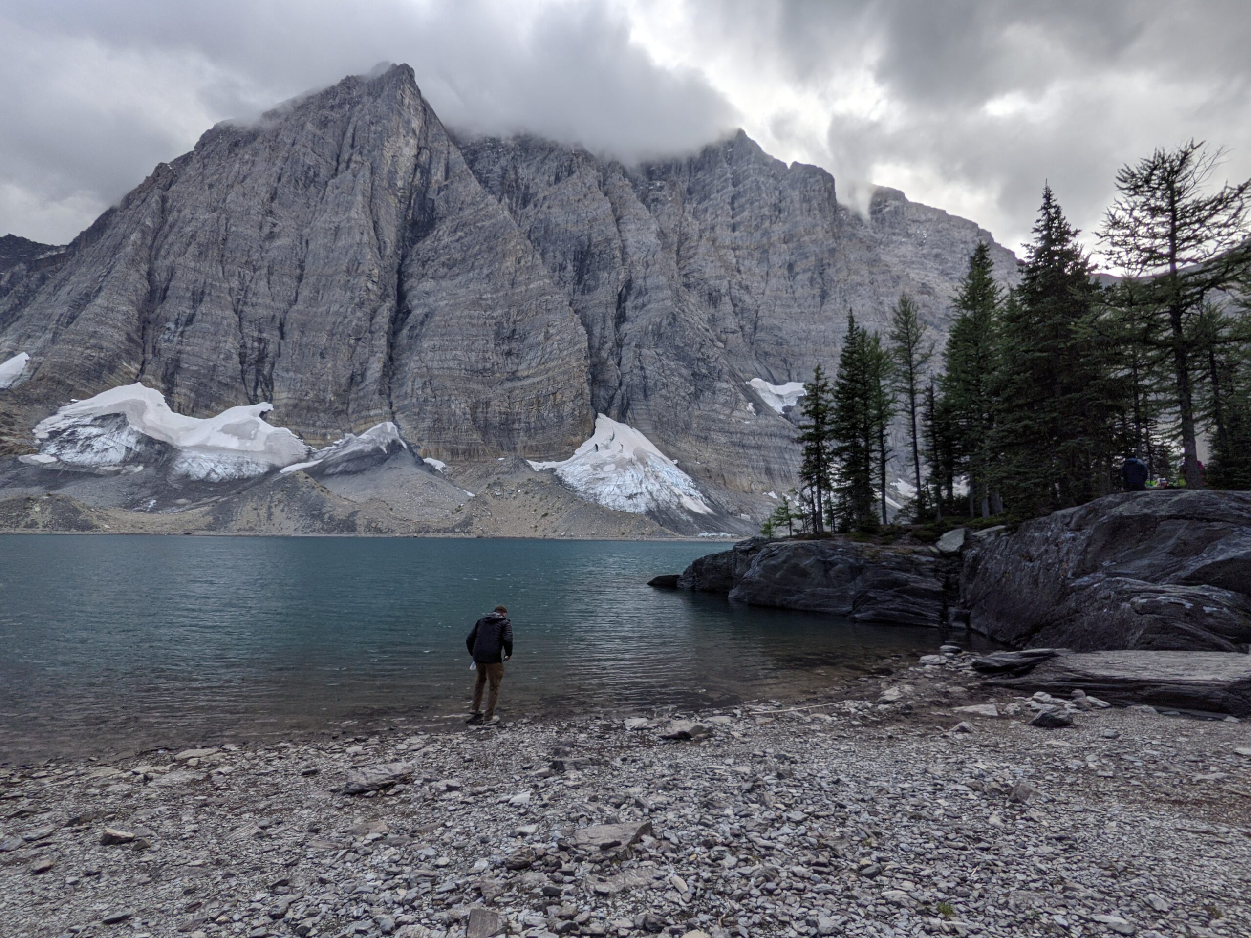
One particularly memorable moment was standing at the top of Wonder Pass surrounded by snow and I turned back to see the ridgeline of mountains behind us. Although I was chilly, I took some time to ponder how I was standing there in the snowy mountains. I never imagined myself hiking in a place like that, and there I was. It felt surreal. We had come so far and we couldn’t see where we had started from. There was still so much trail to go, but I felt like I had conquered the GDT.
Hike Your Own Hike
On the trail, I tell my husband he hikes like a gazelle or a mountain goat. While he happily hikes up a mountainside, I work for every inch. He doesn’t look like he feels any drain from the climb while I need to stop and guzzle water. Our bodies are very different and it can make for some interesting challenges when I want to rest on flat ground when he is getting twitchy, anxious to get moving again.
Hiking your own hike, to me, means hiking without judgment. Don’t try to compare your need for breaks against your partners. Communicate what you need and set expectations for frequency of stops and distances that can be covered in one day. Depending on your comfort level, you might have your faster partner hike ahead of you with the intention of to meet up where there is a junction or at a creek crossing. Your partner could scout out flat ground during difficult climbs so you know how much further you need to go before your next break.
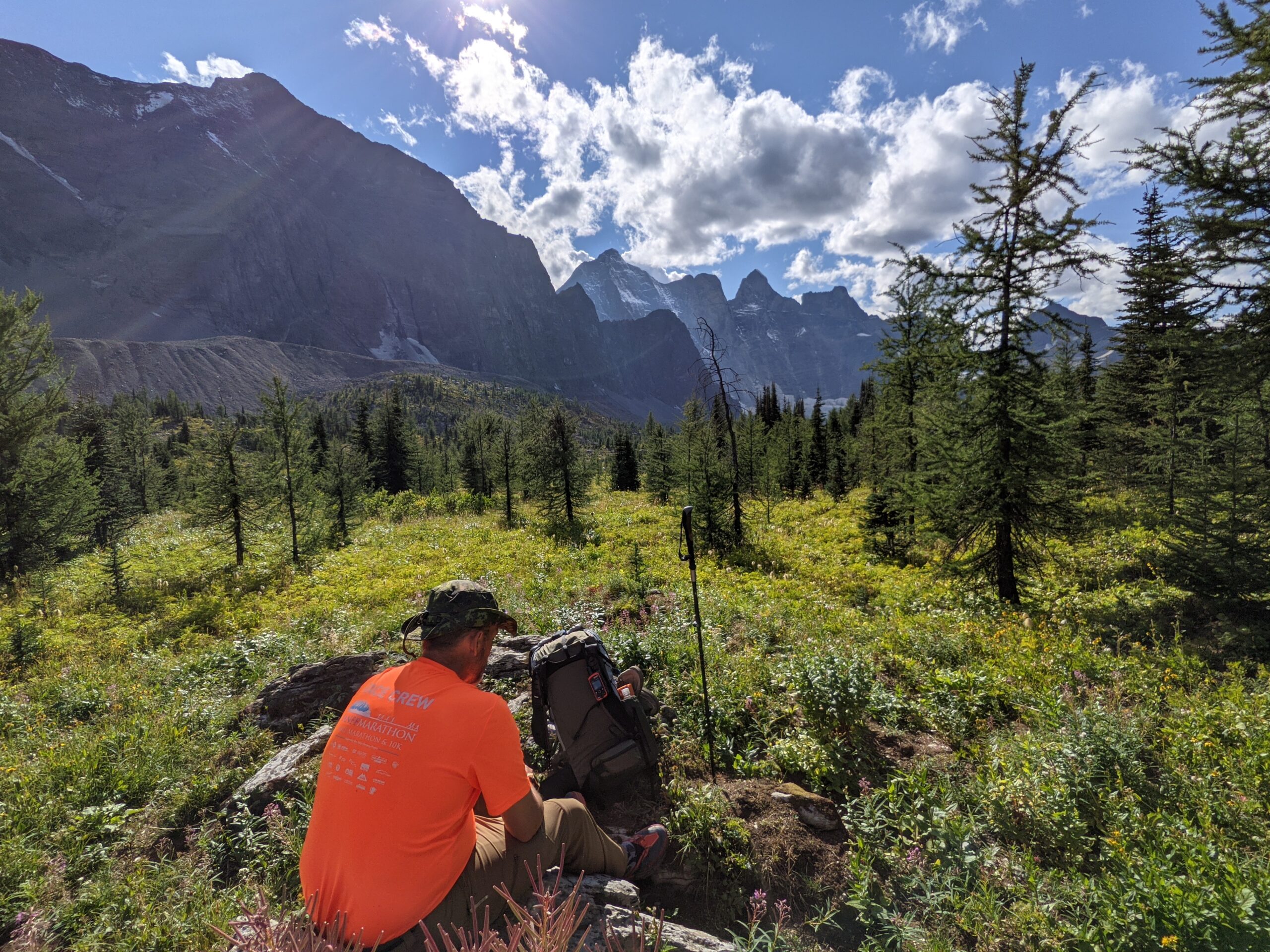
You don’t need to be jealous of your hiking partner’s abilities or criticize how you perceive your fitness level. Remember that you have 30lbs or so of weight on your back and are doing something that millions of people wouldn’t dare try. You are already doing something amazing and while it’s hard, you’re putting one foot in front of the other and will reach your campsite or the trailhead if you keep going.
Include Your Loved Ones
Being in the middle of the mountains or forest means you have limited to no access to internet or cell phone service. This can be challenging if you have children or pets at home. Even though you have made arrangements to have them cared for while you are on trail, you will find your thoughts being pulled toward wondering if they miss you or if they are okay. These thoughts distract you from the views you have worked so hard to reach.
Remember that your time on the trail is limited. While you aren’t away on a work trip, you are doing something that mentally recharges you. Your children, and your pets, will enjoy hearing about your adventure and see the pictures you took along the way. Your dog will be especially interested in hearing about all the squirrels you saw.
Identify plants, rocks, formations, or any other sights long the trail that a loved one back home would appreciate and take a photo of it. Finding ways to include them helps to eliminate any guilt you feel about leaving them behind and makes it feel like they are with you. Thinking about what they might like will also get you thinking about different perspectives and you will spot things on the trail that you might otherwise have missed. You don’t need to bring them a souvenir when you come home. Just tell them what you saw that reminded you of them.
Write It Down
My final recommendation is to journal and write about the highlights of your day. Write about there being toilet paper in outhouses, animals you spotted, the ups and downs from the day… whatever it is, document it. You can read your entries while on trail or when you leave trail, but writing helps you sort through your thoughts from the day and identify changes you need to make to improve the next day.
Journaling also gives you something to review before your next hike. You can see what worked for you and what factors were negatively impacting your experience. When preparing for your next hike, you can implement changes or equip yourself differently so you have all the tools in place to have a successful hike. Adding a pen and a thin notebook to your pack isn’t a big addition to the weight you’ll carry. It will not only give you that opportunity to mentally check-in, but it will also give you another way to capture your trip and recall those great memories you make along the way.
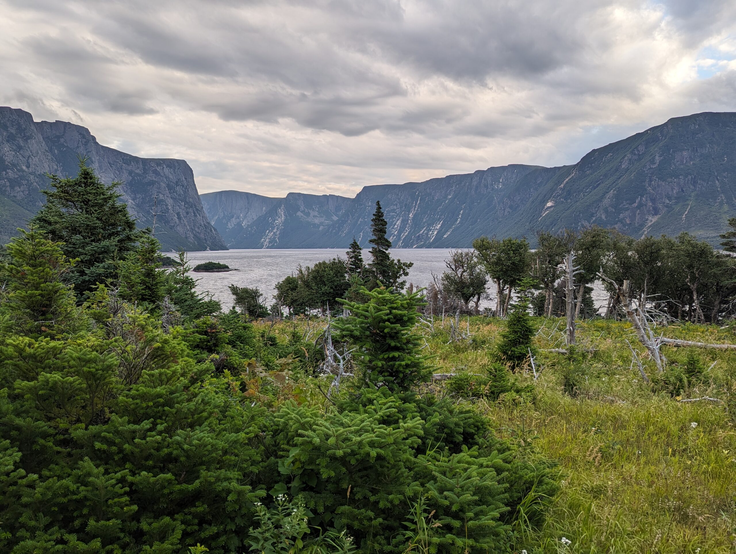
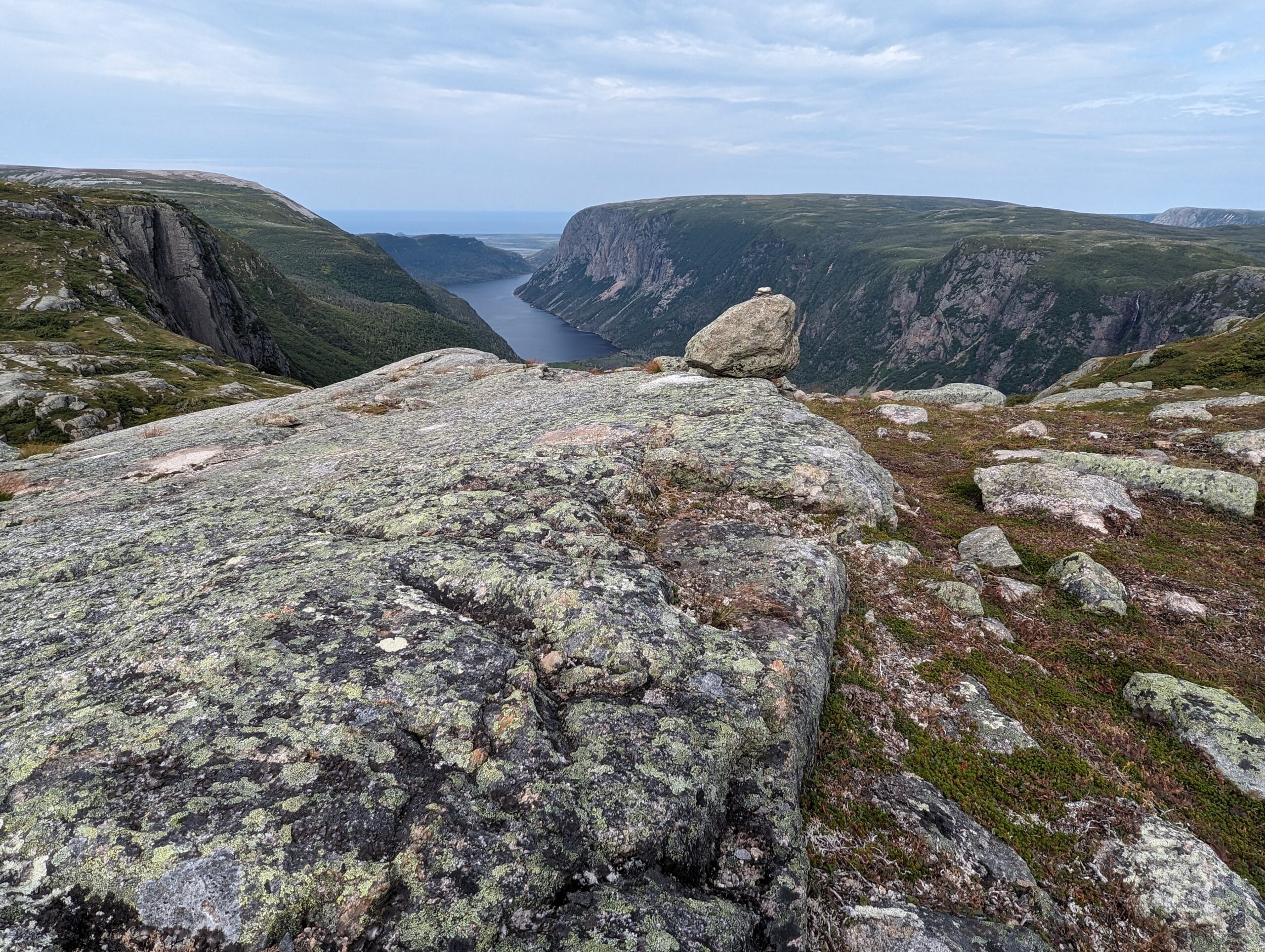
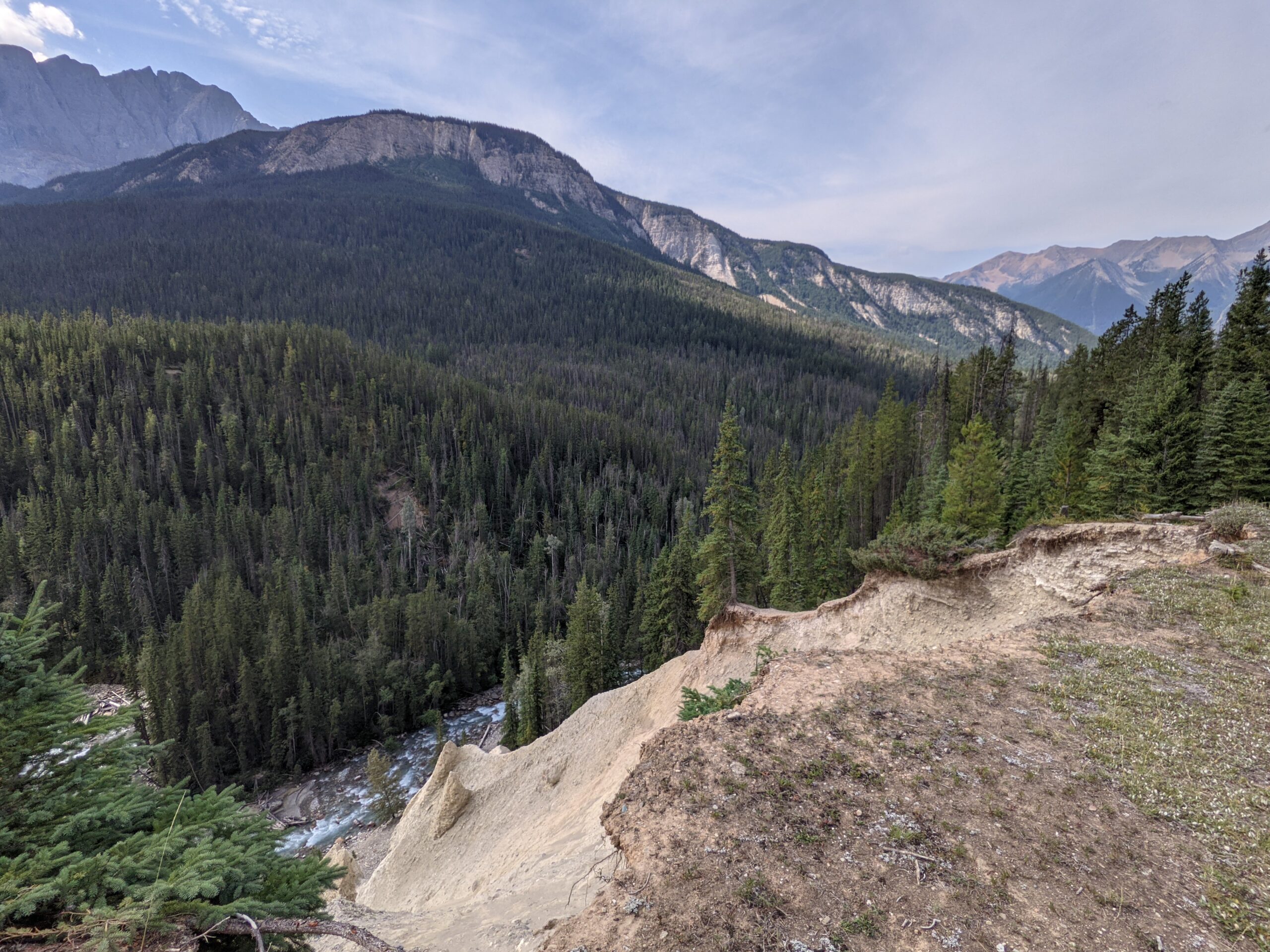
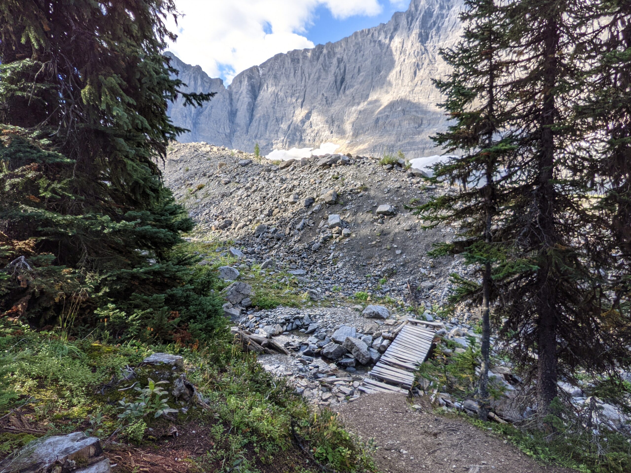
In August 2023, we decided to hike both the Northern and Long Range Traverse in Newfoundland. The Northern Traverse is estimated at 27 km long and the Long Range Traverse is said to be 35 km. To those who enjoy multi-day hikes, this doesn’t sound like a lot of km to cover, but this route does not have a trail and goes through some difficult terrain which makes you earn each one of those km.
Before going on this hike, you need to get a permit from the visitor’s centre and to be granted a permit, you must attend their mandatory orientation. Here they will go over how this is not a trail, you are not going for a nice little stroll, and you are choosing suffering. They tell you to be prepared to have wet feet, be eaten by black flies, and generally have a miserable time. They also tell you that it is some of the most beautiful scenery you will see, and they are right about that. Most of what they emphasize is the tuckamore, especially the section they call “Tuckamore Tangle” if doing the Northern Traverse, and what it will do to your gear and your navigation.
I almost backed out of doing both traverses in one go after a pre-orientation conversation with Parks staff as we had a timeframe to complete the trail and I worried that we might be better off doing one or the other. After digesting what was said and seeing the actual orientation, I changed my mind and we were back to doing both. We were experienced and were prepared for what was going to be thrown at us. We got a ride to the trailhead from a couple who were going to do the Long Range Traverse the following day and got ready to step off.
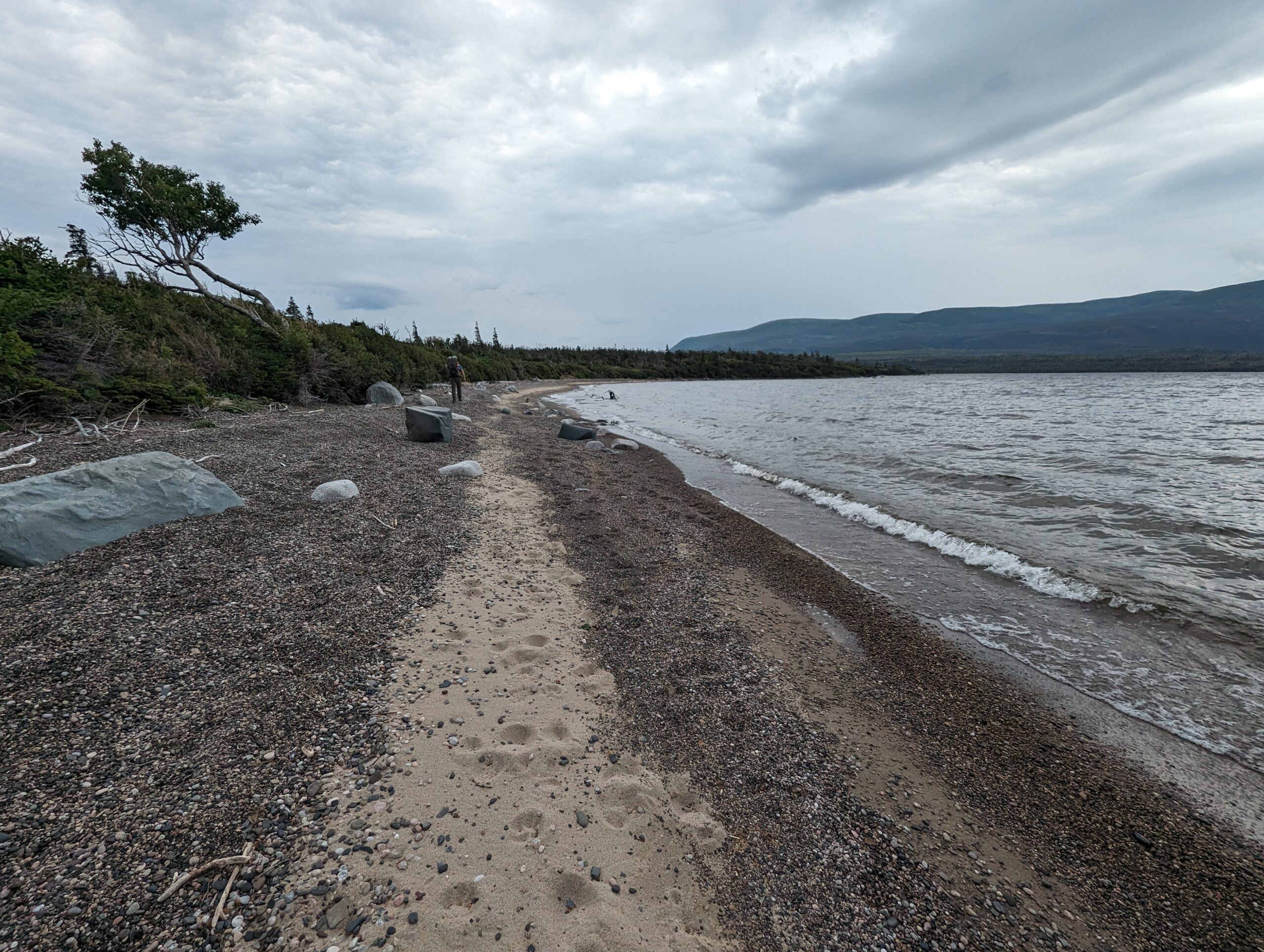
Day One – Northern Trailhead to Snug Harbor This was the easiest portion of the hike as we walked down a nice gravel path which leads to the tour boats. There is a little junction for those going on the Northern Traverse that leads into the forest and eventually to a river crossing where we waded in knee-high water to the other side. We were warned that this water crossing can get waist high in some weather conditions. This stretch was generally uneventful as we pushed through overgrown paths, climbed down onto the sandy and rocky beach and back into the forest again. Eventually we made it to Snug Harbor which had about four or five tenting spots, two large chairs on the beach, a bear box, picnic table, and a green throne. It was the best maintained site on the trail with a beautiful view. At night, the toads were very loud and woke me up, but experiencing nature is what we were out there for.
Day Two – Snug Harbor to the Crest We started out this day with a beach walk to where the “trail” begins in the trees. We ran into a couple who were exiting the Northern Traverse and showed us their scratched, bitten, and bruised legs. Almost immediately we were climbing and we attempted to follow the ribbons tied to the trees. We’d check the GPS and find we were off track and readjusted only to see another ribbon to our left or right that was only visible from above. We found clothing items that had been snagged on branches and chuckled, making a mental note to keep a close eye on anything drying on our packs. Eventually we made it out to an open area on the hillside with a view of the ocean in the distance. The clouds were moving in (and the fog) and we knew we needed to find our stopping point for the night before the forecasted storm hit. The wind was kicking up as we settled on a patch of moss in the tuckamore. It wasn’t perfectly flat and I had a mound of dirt to sleep against all night, but it was sheltered. The wind and rain battered our tent and both of us went out into the field across from our site to gather stones to pile onto the stakes as they had a difficult time staying stuck in the moss. It was a long night as our tent took a beating until the storm passed in the early morning hours.
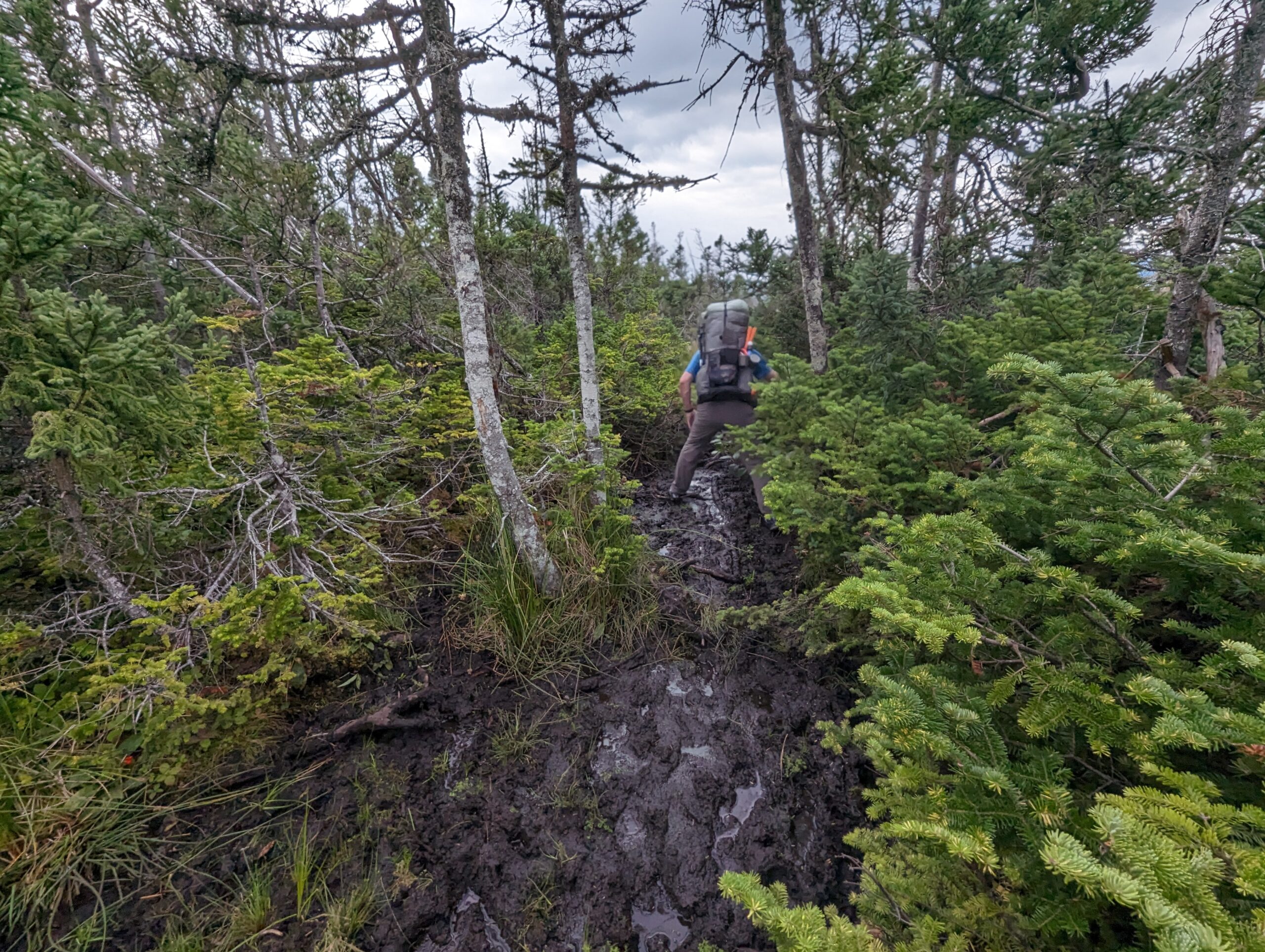
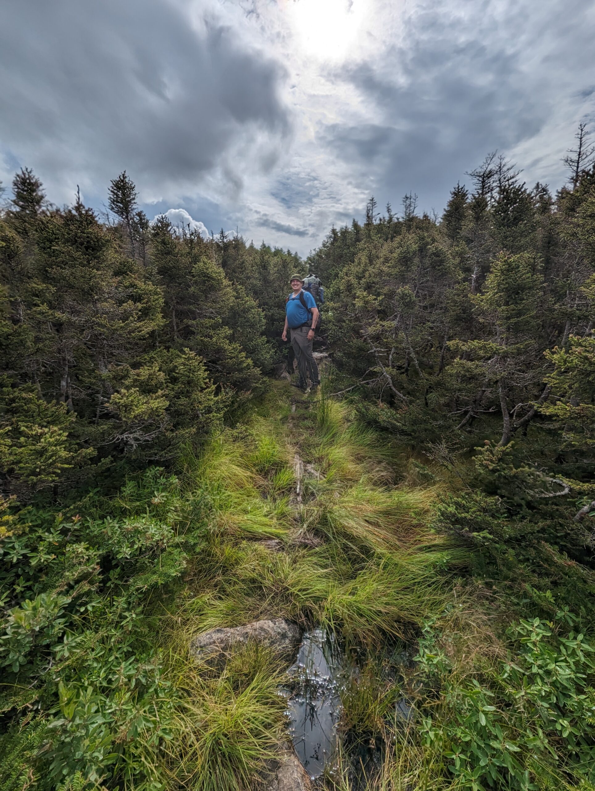
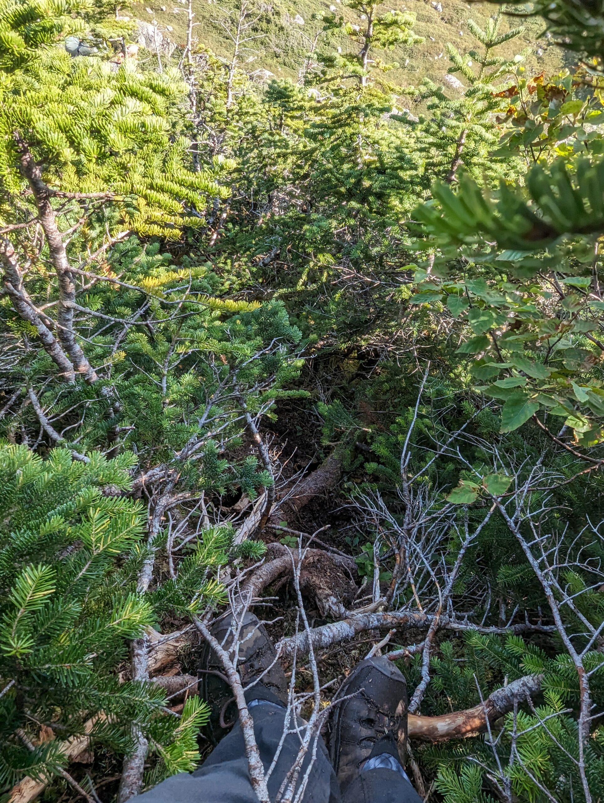
Day Three – Crest to Triangle Lake This was the day where we were introduced to tuckamore. We spent a bit of time trying to locate the trail. It was hidden under the low brush and while we thought we could make out where there was a break in the tuckamore, or where the trail might be, we couldn’t spot how hikers chose to get there. We had to backtrack a couple of times as we ended up on game trails and then got deeper into the tuckamore. Everything was boggy. Grass was boggy, mud and water pooled around the base of the tuckamore, forcing us to swing from the branches from one root to another, hoping to land of firm ground on the other side. I tested a patch of grass with my trekking pole only to find the ground give way when I stood on it, sinking to my knee. I placed my other foot on another patch to pull myself out, only for that foot to sink in too. My boots were now suctioned in knee-deep mud and my husband had to help pull me out as I couldn’t get any leverage.
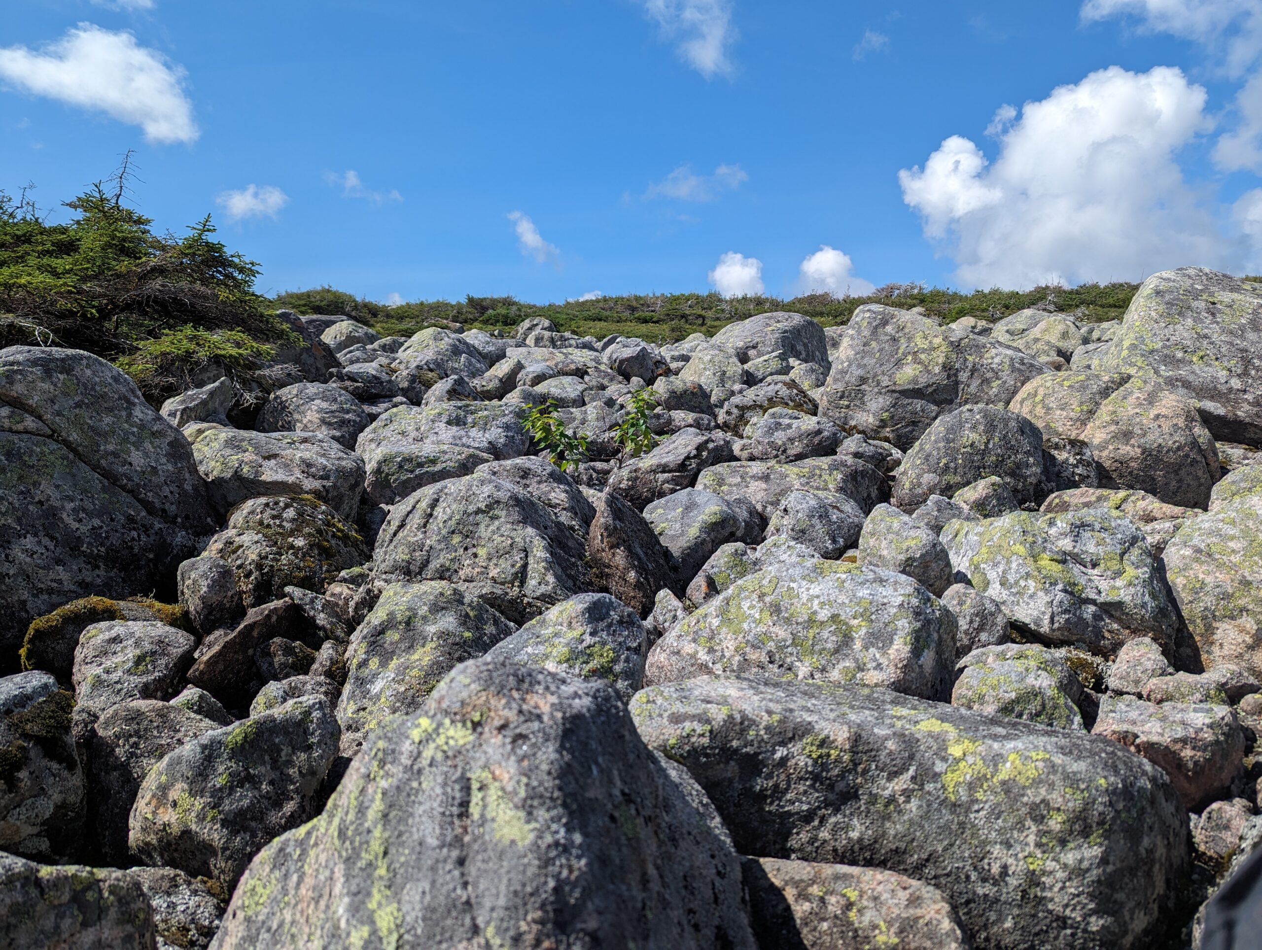
Of course, the Northern Traverse wanted to also introduce us to its boulder fields where I learned that my balance on rocks needs improvement and it took a lot of patience to pick away at the obstacle. We reached Triangle Lake which had a couple of wooden tent pads and a few other flat patches that were suitable for tents. We had a nice rest in the sun and set up camp for the night.
Day Four – Triangle Lake to Gilley Pond Today we learned that tuckamore likes to grow in hillsides, which means climbing up and down while it snags on your packs, and for fun, the ground likes to erode under the branches and roots, so you could be scrambling over a drop of several feet all while hoping that the root you’re standing on will hold.
Where there was no tuckamore, there was a lot of uphill which was at such an angle that it was easier for me to claw my way up than try to stand upright. Oliver didn’t have this problem and just walked up, but I felt closer to the ground and decided it was a much better idea to take a few moments to sit on the moss and celebrate how far I’d come. It was during one of these moments that I looked up at a distant hillside and saw a moose running along the ridgeline. It was the only moose we would see on this trip. To finish off the day, the Northern Traverse decided to treat us with a long descent down into Gilley Pond. It might not have been that challenging of a descent, but given how muddy the hill was, it was a slow climb down. Even though we could see the camp, it took forever to get there. The view that night of the stars and the silhouettes of the hillsides was stunning. You could also hear the coyotes in the distance.
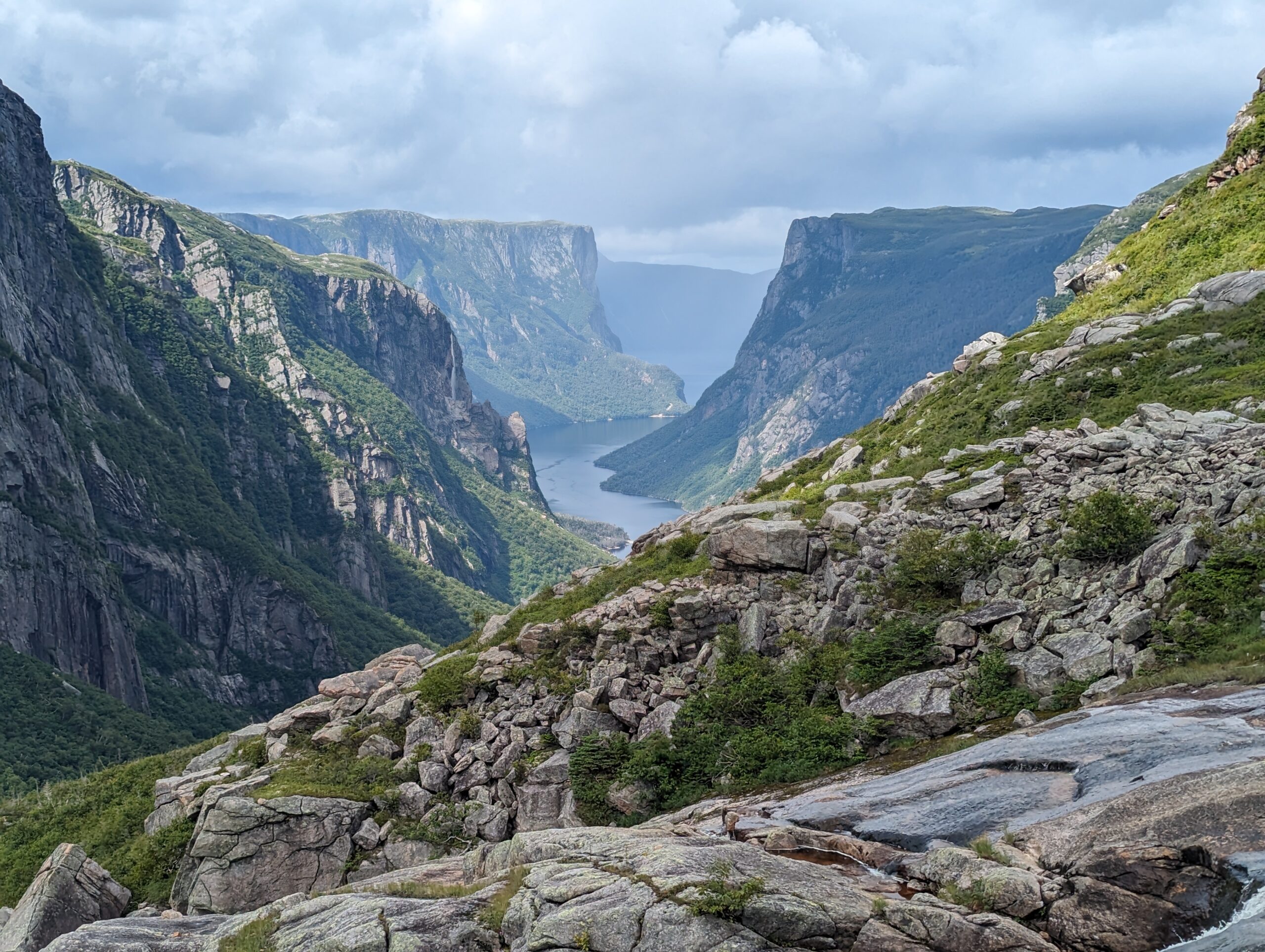
Day Five – Gilley Pond to Mark’s Pond For those choosing to do both the North and Long Range Traverse, this is decision time with regards to if you want to complete both traverses. After this day, you reach the top of the Fjord where you can climb down the waterfall and wait for space on the tour boat to get a ride back to the parking lot and quit the trail, or keep going. After talking about how we were feeling (tired, wet, and literally bruised by the tuckamore), we chose to keep going.
Being that is was the Northern Traverse, we had rain in the morning as we climbed out of Gilley Pond, making it a soggy and muddy climb out, then we found ourselves searching the tuckamore-covered hillside for signs of ribbons to guide our way through, and climb even more combinations of uneven ground and tuckamore before we finally reached the rock and moss hill that lead down to the viewpoint at the top of the waterfall. It was the payoff. We stopped here for lunch, had a good rest and celebrated reaching this beautiful location. We had chosen the hard way to get there, but it was beautiful. As we went to take a picture together, we realized that the legs of the mini tripod I had attached to the shoulder straps of my pack and been ripped off in the tuckamore, so our angles became limited.
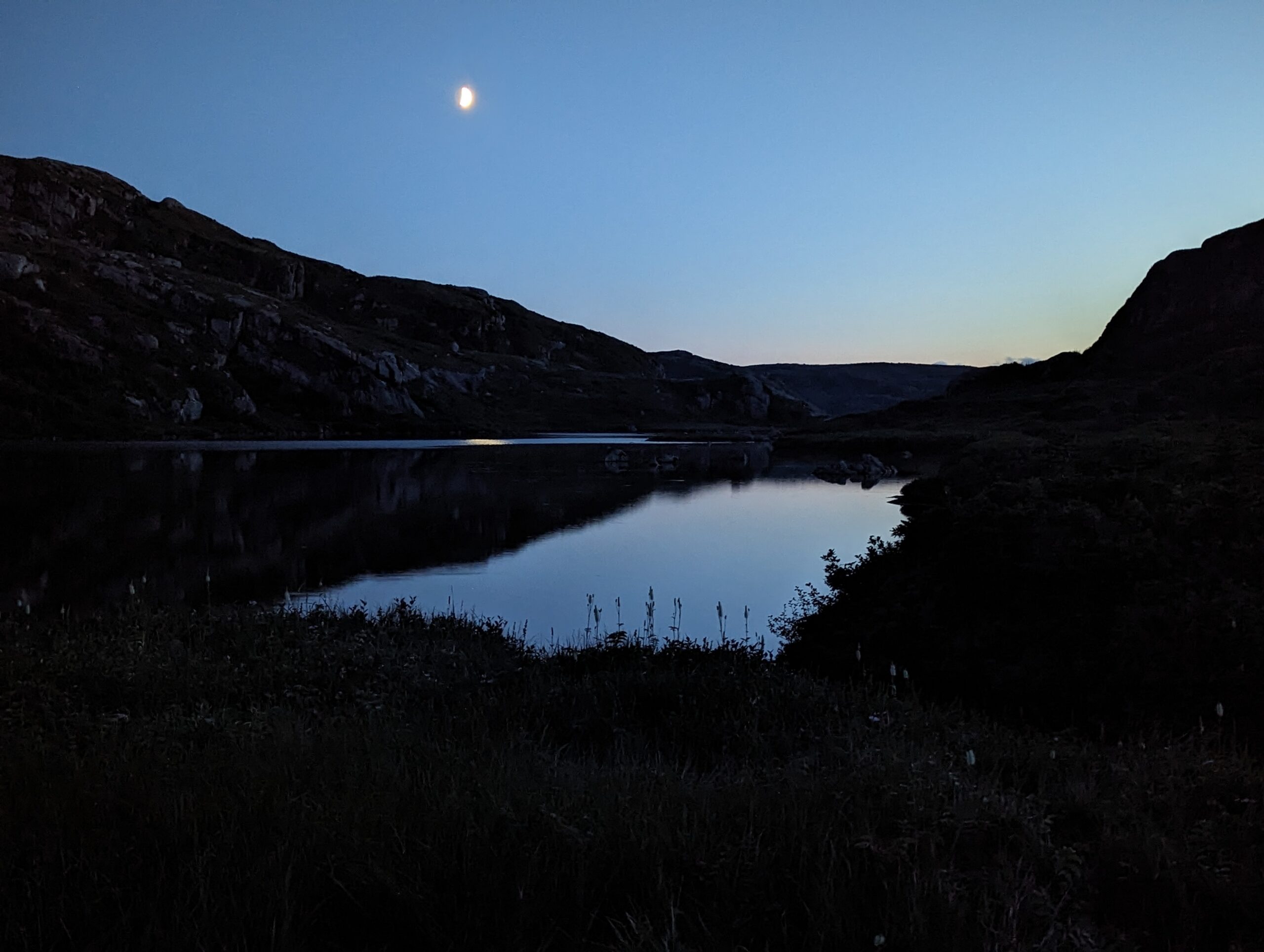
Energized from reaching the top, we climbed up the rocky waterfall and continued along the top of the ridge, following the rolling hills to finally get to Mark’s Pond where we snagged a dry site along the lakeshore. You really need to get used to mud on this trail because there was a lot at this campground and at Little Island Pond before it. Also, look out for hidden little washouts on the paths. When lighting was poor in the evening, I stepped in a hole on my way to the green throne and made a splash as I landed in a puddle near the tent. I had one of my best sleeps at this site. It was lovely.
Day Six – Mark’s Pond to Lower Green Island Pond A creek crossing is the first thing to greet you as you leave Mark’s Pond. Most of this day didn’t feel all that bad, except for Oliver’s determination to keep his feet dry. The “trail” would run along the bottom of the hills and cut right through the muddy bog. Oliver would take wide swings around the bogs and climb up and down the hills. I would follow behind him, but found the effort was wearing me down. It added extra km and it was just more up and down for me to manage. The tall grass was also damp and as I followed him, I slipped. As I fell, my trekking pole sunk into the ground and I managed to grab hold of it and prevent myself from sliding all the way down the hill into the waiting bog. But the Northern Traverse had another slip in store for me.
I gave up following Oliver up onto the hills and decided to remain down in the bog and mud. My shoes and socks were already wet and I embraced the situation. The sound of squishing moss became the soundtrack for the trail as I stomped. And then I took another tumble. This time I was walking through mud and stepped on a rock. This should have been something solid for me to stand on, instead my mud-covered boots slipped on its surface as my trekking pole didn’t quite catch the solid patch of grass on my right side. As my pole sunk into the deepest portion of the mud, so did my right foot… and down I went. Oliver asked if I was alright and I lifted my now bent trekking pole out of the mud. RIP trekking pole.
At the end of the day, we reached a descent to our camp but quickly realized we were off the GPS route as we were at a cliff. It was a cliff we had been warned at the Visitor’s Centre to avoid and there we were, standing at the edge of it trying to figure out the best course of action. Neither of us felt like trying to jump or slide down nine feet onto a narrow dirt landing and instead chose to hang on to a piece of cord and a tree branch while inching our way across a slick rockface to another, much shorter drop. By the end of this, I was done for the day and we found a patch of grass near the occupied tent pads to set up for the night.
Day Seven – Lower Green Island Pond to Gros Morne Trailhead The final day on trail. This felt like a long day as we started with another creek crossing and then had several climbs to do and almost all of them were muddy. You have to understand that the steps that you climb up are goopy footprints from previous hikers and the mud wraps around your shoes with each step. Something about stepping on the mud didn’t make me feel confident as I didn’t have the grip I wanted. One really has to embrace getting wet and muddy on this trail and just lean in and grab hold of anything to get yourself up a muddy hillside. Let’s just say, I chose to slide down a few times.
We reached Bakeapple viewpoint which, I would say, is the second best view on the trail, but there are so many wonderful views along the way. It was another great place to stop and eat before we continued down Ferry Gulch (again, muddy and slippery) and then finally connected with the very long trail for day hikers doing Gros Morne mountain. Just when we thought we would be on a nice hiking trail, we encountered scree and plenty of uneven rock. There was even a little tuckamore thrown in, which we laughed at and called “baby tuckamore”.
The walk back to the car seemed to go on forever. By this point, we were ready to be at the parking lot as we were now in the trees on a wide open path with nothing to see, wondering “how much further”. As we met people along the way, they wanted to hear about our adventure, astonished that we had hiked all that way with the mud and tuckamore. When we reached the parking lot, we were relieved to see our car to make our way to Rocky Harbour where we would get a hotel and drop off our permit at the Visitor’s Centre so they knew we made it out.
At the hotel we got our town bags out of the car, had nice long showers, and treated ourselves to a huge meal at the restaurant, even if our now stiffening legs just wanted us to go to bed. After we were well fed, we finally gave in and climbed into the nice warm bed we had worked so hard to earn and had a great rest before our drive home the following day.
I was woken up by my husband playing “Rise Up” from the Hamilton soundtrack. After taking forever to fall asleep with sore legs, I needed to sleep in. While we got a later start at 8:30am, it wasn’t a sleeping in morning. We still needed to hike out.
It was a slow morning as I wanted to rest my head on the picnic table, but I slowly woke up and we packed up the tent. My ankles took a bit of time to loosen up on the trail as everything was tight from the day before.
The hike started out on a quad trail that was mostly clear, except for the odd spider web. There were some taller weeds growing on the trail and a few branches hanging over, but nothing like the other trails we were on,
It was hotter this day and I needed to drink a ton of water just on the flat sections. There ended up being more climbing on the way out than either of us expected. It wasn’t terrible, but I was tired from not sleeping and my muscles were done. Had this been the first day on the trail, it would have been a breeze.
At one point, we heard some rustling in the trees and a martin ran onto the trail toward Oliver, then quickly changed course and ran across the path, out of sight. I spotted a second martin running toward the path before it changed directions and went up into the forest. That was our excitement on this walk.
We were treated to views of the mountains, although not as majestic and they turned into hills the more we descended into the river valley. It was mostly rivers and logs that had been cut away to clear the path.
There was one viewpoint where the land had eroded away leaving hoodoo-like formations below. Someone had arranged stones on the ground to form numbers, although neither of us took a picture of the numbers or recall what was written.
We could finally hear traffic from the highway as we neared the end of the trail. The hoods of vehicles reflected in the sunlight and I hugged our car when I reached the parking lot. My feet were happy when I finally took off my runners, but were unhappy when I put my shoes back on to enter Truffle Pigs restaurant to eat lunch.
We ate all the food we could and then drove to Canmore where we stayed at Canmore Inn and Suites to rest up and clean up before traveling home the next day. For my first section hike, it was difficult, but rewarding. Most importantly, it didn’t scare me off from future hikes and only made me want to do more.
In the morning, we discovered that our lighter wasn’t working to start our Jetboil as it got wet the day before. That meant no hot tea or coffee to start our day on a cold morning. We packed up and were on the trail by 8am with a long ~24.5km day ahead of us. We grabbed water just above the dry creek bed outside of the campground and followed the trail toward Wolverine Pass.
It was a switchback climb with us on alert for mama grizzly and her cubs. Oliver admitted that he did want to see bears on the trip, but at a distance so he knew where they were. He didn’t like knowing they were sighted the day before and not know if they were still nearby.
The area around Wolverine Pass was open meadows with another short climb in the direction of where we were to camp the day before. We had made the right choice to stay at Tumbling Creek because I would have been too exhausted to have made that final climb.
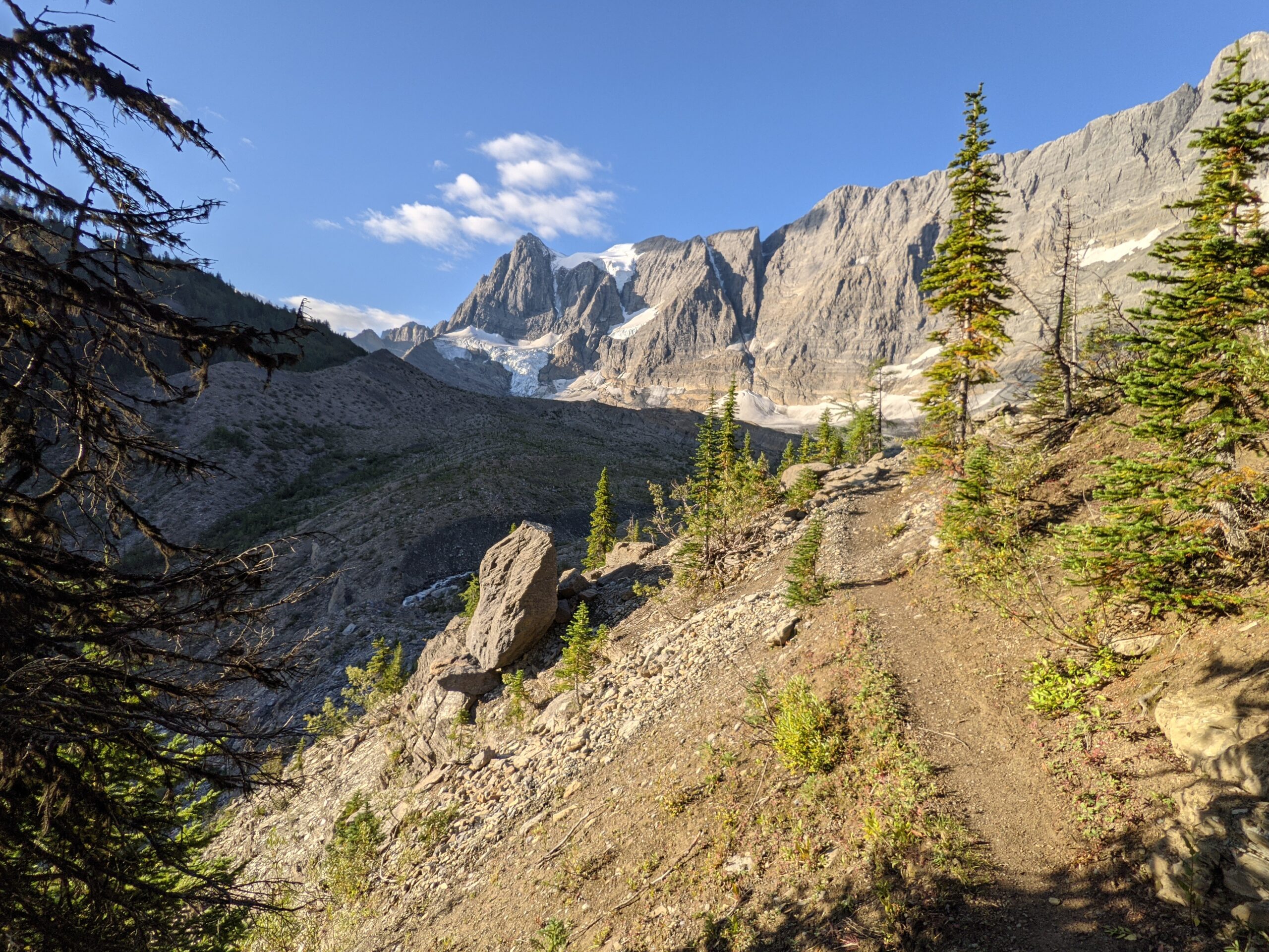
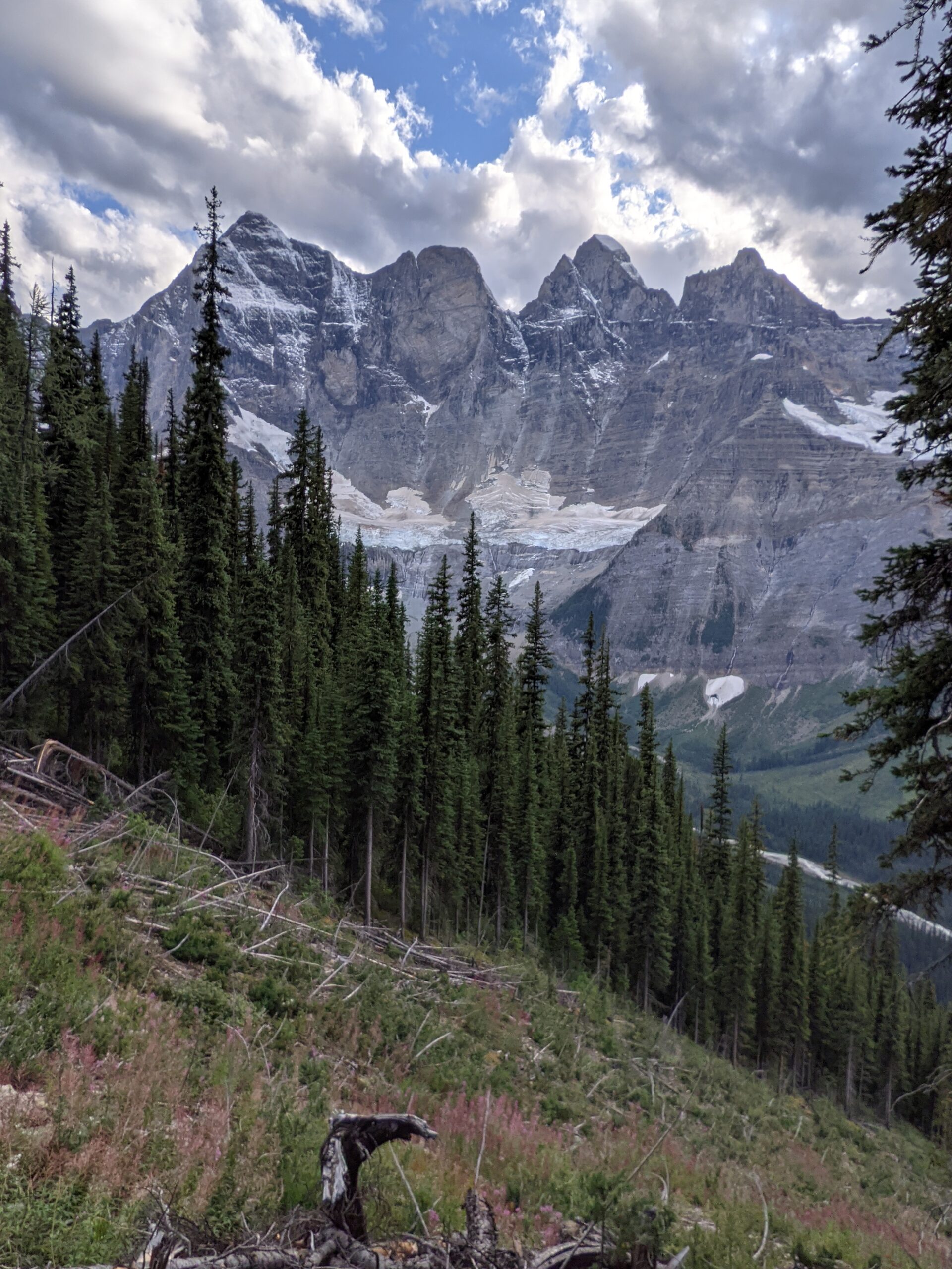
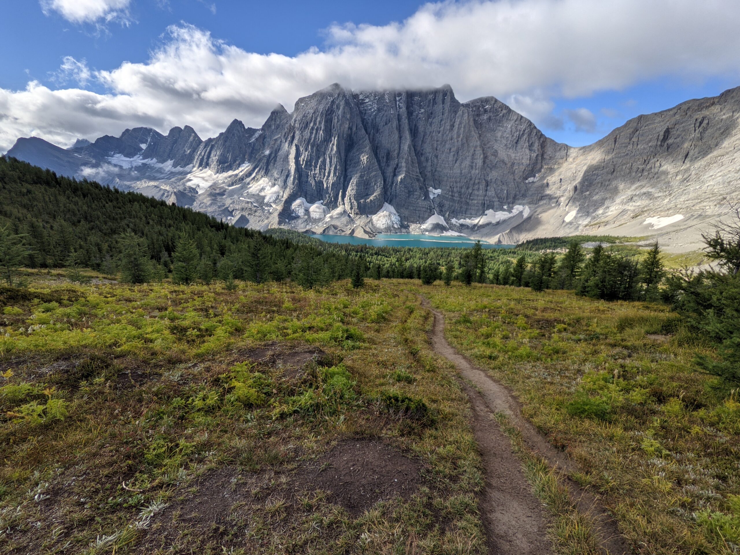
We enjoyed the spectacular views of the Rockwall with the cliffs towering over our left side along the path. There were blue glaciers clinging to the base and a cool breeze was blowing but we weren’t chilly as long as we were moving. We still kept our eyes open for bears and saw nothing.
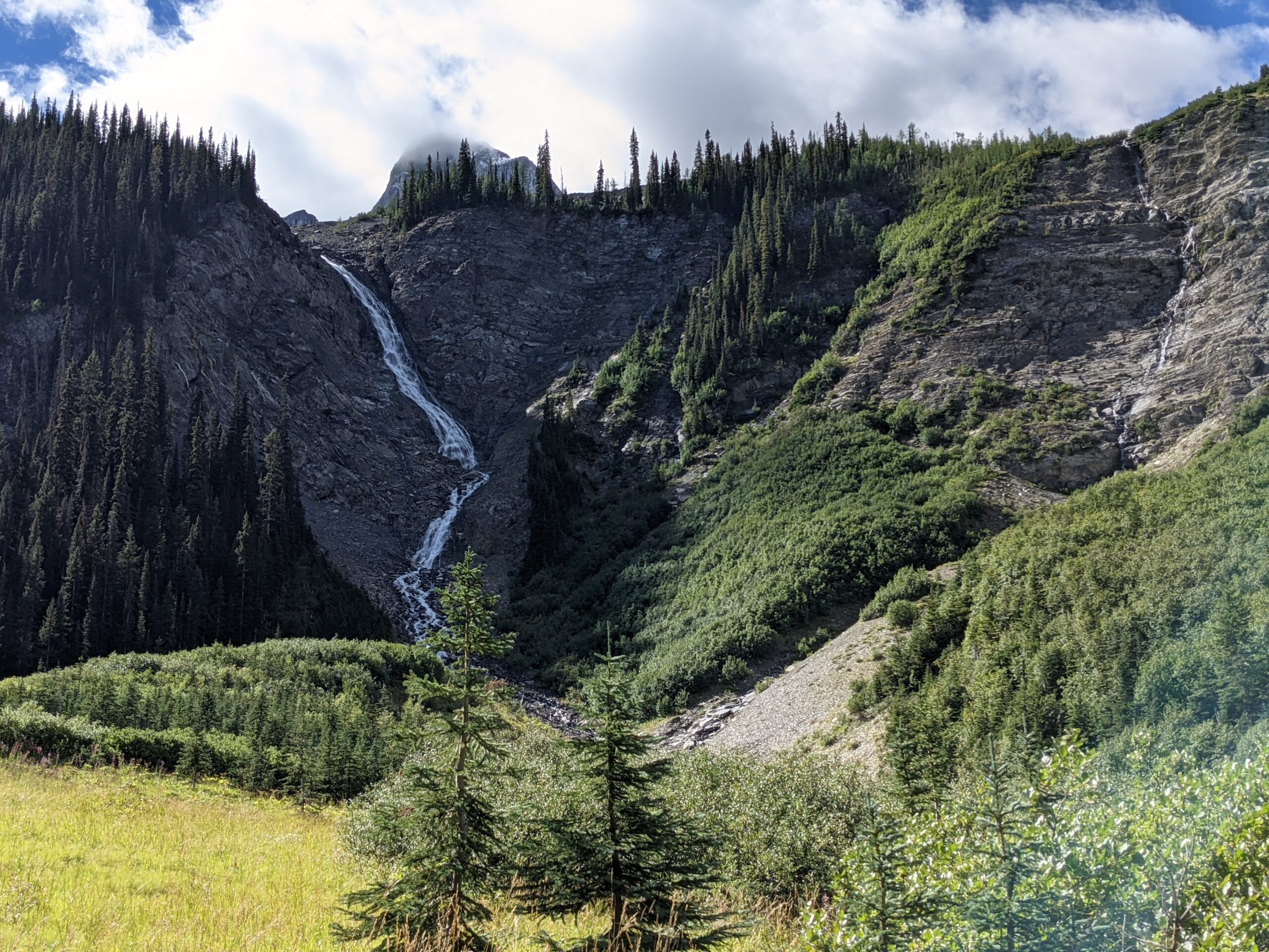
There were some interesting paths where the trail looked like it had been washed away and we needed to dip into a dry creek bed and back out again. Helmet Falls was beautiful and we had to push through more branches to reach the campground where we ate a late lunch. We were starting to feel that we were falling behind but only because we had an arrival time in mind. I tried to just focus on “getting there”.
We grabbed water at the campground and began to climb up to Goodsir Pass. As we climbed, I was definitely running out of steam. It was getting increasingly difficult to remain positive on push up the hill. I was determined to keep picking away, even with sore feet, ankles, knees, and shoulders.
We encountered our first horseflies on Goodsir Pass and batted them away. There was one for each of us. Luckily, that was all. There wasn’t much to this pass compared to the others. We did find a lovely spot, with views to have a snack before beginning the climb down.
The descent was where I struggled. My body was tired and sore and we counted 30+ fallen trees we had to climb over before we stopped counting. There were also alder bushes we had to push through. My fatigued ankles struggled to keep me balanced on the uneven trail and they bent in many uncomfortable positions. The view of Mt. Goodsir was at least a good payoff for all the hard work.
We reached McArthur Creek Campground at around 8:30pm and searched the blowdown covered campground for the cooking area to eat and hang our food. It was a late dinner and a late tent set up (by headlamp light), but we were happy to get to bed on our last night on trail. The long day resulted in the worst leg spasms I had experienced on the trail, so it was also a long night.
Oliver woke up to the sound of an animal sniffing around our tent. The women camping nearby also reported the same thing, so we assumed it was a porcupine which had been reported to be in the area and frequent visitors to the campground. I also woke up to my pack falling over in the vestibule, which I had to prop back up as it had been hailing with freezing rain throughout the night.
We were up around 7am for breakfast and chatted with a few folks. Taking pictures of the sunrise on the mountains was a challenge as there were a group of young women skinny dipping in the lake nearby.
With our packs ready to go, we set out for Wolverine Campground. The path went up almost immediately and I was in shock as I understood we had a nice easy exit from the campground to warm up, but we were straight into the climb up Numa Pass. It was tough to get up the switchbacks, but felt easy compared to the climb ahead with Tumbling Pass.
On the descent down Numa, my knee was getting sore again, so I strapped on the knee brace, which I found helpful. It was also helpful, mentally, for me to understand that we were on the Numa Pass ascent itself and not an extra climb before the pass, which Oliver had mistakenly told me when he looked at the map. I was worried as I was quickly running out of gas on the climb and thought I still had to do Numa Pass and Tumbling Creek. It didn’t feel doable. Once the correction was made, I felt better. There was only one more climb to do, which felt manageable.
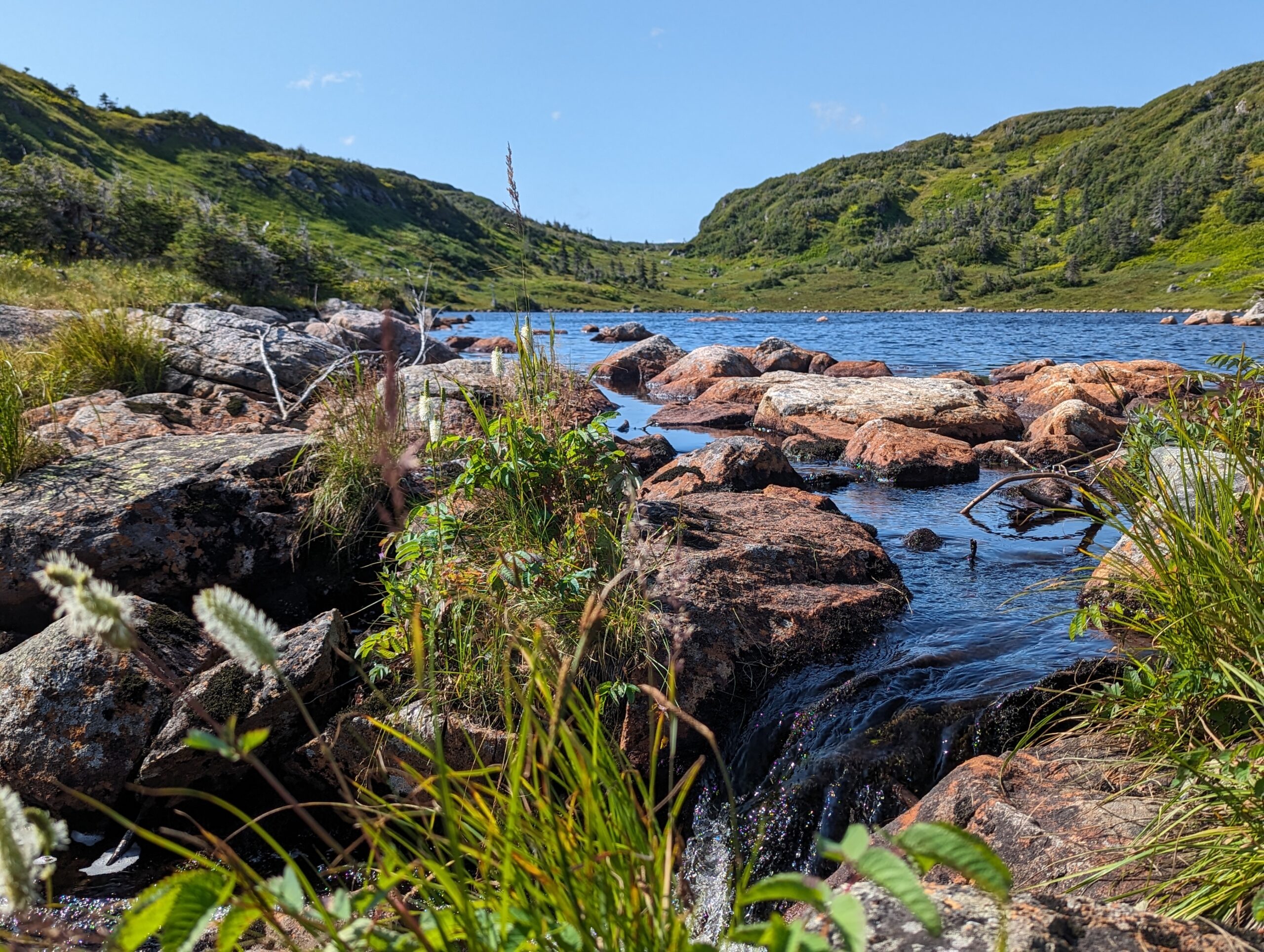
The long descent took us to Numa Creek Campground. There was a pile of scat on the way to the campground and no more. There was a young woman staying at the campground and she was using it as a base camp for other day hikes. We stopped for lunch and the trail running family from Floe Lake arrived after us. They were going as far as Tumbling Creek where they were ending their weekend trip.
We continued on and began the climb to Tumbling Pass. The climb was terrible. That’s an understatement. There was lots of incline through overgrown alder trees. One SOBO hiker we met along the way lost his bear spray in the tangle on his way to Numa Creek. It wasn’t surprising as the branches snagged our packs.
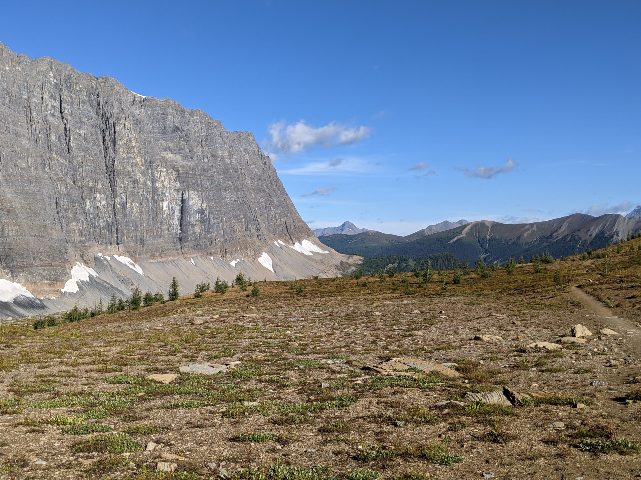
The final climb was steep and we walked sideways up the hill. Once we reached the top, we had a beautiful view of the famous Rockwall. The teenagers from the trail running family caught up to us at the pass and we walked with their mom for the descent into Tumbling Creek where I decided I was not prepared for a third climb to Wolverine Pass. We were also warned of a mother bear with two cubs on the trail out of Tumbling Creek to Wolverine Pass and we didn’t want to encounter them. Giving them time to move on felt like the best move. That meant added 3km to the next day, but was smart. We set up camp at Tumbling Creek and quickly fell asleep.
We repacked our bags, checked out of our hotel, and were picked up by our trail angel by 9:00am. After a drive, and a chat we were on the trail at Floe Lake Trailhead by 10:15am. The parking lot was crowded with cars and we were unclear if they were all day hiking or if they were people camping and making their way back to their vehicles. There were not many parking spots available.
We gathered water at the bridge, but there was another accessible spot further down the trail. The climb started almost immediately, with no cover. The trail went through an old burn area, which would have been hot in higher temperatures. We were lucky to have an overcast day.
There were parts where the trail was rough and washed out, making some of the steps challenging. We also reached a point of the trail where we were on an old creek bed with no signs of where the trail went other than the odd ribbon tied to a branch to guide us.
We encountered a few groups coming down from the lake who told us that there was no one camping there yet, so all sites were open. It made me want to push harder as we had heard about the best camping spots at the lake that were to the left of the campground and we wanted to reach them before they were taken. We didn’t see anyone else coming up behind us and that meant only those going SOBO could get there before us.
One family we passed by were interested in our adventure and said we were the “first true backpackers” they had seen. As someone on her first section hike, I was pleased to be called a “true backpacker”. I guess I had earned the title by that point.
The final climb was tough. Brutal. So many switchbacks and not great places to step. I also didn’t give myself much recovery time as I really wanted to get to those campsites and knew time every minute took to catch my breath, someone was getting closer in the other direction. I felt discouraged and struggled to find my legs. We finally crested the hill and began the drop to the lake.
The prime camping site was already taken, only a few minutes before, but we got the second best spot. The women who were there before us said they sent their fastest partner ahead to secure that site. I stayed at the campsite while Oliver scouted for any other sites and also locate the eating area and washrooms.
While he was on his scouting mission, a teenage boy came running down the trail from the same direction we had hiked from. He was a trail runner and his family had sent him ahead to try to get one of the two sites that were now taken. That was how popular these two sites were and we had all arrived within minutes of each other.
After dinner, we played a quick game of chess. Somehow, I won. We then decided to take a quick nap because it was too early to go to bed, and then woke up at 9pm. Oops. We were more tired than we thought. So, it was time to get properly ready for bed and end the night, just in time for what we thought was rain beginning to fall.
Today was the day for chores and shopping. We had a great buffet breakfast at the hotel and then went to the basement of the Cascade Mall to do our laundry. While we waited, we searched for a light weight massage tool to take with us on trail and foot care supplies for Oliver. We also grabbed a knee support sleeve at the pharmacy for me to try. I was willing to try anything to get through those downhills.
After flipping our laundry into the dryer, we searched for a game we could play when stuck inside our tent during the rain. We found cloth 3 in 1 game set for checkers and chess that we felt wouldn’t add too much weight.
As we had extended our reservation at the hotel, we had to switch rooms. We moved our packs to a storage room and were passing the time while we waited for our new room to be ready. For lunch we went to a Thai Restaurant where I got a stir fry, I had been desperate for vegetables all morning and the stir fry hit the spot. We then stopped at Cows for ice cream and stopped by the Visitor’s Centre in search of activities we could do that wouldn’t involve a lot of walking. We were looking to rest our bodies.
Out of luck, we went back to the hotel and drank coffee and tea at the lobby café until our room was ready. It had felt like a long day even though we were “resting”. Our muscles were tired and we still had a few more trail days ahead of us.
With our packs in our new room, we set off for Old Spaghetti Factory for dinner where I was thankful they seated us at a bar height table so I could dangle my feet from the stool. Now all that was left for the night was repacking our bags, thinking through what we would need in the morning and what needed to be accessible once back on the trail. Finally, it was time for bed to have another good rest.
It was another cold night and everything felt damp in the tent from the dew and condensation. I was half asleep when Oliver smacked the side of the tent to scare away a mouse sitting on top of his backpack in the vestibule. With both of us now awake, we got up at 6:30am to frost on the ground and frozen water filters. We were glad we had filtered our water the day before.
We stepped off at 7:30am and the fireweed was still frozen, saving us from getting soaked feet first thing in the morning. The climb out of Porcupine was challenging and slow. It took about an hour to reach the Citadel Pass junction and there was still more climbing to reach Citadel Pass. We still never saw any bears and continued to make noise to keep them away.
It took a long day to reach the Howard Douglas campground where we stopped for lunch. The outhouse was filled with mouse droppings but someone had created a lock with a stick, so there was that going for it.
Next was the climb up Quartz Hill and it was one of the steepest climbs up the shortest distance. We also heard something thumping around in the bushes across from us and pulled out our bear spray. The noise went away and we assumed we must have started a deer or some other animal that took off, but it got our hearts racing.
When we reached Sunshine Meadows we were excited to see some flat trail ahead but there was still some uphill in our future. When we reached the ski lifts, there were benches to sit on. Of course, we sat. Sadly, the Gondolas weren’t running at Sunshine Village, which is the usual mode of transportation when heading into town for resupply, so we had a road walk ahead of us. My knee wasn’t feeling great coming out of the meadows and definitely flared up on the long winding road. It was also a hot day and we were feeling the heat.
Maintenance vehicles from Sunshine Village and Parks Canada were driving the road, kicking up dust in our faces. Due to insurance issues, they weren’t allowed to give us a ride to the bottom of the mountain. One truck stopped and offered to take our packs and leave them at the building at the bottom and gave us directions to a shaded ski trail that we could take to get us out of the sun. We were appreciative and took them up on their offer.
We eventually got to the bottom, found our bags, and rested before walking up to the parking lot to wait for our trail angel who agreed to bring us in to Banff. We stayed at the Banff Aspen Lodge and decided to take a zero the next day, which allowed us to coordinate with our trail angel for a ride to the Floe Lake trailhead. It did mean shaving off a bit of the trail, but there was a closure at Egypt Lake campground because of bear activity and we would have needed to walk back up the ski hill road to get back on trail and we weren’t excited by that idea.
Once at the hotel we quickly realized we never packed town clothes, so we went to the thrift store and found some clothes to get by while we did our laundry. I spent a long time in the shower taking off layer after layer of dirt as the heat soothed my aching muscles. We also stopped at an Indian Restaurant where I experienced hiker hunger for the first time. I believe I entertained the folks sitting nearby as I practically inhaled a shareable portion of coconut rice and butter chicken. All I can say is, it felt so nice to be in a nice soft bed for the first time in six days and I knew it was only temporary.