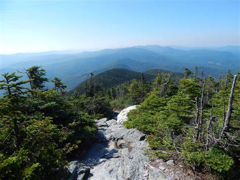
The following days was likewise perfect weather – partly cloudy and warm but not hot. We hoped against hope the Tuckamore was behind us. It was not to be. There were stretches where the going was easy and we were able to pick our way over stony stretches. But there was a lot more up and down today. And worse: the tuckamore we encountered lined the walls of the valleys we traversed! Now we had to fight the tuckamore up or downhill! And when you can’t even see where to put your feet… it was less hiking and more pulling and pushing.
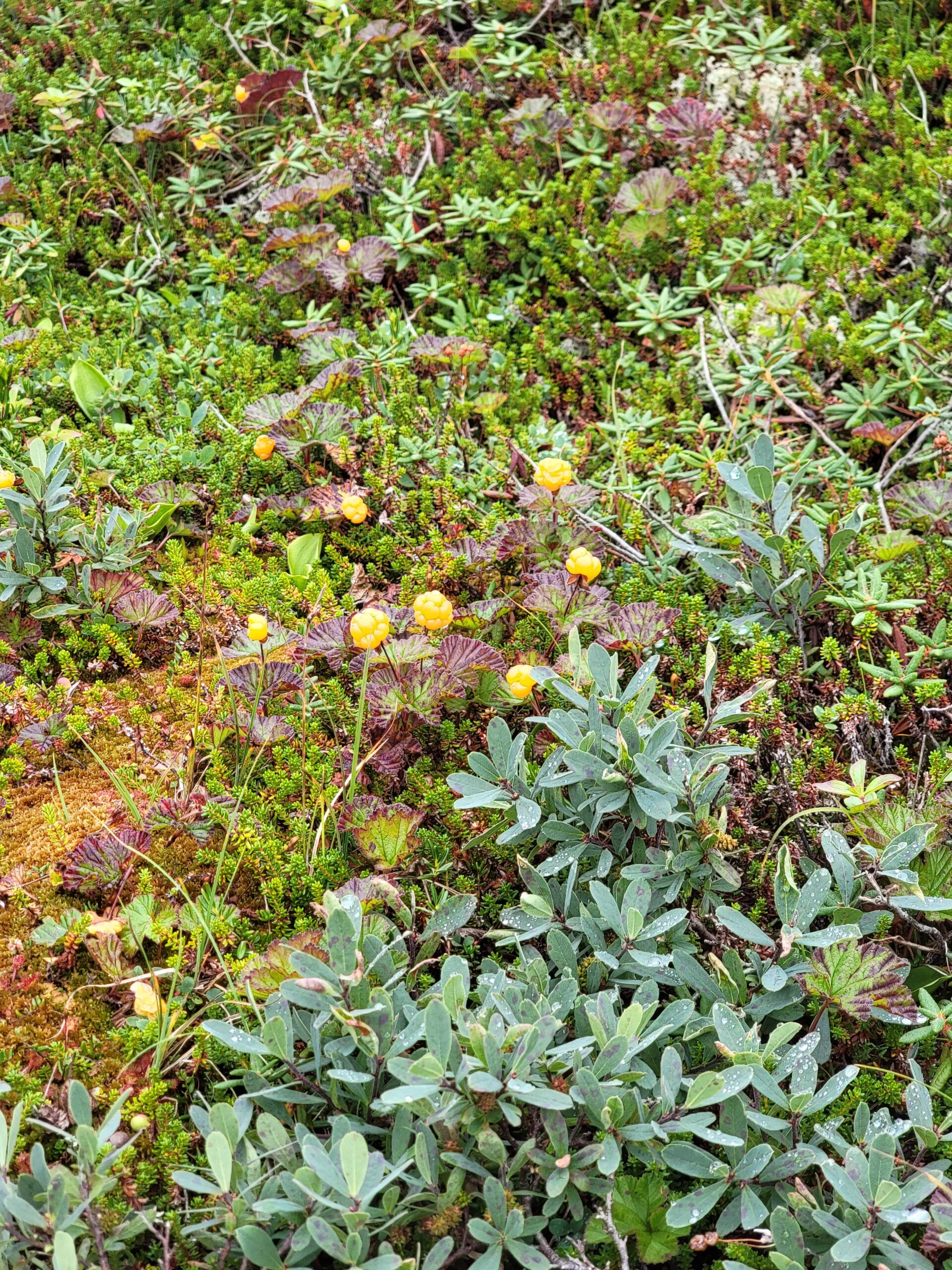
The highlands, where the tuckamore opened into rock-strewn clearings, were covered in berries. low-bush cranberries (locally called partridgeberries), bakeapples (cloudberries to some) and blueberries – millions of blueberries. There is a reason the bears are no trouble up here – they are full of berries! More accessible and less trouble than any hiker’s lunch!
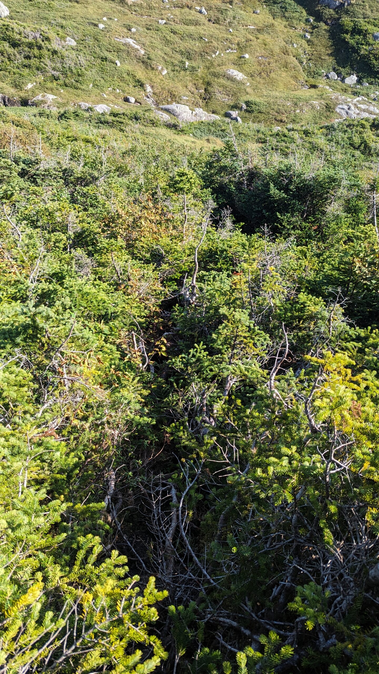
Steep look down on a tuckamore slope
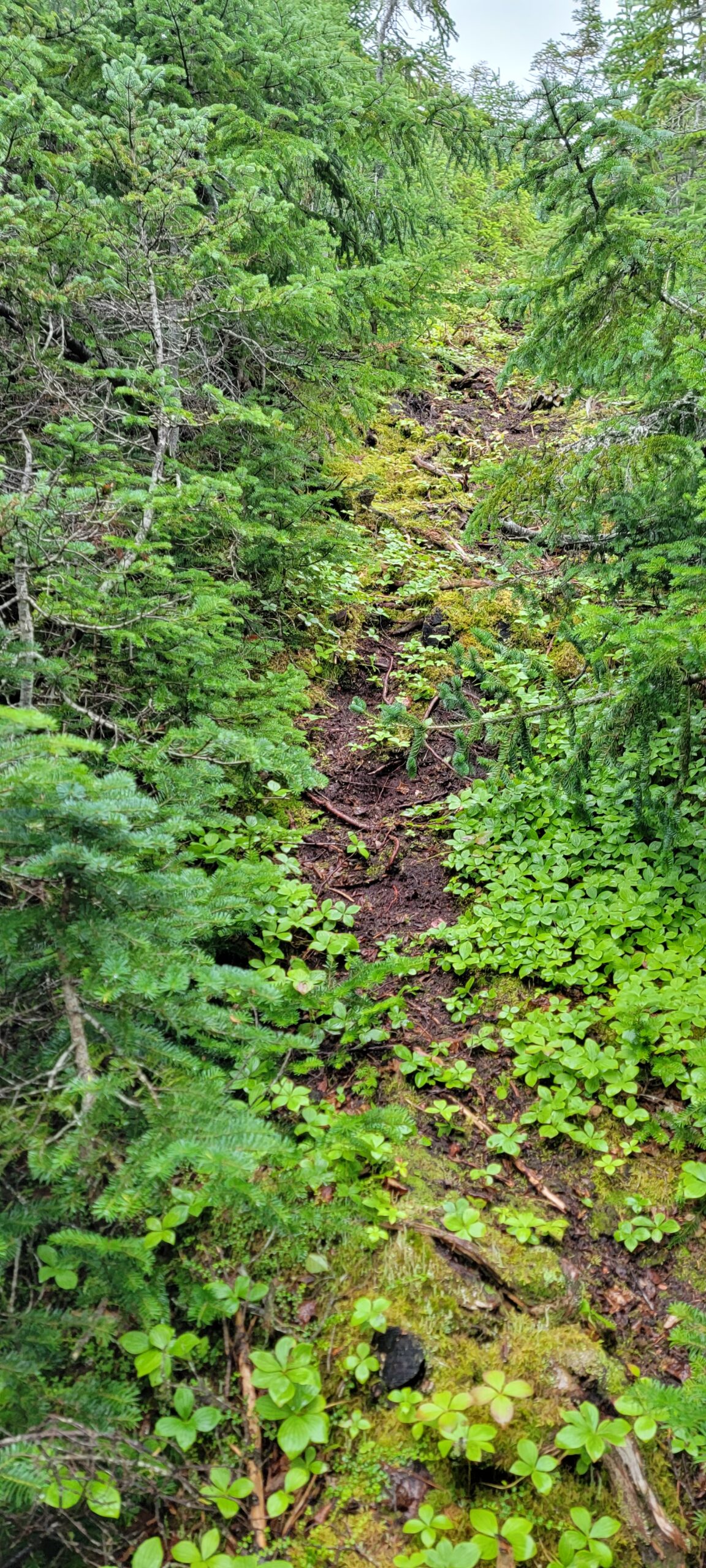
I neglected to mention just how thick and violent the tuckamore was. On the second day as we climbed the headland, at one point I passed a pair of women’s underwear hanging on a branch. We saw a couple coming down on day 1, before we reached Snug Harbour. My guess it was theirs. It must have been drying on the outside of her pack and the branches stripped it clean off without her realizing. We ourselves had brought a small tripod to use with our phones – we arrived in camp this evening with only the phone clamp still attached to my wife’s pack. The rest had been ripped off somewhere in the tangle. We hadn’t even noticed. Brutal stuff. If you come this way, do not keep anything tied to the outside of your pack. You will lose it.
Resting on a steep climb up
I wish I could show you a picture that did justice to the terrain we crossed on this day. It would just look like thick bush. You wouldn’t be able to see the ground standing like a wall behind it and having to pull myself up it by inches. Or the ground dropping away at other times, and I would find myself walking on branches suspended far from the ground, wondering where the GPS line was, because anything had to be easier than this. I’d find some easy walking, then realize I was 50, 100m off the track. Then I’d have to backtrack.
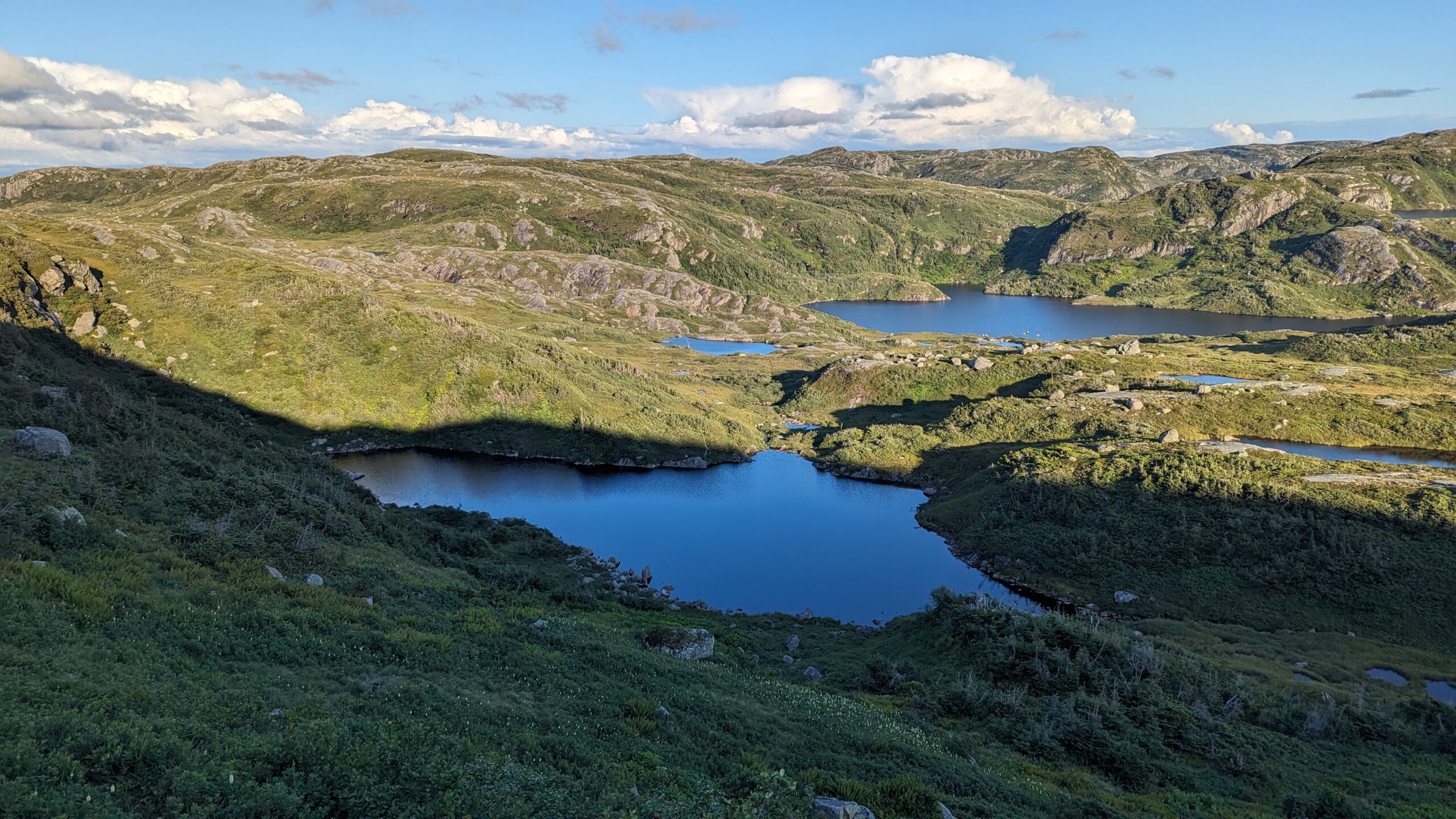
Finally, as the sun began to make its descent, the ground fell away on a steep grassy slope, and a lake was at the bottom – our lake! The next campsite was visible on its shores on a wide open dry grassy area. Signage was clear – there was a toilet there too! The bear locker looked in good repair! I began to rejoice.
Gilley Pond is the one at the back. The steep slippery slope is before my feet in this shot. You can see a bit of a track… at the bottom. But not on the slope before me.
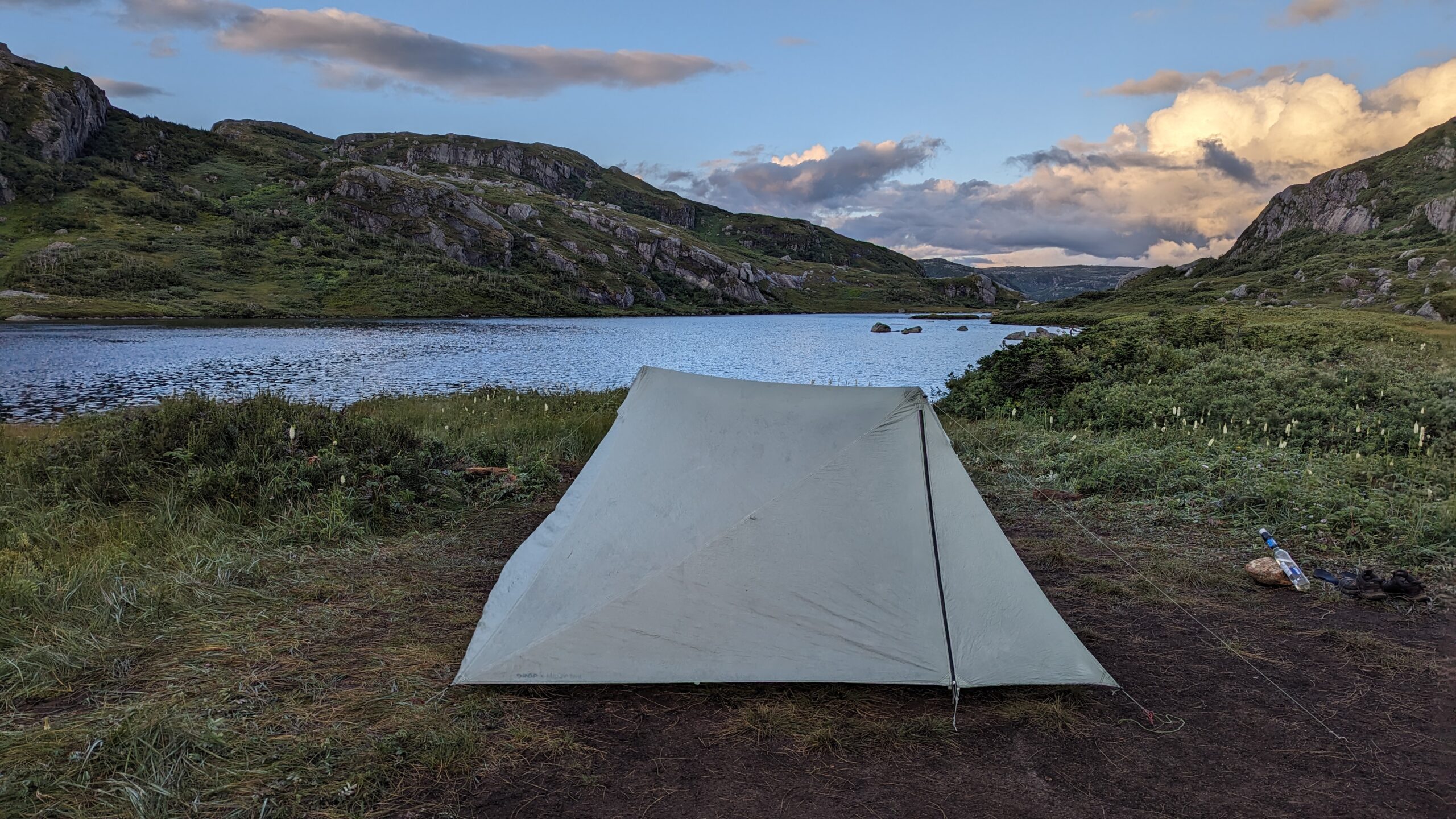
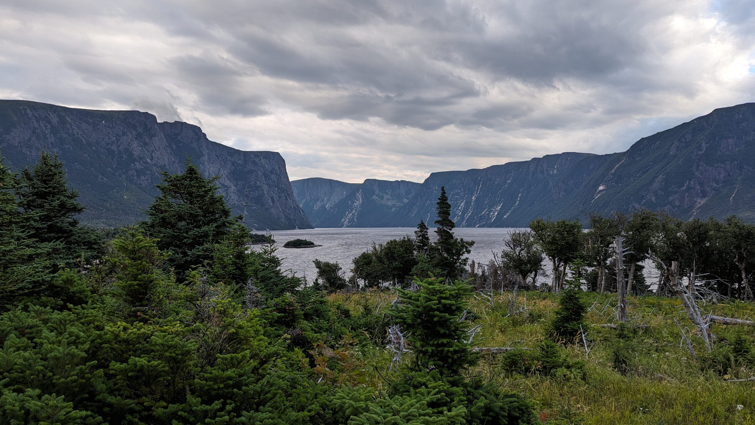
But then we looked at the slippery, narrow, muddy, slick, grass-covered track that others had used to get down this hill. And with tired, aching muscles, we tried to make it down. It was painfully slow. Especially since this slippery track traversed the top of a 50 foot cliff. We picked our way down that hill over the course of an hour, at our slowest pace yet. The sun was fully setting as we shambled into the shockingly flat, dry campsite. No wood platforms needed – it was big enough and flat enough to accommodate a dozen tents. And the ground was loamy and great for tent pegs. The tent went up in a flash and we settled in with a lovely view down another lake which fell away directly into the Western Brook fjord.
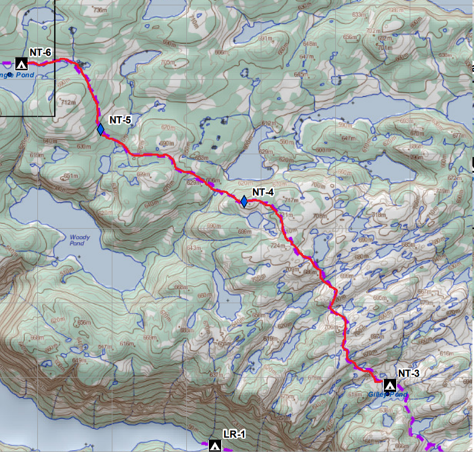
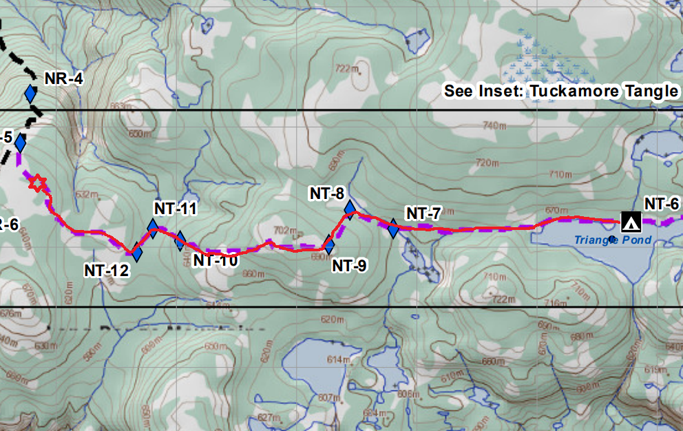
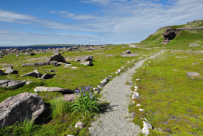
This is what is known on the Northern Traverse as the “Tuckamore Day”. Newfoundland is famous for low scrubby black spruce bunches, twisted and bent by deep snowpack and howling winds. This type of forest is rarely taller than 8 feet, and often around 5 feet or less. But the height means nothing. It is DENSE. It is tangled and vicious and it snags on everything, pulls on everything, it cuts bare legs and scratches legs in pants. And up top on the Traverses of Gros Morne, there are many many patches of Tuckamore to navigate through.
We actually hit the first bunches of them on Day 2 but they were relatively minor. On this day we would be fighting them all day long. The GPS track we were assigned was our only guide most of the time, as the “trail” would fade in and out of sight. And when the track let to Tuckamore, it was a misery trying to spot where the bush would give way to a slightly more passable tangle than the untouched parts. It would not be a trail or an opening we would be looking for – just a slightly less dense passage. And because GPS is typically only accurate to 2-4m, we could be standing right next to the right path and not even see it.
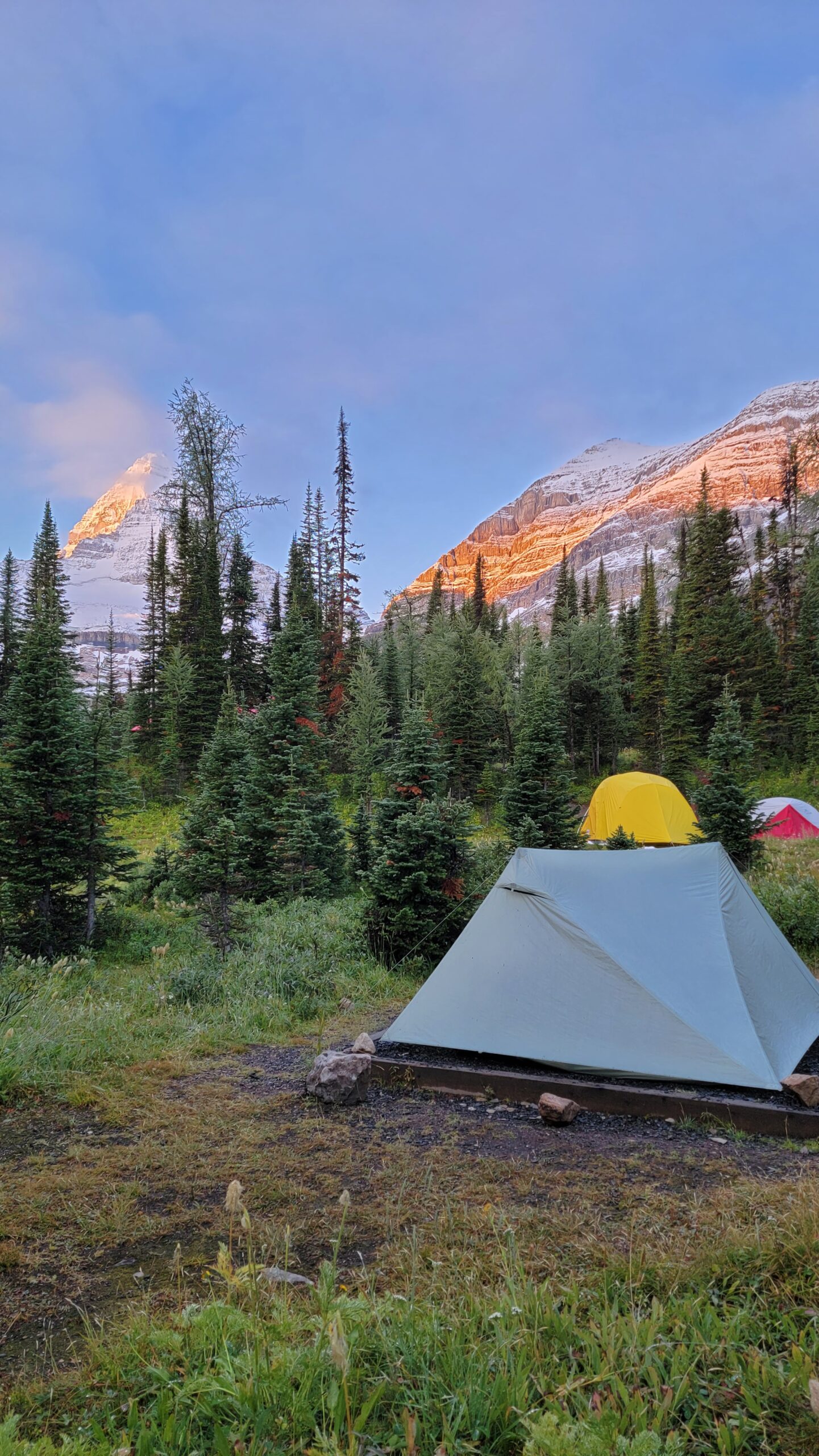
Our camp to start the day. The fog was lifting. Note the Tuckamore on three sides of our tent.
But to our experience. Up reasonably early, the headland was socked in with swirling fog. We had been warned that fog could sock in so hard we might have to wait hours for it to clear. But thankfully, the fog began to clear before 9am. It was thin enough that we could get going. And it burned off before an hour or two passed, giving way to a beautiful sunny day.
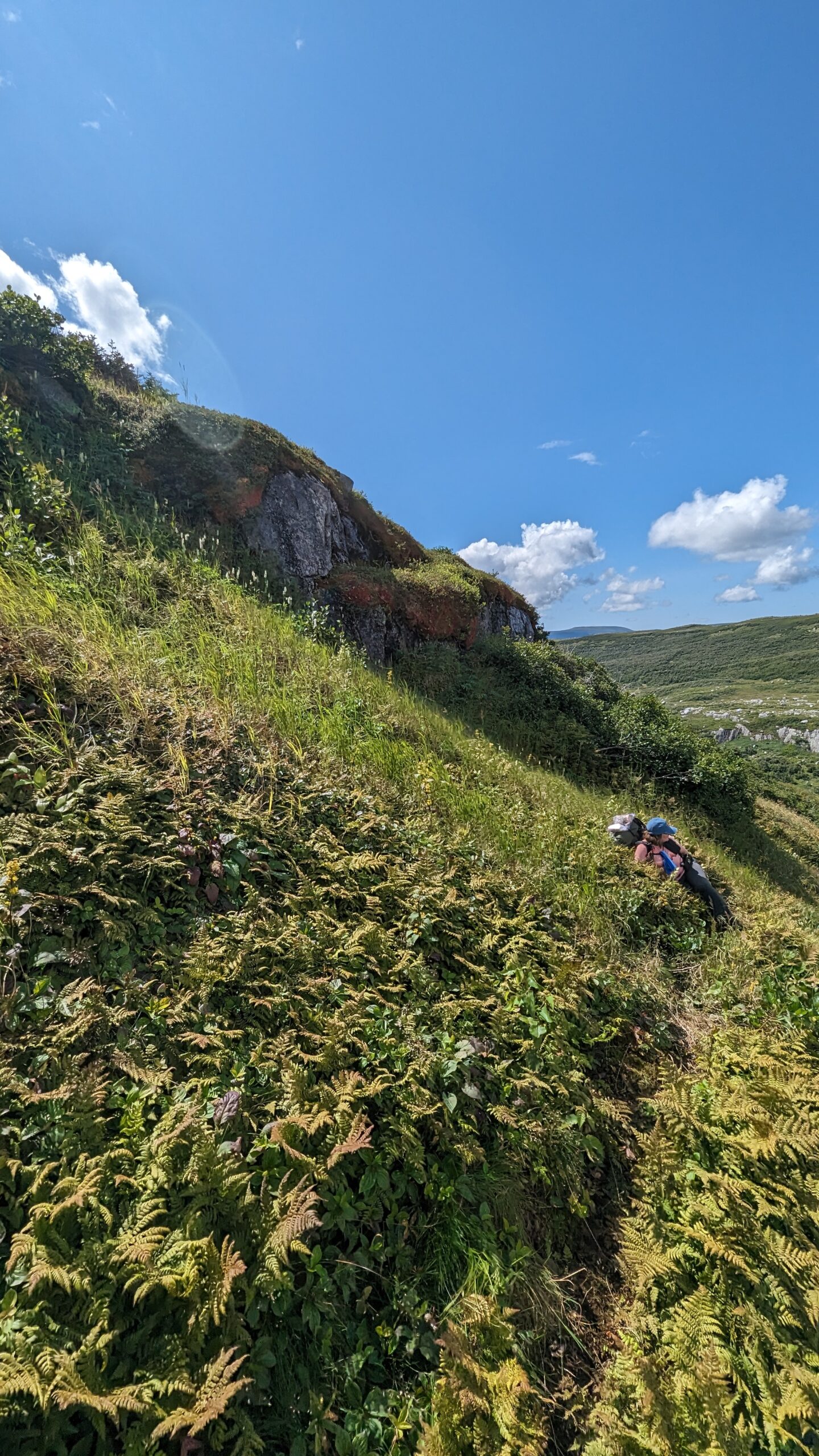
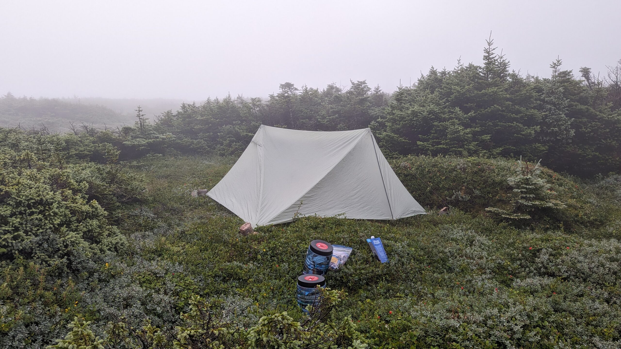
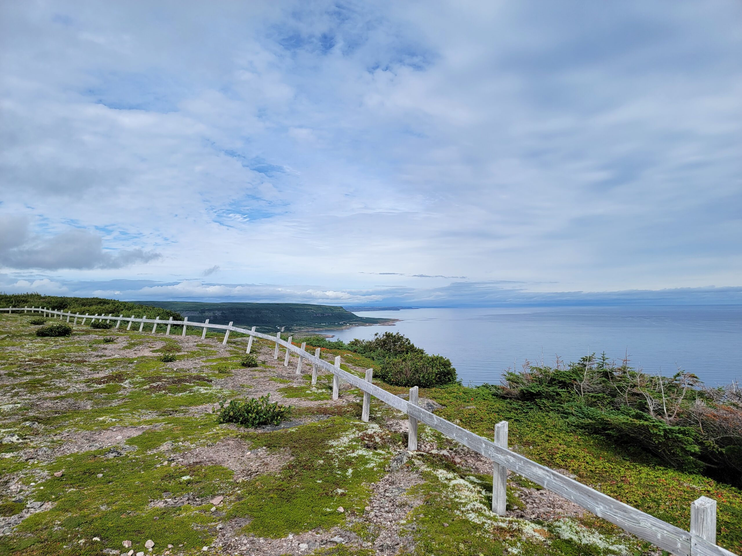
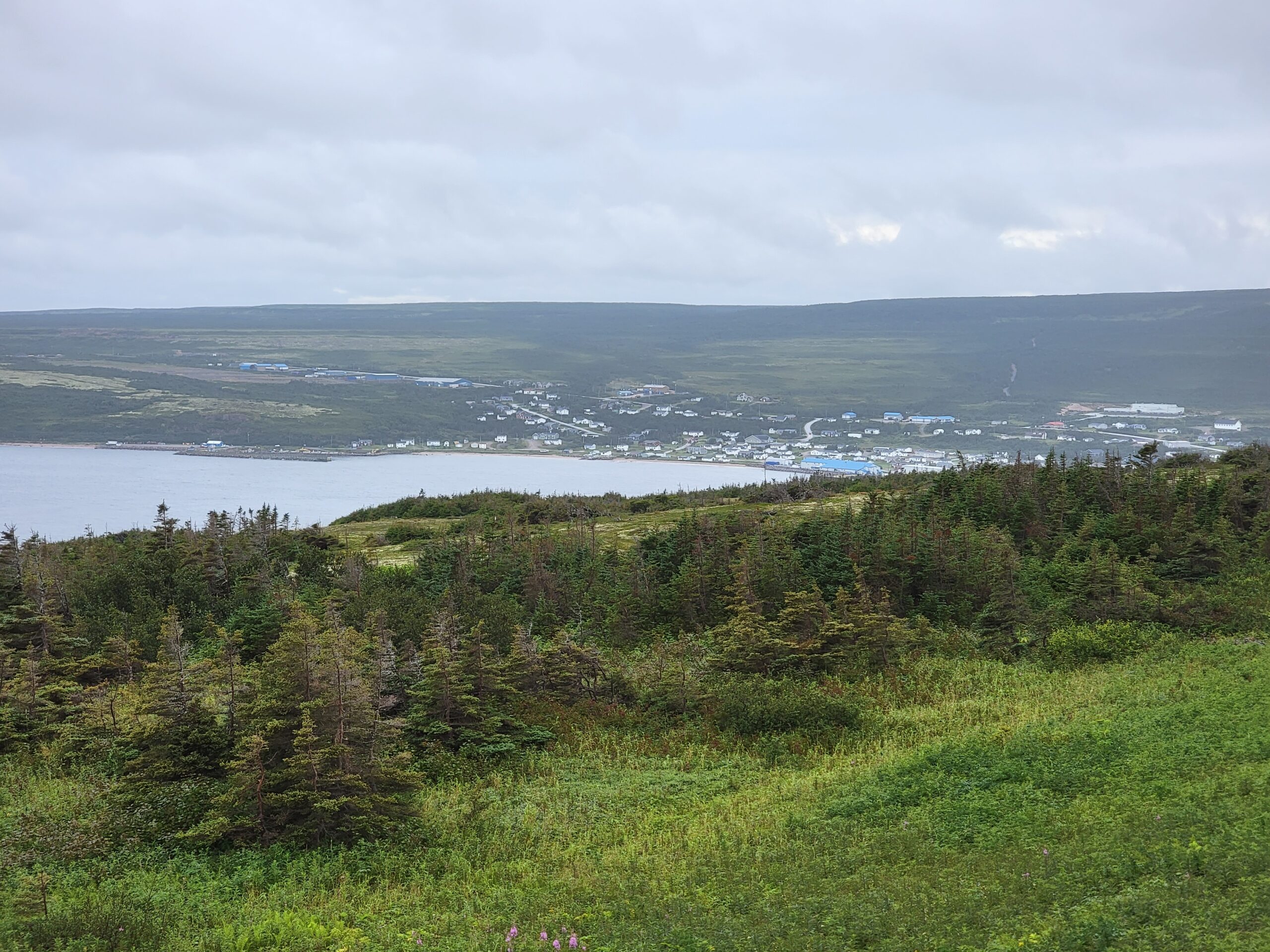
That was good, because as I said, the navigation was hard. My wife managed to find a soft spot in the swamp and sank one leg up to her thigh. I hit a spot before long too. We desperately hoped we would see Triangle Lake, the first established campground in the direction we were going. It was only 7km away, but it was a fight. Still, when we would climb a rise, the views of the surrounding hills, especially the distant views of the fjord, were breathtaking.
Triangle Lake in the distance. The rocky opening you can see on the left. Looks tempting doesn’t it?
Finally we glimpsed the lake. It glistened bright blue in the distance. I saw a rocky draw that pointed the way to the lake and celebrated – rocks would be simple to navigate compared to the tuckamore. But it turned out that wasn’t true for my wife. Her balance was not as good as mine, and so we climbed over each and every boulder one at a time, until finally reaching the campsite around 3pm.
Tired feet in cold water.
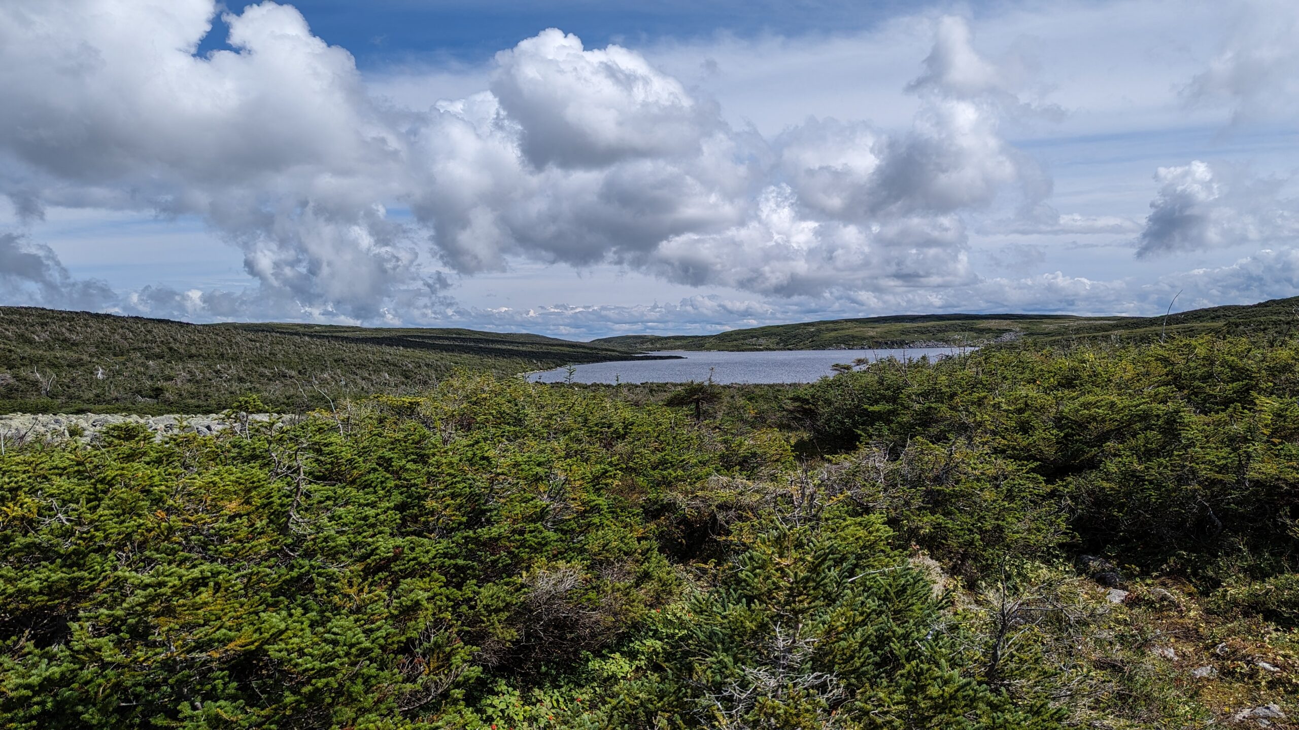
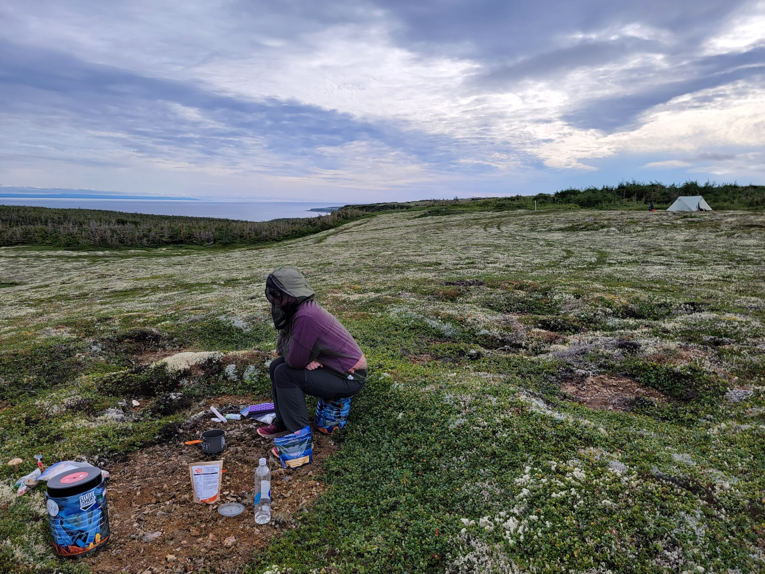
The campsite had seen better days. There were three wooden tent pads in various states of disrepair. There was a bear storage locker, but it looked like someone landed a helicopter on it. All our literature said there was a toilet here, but we never did find it. The most sheltered, dry, flat tent pad there had a nice piece of sod dug out and replaced – someone used it as the toilet. Still sunning ourselves on the unused wooden pads in a fork in the little creek that bisected the camp was glorious. There were no bugs there which was amazing. We soaked tired feet in the cold creek water and contemplated taking a swim in the lake. The lake and stream were very cold and the sun was nice but not quite hot enough to overcome our fear of the chilly water.
The sun allowed us to dry out wet shoes and socks, and wet tent from the night before. It definitely increased morale! We began to look forward to the next day where we hoped to get all the way to famous viewpoint.
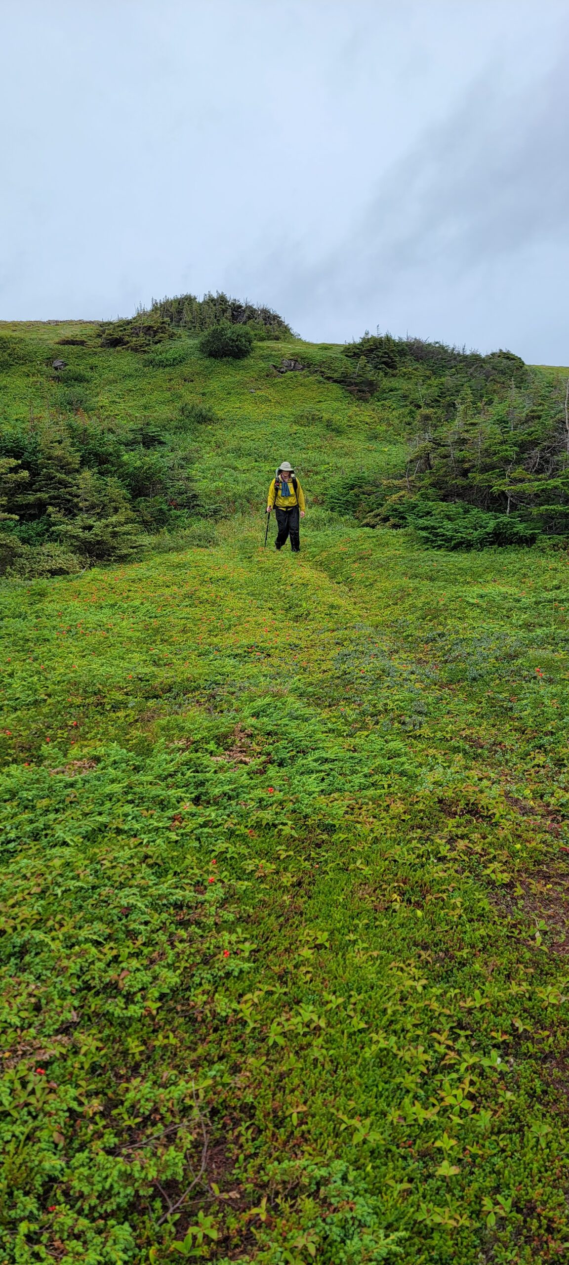
Ups and downs and battles and swamps – oh my!
Distance: ~7km officially, 15km according to my Garmin
Waking up at Snug Harbour we had cause for trepidation, but were ready to face the challenge. We set off fairly early, and the trail would take us along the beach for 1km or so before cutting uphill.
Our destination for the day was not an established campsite – most people who do the Northern Traverse do it by itself, so they take the boat up Western Brook Pond and then turn left at the top of the waterfall. The campsites are laid out with that in mind, and usually when people come from the east (westbound) they are prepared for a few more kms because they have been going downhill, and are looking forward to getting off trail. We were doing it backwards, and expected after climbing to the top of the headland, we would be out of gas, so we were planning to random camp near where the trail forks to a viewpoint over the pond, or heads towards the “Tuckamore”. I’ll explain more about that word in Part 4.
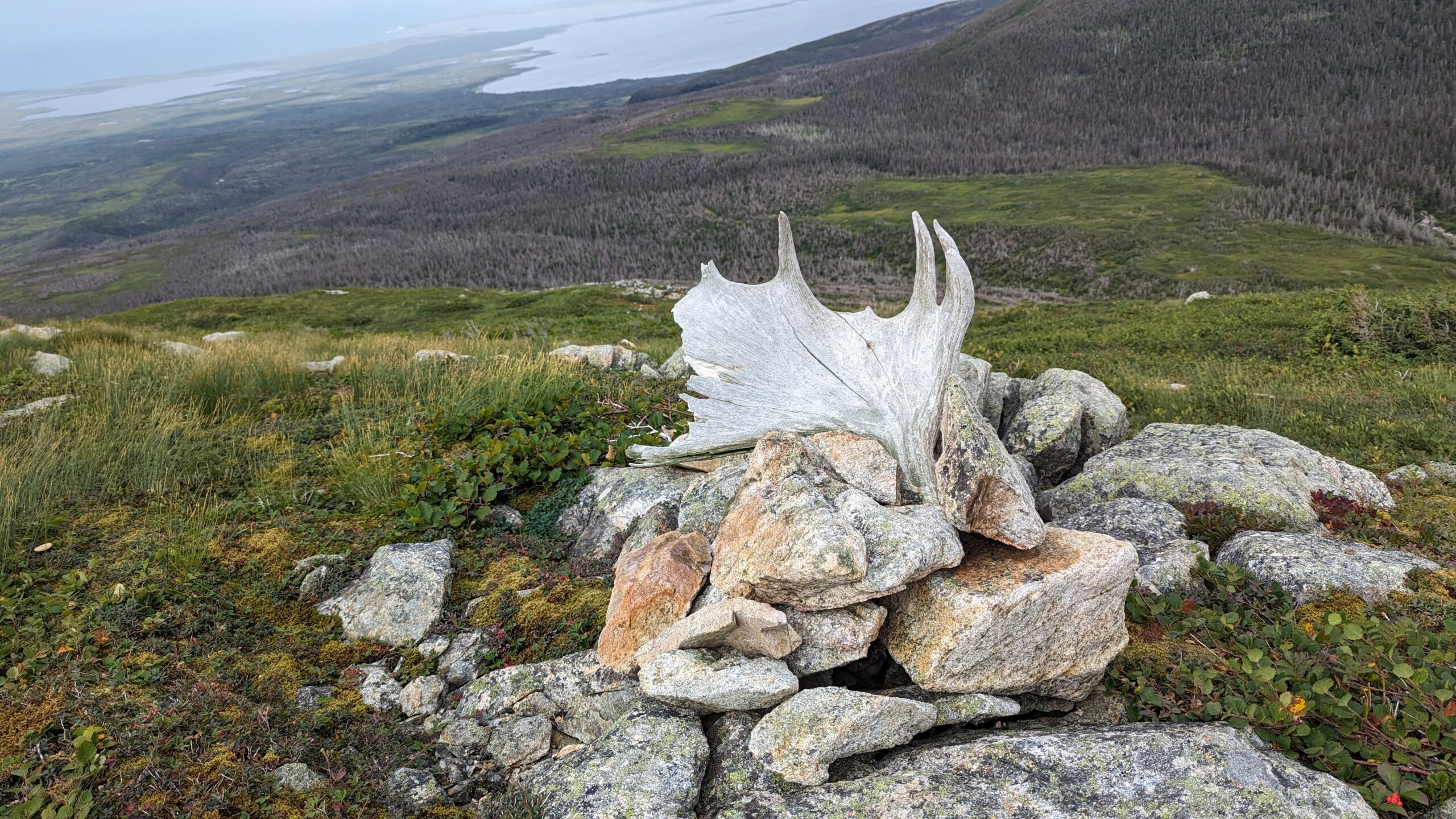
A small cairn marker close to the top of the climb
Climbing the hill was not great. Trail markers were more and more scant – few people take this route at all, and the markers were put up over 20 years ago when the park had a vision to actually make this a trail. Now, they are content to let the wilderness claim it and just warn people what they are in for. Once we got out of the draw we were climbing, the terrain opened up and we could make out faint trail… sometimes. They were very untrustworthy as these paths saw more moose prints and bear paws than human boots.
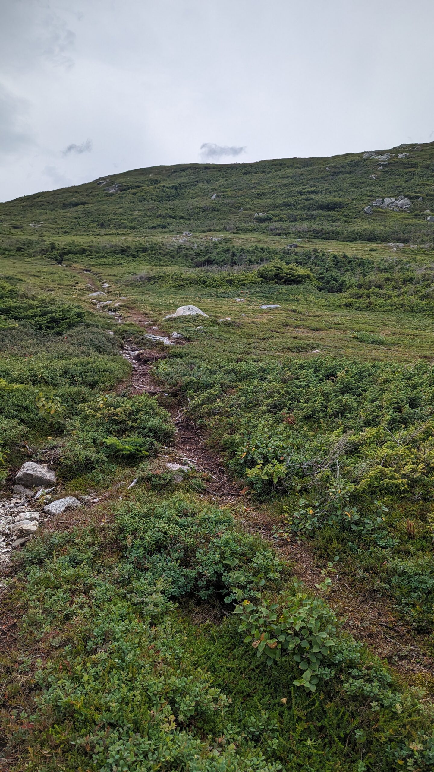
Open terrain above the draw
The terrain climbing up I thought would be fairly rocky. It was not. Somehow, it is possible that swamps can exist on slopes. We were sloshing through moss and wet, desperately trying to hop from log to log, stable spot to stable spot (and hoping what we thought were stable spots weren’t just taller piles of moss that would give way when we put our weight on it). It was not long before both of us had feet soaked through.
A word about footwear. If you are looking for a nice dry stroll in trail runners, this is not the trail for you. The terrain is so treacherous, I see why many prefer real hiking boots for this trip, but I chose to wear Keen Gore-Tex lined low rise hiking shoes. My reasoning was this: if I stepped in wet but shallow, the gore-tex would keep my feet dry and if I stepped in the deep stuff, they would dry faster. Higher ankles might have given me more support, but I am not prone to ankle twists, so I wasn’t worried. I was happy with my shoe choice. Normally I’d think a waterproof hiker would be too hot, but Newfoundland is rarely hot and the amount of wet we faced, there was no chance I’d have to worry about heat blisters. Trenchfoot? Maybe. Heat blisters? No.
We reached the top and the weather was getting blustery again. Nothing to block it up here, so we hunted around for as much shelter as we could find. At the top, the trees don’t get more than 7 feet high, and they are stunted and twisted into a mass that is well nigh impassable. But we found a little clearing with thick sphagnum moss to tuck our tent into an set it up before the weather hit.
Today’s progress
And the weather did hit. It began drizzling, and the wind became very gusty. It would blow lightly for a few minutes, then hit like a freight train. At about 6pm one such gust did manage to knock loose one of the tent pegs, so I had to go wander the field next door looking for rocks to stack on our pegs. The moss was so thick we couldn’t sink the pegs into soil at all. Once I had 3 or 4 on each corner, the tent held up all night.
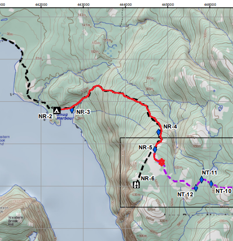
Our plan was to start with the Northern Traverse. This means instead of the popular boat ride, we would be hiking to the boat launch on lovely groomed trails, then heading north along the edge of Western Brook Pond, destination a Parks Canada maintained backcountry campsite called “Snug Harbour”.
As you can see, we had a choice of going all the way to the boat launch or take a trail through the woods. The first leg from the parking lot to the fork (where the green line diverges) was on wide, gravelled trail. It is well maintained because anyone taking the boat tour has to walk in. At the fork, it just looked like a narrow bush trail heading off to the north, skirting a swampy area. It turns east again when we hit the Western Brook outflow, a creek/river about 20m wide. We needed to wade it but the water was never past my knees. Refreshing.
After crossing the creek the trail reduced down to barely a discernible path – except for where it gets swampy. Still, we ran into the odd boardwalk in poor condition, which sometimes made the going easier. The clouds were building as we went, but we knew we only had a short distance to cover our first day and little elevation to deal with. A good portion of the walk was along a gravelly beach which was better than picking our way along the swampy bits. Little did we realize it would get much worse.
View from the trail looking east over the Brook. Trees up here are mostly scrubby due to the winds.
But not today. We pulled up at Snug Harbour in just a few hours, and set up camp. Snug Harbour was very nicely appointed – a good bear locker, a “green throne” toilet, and easy to find camping spots for tents. It wasn’t called Snug Harbour for no reason – we faced a sheltered cove and listened to the wind and rain all night howl around, but little of it hit us. By morning, it was cloudy but the storm had passed.
Our snug tent at Snug Harbour
Total distance: about 6km by map, 11km by my Garmin
Wow! I never realized I had not done a series of posts about our summer 2023 adventure. Probably because it was a bit of a surprise. I wasn’t expecting my missus was going to be up for a trail this summer, because she had some trips for her new career planned and she didn’t think she would have the energy. But 2 weeks ahead of our planned vacation time, she says, “Wanna do Gros Morne?”
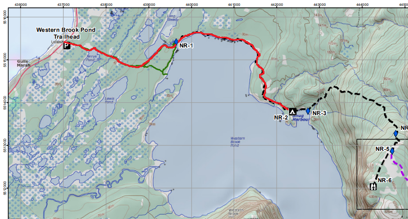
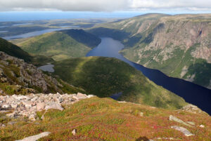
Now, some explanation. Gros Morne is a place of stunning beauty – a national park in the province of Newfoundland and Labrador in Canada. Basically, if you have ever seen a picture of a national park in Canada, it’s either Banff or Gros Morne. This view is what it’s most famous for:
Western Brook Pond from the east end
Stunning, right? Funny thing is this view isn’t even of the park’s namesake: Gros Morne mountain, the tallest mountain in Newfoundland, and part of the International Appalachian Trail.
She wasn’t interested in hiking the mountain – oh no. That would be far too easy. This park does have a number of trails, but they are mostly dayhikes. What it does have is a famous route: the Long Range Traverse. About 35km through the Newfoundland wilderness, with no official trail. Just a route. Through swamps, the thickest brush you’ve ever seen, more swamps, and more brush, oh and some very rocky mountains (shorter, but rugged).
The Long Range Traverse is the most popular – you take a beautiful boat ride up the above gorge to the eastern end, hike (read: climb) up a waterfall, then head out. It ends roughly 3 days later at Gros Morne mountain where you can elect to head down to the parking lot or add another 5-10km to summit the mountain first.
But there’s more. There is another traverse. The Northern Traverse. A much harder, much more rugged, equal lengthed traverse. Taking both traverses circumnavigates Western Brook Pond and doubles the time in the backcountry. And she suggested we do both.
I’m a sucker for a challenge so I didn’t have to be convinced. We made a plan: 7 days to do both traverses! A paltry 70km – 10km a day! Surely that will be easy! I called ahead to make a reservation – they only allow three hiking groups per day on each traverse. the LRT I was fortunate – I got pretty close to the dates we were interested in. The NT was no problem – as far as I know we were the only people on that traverse at the time we went.
We drove down to Rocky Harbour, and stayed in a lovely place on Cow Bay the night before the trail. We also had to attend a mandatory trail briefing at the visitor’s centre, where an experienced hiker and trail guide did her level best to talk us out of going. She told us the LRT would involve pain and suffering most likely. When we told her we were doing the NT too, she said she guaranteed pain and suffering. She warned us of all kinds of dangers – from thick fog to deep swamps to getting lost, to falling and twisting or breaking things, to cold rain and even a chance of snow just about any time of year. One thing she did NOT say was a danger was bears. Oh sure, there were lots of bears, but apparently the bears in their park run from people – and have no interest in people food. According to her they have never had a negative bear interaction reported by hikers. Not one. Ok…
The next day we hit the trail. I’ll do a post for each day on the trail. Stay tuned!
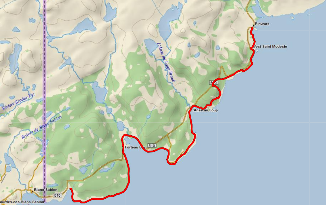
My wife and I set out late last week to take on Labrador’s Pioneer Footpath: a trail shaped by the old footpaths that for 150 years were the only means of travel between the tiny fishing settlements along the south coast of Labrador on the Strait of Belle Isle. It is the closest trail of overnight length to our new home, so we wanted to give it a try.
The Labrador Pioneer Footpath GPX Track up the south coast of Labrador
A little more detail: the Labrador Pioneer Footpath is a coastal trail that runs from the village of L’Anse Au Clair in the south up to Pinware in the north (though an expansion plan is in the works to extend the trail to Red Bay – more on that below). Its current length is approximately 63km. The terrain is surprisingly varied, with beach walks mixed in with exciting climbs over rocky points, short Labradorian forests stunted by the cold, blustery coastal storms, open heath covered with moss, stiff ascents onto jutting promotories, lichens, blueberries and the local unique treat, bakeapples. Interspersed along the way are the coastal villages themselves, absolute gems populated with friendly folks. And when I say friendly… Labradorians take it to a level you have never seen. More on that later.
The weather out here is coastal but cool, not as rainy as the West Coast of Canada, but still moist. We expected temperatures between 15 and 20 Celsius the entire time we would be here, with overnight lows around 10-12.
Prior to starting, we attempted to gather information about the trail. There is an information centre in L’Anse Au Clair but we weren’t going to drive all the way down to get it. We called them up and the staff emailed us a GPX track and put us in touch with a fellow who had recently hiked the trail to fill us in on where to camp – there are no established campgrounds on the trail, but there are also no rules about wild camping – you can stop and set up wherever you want.
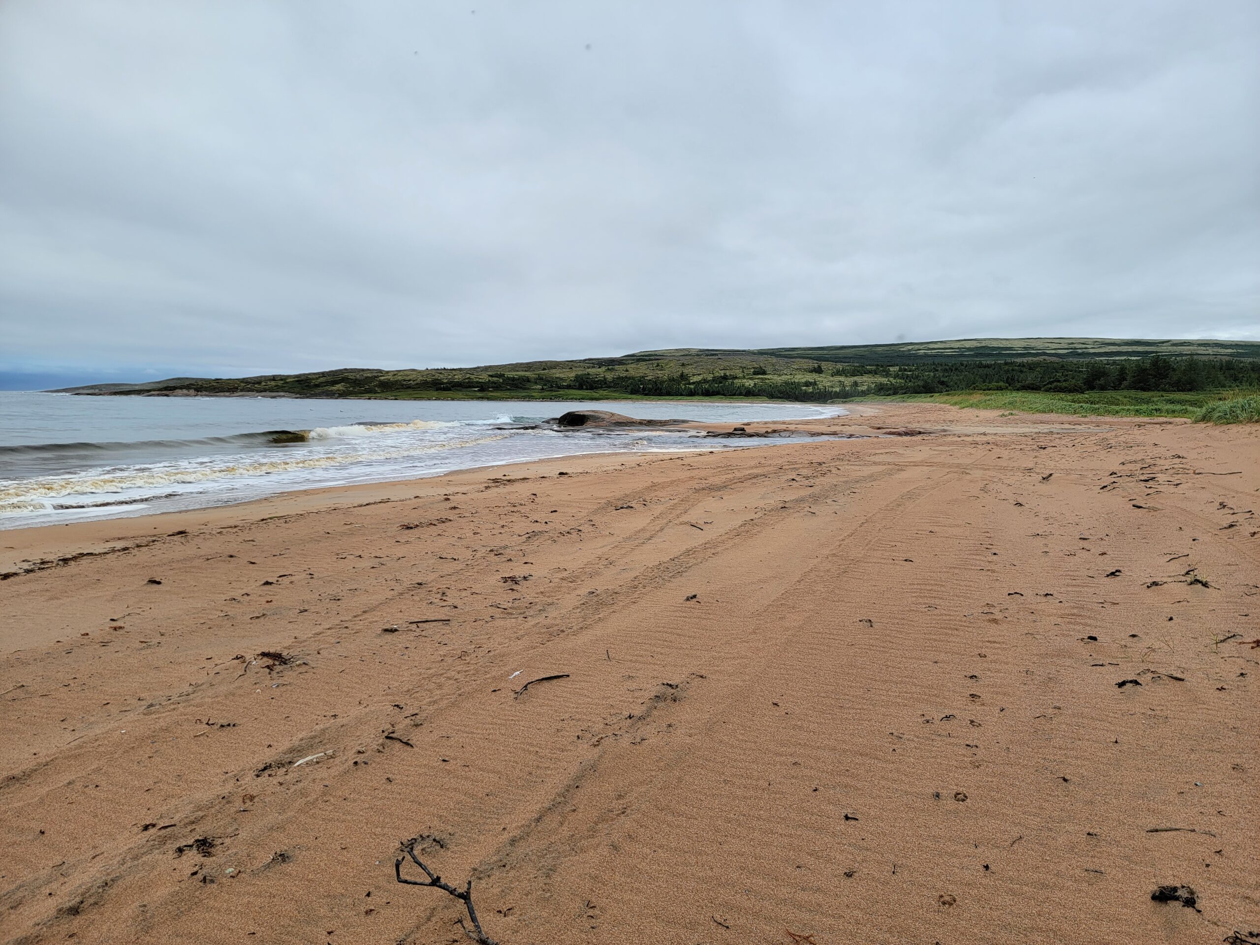
We decided to hike it north to south, which is the opposite of what most people do. We arrived after a 5 hour drive from Goose Bay at Pinware Provincial Park, the only provincial park in Labrador and probably the most organized campground in Labrador. We got a spot to car camp, knowing we didn’t want to start our hike in the evening. After setting up our tent, we took a wander down the oceanside beach literally just behind our tent and enjoyed a sunset while watching the waves and birds and studying the shells and husks of crustaceans devoured by the gulls and cormorants.
The lovely beach at the beginning of the trail by the trailhead. Two brook crossings to get down it though so we opted to go around.
It was out there with little seabreeze blowing we were introduced to the blackflies. We were pre-warned about the little menaces, who swarm anything with skin through the summer on the Labrador coast. Inland too, but most say they are particularly voracious down here. We had hope by delaying until the end of August they would have lost some of their fighting spirit, but that was not the case. Thankfully we came armed with bug jackets. They may not be as effective against mosquitoes, with their long beaks but against blackflies they work great.
The Trailhead by the graveyard at Pinware Town Hall
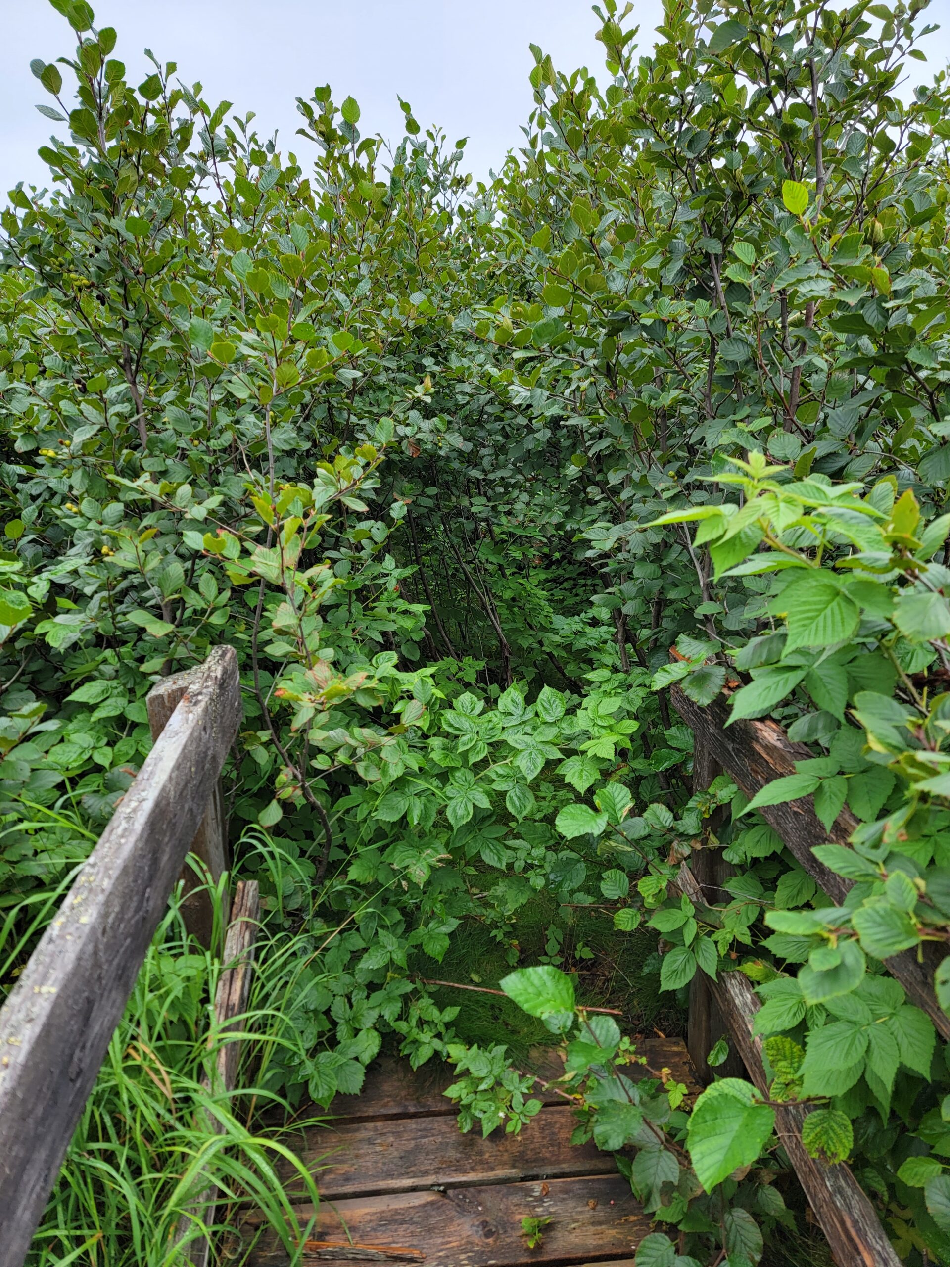
With our email contact’s briefing and my Gaia GPS app all loaded up, we set out Friday morning. The trailhead is behind the old Pinware Town Hall by the graveyard. Our instructions, which should have generated some foreboding music, said to forego the actual trail and walk the beach, fording the two brooks that drain there. Sadly, we never consulted the tides (which aren’t that high here – they only vary about 3 feet high to low). The two fords were uncrossable without stepping into unknown depths. We couldn’t see to the bottom of the water so we didn’t risk the crossing. Instead we set out along the path signs we could see until they led us to the yard of a private residence close to the road. We had already decided to get back to the road to roadwalk to the other side of the brooks, then bushwhack down to the trail again. The bush didn’t look *that thick*.
An early example of overgrowth. The bridge is helpful but ends at a bush. No trail visible.
We were wrong. It was that thick. Wet channels disguised by ferns, draws filled with thick green alders, and tight stands of stunted but bushy black spruce. We were at a crawl for about 1000m until after the 3rd or 4th swampy crick crossing, we stumbled across a Footpath sign – we had found the trail!
Once rediscovered, the footpath signs were pretty regular, though there was little sign of the actual trail. In this area it is almost completely overgrown. But once we returned to the oceanside, we could see a clearer trail winding around the next point south of the beach. Finally we felt like we were on our way!
Shoreline between Pinware and West St. Modeste
The next section lasted about 4km and was easy to follow, but not exactly well-used. A few brook crossings we had to look around for a good spot to rock-jump but crossings were to be found. Looking back at how wet our bushwhack made us, we probably could have done the fords on the beach and not gotten any wetter, but that’s hindsight for you. We followed this track to the edge of the next village: West St. Modeste. Then it was a 3 km road walk through town until a well-marked pullout with an interpretive sign talking about the town and pointing to the next section of the footpath. Another lovely seaside saunter was our next section, featuring plentiful sea urchin husks and interesting crab shells. At least half of the crab shells we saw were not “ordinary” dungeness-type crabs. they were snow crab shells! That’s how far north this is. The Labrador current runs down the coast here from Greenland bringing all kinds of arctic fauna, before slamming into a current out of the Gulf of St. Lawrence and then buckling against the warm Gulf Stream up the US coast.
One of the nicer markings, pointing north.
Another 4km or so around this area – watching our footing on the slippery lichen and picking blueberries as we walked. Here was where we first encountered bakeapples – a unique berry growing out of a leaf on the ground resembling a geranium. The berry itself looks like a yellow-pink raspberry and has a flavour I cannot describe except to say I’ve never eaten anything like it. They grow in swampy areas mostly. The usual picking season is late July to early August so I was surprised to find any out here. This section wrapped up with entry back to the highway. We lost the trail just at the end before the highway but it was clear how to get to where we needed to be.
Bakeapples in the wild
Another 3km road walk through Capstan Island and L’Anse au Diable, and the GPX track told us to follow a dirt road down a wide valley bottom. We looked up to see a huge promontory with cliffs facing us rising on the other side. The only obvious way up was some dirt road cut under a power line. The highway switchbacked several kms to climb the steep rise we would learn is called “The Battery”. The dirt road we were to follow would cut off much of that distance but would feature the most concentrated elevation climb of the day – about 200m over 2km is my guess. Before the climb I paused to sit on a log and wring out my socks and shoes – I didn’t want saturated feet before such a climb.
After the dirt road caught up to the road at the top of the rise, it was another 2km road walk until the next trailhead. Here, the trail is also marked “Battery Trail” and is used a little more heavily for dayhikes out to the cliffs over the ocean. The first few kms wind through the stunted black spruce forest. We encountered a bear track on this path at one point and a few small droppings but they looked a few days old and there was very little bear sign, so we were not worried. After winding around a picturesque lake, we popped out on unsheltered headland, with a white picket fence running along the break. We learned at the fence that it was installed after a woman and her dog approached the cliffs too close and fell to their deaths berry picking. The path then proceeded to what we were told was the height of land in the area over 300m I think. There is a cairn there. We did not proceed all the way over to it because we were approaching our limit for the day and wanted to set up camp. We found a nearby meadow and set up there.
View from the fence on the Battery.
Because of the terrain we knew would be on this hike, we opted to buy Bear Vaults before the trip. We have used Ursacks in the past but knew that there may be camping on this hike far from trees that could resist a determined bear. With the sign we saw towards the end of the day we were glad we made the decision we did.
Campsite on the Battery
One challenge tenting on this trail is there is very little soil, and few objects you could tie to that would hold your tent up in a wind. We use a Durstongear XMid 2p, which is trekking pole style, so staking is very important. But the ground on this trail is either rock or moss. Staking in moss was sketchy. Thankfully the rain that came that night was not accompanied by wind so the tent held up well. In hindsight I would almost bring snow/sand stakes and use them in the moss.
First descent off the Battery into L’Anse Au Loup
The next morning we realized we had not prepared as well physically for this trail as we did last summer for our Rockies adventure. We were still quite sore. And with the rain expected to last all day, we had time to ponder our experience so far and assess what would be next. The first few kms were over nice heather and great views but we knew we would have to descend off this headland to the town of L’Anse Au Loup. And the way down was not fun. First, a drop of about 30m down a fern-covered slope, where we could not see our footing at all. In the rain. Then another drop of 30m down a trail, but mud and rock-strewn with even more treacherous footing. Had we been ascending it, we would have been almost climbing. THEN ANOTHER TWO drops of 30m down even rockier faces, all in the rain. We finally popped out onto a sideroad, where the GPX told us to cross the street and walk by someone’s garden to take an old footpath the original residents used to get from this side of the brook into the town. And this part of the footpath, though clear to us, ran through VERY boggy stretches that are best traversed wither with an ATV or a horse. After a total of about 5km since our camp, we roadwalked up the hill in L’Anse Au Loup to a wonderful bakery we knew of and ate some well deserved soup and cinnamon rolls.
Second descent off the Battery – even worse!
Looking ahead, there was another headland to climb, and then the longest section without road or town on the Footpath, about 18km. It would be relatively easy after the ascent, and go past the stunning L’Anse Amour lighthouse historic site. But it would mean either camping along there in the wet and rain or making an even longer hiking day on our drenched feet. We decided the combination of poor trail conditions, thick swarms of blackflies (except when it was actively raining), and our lack of trail fitness leads us to wind up earlier, with only 25km of the 63km behind us.
L’Anse Au Loup, our endpoint below. And another hill to climb beyond.
When we had passed through West St. Modeste we met a bikepacker from BC who was trying to ride the trail. He said the first stretch from L’Anse Au Clair to Forteau was lovely but it got very poor after that, and described the misery of climbing the ascent above L’Anse Au Loup we did above, only with his bike above his head. When he heard from us the condition of the trail we had done from Pinware to West St. Modeste, he elected to call it himself. But we all agreed, having enjoyed many beautiful mountain trails in western Canada that this trail, if maintained, would be a world class attraction. Unfortunately, with bad maintenance and bugs, it makes the trail hard to complete. More on that in a bit.
Put down the backpack for a minute.
So at the bakery, we asked if there were taxis we could take to ride back to our car in Pinware. The locals said no, but three gentlemen in a quad-cab offered us a lift for free. So after returning to our car, we arranged for a room in Red Bay (actually an old seaside house on the Strand, for a VERY affordable price, a few steps from perhaps the best restaurant on the south coast of Labrador AND the historic site of a 500 year old Basque whaling station, complete with tours and wrecks to see) and played tourist for a few days. The lady at the historic site also happened to sit on the Footpath committee, and was able to tell us that yes, she was aware of the condition of much of the trail. The problem is the committee agreed each community would maintain its own section of trail, but many of these villages are really 20 years from becoming ghost towns. The fishing is minuscule compared to its heyday, and in Red Bay for example, the average age is 75. Not much young muscle for trail maintenance. She did inform us that the Red Bay to Pinware section of trail is doable, but you would need a water taxi over the Pinware river (which is not hard to arrange if you ask around) and then the “trail” is really more of a traverse along the heights above the sea. At the north end there is a stair that descends to the village of Red Bay, and you come out right next to a beach covered in whalebones called the “Boney Shore”. That was a sight we never got to but will next time we come!
Coming into Capstan Island
So, in review, having not completed the whole trail but based on others’ accounts and what we experienced, if you want a challenging trail with no reservations or established campgrounds, with options to stop in quaint historic communities regularly, and are prepared to deal with some bushwhacking or traversing with only a GPX track to guide you, this is the place. We do plan to return and finish the trail, but based on the advice of the committee member we met in Red Bay, we will be doing it in late September, probably next year, after the first killing frost has laid the blackflies low. Without bugs to contend with, the rest of the challenge of this trail is not nearly so insurmountable. Chilly evenings would be easily manageable considering our quilts are rated to -6C or so and we know how to layer from our time in the Rockies. We sincerely hope that the committee maintaining the Footpath finds a way to maybe get a grant or two and hire some summer students to clear the rough sections of the path. An easier hike with blackflies would be more doable, just as a rough hike with no blackflies would be. Take one of the challenges out of the mix, and it gets a lot more appealing. The payoffs on this trail are truly glorious though, so it is absolutely worth investing your time in if you plan well and come at the right time of year.
My job has required a move to the East Coast, so my personal hiking ambitions have shifted. Unfortunately, Rocky Mountain hiking may have to wait for a few years now, and sectioning the rest of the Great Divide Trail, along with the #1 item on my Trail Bucket List, the Pacific Crest Trail (which I always knew would most likely have to wait until I retire, unless some special circumstances arise).
But being in a remote area of Canada (perhaps the most remote south of the Arctic Circle) has some advantages. There are hikes around that few think about or even realize exist. And we will take lots of pictures and provide a trail report for your benefit! (Most of the following pictures are borrowed from TheClym)
So, without further ado, my bucket list for the next 3 years:
Jersey Trail near L’Anse-au-Clair, Labrador (one piece of the Pioneer Footpath). This is on the south shore of Labrador on the Strait of Belle Isle.
Labrador Pioneer Footpath. The scattered fishing and whaling communities of the Labrador coast had no roads at all for hundreds of years. What they had was a footpath that linked them together for when the seas were too rough to navigate. That footpath is now maintained by the local communities for recreation. Currently about 60kms long (with development currently building a 35km extension from Pinware to Red Bay), we actually plan to do this hike 2 weeks from now as a 6-7 day yo-yo. Information is sparse because few hike it as a thru-hike – mostly dayhikers between towns. We will let you know how it goes!
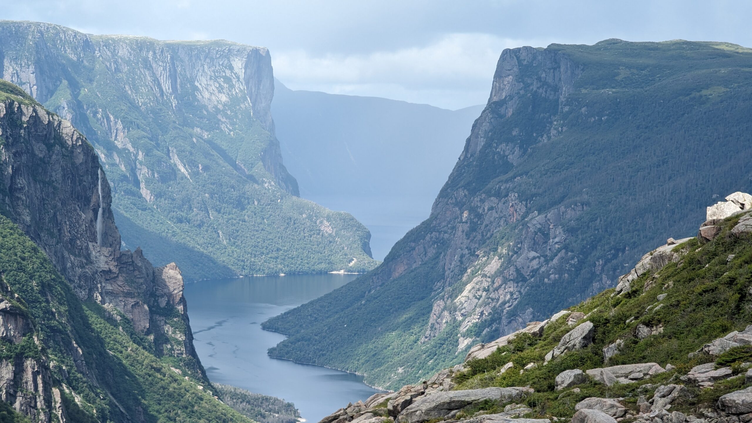
Gros Morne from the top
Gros Morne. Featured in just about any video or photo collage of Newfoundland’s most scenic spots, Gros Morne features a long-range traverse that takes you into subarctic ecosystems at the higher elevations, and takes about 4 days to complete. But because it’s a little further away from us, it will wait until next year.
Scenic view along the shoreline at Father Troy East Coast Trail along the Killick coast near Flatrock NL
East Coast Trail. Similar to the Pioneer Footpath, this is a series of intercommunity trails along the east coast of the Avalon Peninsula, near St. John’s – the capital of Newfoundland and Labrador. It currently stretches over 336km, so we will have to work our schedules to do that one – maybe in two parts.
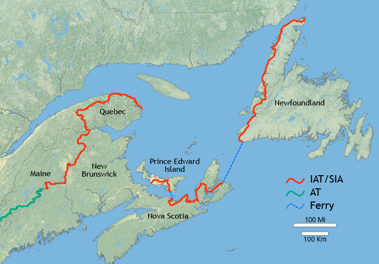
Appalachian Trail – Canadian side. Did you know the Appalachian Trail continues past Katahdin? It does! It winds its way into the province of New Brunswick, and reaches a terminus at the Atlantic Ocean in the Gaspé region of Quebec. Even further, the “International Appalachian Trail” continues, guided by geology, out all the way to Europe. I don’t know about going that far myself, but the Canadian side seems doable, if not maybe doing a special trip down to Maine for a section of the main trail.
A shot of Vermont’s Long trail borrowed from TheTrek
To make it a five point list, I will also include Vermont’s Long Trail, clocking in at 439km, though I think that may get pushed off further. We may take another job in the East when this one completes, and if so Vermont will be more accessible after 2025 for us. But it looks sweet and a decent length to complete without taking huge amounts of leave.
One of the more challenging pieces of the Fundy Footpath
Honourable Mention: the Fundy Footpath. There is a trail that winds around the edge of the Bay of Fundy, notorious for the highest tides in the world. It goes up and down ladders and cliffs for 49 km, much like the West Coast Trail out on Vancouver Island. Another trail that will be more accessible once we leave Labrador in 3 years.
If you’re tracking other middle distance thru hikes not too far away from us in the East, let us know!
Just about to the end folks! It has been a go hasn’t it? I had planned to take a friend of mine through two of the best trails in the Canadian Rockies, but instead I got to take my wife on her first multiday backpacking trip, which was even better! Our plan was this:
From my Facebook, ca. spring 2021 when I was uber-excited.
And if you want to read about how the first 9 days of the trip went, follow these links!
Day 10 dawned behind schedule. Our original itinerary had us bedding down 3 km and 300m above where we were. It doesn’t sound like much, but it was going to lead to the longest hiking day of our trip the next morning. The original plan:
Day 10 – Wolverine Pass to McArthur Creek Camp (Yoho National Park) – 21km, over Goodsir Pass.
Day 11 – McArthur Creek down to our car on the Trans-Canada Highway at Ottertail Trailhead – 15km.
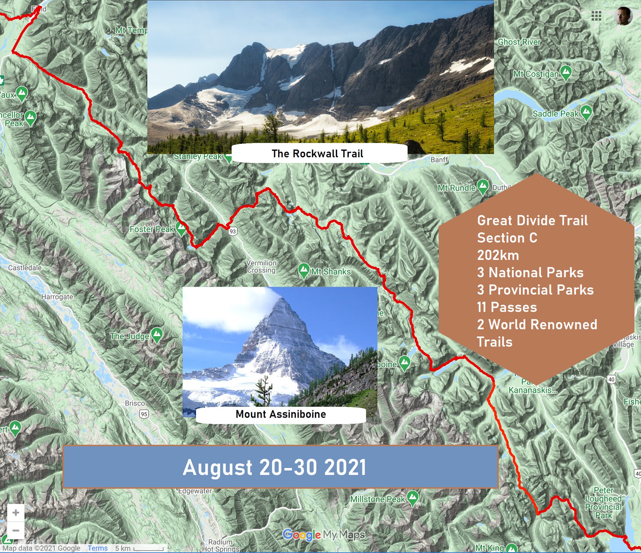
It’s been a bit since I last worked on this report. Here we go again! If you aren’t up to speed, the Great Divide Trail is a stunning thru-hike in BC and Alberta, Canada starting where the Continental Divide Trail ends in Glacier National Park, MT and proceeding north for 600 miles of the wild Canadian Rockies. We didn’t do the whole trail: we only tackled 120 miles of the middle of the trail – Section C – the part that is perhaps hardest to book, though maybe easiest to hike, due to the popular National and Provincial Park trails that are well maintained. To catch you up on our trip so far, read days 5-6 here and follow the links back to our beginning.
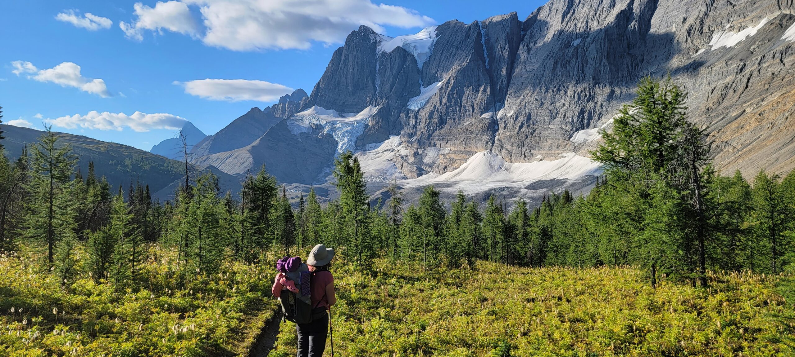
When last we left off, we had hiked 6 days and heavily modified our itinerary, adding a camp on the fly using our Garmin Inreach to get family to book a site for us, then using an optional site I had foreseen we might need to get a night in the astonishing Mount Assiniboine basin. But we made it to Banff on schedule!
The plan was to get a hot meal and sleep the night in Banff in a hotel, then hit the trail bright and early the next day up Healy Pass. Like so:
Day 7 – Taxi up to Sunshine again, hike up Healy Pass, over Whistling Pass and camp at Ball Pass Camp (Banff) – probably 23km with two passes.
Day 8 – Ball Pass Camp to Floe Lake (Kootenay National Park) – 21km with a brutally steep ascent to start and end the day.
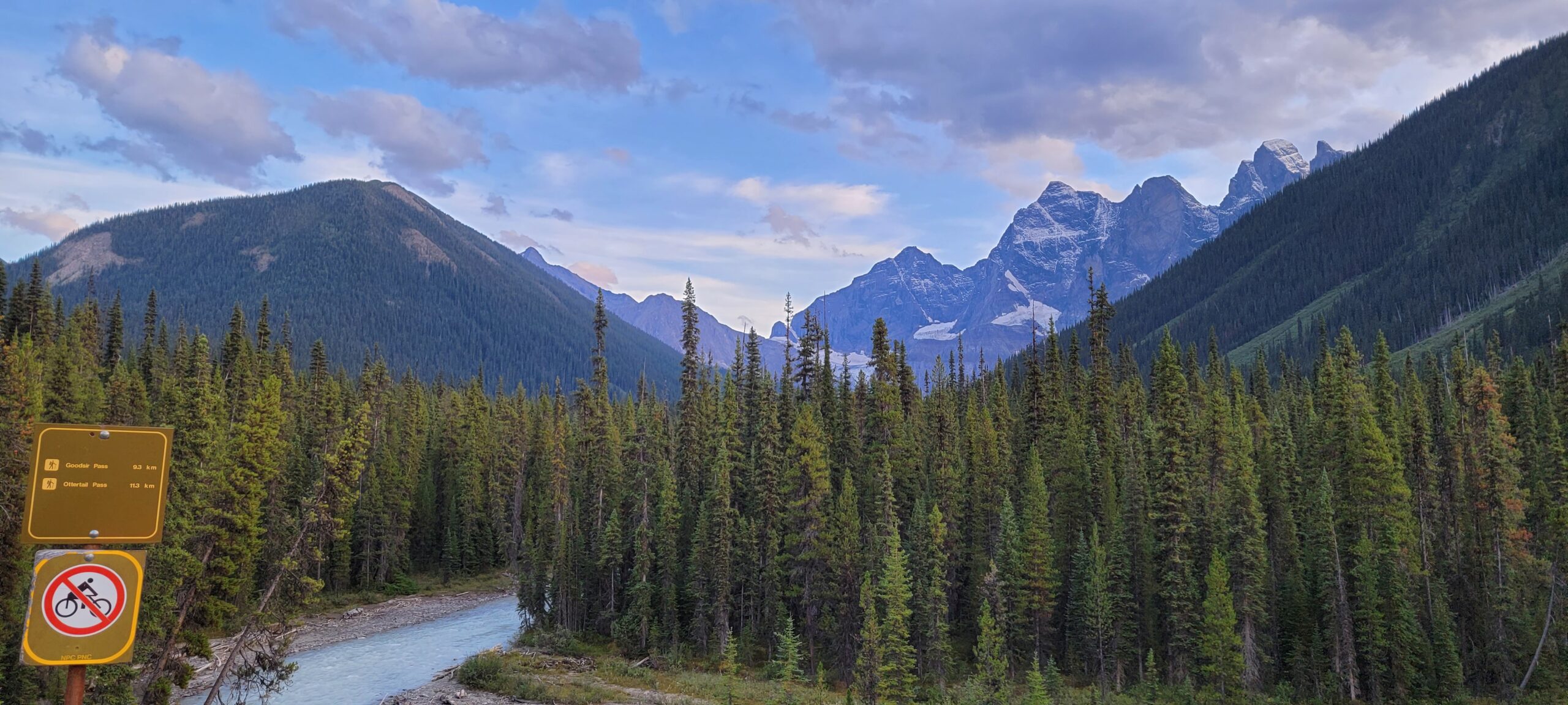
Day 9 – Floe Lake to Wolverine Pass – 20km over Numa Pass, Tumbling Pass, and Rockwall Pass.
Section C of the Great Divide Trail according to most information is a hair over 200km of hiking trails running through mostly National Parks. I’ve been dreaming about this hike for 3 years, and I finally got to go, despite my hiking partner once again canceling on me, because my wife signed up to go with me! You can read about our first two days on trail here, and days 3 and 4 here.
The story so far: no plan survives contact with the enemy. So far we had made changes to our itinerary almost every day. But thankfully we had only fudged one campground (and that was only because Parks Canada said the campground was fully booked when it was empty!) Today (spoiler alert!) would return us to our schedule.
Our original plan was:
Day 5: Marvel Lake to Porcupine (Mount Assiniboine Provincial Park) – 26km
Day 6: Porcupine to Sunshine Village (Banff) – and sleep in a hotel! – 14km
But we weren’t starting in Marvel Lake. We made it up to Magog Lake in Mount Assiniboine. So things were going to be different.
We woke up in the Magog Lake Campground, or at least I did. I’m an early riser – once my body starts getting achy or my bladder gets full, I am getting up. Thankfully I only beat the sunrise by about a half hour so it was light enough to find my way to the outhouse over the frozen grass without my headlamp. I then proceeded over to the covered cooking area in the frosty morning air to make myself some tea, and was struck by this view: