It was a cold night and I shivered whenever I woke up. I did manage to stay warm if I snuggled up against Oliver to steal some of his body heat and then didn’t move. I also found it helpful to pull my buff over my lips to keep my face warm. I certainly found it difficult to sleep while cold.
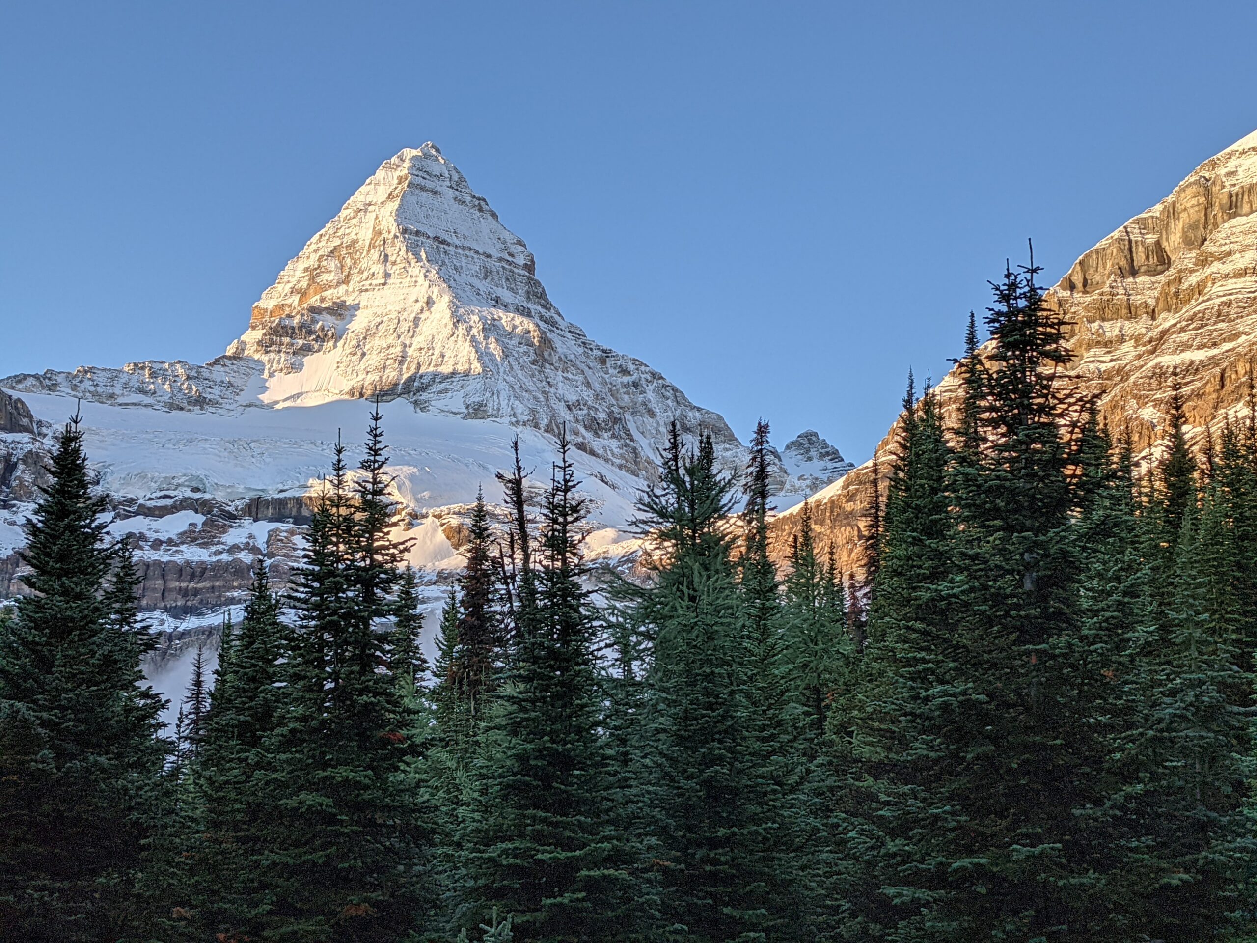
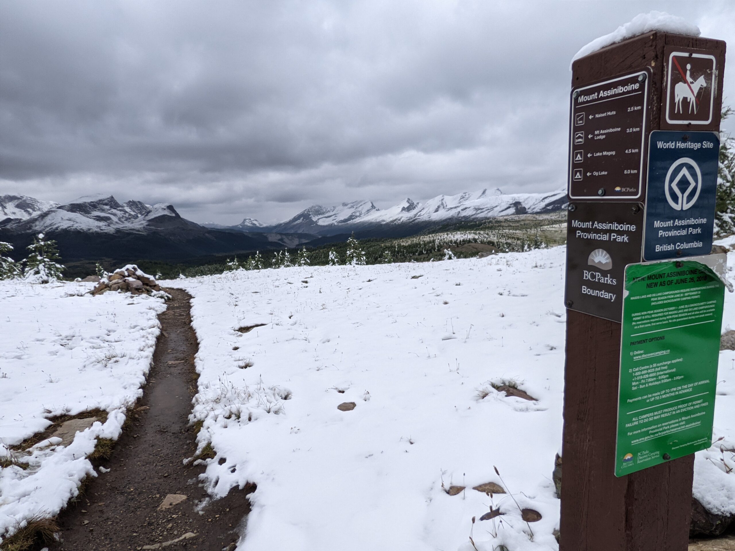
We got out of Magog around 8:45am, but not before we had an amazing view of Mt Assiniboine during breakfast. I can understand why people, like the couple we hiked with the day before, made this location their destination and didn’t continue on down the trail. There are many day hikes to do in the area so may people either hike in or take a helicopter Magog Lake and spend a couple of days there.
Being a chilly morning, we kept extra layers on at the start of our hike. The sky was clear, giving us great views of Mt Assiniboine, but it was cold.
The hike started across several meadows. We were told the grizzly had been seen in that area as well at to keep a watchful eye out for the bear as we passed through. Of course, we didn’t see anything. We were far too noisy, and that was intentional. A close encounter with a grizzly was not on our wish list.
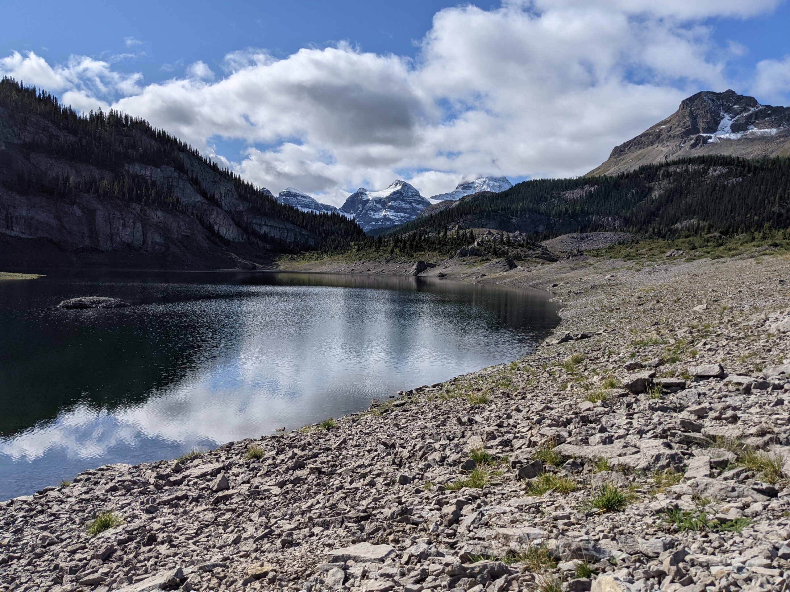
The terrain became a little more rocky as we arrived at Og Lake, which was another stunning spot. It was the only outhouse, besides Magog Lake, that was supplied with toilet paper. It also had a latch on the inside. Probably my favourite outhouse on the trip, if I was ranking them.
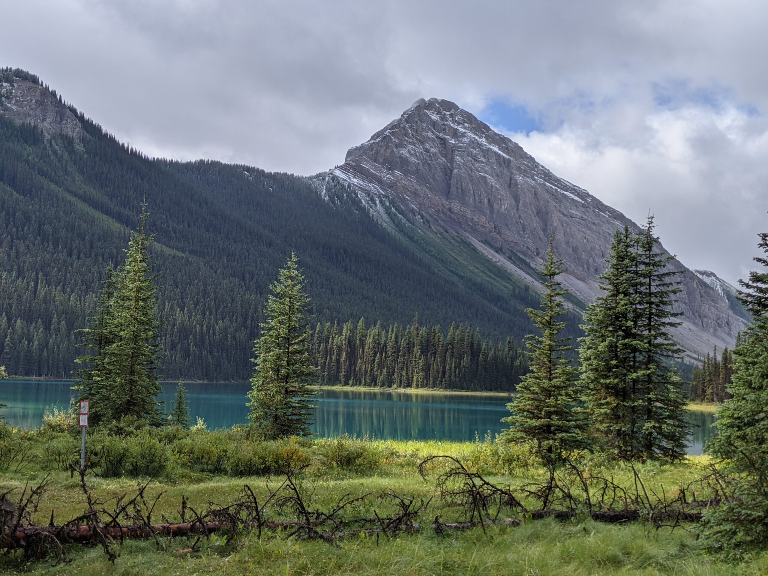
The lake was small but beautiful, with a great view of Mt Assiniboine. It was also sunny and anyone camped there had dry gear to pack away – unlike us. We snacked and filled our water bottles before carrying on toward Porcupine.
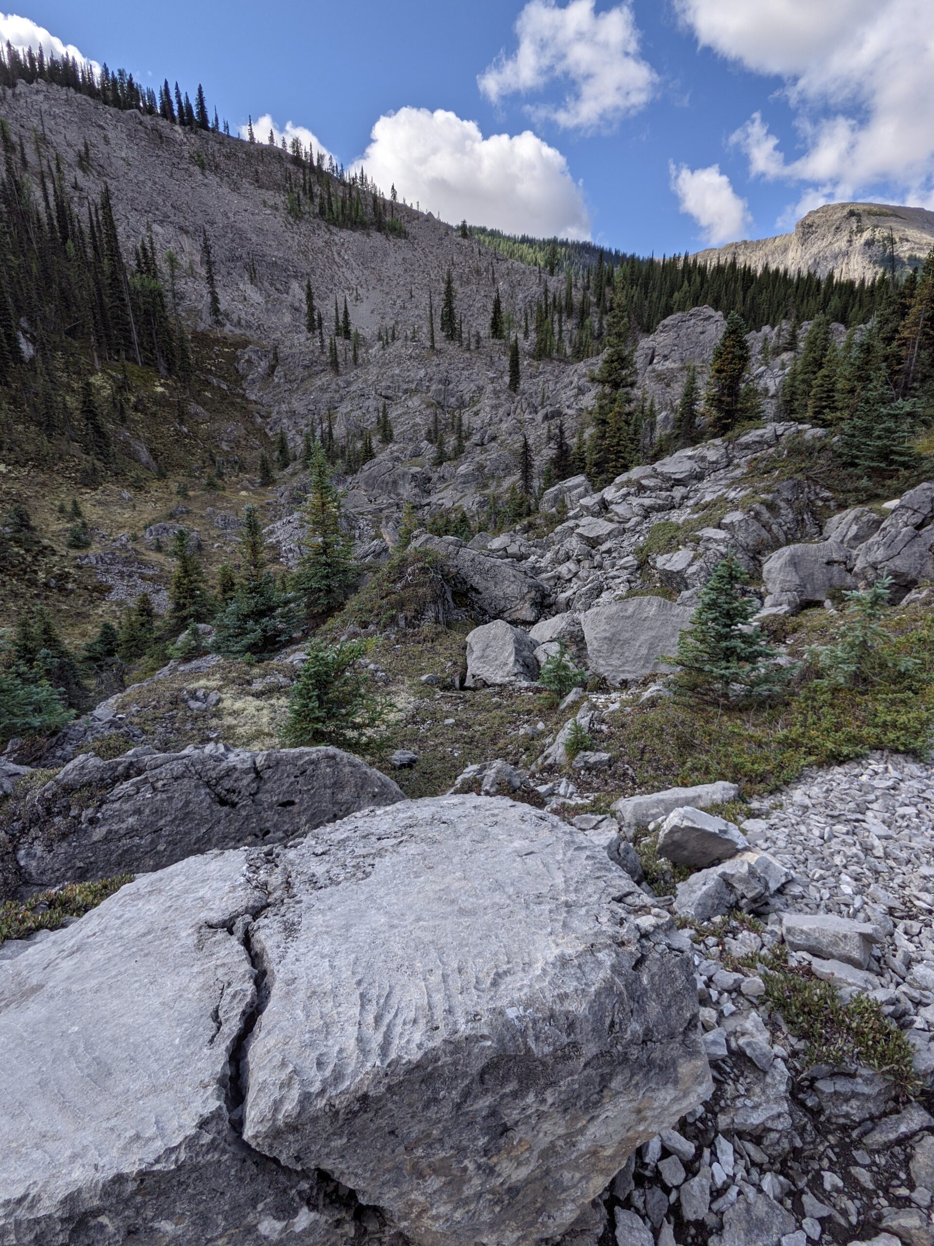
On our way, we passed through the Valley of the Rocks and it was evident how it got its name. It was full of interesting rock formations and many up and down hills. The valley went on for some time with uneven ground and was a fascinating area to hike through.
The descents irritated my left knee again. Whenever I could do a run/hop/bounce down the hill there was less irritation, but because I wasn’t sure of my footing under the weight of the pack, I was always resisting on the downhills. Plus, whenever I would get confident, I was sure to find that one loose rock that rolled under me to knock me off balance again.
There were more climbs this day that I had understood there would be, but it was the downhill into Porcupine that was the worst. It was a long descent into Porcupine. We met groups going up around 11:30am and 1:30pm and they had a long walk ahead of them to get to Magog Lake.
We got into Porcupine around 3:30pm and could pick whatever site we wanted as the campground was empty when we arrived. A bear locker was full of garbage and stored supplies for someone who had labeled the bag for pick up on Jan/Feb 2021. It was now August.
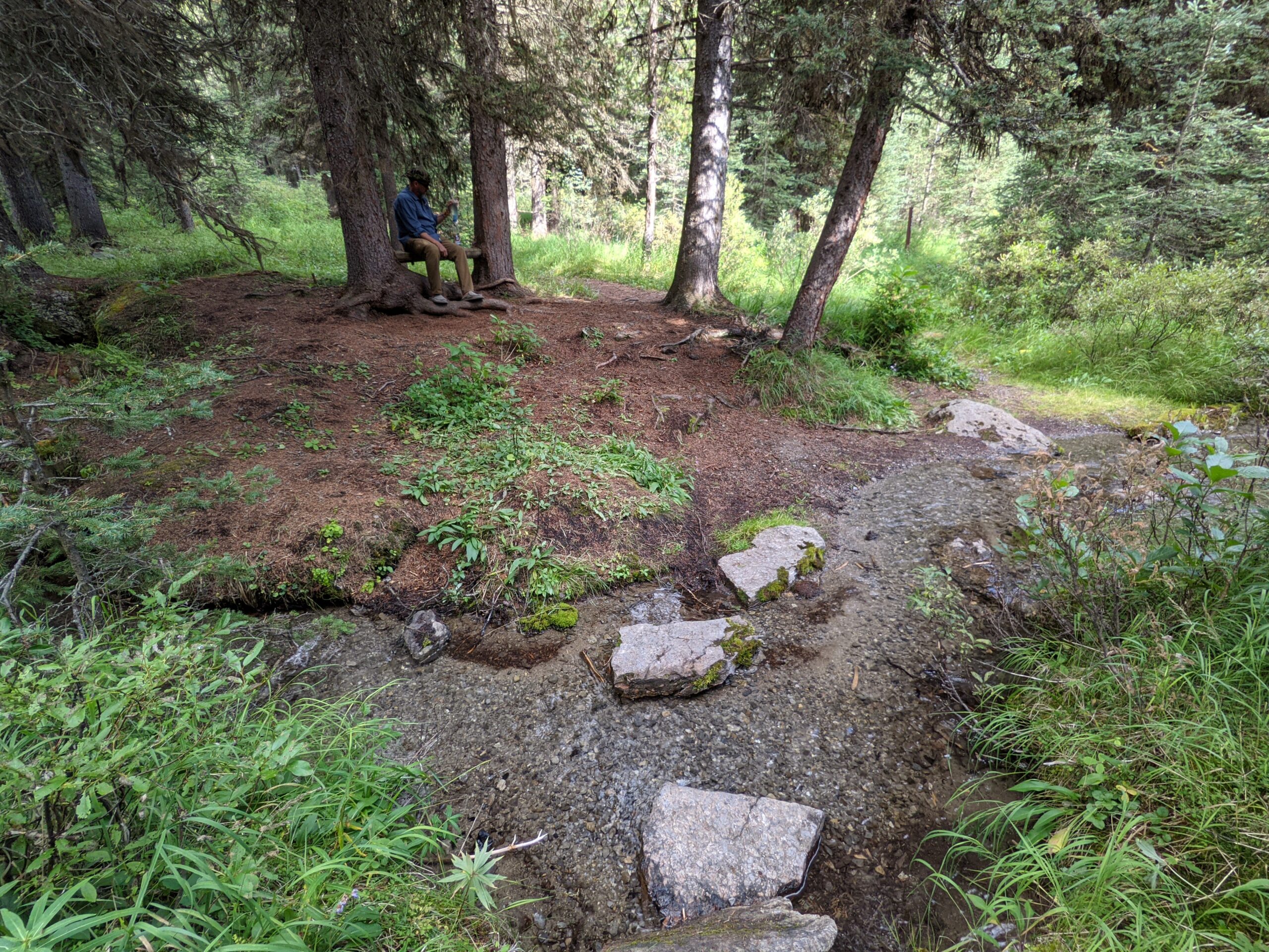
We filled our water bottles at a nearby creek and basked in the sun before the clouds rolled in. There was a muddy creek behind the campsites but down the path there was a lovely little spot, with a bench, where one could relax and fill up without any mud.
Once again we were at a site with an outhouse without toilet paper and we were running low. Luckily, another couple arrived at the campground. They had discovered they hadn’t brought any toothpaste. Since Oliver and I had our own mini tubes, we did a little trade and found ourselves with enough toilet paper to get us through to when we got to town.
After dinner we climbed into bed and tried to get as much sleep as we could knowing we faced a long climb out of Porcupine the next morning.
It was a later start to the day as the couple got ready and packed up. We all had to put wet gear away and they needed to figure out what to do with all their canned food and garbage.
The start of the trail was generally easy with wide trails even though it was steep. Then it turned into a “proper” trail with rocky, uneven paths. We found grouse family along the way, which upset the mother who wanted to distract us from her little ones. We also startled a moose, which was far enough away and it ran into a lake to swim across to the other side. We had made enough noise to give it enough warning to make a departure from the area.
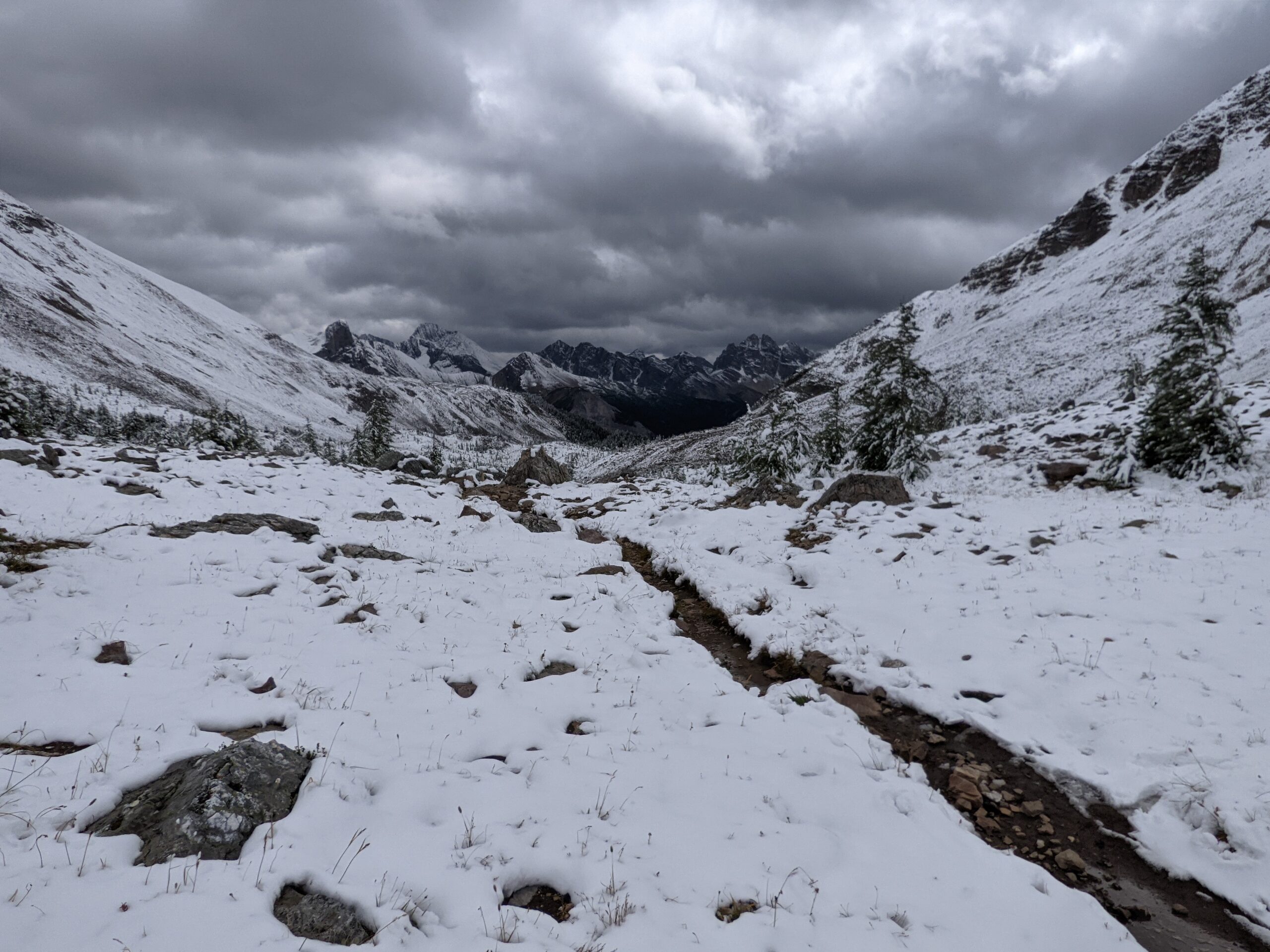
The climb became more challenging, but the trail brought us to some amazing snow-capped mountains and turquoise lakes. As we climbed, there was snow on the ground which was deeper as we reached the top of Wonder Pass. The Pass was spectacular and it was hard to believe I was standing on a trail, surrounded by snow. It is a indescribable feeling to stand on top of a mountain pass looking back at the ground you had covered, wondering how you managed to find yourself there.
There was no sign of Bruce the grizzly, even though people we passed had reported seeing him on the trail not long before we crossed through. There were plenty of signs of Bruce, with scat on the trail and plenty of mounds where he had dug up ground squirrels.
The path ended with a stretch of boardwalks leading to Mt Assiniboine Lodge. We had made it in time for Happy Hour at 4pm which campers and hikers could enjoy. We were 20 minutes early, so we sat around at the lodge and imagined what the view of Mt Assiniboine would have looked like if it wasn’t hidden behind the snow clouds. It was actively snowing and when Happy Hour started, we sat with tea and wine while we rested our tired feet
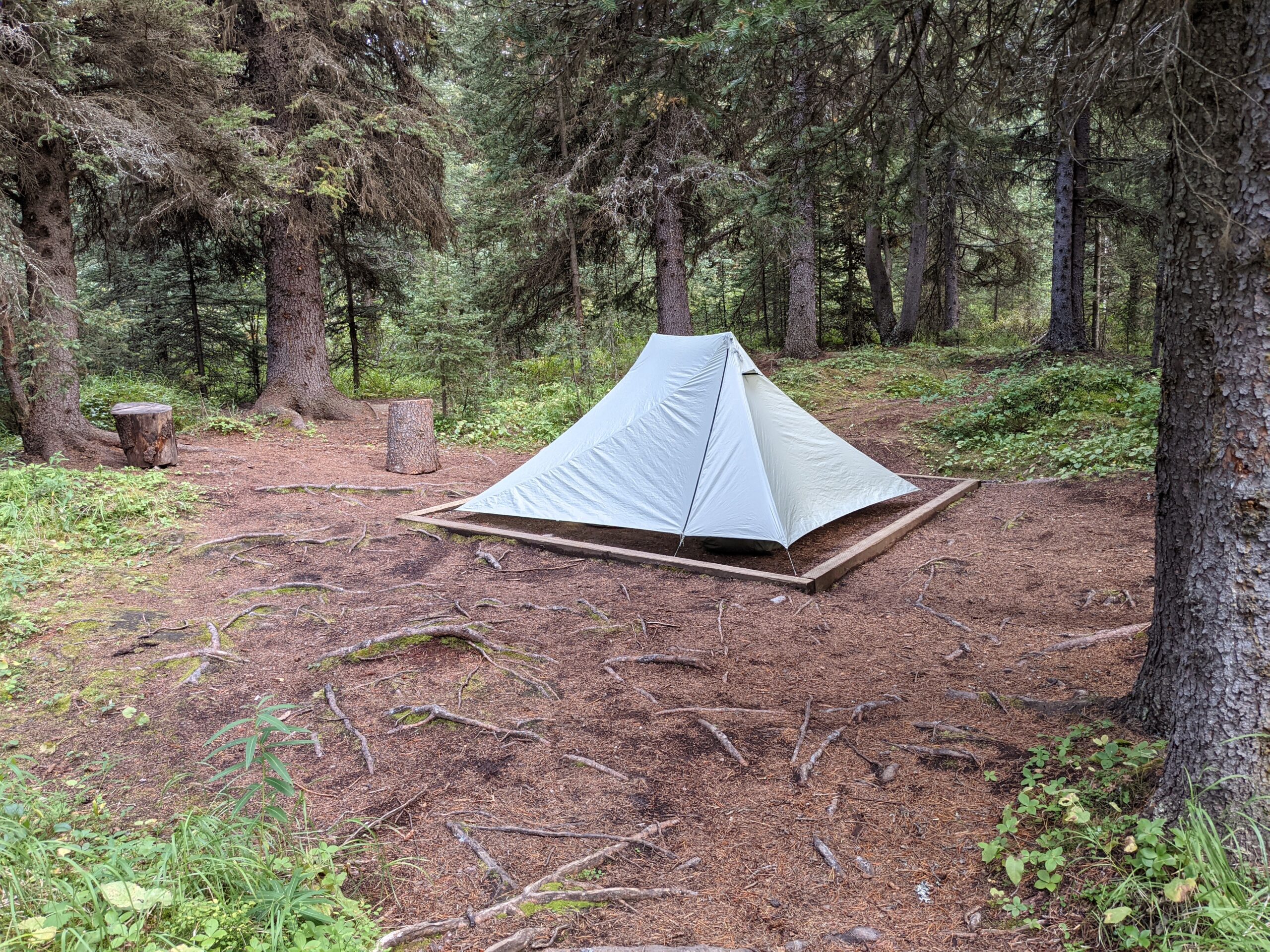
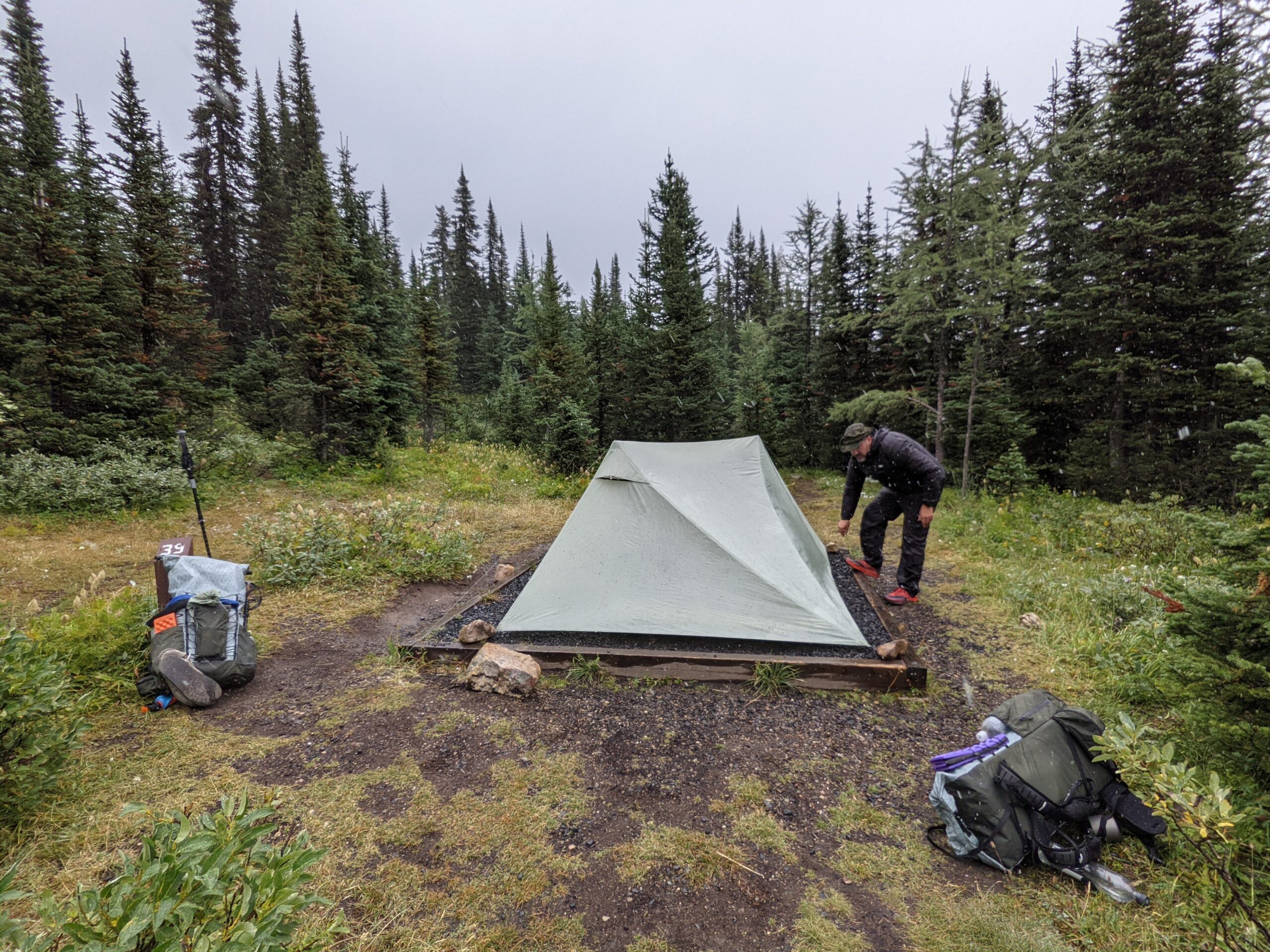
Magog Lake was busy. Many of the bear lockers were already full when we arrived, but there was room on the bear hang. This was the first campground that required campers to set up on the tent pads. Campsite 39 was close to the washrooms, and was in a corner away from the noise of the rest of the campers.
The night, I froze and put on as many layers as I could and stole Oliver’s quilt while he was at the cooking shelter playing board games with other hikers. Sadly, he took his quilt back when he returned to the tent.
We got up around 7am or so and had our site packed up by 8:30am. It was raining while we were packing, which made it difficult to keep things dry. We said our goodbyes to the Quebecers and got water near the bridge crossing before the campground and set out.
Not too long into the hike, my shoulders were in pain again and were excruciating by the time we reached Birdwood. It was the first time that I was worried about being able to finish the hike as I couldn’t picture being able to endure that much pain for several more days. We spent a significant amount of time adjusting my pack and I took some Ibuprofen. The time spent making the adjustments was a good investment as it worked and I was much happier.
Our feet were very wet today. Both pairs of socks were damp so we chose the least damp pair to start off our day. They were quickly soaked in the rain and the water from the damp brush. Oliver changed his socks part way through the day, but I kept mine on as my spare were too damp for it to have mattered.
The trail was pretty flat with some short climbs, but nothing that would have drained my energy. We sang songs as we passed through meadows and walked through the denser forest to alert any bears of our presence. There were no creek crossings that needed to be forded today and any water in our path we could easily jump over or it had a bridge.
There were more signs of moose, but saw no wildlife. Outside of Birdwood, was an unoccupied ranger cabin with a Canadian flag blowing on the flagpole. It was shuttered, but clearly well maintained.
As we walked, we sent a message on our Garmin to family to ask for help to make a reservation at Big Springs as we were ahead of schedule and would need a permit to stay at the campground. Luckily, they were able to secure a site for us and we were all set for our arrival later that day.
It rained off and on keeping us slightly damp. When we reached the Spray Lakes area, the trail changed to wide and graveled paths, with the odd trail cam strapped to the trees. This was when we started to see people and those we talked to were coming from Mt. Assiniboine. We were cautioned about “Bruce” the 3 year old resident grizzly in Wonder Pass that liked to hang out beside the trails. They told us he was used to people, but you needed to navigate around him as he dug up nearby ground squirrels.
With permits to Big Springs in place, we got campsite 5 (the best one, in my opinion) and started to dry everything out after our arrival around 2:30pm. It was time for a nice, restful afternoon. Camping spots were spacious and we were right next to a creek. Food lockers were all the way down the hill and not a climb you want to make often with sore muscles. With the afternoon to do whatever we wanted, we took a short walk to the spring that fed the creek, which proved to be a little challenging in crocs, which I had changed into at the campsite.
We had dinner with a couple were on their way to Mt. Assiniboine and we decided to hike together tomorrow to increase our hiking party to four for when we ran into Bruce the grizzly. The rain hit and we all retreated to our tents by 7pm.
We packed up camp by 8am to start our hike Sleep was alright and we found the sound of commercial jets flying overhead to be somewhat comforting knowing there were people “nearby”.
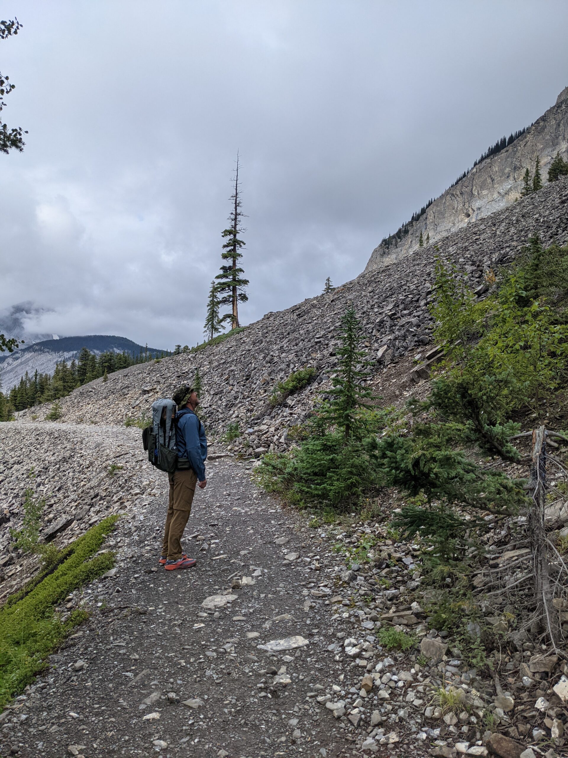
There was a slight climb out of Beatty before beginning a descent on a rocky avalanche slope onto scree. The screen slope kept going for what ended up taking us about 45 mins to 1 hour, taking a big bite of our time. My knee felt better on this descent compared to the day before. I did take a tumble on the scree, but only landed on my backside, which is better than tumbling down the slope.
There were many ups and downs heading into Palliser Pass. I needed to stop every few feet. My left shoulder was hurting under my pack strap and I was exhausted from the ascent. There may have been tears, mostly trigged by the pain from the pack needing to be adjusted. We had to push through so much overgrown plants that our pants, shoes, and socks were soaked. Even though we had wet feet, we still made the switch to our water shoes (Crocs for me) for our first river crossing. Lee Roy creek was my first river/creek ford. The water was freezing and my feet were much happier when I stepped onto the shore on the opposite side.
We climbed for a while and thought we had reached the top of Palliser Pass, but we hadn’t. There were more climbs to go. On our travel up the switchbacks, we met a group of four from Montreal who going in the same direction, but had taken a different route and didn’t stay at Beatty Lake.
When we reached Palliser Pass Campground, there were no bear lockers and there was evidence that there had been a bear digging not too far away, with a large patch of dug up soil. We chose to keep going.
It was raining at the top of the Pass where we found the four from Quebec eating their dinner at the Pass marker. We continued on past wild flowers and scenic mountains. There were shrubs and berries along the way, making us feel better that the bears in this area were already full with the berries they found.
Around this time, we encountered some ultra trail runners who intended to complete 100km that day. They were running 50km into the park and would then turn around and run 50km back to their car, which they wouldn’t reach until sometime later that night. We thought they were brave as we had run across a lot of bear scat during our hike and wouldn’t want to be the one to surprise a bear while running down a trail.
The walk to Burstall Campground felt long, but we were the first to arrive and could pick from any of the sites. We chose campsite 2. There were bear lockers and an outhouse covered in chicken wire to keep the critters away. The four from Quebec arrived a few minutes after we had begun setting up our site and Oliver helped one of them patch up their backpack with some duct tape we had wrapped around our trekking poles incase we needed it. The poor guy’s pack had developed a tear and the contents were at risk of spilling out onto the trail.
The day before, we drove down to Lake Louise, Alberta and stayed in a nice hotel in the town. We had a great dinner and filled up for breakfast before driving down to Ottertail Trailhead in Field, British Columbia. I wrote a quick little note for the dashboard of our car to notify Parks staff that we were on Section C and we switched to our trail shoes as we waited for our trail angel to arrive and give us a lift to our starting point. We were among the first to park in the parking lot that morning, so we found a spot right by the trail information sign.
I was in great spirits this morning and full of excitement over starting my first section hike. We had been preparing for it, although for only a month or so after my husband found himself without a hiking partner and I stepped up to fill the vacancy. We had been reviewing the map of the route, which appeared to be a reasonable distance, but once we got in the car and we kept driving further and further down the highway and past Canmore, Alberta, I finally understood what I had truly signed up for. I thought for sure we were going to turn off of the highway sooner, but we didn’t, until we were well out of Canmore and finally reached the turn toward Kananaskis Lake.
After saying our goodbyes to our trail angel and freshening up at the parking lot restrooms, we started at Kananaskis Lake Trail at 11am. We strolled along the side of the lake for a short distance and then stepped into the trees, passing by a few small slides with crushed rock paths. The walk to Forks campground was quite easy and gave my legs a warm up. There was some elevation gain, but it was manageable. It was raining when we got there and stood under a tree while we ate our lunch.
As we exited Forks, we encountered our first pile of moose droppings. A lot of droppings and rather fresh. We agreed that neither were concerned about encountering black bears on the trail, but grizzlies and moose were entirely different beasts. Both of us had bear spray for grizzlies but had nothing to defend ourselves against a stupid moose that might charge at us if we spooked it.
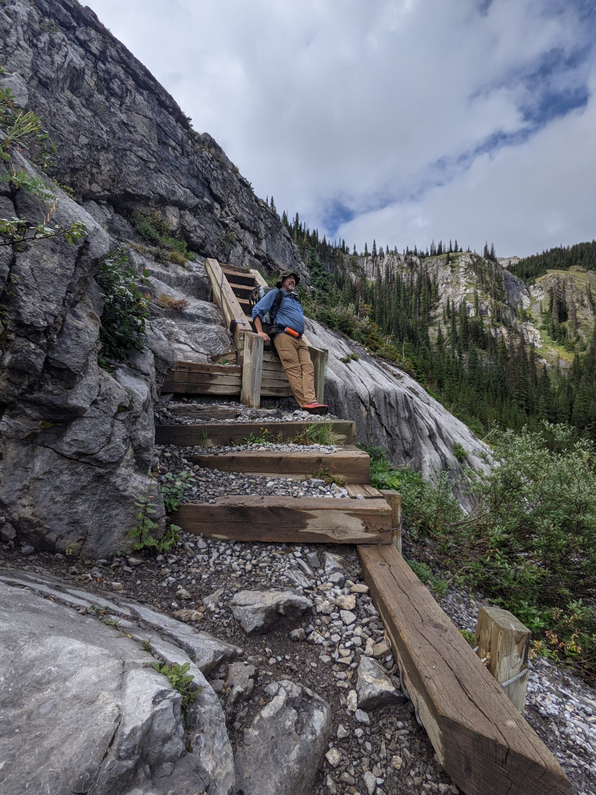
After Forks, the trail began to climb almost immediately, taking a bit of effort to get up the slope. In increased in difficultly, requiring us to pull ourselves up at times and to use stairs with a chain to get up. Just as we were reaching the stairs, we heard some noise in the trees and below us and saw a moose with her calf. Luckily, we were far enough away that we didn’t spook her.
We finally made it to Three Isle Lakes where there was sunshine and we sat on the shore where we filled our water bottles and rested. There was another climb out of Three Isle, but not as bad as the route to get there.
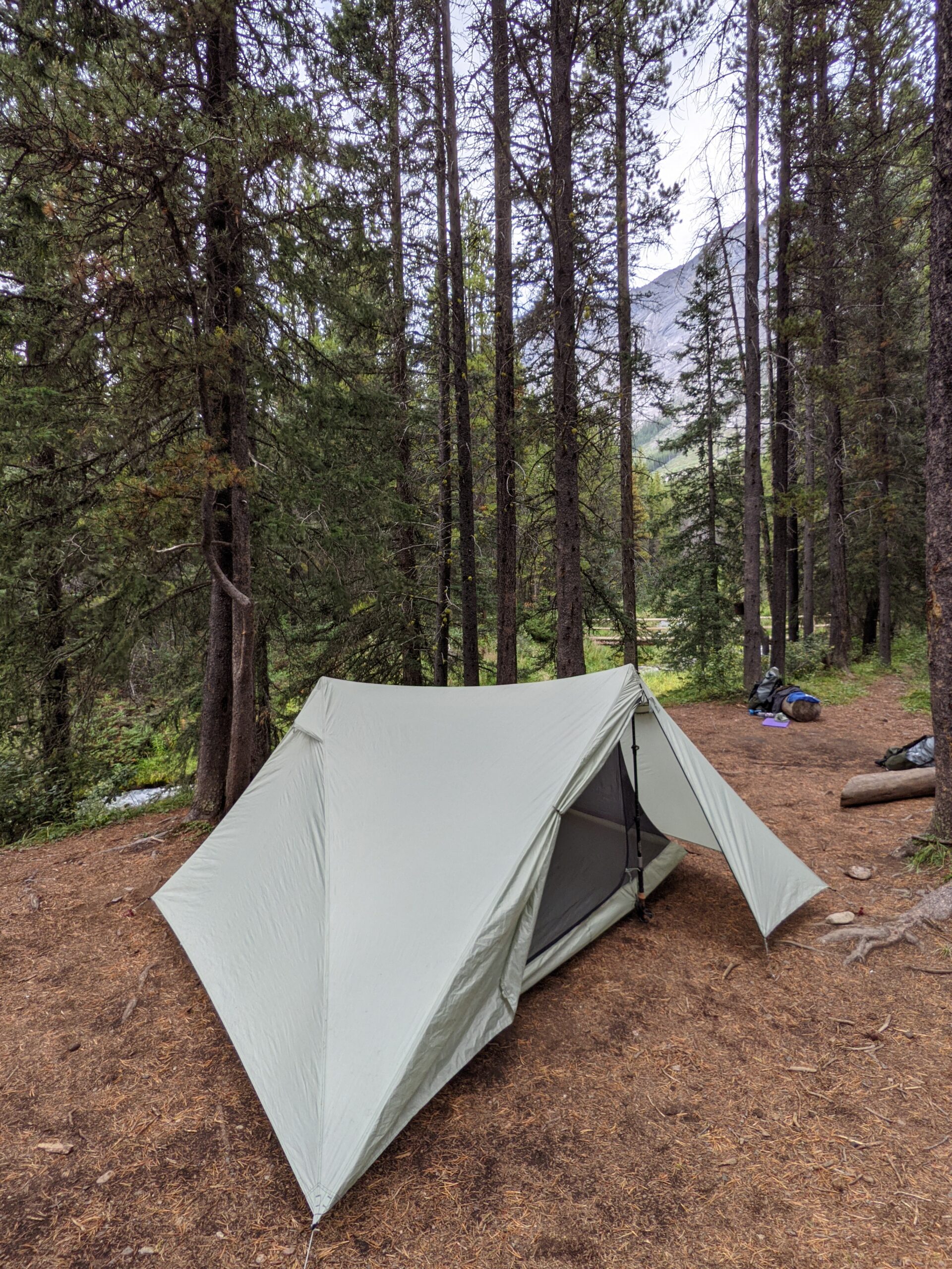
There was off and on rain throughout the remainder of the day. My knee started to ache on the descent out of Three Isle, which I had never experienced before and I took my first tumble just before we reached Beatty Lake around 6pm. The campground was empty and we enjoyed a nice meal and got our tent set up before the rain hit around 7pm. There were was a bear locker with four cupboards and an outhouse with a door that had been chewed up by some critters. We got the best spot campsite, #1, right at the shore of the lake. It was a great start to our trip. Now I just had to adjust to the idea of being in grizzly bear country, get used to the sounds of the forest, and try to get some sleep.
Somehow writing this post slipped my mind for 3 years. Despite its importance in a number of ways – for one, I visited a bunch of times, and another – it was a critical part of our preparation for Section C of the Great Divide Trail. We spent most of 3 years in Cold Lake, AB and this was the longest and most accessible trail for us to hike locally.
During our time up there I always meant to thru-hike the trail. At 128km, it’s a nice length for a 4-5 day trip, though the trail is advertised as a 7 day trip. However, despite my shoes stepping on 90% of the trail, I never did get to do the thru-hike.
You can take a look at my previous post about how to book the Boreal Trail. However, since I wrote that post, they have released a better more current trail guide. It can be downloaded here. In my several trips out to it, I have learned that despite it feeling like it is administratively rigid, it is not. The park staff straight up told me that it’s fine to hike the trail, then retroactively pay for camp spots and such. This was as of 2022, so double check to see if they have tightened up the regulations.
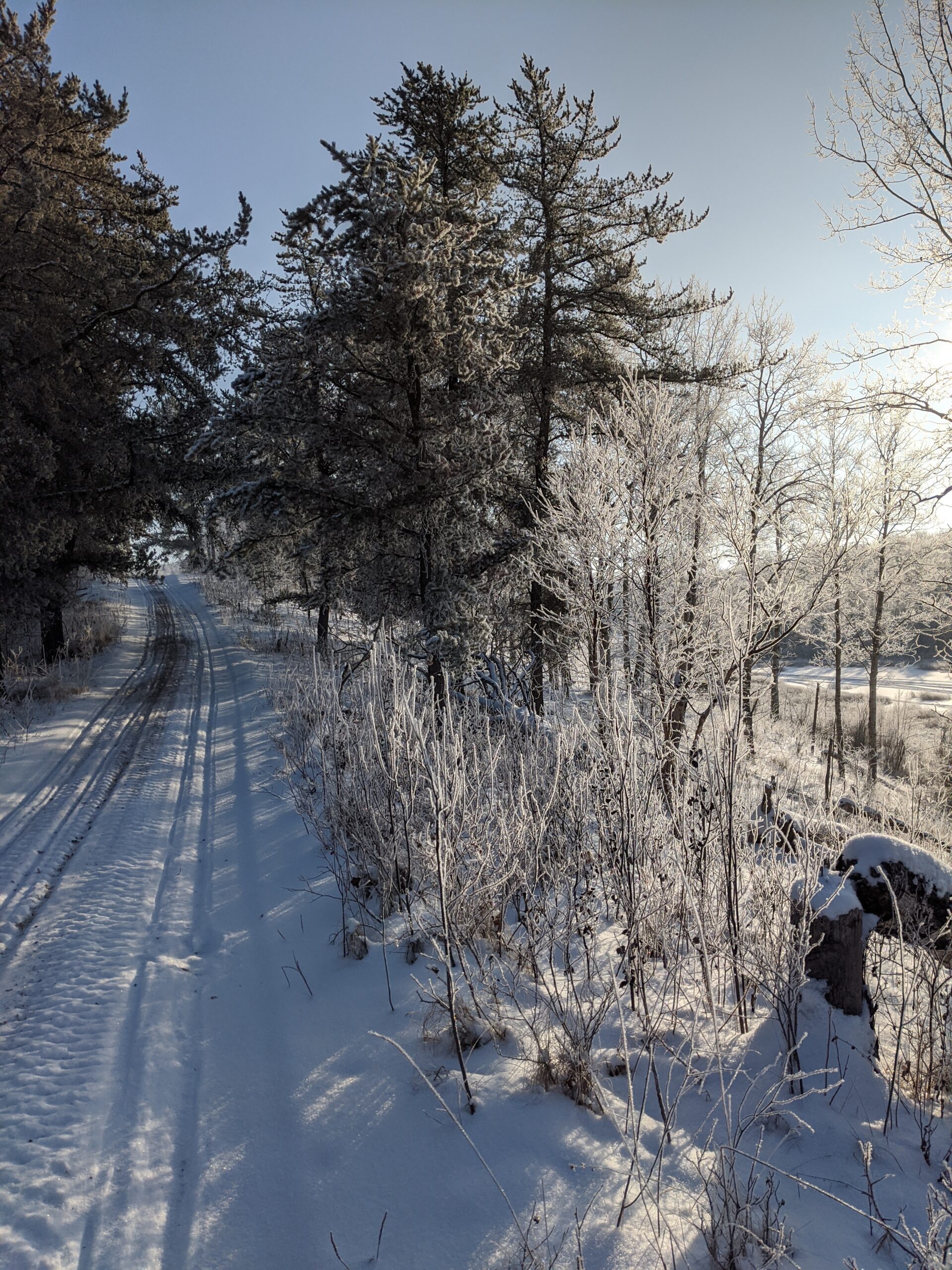
Dec 2020. A little hoarfrost never hurt anyone…
On to my trips on the trail: first was a dayhike in the winter with a friend of mine. We wanted to do some “rucking” training, so we drove out to the park one Saturday with about 30lbs on our backs to walk the first 20km. We parked one car at one end and one at the other of the section we planned to do – the Cold River camp (BT1) to Sandy Beach, a frontcountry campsite on the trail. While on that walk we passed by BT2, a pretty little backcountry camping spot on a spit of land that juts out into Pierce Lake. It has a bear locker, elevated barbeque cooking spots, and several flat areas to pitch tents. It also has an adjacent “Green throne” privy set back from the camp.
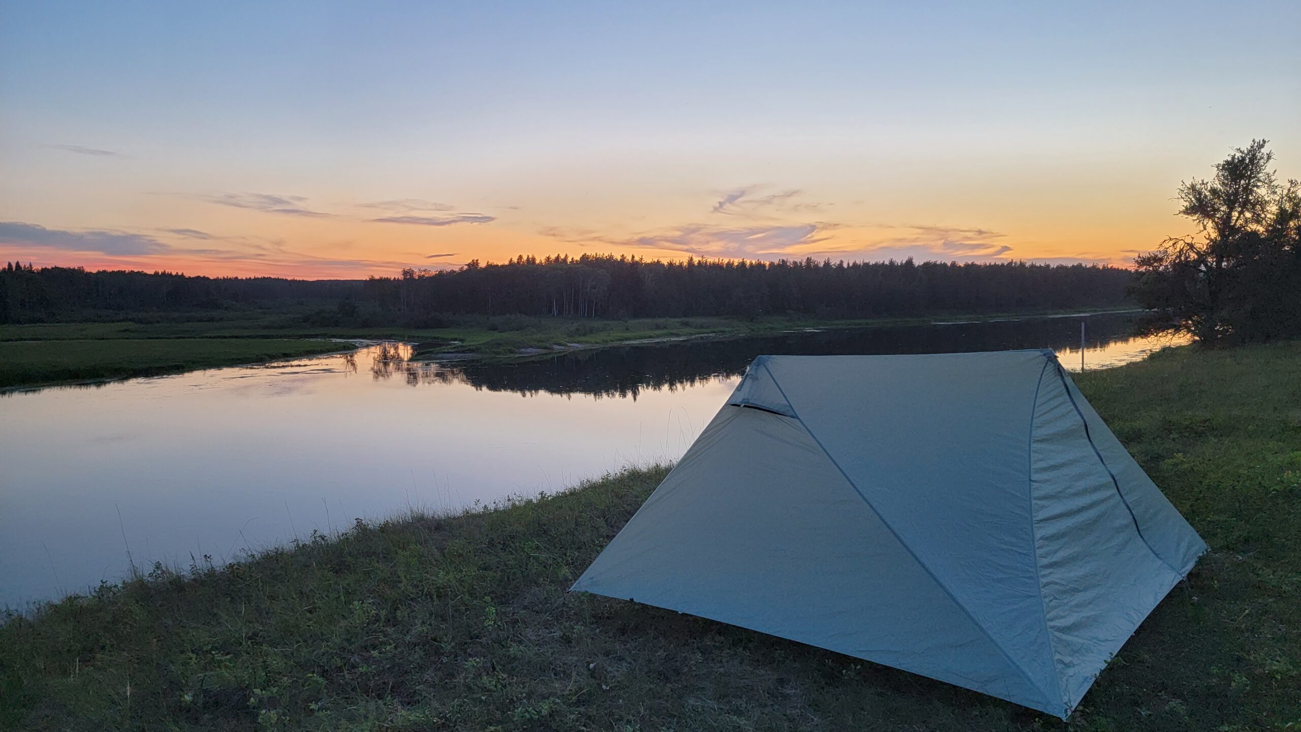
My second trip was a spring overnight with one of my sons. We the the same route as the one I did in the winter, and camped at BT2 before hiking out to Sandy Beach, and the sunset was well worth it. Some swarms of mayflies liked the spot we pitched our tent, but that really was our only complaint. The way to Sandy Beach was more complicated in the spring than in the winter, as there was some beaver dam problems that flooded certain spots on the trail, but there was a way around.
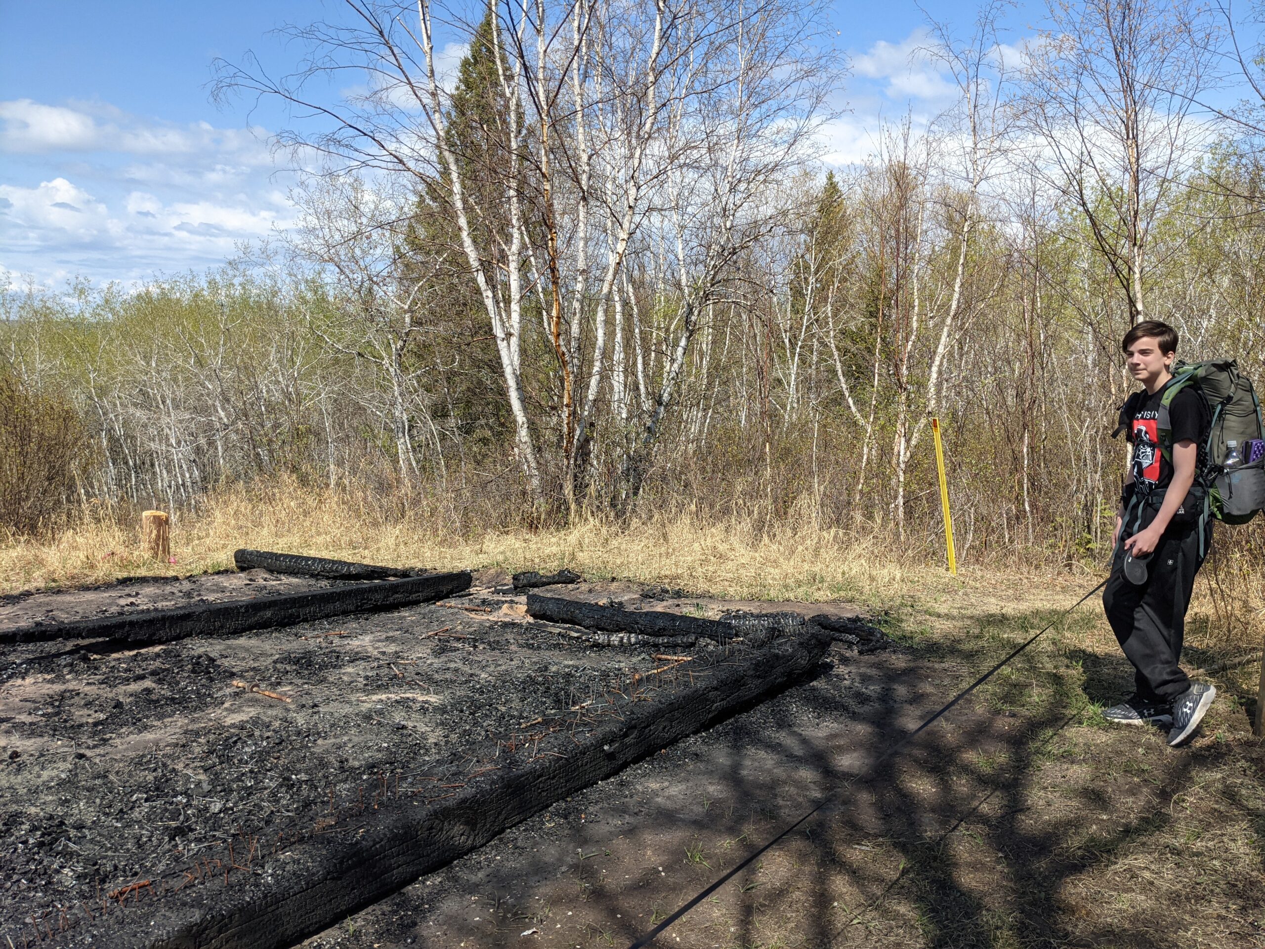
My third trip was with the same son, another daytrip hike. We parked a little past Sandy Beach at the trailhead for Humphrey Lake and Humphrey Tower – the former location of a fire tower turned viewpoint on a knoll above the surrounding terrain. We hiked up to the tower site, skirting around one shore of Humphrey Lake, a little pond not really accessible for water (it’s swampy around the edges) but nice for waterfowl. The climb up the hill was brisk, and at the top, we were saddened to see that the tower had been burned down by vandals. But it was cleared in one direction, so we did have some nice views to enjoy a break at. We continued on to the narrows between Pierce Lake and Lapine Lake, where we had lunch before turning back to the car. On the return trip we did the other shore of Humphrey Lake which makes a nice little circle for dayhikers.
The remains of the tower, May 2021
My fourth trip to the park was another overnight with that same son. He was a trooper that year! This time we had our sights set on a backcountry site set back from the rest – if you are thru-hiking you’d probably skip it as it’s up on a spur trail north of the main route. We parked the car at Grieg Lake near the east end of the park, and hiked up to BT9 on Fourth Mustus Lake. We chose this site because we brought my dog, Watson with us and he was a little unpredictable with people (he was an SPCA rescue) so we wanted to have a campsite with nobody around. The trail was sandy and mostly easygoing, and once again we were treated with a beautiful camping spot.
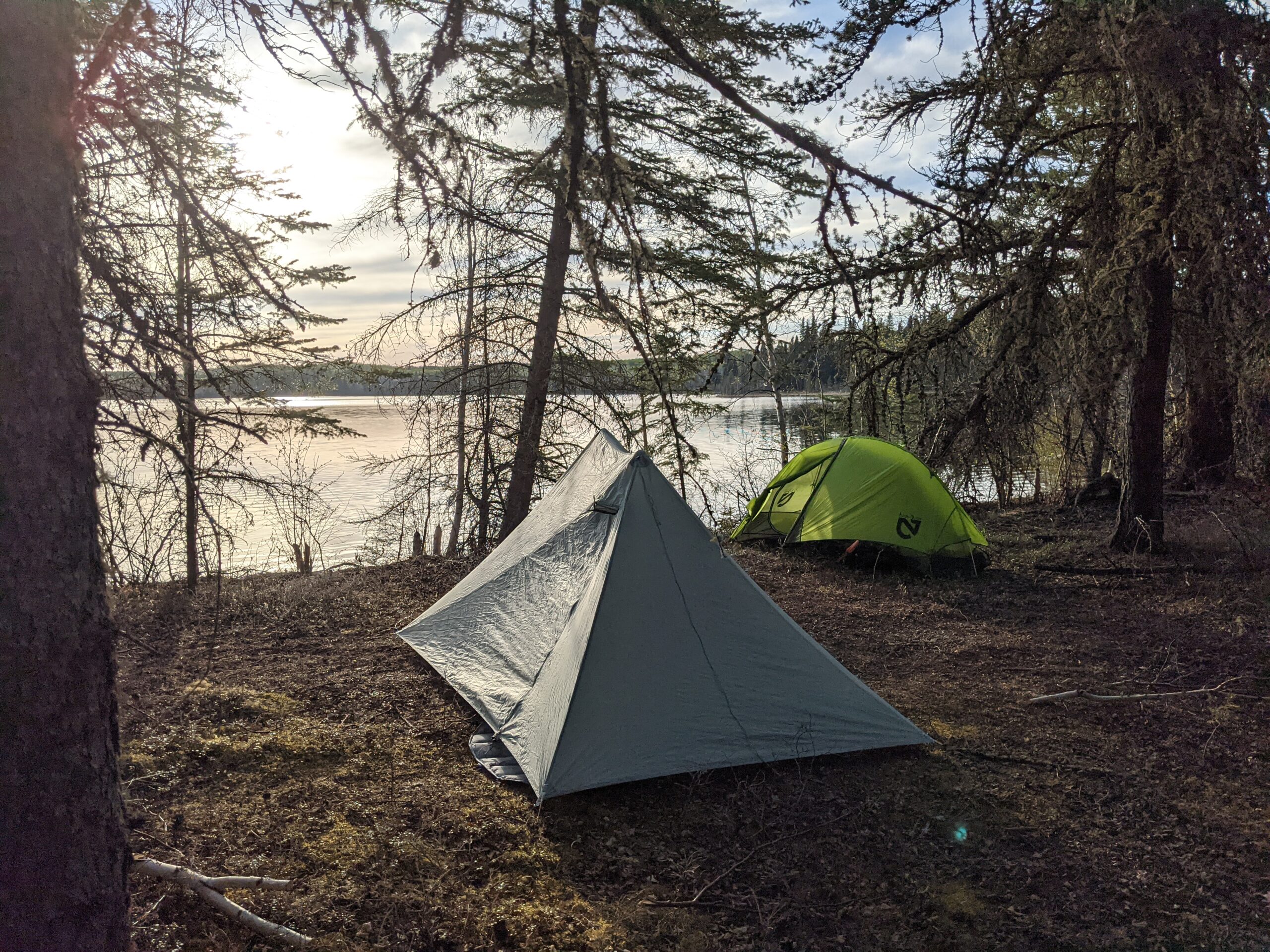
Nemo Hornet 1P and Durston XMid 1P at 4th Mustus Lake, May 2021
At that time (2021) there was no privy at that campground, and the picnic table was in bad repair but there was a working bear locker. But the tent sites were glorious and roomy, and we never saw another soul. We spent the evening after supper exploring some game trails on the north side of the lake, then tried to put the dog to bed. He didn’t go down easy, refusing to sleep in the vestibule. He ended up being off leash all night, and patrolled around us while we slept. Around midnight something got his attention because he bolted off barking at something, but he never left earshot and returned after being satisfied that whatever it was was not coming back. Glad there was nobody else there to be disturbed by him! Lesson learned.
Crossing the creek on the way to 4th Mustus Lake, May 2021
My fifth trip was again with that same son, and we were aiming to do the whole trail. We started at Cold River this time, and once again camped at BT2. The next day we pushed pretty hard, and made it to BT3 by midafternoon. We could have gone further but the clouds had socked us in and the wind was blowing, and rain was beginning to make us miserable, so we set up our tents and hoped that the rain would slacken for some soggy dinner. The camping was down a rise next to the river, and the dinner spot with a firepit was at the top of the rise by the trail – so was the bear locker. After warming up a bit we came out and had an early dinner, but the weather was still miserable so we just hunkered down early for the night.
Supper at BT2, Pierce Lake, late May 2021
The next morning dawned sunny and nice, to the point where we could get a better sense of the place. It was an old forest fire clearing formed in 2011. The wind affected us because there were few large trees to break the wind. The river was quite nice though, and we took some snaps of a half dozen or so white pelicans who were punting around the rocks in the stream. Then we pushed on.
Campsite at BT3 before the rain hit, from the eating plance. Bear locker just off camera to the left. Late May 2021
Sadly, my son’s feet were not as conditioned as mine to long trail days. By the time we pulled up in BT4 on Lac Des Iles he was pretty out of gas. We took a long break sunning ourselves on the functionally private beach there (Highly recommend this camp for a stop!) and then tried pushing on. We got to Murray Doell frontcountry camp (in the middle of another burn, so hot and sunny also beat us down) and then shortly after, we made it out to a road crossing and made the decision to call for an extraction. Still, got to see a lot of the park, and good quality time with my boy.
Beach at BT4 on Lac des Iles – contemplating sore feet and solitude. Late May 2021
My sixth trip to the trail was in the training runup for our Great Divide Trail Section C trip. At this time my wife had decided to accompany me, but we needed to prepare her. So first order of business was to test her feet and our big four with an overnight. We selected a start at Jack Pine and hike into BT7 on the Waterhen River. We pitched my newly acquired, slightly used Durston XMid 2P above the river at sunset and it was lovely. The campsite had treed or open grassy field options, good fishing spots on the river, and well kept Bear Lockers. The trail used to go from BT7 east to the chalet and then north, but north of the chalet they had some beaver flooding issues, so they elected to close that part of the trail.
BT7 on Waterhen River, August 2021.
The following date we pushed for a longer day, crossing Mistohay Creek (nice views), passing the visitor center, and continuing on past BT5 to the Gold Creek area. There was some gravel roadwalking in this section, and the hot August sun beat down on us pretty ferociously. We had to hunt for water a few times in the drier stretches. Towards the end of our time in between the Murray Doell and BT5 area, it was quite hilly and nice. But we decided to call the trip there, almost connecting to where my son had left the trail on the previous trip.
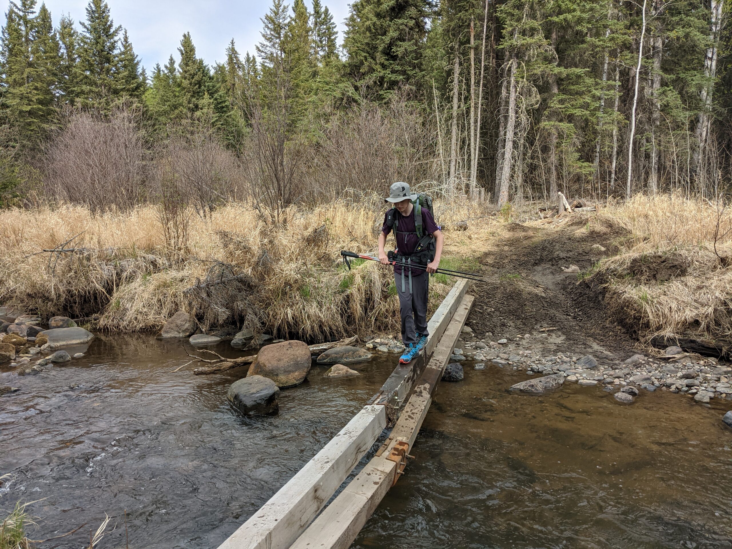
Crossing the Mistohay, August 2021
All told, I probably got to see 80% of the trail, and the only significant backcountry stretch I didn’t get to hike was from Jack Pine to Kimball Lake area – most of the rest was roadwalk I was not sorry to miss.
I’d call it a well kept, well maintained set of trails for the most part, with well appointed campsites, though they frown on random camping. The challenge level is not Rocky Mountains, but there are hilly sections, and I’d definitely call it a good early season warmup hike, or late season final go before the snow flies. It is hikeable by May, and can still be done well into the fall (though make sure you hike in blaze orange in the fall!) If you’re in AB/SK, it’s definitely worth the trip!
After our go at the Gros Morne Traverses, we found ourselves a little worn out of rugged, wild, barely-there trails. Especially when said routes cross bogs and other such fun things. We began to talk about our next adventure, and how our current locale has a very long winter (even for Canada). Wouldn’t it be nice to get in an early season hike, before the snow melts? Not on snowshoes! Sorry, I have done a little winter camping, enough to know that ultralight and winter don’t mix well – at least not in Canada!
A unique quality to the military life is the end of fiscal year. At that point our annual leave rolls over to a new year, and all of a sudden we have more. Some people have attempted to “save” their annuals from one year until the end of fiscal, so they can add them to leave days borrowed from the next year to create a mega-trip. It worked out for us to do that this year! So with a big chunk of time available, we began to look for a “fair weather” destination.
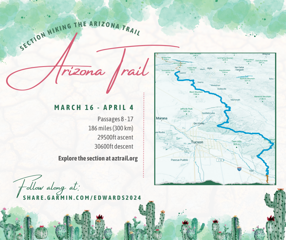
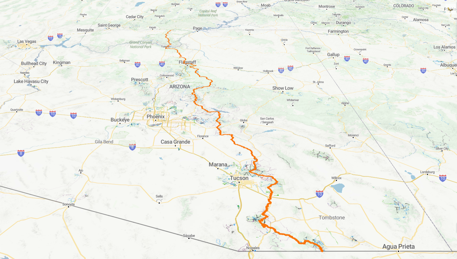
We looked at the Pinhoti Trail, the first few hundred miles on the Appalachian Trail, the Florida Trail, Ozark Highlands, the Lone Star, and even the PCT up to San Jacinto. (There were more shorter trails too). But none of them sat quite right. I liked the idea of a desert hike over a forest hike where the leaves haven’t come out yet. So we looked again at the beginnings of the PCT and I also threw out a question on the Arizona Trail subreddit: what’s the best stretch of passages to do if you only have a couple weeks?
The answer was “Vail to Superior”. So we watched some videos. And some more. And it started growing on my hiking partner. Over Christmas break we pulled the trigger on some flights and now we are set! We will be on trail over Easter, enjoying the sunny days of Arizona! This will be our longest trip yet – our previous longest trip was 11 days of hiking on the Great Divide Trail. This one we will be on trail 16-18 days (I built in some flex into our plan, depending on how we are handling the altitude and such). The plan is to cover over 186 miles. Given the choice between this or a standard all-inclusive in Mexico like many friends and family like to do, we much prefer this plan!
But here’s the best part: previously we snapped a lot of pictures, but we never really did video. This time, we have invested in a little videography equipment, and my wonderful partner will get to put to use her long dormant cinematography skills (she used to have a vlog on YouTube a dozen years ago). So keep watch for video once we get on trail!
The final day. We would get a lovely restaurant meal when we got out. But there was the small matter of getting out. And contrary to popular wisdom, downhill isn’t always easier.
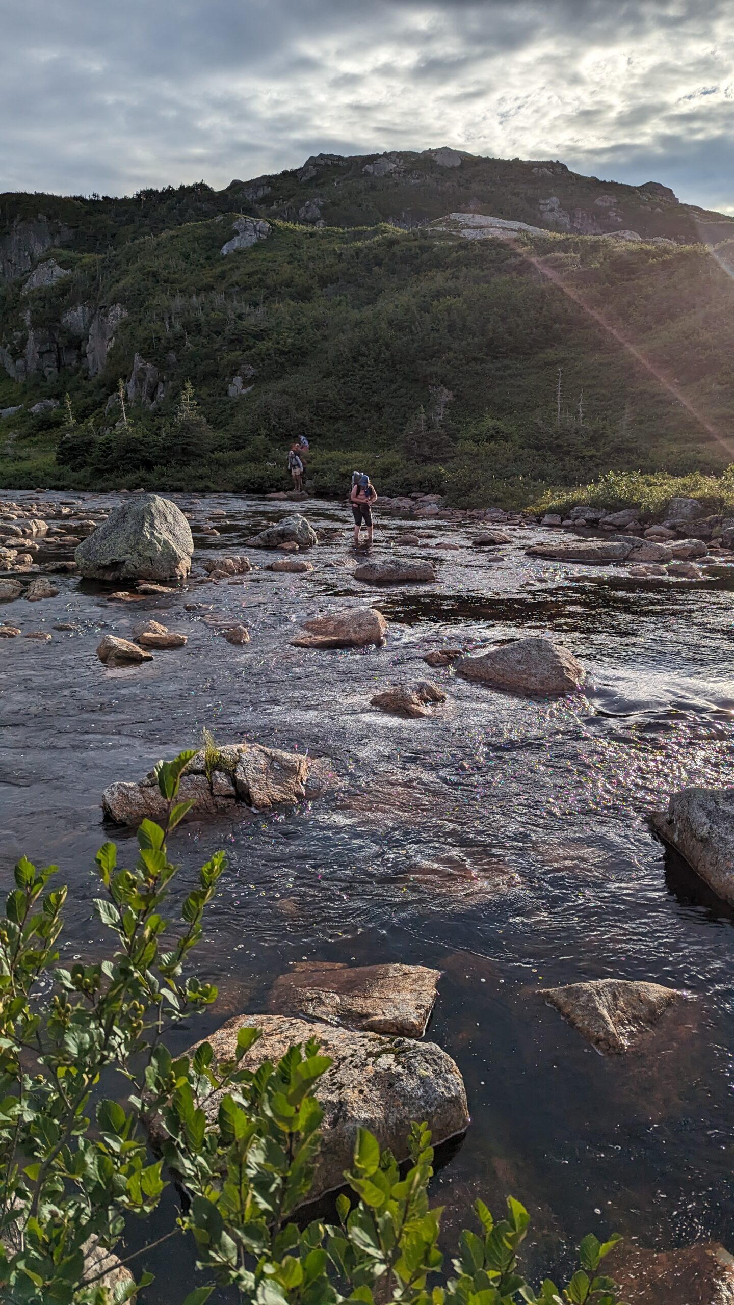
The morning started with a ford across a complicated creek with many pools and holes. I managed to find a very good track crossing first ahead of the two other groups we shared camp with. The ones that followed me did well. The others… did not.
Picking their way across the ford
Then a bracing climb up to Upper Green Island Pond camp. Breezy and exposed, with a long trek to water. We made the right choice the night before. The terrain rolling away from this point was up and down, over exposed rock with few mudholes. We made good time.
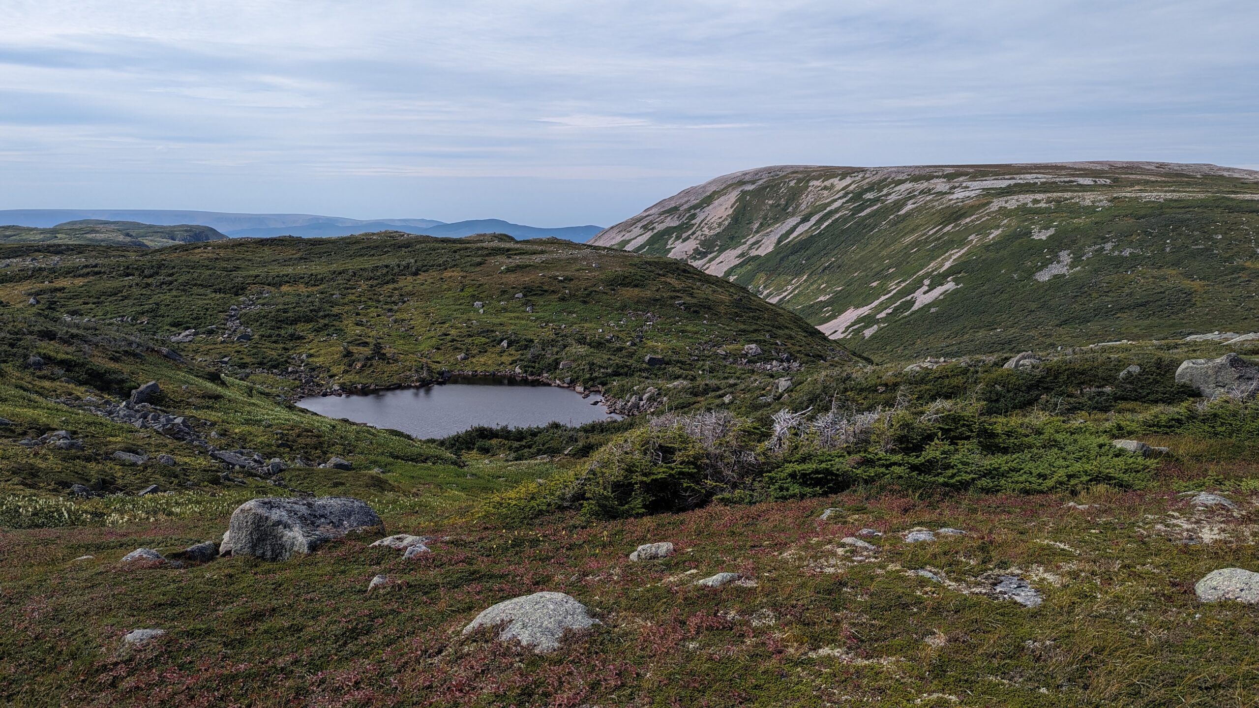
We stopped for a break at the Bakeapple Viewpoint, which looks down on Ten Mile Gulch, another fjord that had been silted in until it was a lake. Quite breathtaking if not quite as breathtaking as Western Brook Pond.
As Gros Morne rounded into view, we began to see the drop into Ferry Gulch campground was going to be steep. Very steep. Despite the strength of the trail (it saw a good amount of traffic because dayhikers would come up from Ferry Gulch to Bakeapple Pond viewpoint), the steep inclines and lack of good handholds going down made it quite challenging, especially after 6 long, taxing days. We took our time picking our way down to Ferry Gulch, reaching there around 2pm. The well established and maintained trail up Gros Morne on the other side of the gulch seemed covered with ants, as we watched the dayhikers taking on the mountain. A couple of times we recognized our former campmates giving it a try. But clouds were forming, and we were tired so we elected not to go for the peak.
At the top of the drop. Gros Morne is on the right.
And it was a good thing we didn’t. The trail down to the parking lot from Ferry Gulch felt much longer than it looked on a map. It went on forever. The first 5km was brutal – it was a trail, but not gravelled – more like broken out of the stone into fragments. We traversed several scree fields, and footing was treacherous often with shifting rocks under our feet. At least it was dry…
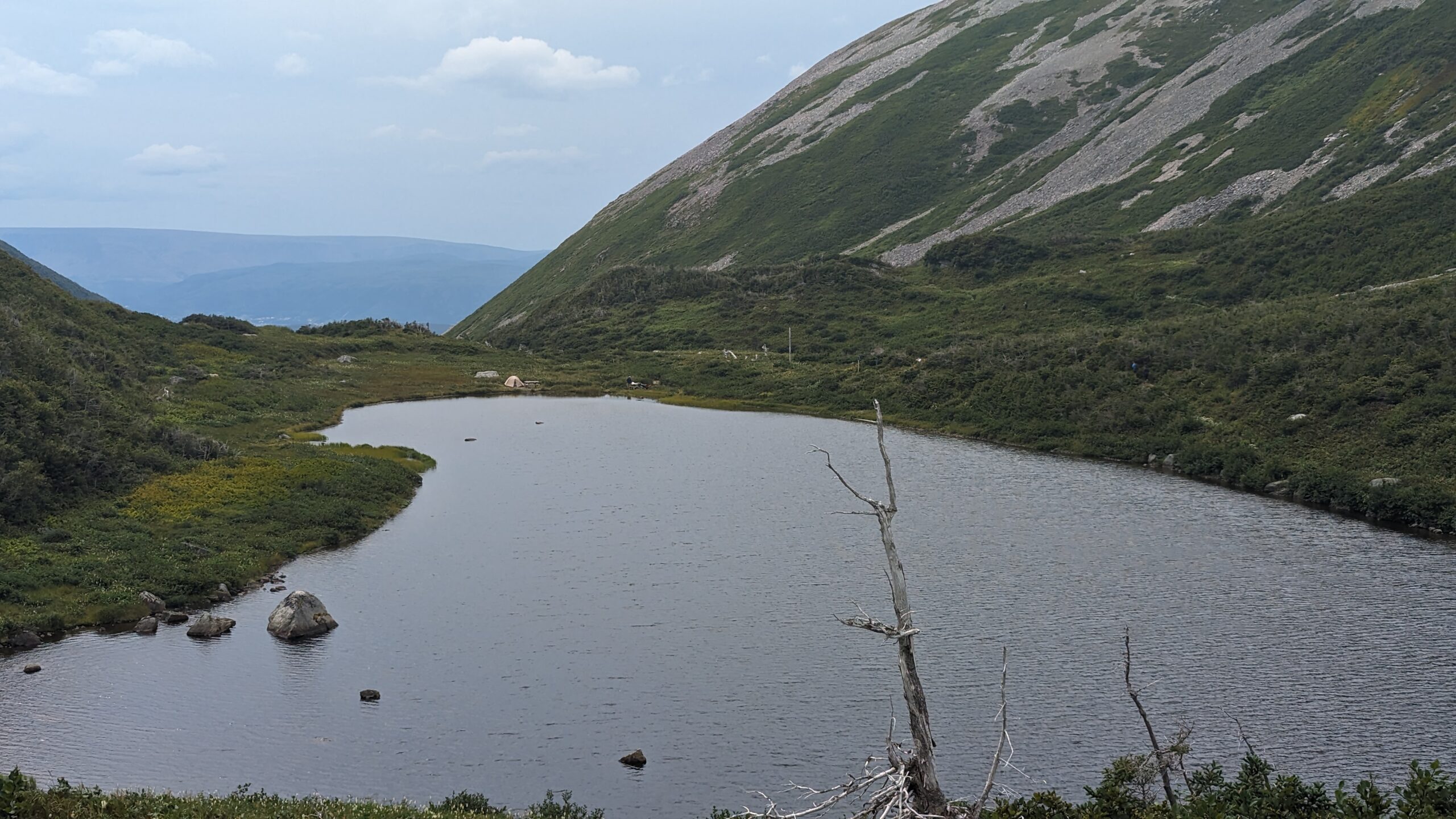
Finally arriving at Ferry Gulch. The camp was on the far end of the lake – I’d call it a front-backcountry campground.
Finally the rocky footing subsided into gravelled trail. But that still stretched on for some time. The map says we did 14km today, but it felt like 18. The trail on the map was not the same that we walked, and I believe the reroute added 4km. The last 5km water was sprinkling out of the sky on us – so this experience began with some cloud and rain, and ended with cloud and rain – but because the 5 days in between were glorious and sunny, we cannot complain about that at all!
Too tired to celebrate…
A well deserved feast in Rocky Harbour was a fitting denouement to this trip. All told, with the many extra kms we logged getting off track then back on track, I am convinced we made this trek into one closer to 100km instead of 80. As I have said to many people, it was a once in a lifetime trip, and we loved it… but we NEVER want to do it again!
Rising early is my normal. I tended to get nice sunrise photos of our campsites.
On this day we would be making for Green Island Pond. There is an upper and a lower campsite we would have to choose from. But that was later.
First, to leave Mark’s Pond we had to cross a swift, rocky creek. Cold feet first thing in the morning wasn’t as bad as we had feared – and we scouted a crossing for our friends to follow. But they hiked much faster than us so they quickly left us behind.
We went up and down several lovely passes. The views to the interior were beautiful. If I didn’t know they were covered in swamps I would have called them idyllic. But I didn’t have to walk there so I enjoyed the views.
The walking was once again much easier. I began a streak on this day where I did not get my socks wet again for the rest of the traverse. Now, my wife thought I was nuts because I would skirt widely around wet boggy spots that she would slog through. I probably added at least 1km to my distance on the day from all my extra steps. But I had dry feet and I think that was worth it.
The group of young fellows from the States caught up and passed us. Several times. They took long breaks but pushed hard when they were moving. They ploughed through the sloppiest bogs – they had totally given up keeping their feet dry. black mud all up their legs, they were just going hard. With higher amounts of traffic, it was easier to guess where the traverse went, but at the same time, we found a couple of instances where the “good” track went off in the wrong direction from many people making the same mistake in trusting the tracks in front of them.
We enjoyed this day’s walk until the very end, just before Green Island Pond. There was a steep draw down to the lower campsite by a wide creek crossing. We had been warned about this place by the guide who briefed us before we started – she told us “stick to the wooded draw. Don’t take the cliff!”
We took the cliff.
We found out after the trail that we would have had to backtrack at least 1 km to find the wooded draw once we were at the cliff. But the cliff is so tempting, because from there you can see the campsite just below you. Tantalizingly close. But it’s stupid hard to get down.
You either have to jump about 9 feet down the cliff onto a muddy spot about 1 foot deep, and if you lose your balance, you’re tumbling down a steep muddy bank for another 20 feet and probably getting scratched and stabbed by the bushes growing there. OR you traverse across the cliff, to a point where a spring leaks down the cliff, cross over that slimy surface without falling, to reach a muddy step down that avoids the cliff. Your only assistance is a 10 foot piece of paracord someone tied to a slender tree.
We made it across, but it was a dispiriting end to the day. Down in the campsite, all the pads were taken by the vanlifers and the young men, but we found a mostly dry, mostly level bit of ground and pitched up.
We could have had a tent pad, we would find out the next day, but we would have had to cross the creek in the evening, when we were tired, then climb a steep hill. And when we got there the only water access was to go down another steep hill to Green Island Pond itself. We made the right choice. This would be our last night on the trail.
Total Distance: 14km
Total Ascent/Descent: 2-300m ascent/descent
Day 7 – Lower Green Island Pond to Gros Morne Trailhead
After the difficulty of yesterday, I briefly considered whether we should hike down to the boat launch and call it a trip. But my wife does not go half way. She’s all in. She said she was finishing this, and besides, the rest of the way would be on the Long Range Traverse, which by all accounts is easier than the Northern.
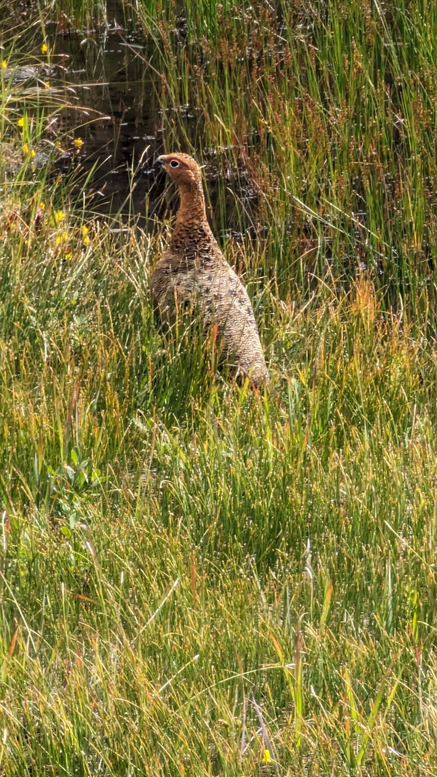
One last view of Gilley’s Pond as we climbed into the treesIf you know what kind of bird this is let me knowThe pile of bones
And she was right. The morning started out tough with a stiff climb out of Gilley Pond through thick bush but the trail was clear at least. Then it was up and down a couple more draws, a creek crossing, but thankfully no more real tuckamore. Lots of interesting sights though. A strange bird family hanging out by the trail, and down in a copse of trees by the trail was a little lair with a pile of moose bones. I wonder if a wolfpack had used it as a den.
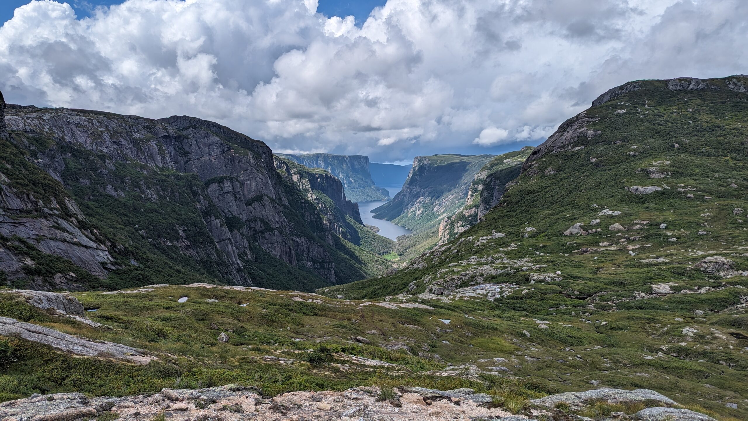
And then we arrived at “the viewpoint”. The place where everyone wants a picture.
And it was stunning.
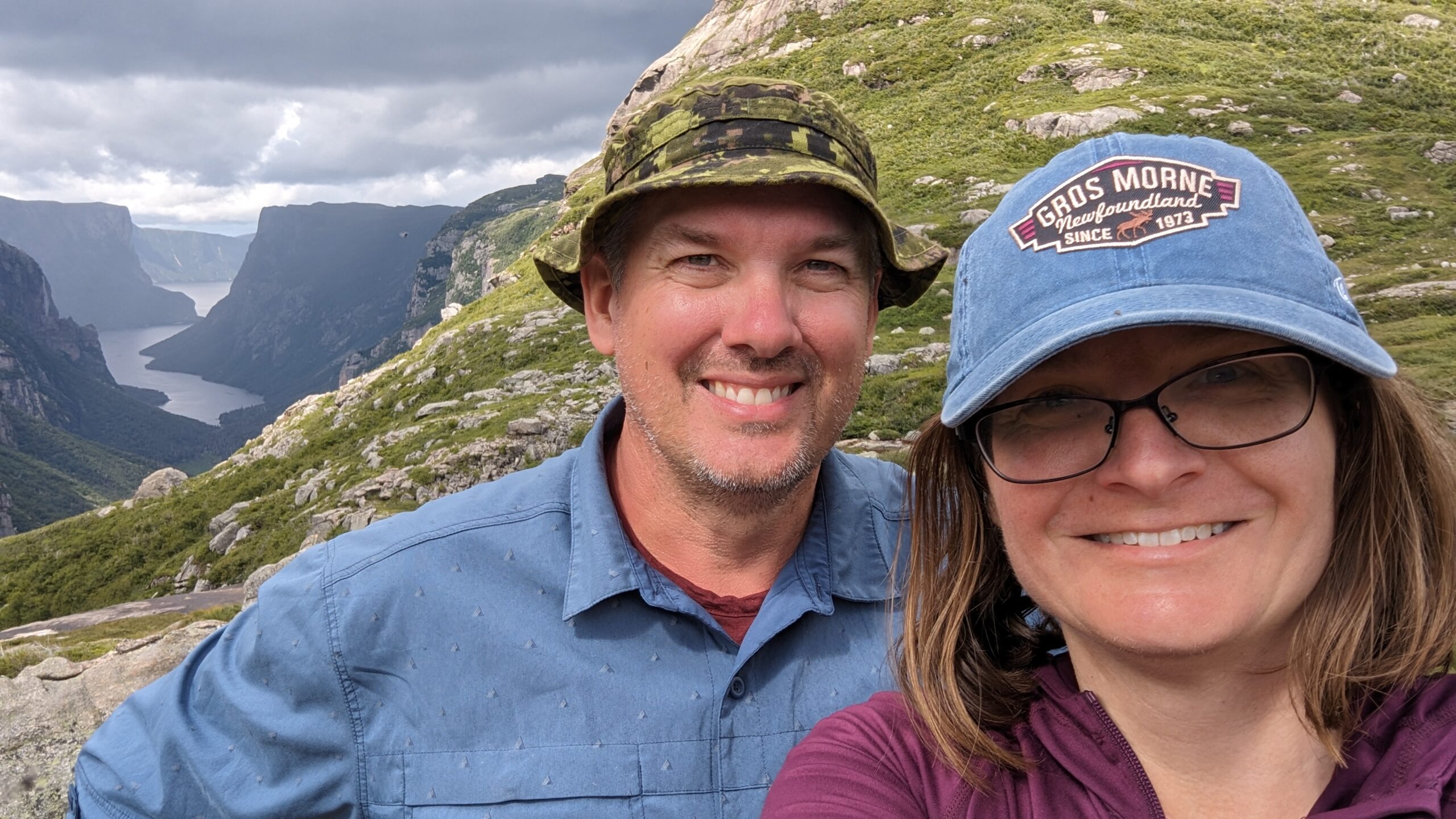
Proof I didn’t just steal the above image from a stock photos site…
There have only been two occasions in my life where I have looked out over a natural wonder, and thought to myself, “This doesn’t look real. This can’t be real. It is too beautiful to be real.” One was here at the east end of Western Brook Pond. The other was at the Grand Canyon. That’s the scale of epicness.
We lunched at that viewpoint, and rested in the knowledge that at long last, the Northern Traverse was done. Now, on to the easy part.
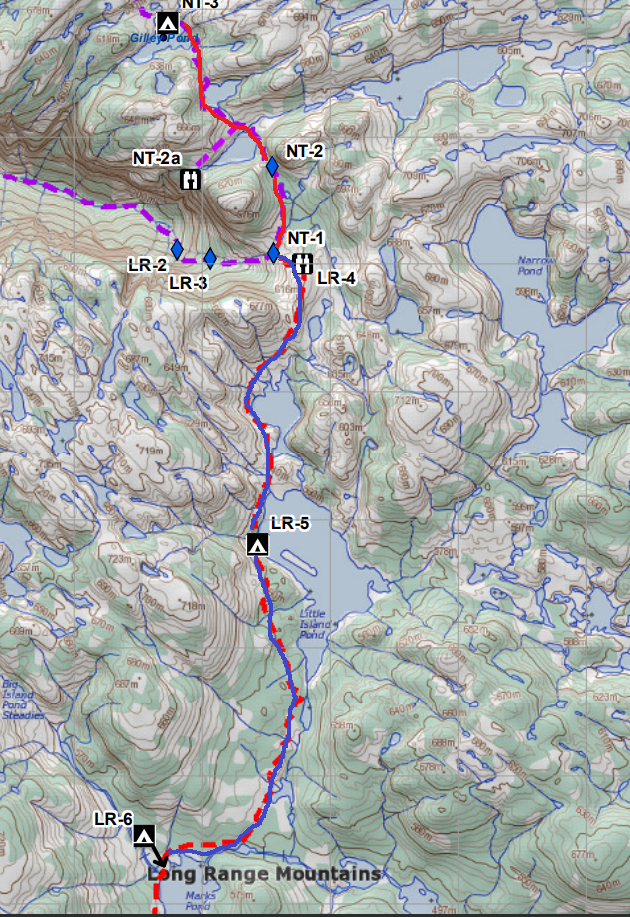
And it was easier. The path was clearer, the swamps were less common. The tuckamore became infrequent to the point where when it did appear, it was a refreshing interlude. The campsites were more frequent. We cruised through the first one (Little Island Pond) with a 30 minute break to snack and sit on a dry tent platform, and pushed on to the second one: Mark’s Pond. Somewhere in this stretch we had a short muddy descent. My wife jammed her trekking pole in too deep and bent it in half. I gave up one of mine to her and used the bent one the rest of the way as I didn’t need steadying as often.
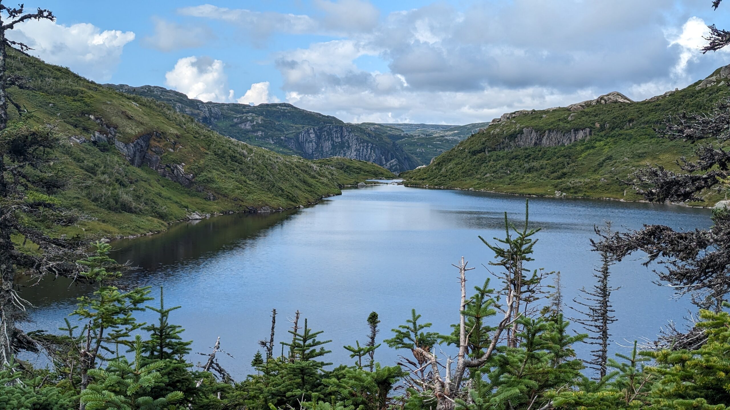
Littel Island Pond. Walking along that rock face that drops straight into the lake was interesting.
Coming into Mark’s was interesting because there was a wide flat swamp to navigate and tracks of those before us went everywhere. It was unclear what the “official” route was. Because most of the day had not needed it, I had gotten out of the habit of referring to my GPS constantly. So we fumbled around a bit, until we finally found tracks into camping spots.
Switched to blue to show our travel on the LRT because the underlying line was red.
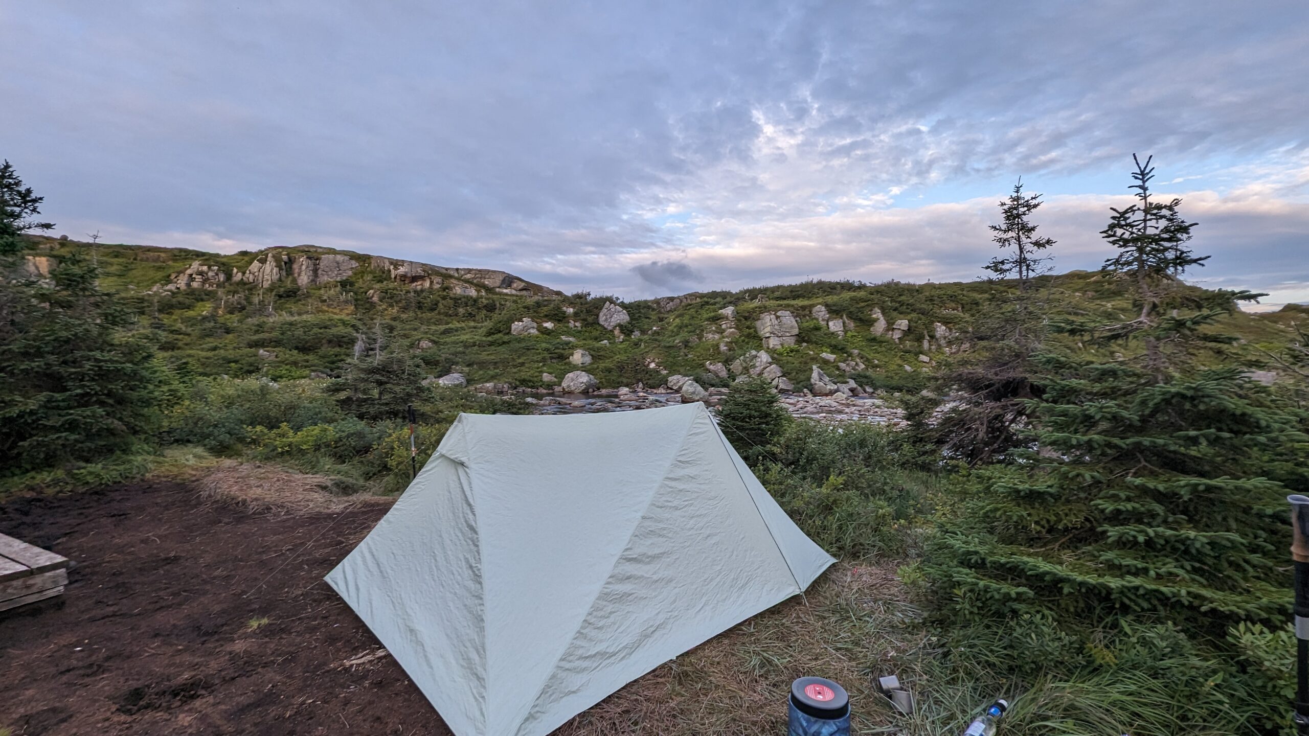
Mark’s has no wooden tent pads. But dry tent sites are plentiful. We found one by the lakeshore with a convenient log to sit on and hang socks off to dry. It was a bit of a walk to find the bear locker and the toilet, but we managed. Another couple, a retired couple who were vanlifing, camped next to us. We really enjoyed their company. They told us a group of young men were behind them, so we would probably see them sooner or later. We settled in for the night, resting much easier.
Total Distance: 16km. That’s how much easier the LRT is compared to the NT.
Total Ascent/Descent: probably around 300m.
Day 6 – Mark’s Pond to Lower Lower Green Island Pond
Day 7 – Lower Green Island Pond to Gros Morne Trailhead